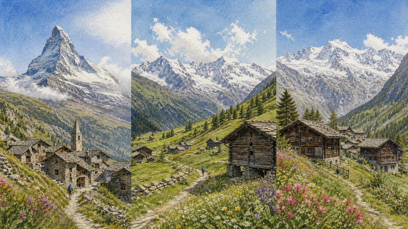
Documentary watercolour of an eastern Aosta Valley panorama linking the Matterhorn, Val d’Ayas and Walser houses below Monte Rosa without compressing the valleys into one literal viewpoint

Illustrated guide · Aosta Valley

Three valleys,
more than two famous peaks

Eighteen chapters from Valtournenche and Breuil-Cervinia to Ayas, Gressoney, Walser houses, mines, royal architecture and the high world of Monte Rosa.

Explore the places
Valtournenche · Val d’Ayas · Gressoney · Monte RosaSources checked on 25 August 2026

Famous silhouettes, distinct communities

The Matterhorn and Monte Rosa dominate travel imagery so completely that the valleys below can disappear.

Valtournenche developed its own guide tradition and transformed the Breuil basin into Cervinia. Ayas joined pasture, mining and tourism across many villages. The Lys valley retained Walser language and building practices while becoming part of the Monte Rosa resort network.

These are not interchangeable Alpine backdrops. Their settlement forms, dialects, routes and political histories differ, even when lift systems and high traverses now connect parts of the mountain economy.

This guide therefore follows the valleys separately before bringing them together at the high-mountain threshold. It treats glaciers and lifts as changing infrastructure, not permanent promises of access.

One destination

From valley gateways
to ice and language.

The eastern Aosta Valley rises through three major systems: Valtournenche towards the Matterhorn, Val d’Ayas beneath the western side of Monte Rosa and the Lys valley towards Gressoney. Each contains lower villages, high settlements and routes that long preceded modern ski domains.

A complete circuit includes churches, guide memorials, vernacular houses, mining traces, royal patronage and protected high landscapes. The number of places is deliberate: this large territory cannot honestly be reduced to Breuil-Cervinia and one view of Monte Rosa.

The selection

Eighteen chapters,
three eastern valleys

The circuit climbs Valtournenche, crosses the inhabited landscapes of Ayas and Brusson, then follows the Lys into Gressoney and the high Monte Rosa world.

  1. 01Saint-Vincent and Châtillon: The Eastern Gateway
  2. 02Valtournenche Village
  3. 03The Matterhorn as Mountain and Image
  4. 04The Guides and the Matterhorn Ascents of 1865
  5. 05Breuil-Cervinia and the Resort Transformation
  6. 06Blue Lake and the Breuil Basin
  7. 07Plateau Rosa, Glaciers and High Infrastructure
  8. 08Chamois, a High Village without Ordinary Road Traffic
  9. 09Torgnon and La Magdeleine
  10. 10Ayas and Antagnod
  11. 11Champoluc and the Evançon Corridor
  12. 12Brusson and the Mining Landscape
  13. 13Gressoney-Saint-Jean
  14. 14Castel Savoia and Its Alpine Garden
  15. 15Gressoney-La-Trinité and the Upper Lys
  16. 16The Walser Ecomuseum, Houses and Titsch
  17. 17Monte Rosa and the Margherita Hut
  18. 18Connecting the Valleys without Flattening Them
01

Where the main valley divides towards the high valleys

Saint-Vincent and Châtillon: The Eastern Gateway

The journey begins at the transport and historical junctions below the famous peaks.

The place today

Saint-Vincent and Châtillon provide rail, road and service connections before the routes climb towards Valtournenche and Ayas. Their centres deserve time beyond their gateway function, especially for churches, bridges and the contrast between thermal and castle landscapes.

The historical chapter

The central Dora Baltea corridor concentrated Roman and medieval movement. Later roads, spa tourism, industry and regional transport reinforced its role as the base from which the eastern tributary valleys were reached.

What to notice

  • Roads separating towards Valtournenche and Ayas
  • Historic centres placed above the Dora corridor
  • Castle and vineyard terraces controlling the slopes
Turismo Valle d’Aosta · Matterhorn area
02

A community whose name belongs to the whole valley

Valtournenche Village

The village gives the valley history and scale before the ascent to Breuil-Cervinia.

The place today

The parish centre, older houses and guide-related monuments occupy a steep section of the valley. Walking the village reveals a dense community distinct from the open high resort basin farther north.

The historical chapter

Agriculture, herding, timber work and passage supported the settlement. During the nineteenth century, local men became central to Matterhorn exploration, turning mountain knowledge into an organised profession.

What to notice

  • Houses adapted to a steep, narrow valley floor
  • Guide names and mountain memory in public space
  • The Matterhorn appearing and disappearing behind nearer ridges
Turismo Valle d’Aosta · Valtournenche
03

A distinctive pyramid with four difficult faces

The Matterhorn as Mountain and Image

Its silhouette is instantly recognisable, but its geology and scale resist the flatness of a logo.

The place today

Safe viewpoints from Valtournenche and Breuil-Cervinia show different faces and changing foregrounds. Cloud, snow and light can conceal the summit entirely; a visit should not depend on a guaranteed postcard view.

The historical chapter

The mountain’s isolated form emerged through Alpine uplift and glacial erosion acting on resistant rock. European alpinism made it an international symbol, while local guides supplied route knowledge and labour.

What to notice

  • The summit leaning differently as viewpoint changes
  • Rock bands and snow rather than a smooth pyramid
  • Nearer ridges that frame or hide the mountain
Turismo Valle d’Aosta · Matterhorn
04

Achievement, rivalry and tragedy around one summit

The Guides and the Matterhorn Ascents of 1865

The first ascents cannot be told as a single heroic line detached from local guides and fatal risk.

The place today

Valtournenche commemorates Jean-Antoine Carrel and other guides through monuments and local collections. Their tools and names allow the mountain to be read as a workplace shaped by judgement, competition and responsibility.

The historical chapter

Edward Whymper’s party first reached the summit from Zermatt on 14 July 1865, and four members died during the descent. Three days later Jean-Antoine Carrel’s party completed the Italian Lion Ridge, establishing a separate route from Valtournenche.

What to notice

  • Names of guides beyond the most famous two
  • Differences between early rope and modern equipment
  • The Italian ridge visible only from appropriate viewpoints
Turismo Valle d’Aosta · Valtournenche culture
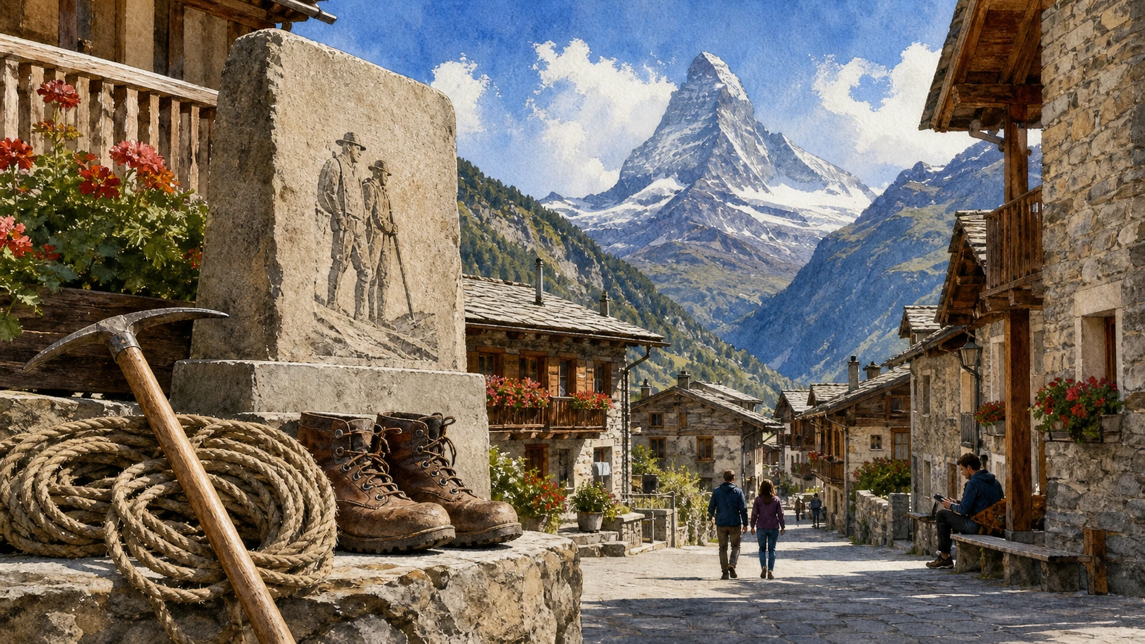
Documentary watercolour of Valtournenche village, guide memorial and early mountaineering equipment beneath the Matterhorn
Valtournenche · the mountain seen through local workThe guide memorial and village street sit below the real Matterhorn profile, with nineteenth-century rope and ice tools treated as professional evidence rather than romantic props.
05

A pasture basin remade by roads, hotels and lifts

Breuil-Cervinia and the Resort Transformation

Cervinia is a major twentieth-century construction within the older Breuil landscape.

The place today

The resort combines large hotels, apartment buildings, lift stations and retained fragments of pasture. Reading it honestly means keeping modern infrastructure visible rather than imagining an untouched Alpine village.

The historical chapter

The name Breuil described the marshy high basin. From the 1930s, road access and planned tourism promoted Cervinia as a modern national resort; post-war lifts and international skiing expanded the transformation.

What to notice

  • Wet ground and streams beneath resort construction
  • Different architectural periods around the central basin
  • Lift corridors climbing towards Plateau Rosa
Turismo Valle d’Aosta · Breuil-Cervinia
06

A small reflective landscape with limited capacity

Blue Lake and the Breuil Basin

The celebrated reflection works because water, woodland and viewpoint align—not because the site is a limitless stage.

The place today

Lago Blu is easily reached near the road and can become crowded. Visitors should remain on durable routes, protect the banks and accept that wind or weather may remove the expected reflection.

The historical chapter

Glacial processes and local drainage formed the small lake within the wider Breuil basin. Tourism turned its Matterhorn reflection into one of the valley’s most reproduced images.

What to notice

  • Submerged vegetation affecting the water colour
  • Erosion at informal shoreline viewpoints
  • The mountain reflection changing with wind and sun
Turismo Valle d’Aosta · Matterhorn area
07

A transalpine system at the edge of ice

Plateau Rosa, Glaciers and High Infrastructure

Cableways make altitude reachable, but they do not turn glacier terrain into an ordinary urban platform.

The place today

Lift operations, cross-border connections and ski access depend on weather, maintenance and snow. Outside controlled areas, crevasses and high-altitude exposure require mountaineering knowledge and equipment.

The historical chapter

Successive cableway generations connected Breuil-Cervinia with the high plateau and Swiss network. Scientific and meteorological functions developed alongside tourism as glaciers changed around the infrastructure.

What to notice

  • Glacier surfaces separated from prepared routes
  • Older lift structures beside newer stations
  • The international boundary crossing a continuous high landscape
Turismo Valle d’Aosta · Matterhorn area
08

Access by cable car and path changes the pace of arrival

Chamois, a High Village without Ordinary Road Traffic

Chamois is defined as much by how it is reached as by its altitude.

The place today

A public cable car links the municipality to the valley floor; walking routes provide slower alternatives. Schedules, maintenance and weather should be checked, because the absence of ordinary road access affects every practical decision.

The historical chapter

Scattered hamlets developed around agriculture and connections across mountain paths. Modern cable transport preserved a different settlement pattern from road-based resorts while enabling residents and visitors to maintain year-round access.

What to notice

  • Separate hamlets rather than one compact centre
  • Paths and small service vehicles replacing through traffic
  • Terraces and former fields around the houses
Turismo Valle d’Aosta · Chamois
09

Sunny terraces above Valtournenche

Torgnon and La Magdeleine

These villages show the valley through farms, mills and dispersed settlement rather than the summit resort.

The place today

Footpaths connect hamlets, chapels, pastures and historic mill structures. Their lower altitude and open exposure create a different seasonal experience from Breuil-Cervinia, though snow and transport still require current checks.

The historical chapter

Agriculture used sunny slopes and water channels to support cereals, livestock and hay. Mills and communal infrastructure reveal networks of shared work across small settlements.

What to notice

  • Hamlets spread across favourable terraces
  • Water channels feeding former mill systems
  • Traditional buildings beside newer holiday homes
Turismo Valle d’Aosta · Matterhorn area
10

A municipality of many villages beneath Monte Rosa

Ayas and Antagnod

Ayas is a distributed cultural landscape, not simply the resort of Champoluc.

The place today

Antagnod retains a parish centre and historic houses on a sunny slope, while numerous hamlets extend along the valley. Moving between them reveals variations in wood, stone and settlement form.

The historical chapter

Pasture, seasonal movement and routes over Alpine passes shaped the communities. Religious art, communal institutions and later tourism developed differently across settlements that were administratively connected but physically dispersed.

What to notice

  • The parish church positioned above the valley
  • Rascard-type timber structures among later houses
  • Views towards Monte Rosa changing from village to village
Turismo Valle d’Aosta · Ayas Valley
11

A resort developed along a working valley route

Champoluc and the Evançon Corridor

Champoluc combines older settlement fragments with the principal tourism infrastructure of Ayas.

The place today

The village follows the Evançon stream and road, with lifts and services concentrated near the centre. Riverside walks and hamlet connections help separate the physical valley from the resort network layered onto it.

The historical chapter

Hotels and mountain tourism expanded a settlement already connected to pasture and pass routes. Ski infrastructure later linked Champoluc to a wider Monte Rosa domain, changing employment and construction across the municipality.

What to notice

  • The stream remaining visible within the developed corridor
  • Older timber and stone buildings behind hotels
  • Lift access branching away from the road axis
Turismo Valle d’Aosta · Ayas Valley
12

Gold, labour and woodland beyond the ski image

Brusson and the Mining Landscape

Mining adds an industrial chapter to the pastures and villages of Val d’Ayas.

The place today

Brusson’s territory includes historic extraction sites and interpreted mining evidence. Galleries and unstable structures require authorised access; surface traces should be read with local heritage information.

The historical chapter

Gold-bearing deposits attracted repeated extraction, with important industrial activity between the nineteenth and twentieth centuries. Mines brought specialised labour and outside capital while leaving waste, buildings and routes in the mountain landscape.

What to notice

  • Waste rock distinguished from natural slope deposits
  • Tracks aligned with mine levels rather than farms
  • Woodland recolonising former working areas
Turismo Valle d’Aosta · Ayas Valley
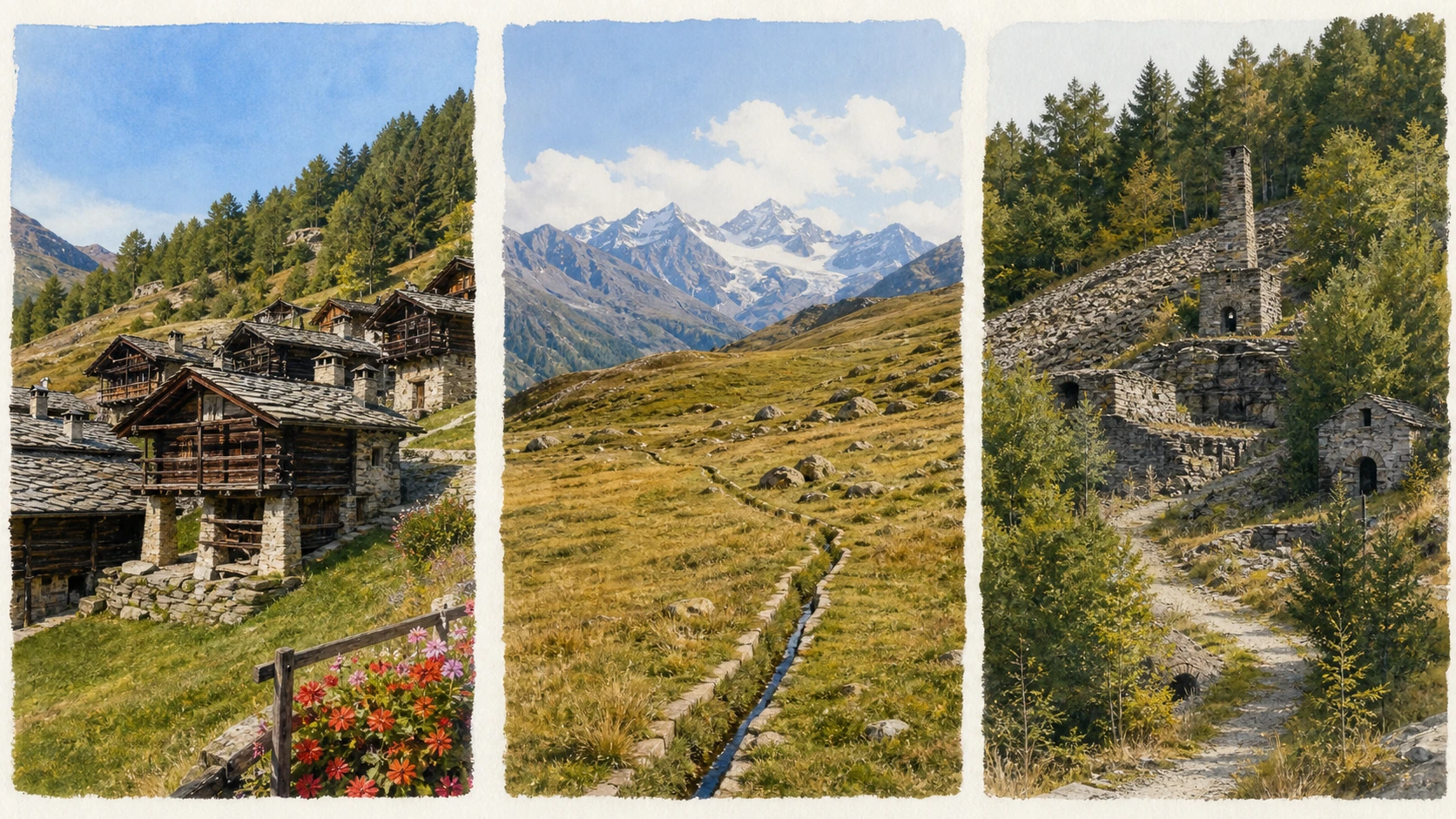
Editorial documentary watercolour triptych of Antagnod village, Val d’Ayas pasture and historic Brusson mine structures
Val d’Ayas · villages, pasture and mining tracesAntagnod, high pastures and the Brusson mining landscape are arranged as an editorial triptych, preserving their differences and avoiding a false single panorama.
13

A Walser centre reshaped by villas and tourism

Gressoney-Saint-Jean

The village joins vernacular settlement, nineteenth-century leisure and the Lys landscape.

The place today

The centre, small lake, surrounding hamlets and early villas can be explored on foot. Timber architecture survives among later buildings, and Titsch names remain part of local identity.

The historical chapter

Walser-speaking communities settled and traded across high passes. From the nineteenth century, royal and bourgeois visitors added villas and new services, placing Gressoney within a wider Alpine tourism culture.

What to notice

  • Walser timber houses beyond the central streets
  • Villa architecture using regional motifs selectively
  • Titsch place names alongside Italian forms
Turismo Valle d’Aosta · Lys Valley–Gressoney
14

Royal architecture looking towards Monte Rosa

Castel Savoia and Its Alpine Garden

The castle is a designed viewpoint and residence, not a medieval fortress.

The place today

Guided access reveals interiors created for Queen Margherita, while the surrounding garden presents Alpine plants in a managed setting. Opening times and tour capacity should be checked in advance.

The historical chapter

Built between 1899 and 1904, Castel Savoia reflects Queen Margherita’s attachment to Gressoney and a romantic interpretation of mountain architecture. Its position and windows deliberately frame the Monte Rosa landscape.

What to notice

  • Asymmetrical towers designed for a modern residence
  • Interior decoration combining court taste and Alpine references
  • Garden collections separated from surrounding wild vegetation
Regione Valle d’Aosta · Castel Savoia
15

A high Walser settlement below Monte Rosa

Gressoney-La-Trinité and the Upper Lys

The upper village retains a distinct community even within an international ski domain.

The place today

The parish centre and surrounding hamlets sit among lifts, roads and high pastures. Walking away from the main facilities reveals traditional buildings and the scale of the upper valley.

The historical chapter

Walser settlement, transalpine trade and seasonal agriculture shaped the municipality. Mountaineering and winter sports later tied it economically to Monte Rosa and neighbouring valleys while Titsch culture persisted.

What to notice

  • Historic hamlets separated from lift bases
  • Timber houses placed above snow and damp
  • Monte Rosa glaciers closing the valley head
Turismo Valle d’Aosta · Gressoney-La-Trinité
16

Migration remembered through language and construction

The Walser Ecomuseum, Houses and Titsch

Walser heritage is strongest when buildings, words and working objects are read together.

The place today

The ecomuseum at Gressoney-La-Trinité interprets domestic life, building practice and the local Germanic language known as Titsch. Small opening windows make current verification essential.

The historical chapter

Walser groups moved from the upper Rhône region across Alpine passes during the Middle Ages, founding high settlements linked by trade and kinship. Log-built houses and raised granaries responded to available timber, storage needs and climate.

What to notice

  • Horizontal timber blockwork above stone bases
  • Circular stone or wooden supports protecting stored grain
  • Titsch terms attached to rooms, tools and places
Regione Valle d’Aosta · Walser Ecomuseum
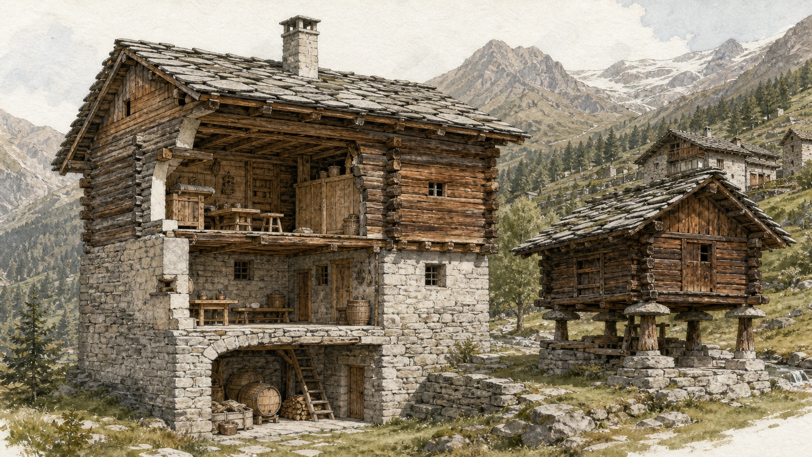
Documentary watercolour cutaway of a traditional Walser house and raised granary in Gressoney with domestic objects and mountain hamlet beyond
Gressoney · architecture as a record of movementA Walser house is shown with its stone base, timber blockwork and raised granary supports; domestic objects and Titsch place names remain connected to a living community.
17

Europe’s highest building on Punta Gnifetti

Monte Rosa and the Margherita Hut

The hut is an extraordinary scientific and mountaineering outpost, not a conventional sightseeing destination.

The place today

Reaching Capanna Margherita involves glacier travel above 4,500 metres, severe altitude and rapidly changing conditions. It demands acclimatisation, technical equipment and appropriate professional judgement; viewing Monte Rosa from the valleys is a complete experience in itself.

The historical chapter

The first hut was inaugurated in 1893 and named for Queen Margherita. Rebuilt in the late twentieth century, it supports mountaineers and high-altitude research on Punta Gnifetti within the Monte Rosa massif.

What to notice

  • The hut’s small scale against the summit ridge
  • Roped teams navigating complex glacier terrain
  • Cloud and wind isolating the high structure
Turismo Valle d’Aosta · Lys Valley–Gressoney
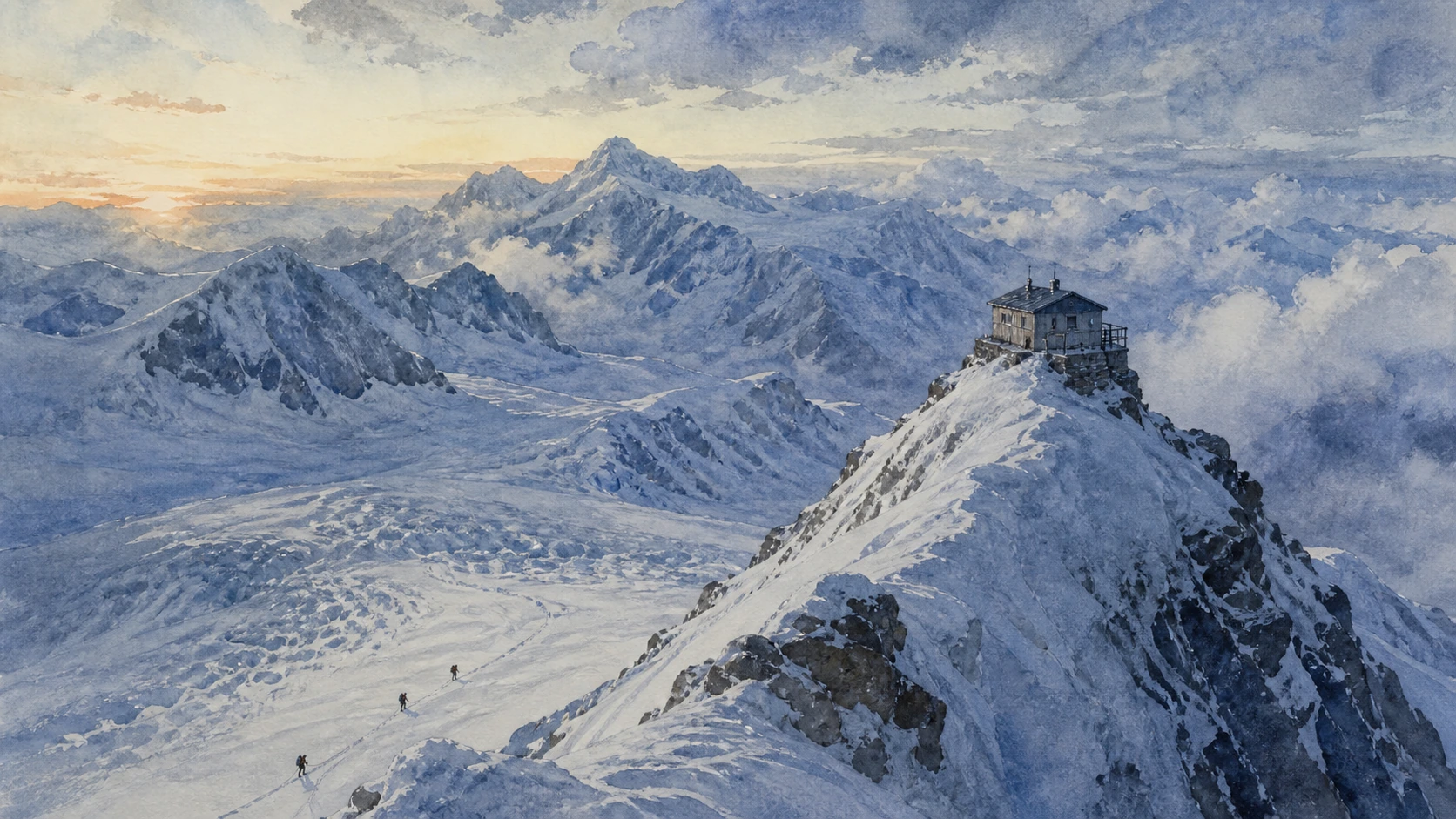
Documentary watercolour of the Margherita Hut on Punta Gnifetti above the glaciers of Monte Rosa with a distant roped mountaineering team
Monte Rosa · the limit of ordinary travelThe Margherita Hut appears small on Punta Gnifetti above complex glacier terrain, making clear that the scene belongs to expert mountaineering rather than a casual excursion.
18

Lift links are not cultural shortcuts

Connecting the Valleys without Flattening Them

The Matterhorn and Monte Rosa networks connect some slopes, but the valleys retain separate roads, histories and conditions.

The place today

Travel between Valtournenche, Ayas and Gressoney by road requires returning to the central valley unless seasonal high routes or operating lift links are appropriate. Timetables, weather and last descents must be checked on the day.

The historical chapter

Passes once supported local trade and seasonal movement; modern lifts created new high connections for skiing and tourism. Neither system made the valleys identical, and climate change is now altering the snow and ice on which many routes depend.

What to notice

  • Different settlement and language traditions in each valley
  • Infrastructure ending where glacier terrain begins
  • Seasonal links that cannot be assumed year-round
Turismo Valle d’Aosta · eastern tourist areas

The eastern valleys through time

From Walser settlement
to connected mountain resorts

The chronology keeps settlement, guiding, mining and tourism in the same frame as the celebrated summit stories.

  1. Walser-speaking groups establish high settlements across the upper Lys and neighbouring Alpine valleys.

  2. Pasture, trade, parish life and routes across passes organise Valtournenche, Ayas and Gressoney.

  3. Mining expands at sites including Brusson, linking the valleys to wider industrial markets.

  4. Whymper’s party completes the first Matterhorn ascent; four members die on descent.

  5. Jean-Antoine Carrel’s party reaches the summit by the Italian Lion Ridge.

  6. The first Margherita Hut is inaugurated on Punta Gnifetti.

  7. Castel Savoia is built for Queen Margherita at Gressoney-Saint-Jean.

  8. Roads, planning and lifts begin the transformation of Breuil into Cervinia.

  9. Ski infrastructure and mass tourism expand across all three eastern valleys.

  10. Walser culture, guide traditions and historic landscapes coexist with connected resorts and rapidly changing glaciers.

Before your visit

Practical information,
without turning it into promises

01

Give each valley a day

Valtournenche, Ayas and Gressoney are separate road journeys. A meaningful circuit needs at least one focused day in each rather than a rapid checklist.

02

Check lift links on the day

High connections depend on season, wind, snow and operating schedules. Never assume that a map line guarantees a return journey.

03

Reserve cultural visits

Castel Savoia, ecomuseums, mines and small collections may have guided entry or limited opening periods; confirm through the official source.

04

Respect the high-mountain boundary

Glacier viewpoints are not glacier routes. Plateau Rosa, Monte Rosa huts and Matterhorn ascents require different levels of skill, acclimatisation and professional support.

Method and sources

Artistic in appearance.
Documentary in content.

Merlintravel combines official regional heritage and tourism sources with valley-by-valley historical interpretation. The editorial structure deliberately resists treating the eastern Alps as a list of ski resorts.

Lift operations, roads, snow, glacier conditions, museum access and guided routes can change quickly. Confirm every practical detail with official operators, municipalities and qualified local professionals before travel.