ILLUSTRATED GUIDE · SICILY
A river port
where Sicily faces Africa
and every street carries memory
Twenty-four substantial chapters follow Mazara from the Mazaro river-port and ancient Mediterranean routes through the Casbah, cathedral, Satyr, Tunisian community, fishing economy and protected wetlands.
Explore the placesTHE SICILIAN CITY THAT LOOKS SOUTH ACROSS THE CHANNEL
Mazara del Vallo is often introduced through three images: the Casbah, the fishing fleet and the Dancing Satyr. All three matter, but none can carry the city alone.
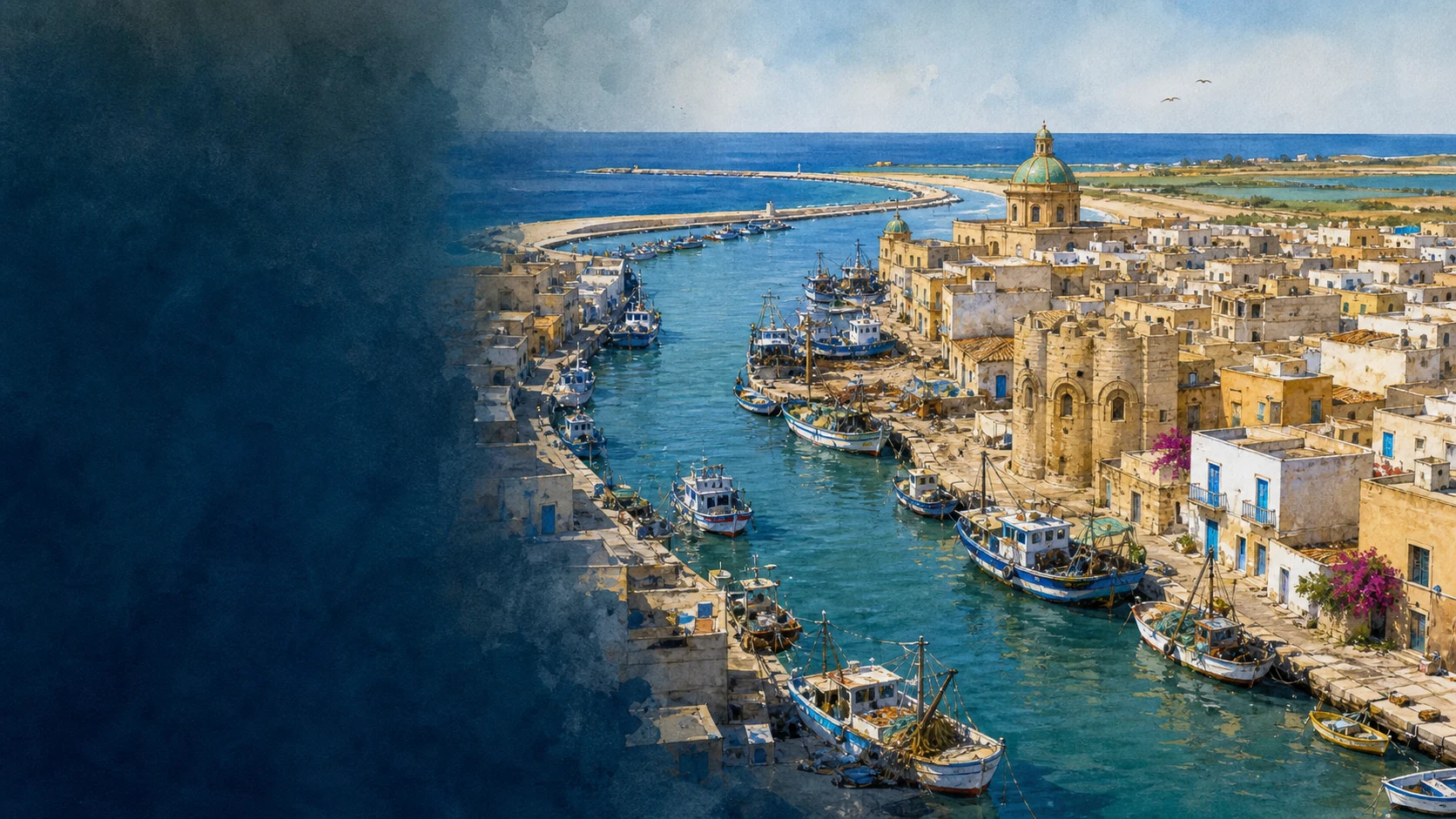
The Mazaro enters the Mediterranean through the centre of the settlement. Around that river mouth grew an anchorage, a fortified emporium, a Roman station, an Islamic port, a Norman bishopric and a modern maritime economy whose routes extend far beyond the horizon visible from the waterfront.
The old quarters are not a preserved ninth-century stage set. Their lanes, courtyards, churches, workshops, empty plots, restored houses, Tunisian families and new art belong to different moments. Reading them well means resisting both nostalgia and the language of cultural purity.
This guide therefore moves from terrain to archaeology, from medieval institutions to working harbour, and from celebrated monuments to fragile wetlands. It treats Mazara as a living Mediterranean city whose histories meet without becoming interchangeable.
One destination
Twenty-four chapters across port, city, communities and wetlands
Mazara del Vallo occupies a low coastal plain at the mouth of the Mazaro, on Sicily's south-western edge. Tunisia lies across the Sicilian Channel, close enough to shape navigation, fishing, migration, language and everyday imagination, but never so close that the crossing becomes simple or politically neutral.
Institutional and archaeological sources describe a Phoenician landing place, a Punic and Roman fortified centre and a settlement that remained significant in late antiquity and the Byzantine period. Islamic conquest in 827 transformed Mazara into a major fortified port and administrative centre; Norman rule then reorganised castle, cathedral and diocese without erasing the population or skills of the preceding city in one moment.
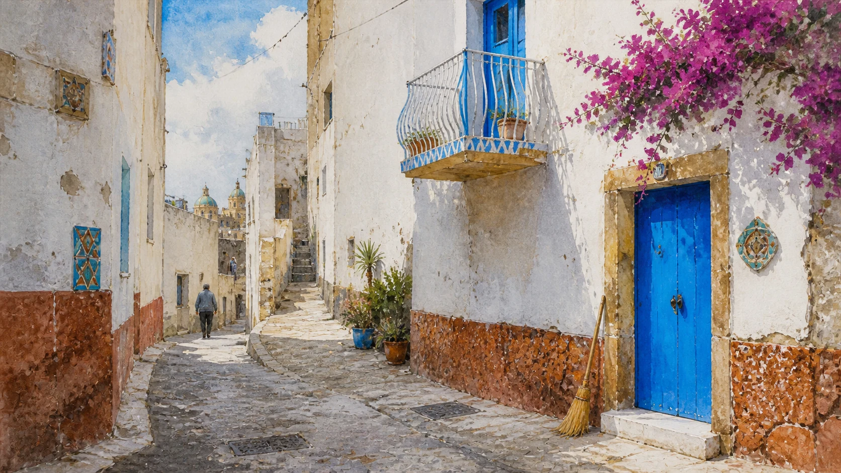
The historic centre is commonly called the Casbah, yet its fabric includes Islamic urban inheritance, medieval walls, Jewish and Christian quarters, Baroque churches, nineteenth-century buildings and twentieth-century rupture. The name is useful when it opens questions about streets and communities, misleading when it turns the whole centre into an exotic backdrop.
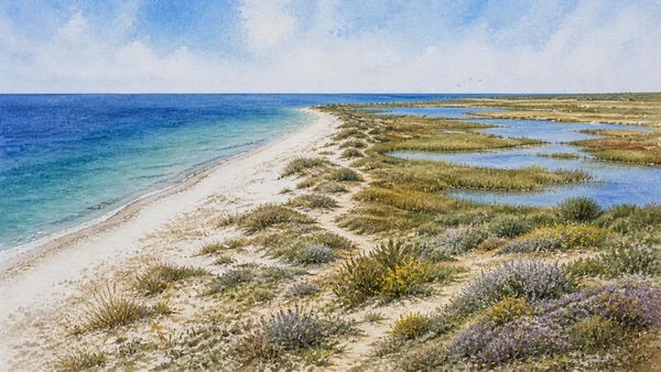
Beyond the monuments, Mazara remains a port of labour and risk. Fishing vessels, shipwrights, markets, dredging, long voyages and conservation rules connect the city to a changing sea, while Capo Feto and Lago Preola-Gorghi Tondi show that the flat coast is also a migration corridor for birds and a landscape of ecological limits.

The selection
Twenty-four chapters,
one Mediterranean city
The route consolidates nearby monuments and connected histories while keeping the port, Casbah, religious centre, museums, living communities, labour and protected landscapes visible in their own right.
- 01The Mazaro, the Sicilian Channel and a Territory Older than the Port
- 02Phoenician Emporium and Punic Fortified Port
- 03From Roman Mazaris to the Byzantine City
- 04The 827 Landing, Islamic Mazara and the Val di Mazara
- 05The Casbah, Lost Walls and Remembered Gates
- 06Norman Conquest, Castle and the Surviving Arch
- 07The Diocese and San Nicolo Regale
- 08The Cathedral from Norman Foundation to Baroque Rebuilding
- 09Gagini's Transfiguration, Painted Cross and Roman Sarcophagi
- 10Piazza della Repubblica, Bishop's Palace and Seminary
- 11Diocesan Museum, San Michele and the Benedictine Monastery
- 12San Francesco and Santa Maria delle Giummarre
- 13San Vito a Mare and the Patron at the River Mouth
- 14Piazza Plebiscito, the Jesuit College and Sant'Egidio
- 15The Dancing Satyr: Recovery, Body and Responsible Interpretation
- 16Beyond the Satyr: Underwater Routes and Mirabilia Urbis
- 17Teatro Garibaldi and the City after the 1968 Earthquake
- 18Tunisian Mazara: Migration, Mosque and the Work of Living Together
- 19The Contemporary Casbah: Ceramic Art, Theatre and Shared Public Space
- 20The Port, Deep-Sea Fleet and Maritime Workshops
- 21Couscous, Broth and the Fish Table
- 22Tonnarella and Lungomare Fata Morgana
- 23Capo Feto, Lago Preola and the Gorghi Tondi
- 24A Complete Mazara Route from River Dawn to the Wetlands
RIVER MOUTH, LOW COAST AND INLAND BASINS EXPLAIN WHY PEOPLE RETURNED TO THIS LANDSCAPE
The Mazaro, the Sicilian Channel and a Territory Older than the Port
Mazara begins with water and terrain: a working river-channel facing Africa and a wider territory occupied long before an urban port existed.

The place today
Fishing vessels, small boats, bridges, quays and flood-control infrastructure turn the final reach of the Mazaro into a working urban channel. The open sea begins immediately beyond the harbour mouth, while the historic centre occupies the east bank and later neighbourhoods extend on both sides. Roccazzo and other archaeological zones lie outside the central visitor circuit, while evidence near Gorghi Tondi and Torre Granatelli belongs to landscapes now shaped by farms, roads and protected habitats.
The historical chapter
Fresh water, a protected inlet and access to the Sicilian Channel favoured landing, storage, repair and exchange. The shoreline and river mouth changed through sediment, storms, quays and engineering, so the present channel cannot be treated as an untouched map of the ancient harbour. Regional inventories record prehistoric settlement and necropolis evidence ranging from the Mesolithic and Neolithic to the Bronze Age.
What to notice
- Read the river from both banks; road bridges and port limits make short visual distances longer on foot.
- Archaeological labels cover long periods and separate sites, not one uninterrupted prehistoric town beneath modern Mazara.
TRADE WITH SELINUNTE GAVE WAY TO A CARTHAGINIAN STRATEGIC HARBOUR
Phoenician Emporium and Punic Fortified Port
Archaeological fragments and later urban layers preserve a port that changed political systems without losing its maritime value.

The place today
No monumental Phoenician quarter stands intact above ground. The phase is reconstructed from dispersed finds, later texts, the topography of the river port and archaeological work beneath the modern centre. The Punic phase survives through archaeological classification, portable material and the broader network linking Lilybaeum, Motya's successor landscapes, Panormos and North Africa.
The historical chapter
Diodorus' account has been used to identify Mazara as the coastal and port outpost of Selinunte. Phoenician, Greek and indigenous networks overlapped across western Sicily; calling the settlement simply a colony would hide the shifting commercial and political relationships around the anchorage. Regional heritage mapping describes the central site as a Phoenician landing place, then a fortified Punic and Roman centre.
What to notice
- The exact origin of the place-name is debated and should not be presented as securely Phoenician.
- Modern defensive alignments cannot automatically be projected back onto the fourth-century BC perimeter.
MOSAIC ROOMS, PORT ROUTES AND CHRISTIAN INSTITUTIONS OCCUPIED THE SAME LOW URBAN GROUND
From Roman Mazaris to the Byzantine City
Roman, late-antique, Paleochristian and Byzantine evidence survives as a layered sequence rather than a complete quarter visible above ground.

The place today
Roman sarcophagi in the cathedral, mosaics below San Nicolo Regale and scattered finds across the centre reveal the phase more clearly than the street plan. Much remains beneath later buildings. The church and the excavated level are part of an active conservation and musealisation programme. Evidence is distributed between the cathedral, museums, excavated areas and reused fragments in later buildings.
The historical chapter
The Antonine Itinerary records a station on the coastal route, while funerary objects, inscriptions and imported marble indicate patrons with resources. The evidence supports an active town into late antiquity rather than a port that revived only after the Islamic conquest. The domus demonstrates occupation, investment and skilled decoration in late antiquity. Research identifies a possible small paleochristian basilica near the San Michele-Santa Veneranda area and notes a Greek Christian inscription preserved in the cathedral.
What to notice
- The ancient name appears in varying Latin forms; Mazaris is a useful convention, not the only spelling.
- Avoid treating Byzantine Mazara merely as a prelude to conquest; it had its own long institutions and material culture.
A MILITARY LANDING BECAME A LONG MEDITERRANEAN URBAN CHAPTER LARGER THAN ONE DATE
The 827 Landing, Islamic Mazara and the Val di Mazara
Conquest, fortified port, markets and the administrative name Val di Mazara must be connected without turning the modern city into the whole of western Islamic Sicily.

The place today
The event is remembered in civic and religious narratives, yet no simple landing monument can recreate the historical shoreline, the army's composition or the decades of warfare that followed. Street patterns and later place memory suggest the scale of the medieval nucleus, but most buildings visible above ground are Norman, late medieval, Baroque or modern. The phrase survives in regional identity and the city's official name.
The historical chapter
The force included North African and other Muslim troops operating from Ifriqiya. Palermo fell in 831, Syracuse in 878 and Byzantine resistance continued elsewhere until the early tenth century. Mazara's landing was decisive, but it was not an instantaneous conquest of the island. Academic research considers Islamic conquest central to Mazara's urban development. The three-valli system took shape through Islamic and Norman administrative geography and was later transformed under subsequent governments.
What to notice
- Use 827 for the expedition's landing and Mazara's occupation, not for the completion of Islamic rule across Sicily.
- Do not project one fixed map across the entire Islamic, Norman and early modern periods.

LANES AND THRESHOLDS RECORD URBAN ADAPTATION, NOT AN UNCHANGED MEDIEVAL STAGE SET
The Casbah, Lost Walls and Remembered Gates
The historic street network becomes legible when its narrow branches are read with vanished defences, property changes and modern daily life.

The place today
Via Bagno, the San Francesco area, the Giudecca, Xitta and connecting alleys form a lived neighbourhood of homes, worship, art, workshops and vacant or restored properties. Public routes cross private thresholds constantly. Street names, changes in block geometry, the former castle zone and archaeological evidence help locate the perimeter.
The historical chapter
Researchers describe an urban tree structure in which secondary lanes branch from larger routes. Yet earthquakes, demolition, rebuilding, religious foundations and modern interventions altered the fabric, so morphology is more reliable than claims of intact ninth-century buildings. Al-Idrisi praised Mazara's walls in the twelfth century, and later records allow scholars to reconstruct much of the circuit.
What to notice
- Casbah is a modern civic and tourism label as well as a historical comparison; use it without turning residents into scenery.
- Street names that recall gates may preserve memory without preserving the exact medieval structure.
ONE AUTHENTIC FRAGMENT NOW CARRIES THE MEMORY OF A DISMANTLED CONQUEST LANDMARK
Norman Conquest, Castle and the Surviving Arch
The Norman Arch is both medieval fabric and a modern urban monument, separated from the castle complex to which it once belonged.

The place today
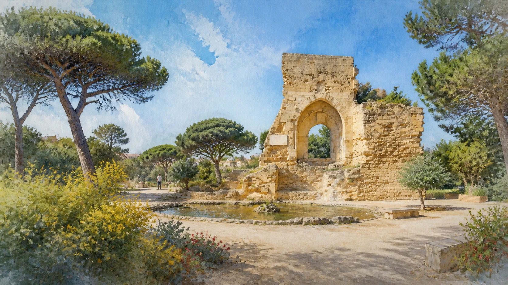
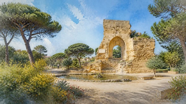
The so-called Norman Arch stands alone as the principal visible remnant. Its isolated appearance results partly from demolition and later urban redesign, not from the castle having consisted of one gateway. The monument was ceremonially reopened in January 2024 after works approved by the heritage authority and supported through public-private cooperation.
The historical chapter
The fortress belonged to the early Norman military network. It controlled the coast and announced new royal authority while Mazara's Arabic-speaking inhabitants, agricultural systems and commercial knowledge continued to shape the territory. The castle underwent major alteration and eventual reduction, leaving the gateway-like remnant as an urban memory object.
What to notice
- The arch is a remnant of a larger fortified complex, not a freestanding triumphal arch.
- Current event access around Piazza Mokarta may differ from ordinary pedestrian conditions.

ECCLESIASTICAL REORGANISATION AND COMPACT MEDITERRANEAN GEOMETRY FOLLOWED THE NORMAN CONQUEST
The Diocese and San Nicolo Regale
The restored diocese and the small riverside church show how conquest, liturgy and architecture reshaped Mazara at different scales.

The place today
The cathedral, bishop's palace, seminary, archive and museum still make Piazza della Repubblica an institutional landscape rather than a collection of separate monuments. Set close to the Mazaro, the church appears compact and almost self-contained.
The historical chapter
The founding diploma assigned a territory extending across much of western Sicily. The new Latin hierarchy reorganised property and worship after conquest, while Greek Christian and Muslim communities remained part of the wider Norman kingdom. The building belongs to the island's Norman culture, where Latin rule interacted with Byzantine spatial models and Islamic workmanship.
What to notice
- The diocese's medieval boundaries were far larger than the present municipality and changed over time.
- Opening and excavation access can be separate, especially during conservation campaigns.
APSIS AND TRANSEPT SURVIVED INSIDE A BASILICA RADICALLY RECOMPOSED IN THE SEVENTEENTH CENTURY
The Cathedral from Norman Foundation to Baroque Rebuilding
The cathedral is neither a pure Norman church nor a generic Baroque interior, but a major record of selective survival and rebuilding.

The place today
The apse and transept walls are the principal witnesses to the early building, while later portals, chapels, columns and decoration dominate the visitor's experience. Reading both phases prevents the cathedral from being assigned one style. Doric columns divide the nave, chapels gather sculpture and painting, and the eastern medieval shell frames a later liturgical interior.
The historical chapter
Tradition and diocesan history connect the foundation with Count Roger and the transformation of an earlier mosque site. The claim expresses the Christian reorganisation of the city; archaeology and surviving masonry are more reliable than triumphal legend for reconstructing the exact sequence. Bishop Francesco Maria Graffeo initiated reconstruction, with Pietro Castro associated with the design and Pietro Schifano with execution.
What to notice
- Phrase the mosque-to-cathedral transition carefully because the exact earlier building is not preserved as a visible complete structure.
- Religious services take priority over sightseeing and can limit access to the choir, chapels or artworks.
MARBLE, PAINT AND ANCIENT STONE TURN THE CATHEDRAL INTO A CHRONOLOGICAL ASSEMBLY
Gagini's Transfiguration, Painted Cross and Roman Sarcophagi
Three very different groups of objects reveal patronage, devotion and reuse without belonging to one original decorative programme.

The place today
The marble figures are best understood from the nave and, when access permits, from closer guided viewpoints. Lighting and liturgical arrangements affect how clearly the separate levels can be seen. The thirteenth-century cross hangs high beneath the triumphal arch, while ancient sarcophagi and Renaissance works occupy new Christian contexts.
The historical chapter
The work belongs to the Gagini workshop culture that reshaped sacred interiors across Renaissance Sicily. It followed the cathedral's adoption of the Transfiguration as a defining image and remained central when the surrounding building was reconstructed. The cross shows Christ on one face and the Mystic Lamb with evangelist symbols on the other.
What to notice
- Distinguish the sculptural group from the earlier Transfiguration icon associated with Cardinal Bessarion.
- Some works have moved repeatedly within the church; current placement should be checked against updated diocesan information.
RELIGIOUS GOVERNMENT, CIVIC REPRESENTATION AND LEARNING SHARE ONE URBAN STAGE
Piazza della Repubblica, Bishop's Palace and Seminary
The main square and its connected institutions explain Mazara as an episcopal city rather than as a collection of isolated facades.

The place today
The column of San Vito, attributed to Ignazio Marabitti and dated 1771, centres the open space. Processions, civic ceremonies and everyday crossing continually change how the square is occupied. The bridge is best read from the square and adjoining streets. The collection is generally encountered through guided openings, exhibitions or institutional programmes.
The historical chapter
The ensemble developed through episcopal and civic patronage. Its Baroque unity partly conceals the medieval origins of the cathedral quarter and the changing balance between royal, ecclesiastical and municipal authority. The palace accumulated administrative, residential and ceremonial roles beside the cathedral. Diocesan chronology records the decision to build a new seminary in 1711 between the cathedral and bishop's palace.
What to notice
- The square is an active religious and civic space; event barriers can temporarily reorganise movement.
- Historic-book counts and cataloguing can change as collections are reorganised.
SACRED OBJECTS AND MONASTIC ARCHITECTURE CONNECT THE CENTRE TO A MUCH WIDER TERRITORY
Diocesan Museum, San Michele and the Benedictine Monastery
Museum collections and the Benedictine complex preserve networks of patronage, female religious life and artistic movement across western Sicily.

The place today
Displays and temporary exhibitions can change, and some objects continue to belong to living devotional communities. The museum is best paired with the cathedral and seminary rather than treated as an isolated treasure room. The monastery remains a religious institution, so the most complete access often occurs during special cultural days.
The historical chapter
The collection reflects centuries of commissions, parish transfers, earthquake damage, conservation and diocesan centralisation. Reliquaries and liturgical furnishings reveal materials, workshops and routes that linked small western Sicilian communities to larger artistic centres. Recent institutional scholarship connects the monastery with Norman Mazara, Giorgio of Antioch and Greek documentary culture.
What to notice
- Verify opening through the diocese because staffing and exhibition schedules are dynamic.
- Describe the church's visible Baroque phase separately from the medieval foundation of the institution.
A BAROQUE INTERIOR AND A FORMER ABBEY FRAME DIFFERENT EDGES OF RELIGIOUS AND SOCIAL MEMORY
San Francesco and Santa Maria delle Giummarre
The two complexes broaden the sacred map beyond the cathedral while requiring careful distinction between open worship, difficult histories and restricted spaces.

The place today
The church is again an active sacred and cultural place, known for a richly modelled interior. Its surrounding quarter, crypt and former convent spaces reveal a much larger institutional footprint. The abbey stands apart from the central walking route and remains a place of worship.
The historical chapter
The diocese records a Franciscan foundation in 1224, while the building later acquired major Baroque decoration. The complex became a Carabinieri barracks and then a women's prison before abandonment around 1970 and subsequent recovery. Local tradition gives a foundation around 1085, but the visible building incorporates later alteration.
What to notice
- The label Arab-Norman is often used locally, but the visible interior is substantially later and must be described as such.
- Confirm worship and visiting times; the distance from the centre makes an unsuccessful visit costly.
THE CITY'S PATRON BELONGS TO A COASTAL LANDSCAPE OF RIVER, FISHING AND DEPARTURE
San Vito a Mare and the Patron at the River Mouth
The small church and its shoreline setting join civic devotion to the maritime geography that shaped Mazara's economy and migrations.

The place today
The seaside sanctuary offers a low horizontal counterpoint to the cathedral quarter. The Festino activates streets and water with religious and civic events whose programme changes each year.
The historical chapter
San Vito became the principal patron through early-modern civic petition and diocesan recognition. Eighteenth-century monuments by Ignazio Marabitti and Filippo Pennino fixed his image in Piazza della Repubblica and at the Mazaro's mouth, joining devotion to urban geography.
What to notice
- Accounts of the saint's birthplace belong to devotional tradition and cannot be treated as independently verified biography.
- During the Festino, check routes and restrictions rather than assuming ordinary access.
EDUCATION, CHURCH ARCHITECTURE AND A NEW ARCHAEOLOGICAL MUSEUM REFRAMED THE SAME CIVIC SPACE
Piazza Plebiscito, the Jesuit College and Sant'Egidio
The former Jesuit and religious buildings show how institutions change use while retaining their place in the public centre.

The place today
Its arcades, facades and courtyard spaces support civic and cultural uses. Nearby Sant'Egidio, the former church that houses the Satyr, creates a dense sequence of sacred buildings adapted to new institutions. The deconsecrated church provides a focused interior in which the bronze can be seen in the round.
The historical chapter
The Society of Jesus established educational and devotional authority through colleges across early-modern Sicily. In Mazara, the complex reorganised movement and public space, then acquired civic functions after the suppression and later transformations of the order. Construction extended from the beginning toward the end of the 1500s.
What to notice
- Current internal uses may change; do not assume every wing belongs to one museum circuit.
- Do not let the bronze erase the church's earlier architectural identity.

A BRONZE RECOVERED IN TWO STAGES BECAME AN ICON WITHOUT SOLVING EVERY QUESTION OF DATE OR GESTURE
The Dancing Satyr: Recovery, Body and Responsible Interpretation
The recovery story and the sculpture's incomplete body must be read together, keeping missing attributes and scholarly disagreement visible.

The place today
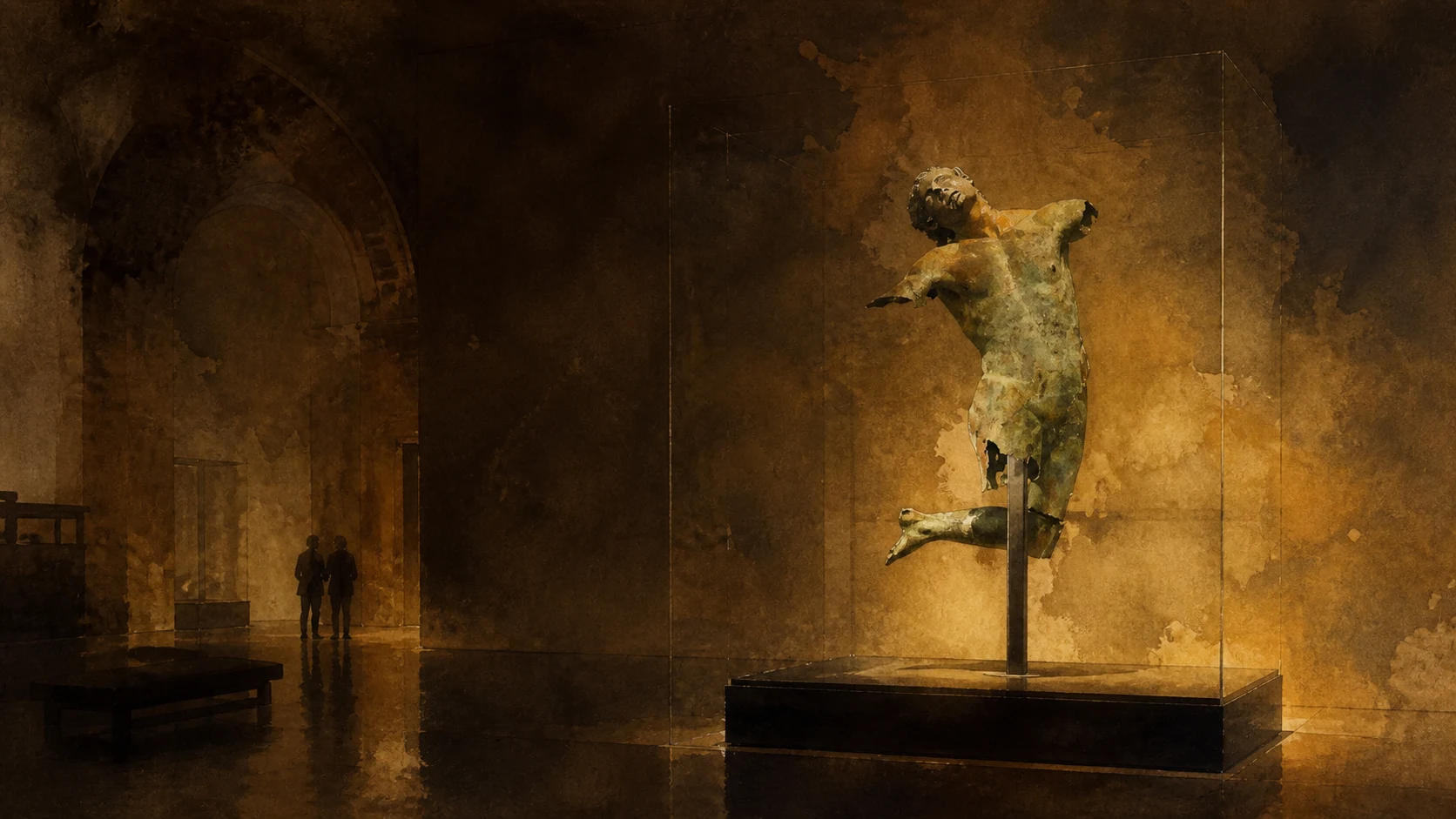
The left leg recovered in spring 1997 and the torso raised on 4 March 1998 are reunited in the museum. Missing limbs remain visible as absence rather than hidden by a complete modern reconstruction. Visitors see a body thrown backward, wind-swept hair and one surviving leg.
The historical chapter
After recovery, the fragments underwent treatment at the Istituto Centrale per il Restauro in Rome and returned to Mazara in 2005. The story joins fishing knowledge, chance, state conservation and civic advocacy rather than a conventional planned excavation. Regional sources have offered dates ranging from the late fourth-century BC to Hellenistic production or a later replica, and have connected the work to the circle or school of Praxiteles.
What to notice
- Credit the vessel, captain and crew; the discovery was not made by an abstract museum institution.
- Reconstructions of the missing arms and objects are hypotheses and should not be described as recovered evidence.
AMPHORAE, BRONZE, CANNONS AND SCULPTURE CONNECT THE SEA TO TWO COMPLEMENTARY MUSEUMS
Beyond the Satyr: Underwater Routes and Mirabilia Urbis
Mazara's collections reveal long-distance navigation and the changing ways maritime and urban finds were recovered, conserved and displayed.

The place today
Transport amphorae, a medieval bronze cauldron, a bronze elephant-foot fragment and other objects require slower attention than the central statue. Together they shift the museum from celebrity object to maritime archive. The display can include medieval sculpture, inscriptions and objects removed from altered or lost contexts.
The historical chapter
Ship cargo, anchors, weapons and containers record movement, risk and exchange across the Sicilian Channel. A possible Arab-Norman wreck near Capo Feto, with amphorae and a bronze bucket bearing Kufic script, adds a rare material bridge between port history and the Islamic-Norman transition. Among the best-known pieces are marble elephant supports whose forms evoke Fatimid visual culture within Norman Sicily.
What to notice
- Not every object was recovered from the same wreck or the same place as the Satyr.
- Museum fragments should be connected to their original buildings where provenance is known, not admired as context-free decoration.
MARITIME CRAFT BUILT A CIVIC INTERIOR THAT SURVIVED WITHIN A HISTORIC CENTRE MARKED BY DAMAGE
Teatro Garibaldi and the City after the 1968 Earthquake
The theatre and the earthquake chapter connect craftsmanship, performance, abandonment and conservation without making the Belice disaster Mazara's only modern history.

The place today
The theatre remains in use for performances and cultural events. Its modest exterior gives way to a warm, compact interior whose boxes and timber surfaces depend on careful conservation. Restored monuments stand near incomplete fabric, vacant plots and buildings recovered through later civic or private initiatives.
The historical chapter
Municipal sources credit maestri d'ascia, the shipwrights who shaped hulls, with the building's distinctive construction. Restoration between 2002 and 2007 returned the space to public life, adding modern safety and conservation requirements. The cathedral closed in 1973 for consolidation and reopened in 1980.
What to notice
- Visit access depends on performances, rehearsals and guided openings; an active theatre is not always an open monument.
- Reconstruction dates differ by building and must be checked individually.
DECADES OF MARITIME LABOUR CREATED A TRANSNATIONAL CITY WHOSE COEXISTENCE IS DAILY WORK
Tunisian Mazara: Migration, Mosque and the Work of Living Together
The Tunisian community, mosque and churches belong to a social history of labour, families, institutions and unequal access rather than a decorative slogan.

The place today
Arabic and Italian are heard in streets, schools, shops, homes and worship. Residents' experiences differ by generation, citizenship, work, gender and neighbourhood, so no single image of integration describes the whole community. The call to prayer and church bells belong to the lived soundscape around San Francesco and the old quarters.
The historical chapter
Migration was strongly connected to fishing and the city's economic links across the channel. Older official statistics already documented a large, family-based Tunisian population, but present numbers and legal statuses must be checked in current demographic data rather than repeated from tourism copy. Modern Islamic worship developed with post-war Tunisian migration, not through a continuously functioning medieval mosque.
What to notice
- Do not confuse modern Tunisian migration with uninterrupted descent from medieval Muslim Mazara.
- Interfaith rhetoric should not replace evidence about housing, employment, schooling and citizenship.
PUBLIC ART MAKES ROUTES VISIBLE BUT CANNOT REPLACE HOUSING, SERVICES OR PARTICIPATION
The Contemporary Casbah: Ceramic Art, Theatre and Shared Public Space
Ceramic panels and inclusion projects show contemporary cultural investment while requiring attention to authorship, maintenance and the people who inhabit the quarter.

The place today
Works vary in authorship, age and condition. Some celebrate Mediterranean exchange; others form part of broader attempts to attract visitors, recover buildings or give neglected routes a new public identity. Municipal initiatives such as Multiteatro explicitly involve the Tunisian community and people in protection programmes.
The historical chapter
These installations are contemporary layers, not surviving Islamic decoration. Their value lies in how present-day Mazara represents itself and negotiates the relationship between heritage, tourism, property and community. The old centre changed after earthquake damage, demographic movement and the arrival of migrant families.
What to notice
- Do not label all decorative ceramics as traditional Tunisian work unless authorship is documented.
- Check dates and participation rules because project cycles and venues change.
BERTHS, REPAIR YARDS AND LONG VOYAGES REVEAL THE LABOUR BEHIND A MEDITERRANEAN FISHING CAPITAL
The Port, Deep-Sea Fleet and Maritime Workshops
Channel infrastructure, regulated routes, shipwrights and markets form one working system whose economic importance should not be romanticised.

The place today
Quays carry nets, ropes, repair activity, vehicles and restricted working zones. Recent projects include dredging, hydrographic surveys, quay improvements and the redevelopment of fish-market infrastructure. The fleet is changing under fuel costs, stock-management rules, vessel age, international boundaries and labour conditions. The old and redeveloped market areas, workshops and quays show a supply chain in transition.
The historical chapter
The channel's usefulness has always depended on managed depth and navigable access. Modern vessels require more controlled infrastructure than ancient craft, making maintenance a continuous economic and environmental question. National fisheries planning documents distinguish Mazara's offshore trawlers from smaller coastal fleets: voyages could last fifteen to thirty days and target shrimp, red mullet and other species over deep slopes and international waters. Shipbuilding knowledge also entered civic culture, most famously in the construction narrative of Teatro Garibaldi.
What to notice
- Stay outside operational areas and never step across lines, ramps or equipment for a photograph.
- Wholesale and work spaces have hygiene and safety rules; observe only from permitted public areas.
A SHARED DISH CARRIES FAMILY TECHNIQUE, MIGRATION AND THE ECONOMY OF THE PORT
Couscous, Broth and the Fish Table
Mazarese fish couscous is a living practice with many household versions, not proof of a single timeless recipe or uncomplicated cultural fusion.

The place today
Recipes differ by household and restaurant: grain size, hand-rolling, steaming, broth, fish species and spice balance are never entirely uniform. Tunisian and Sicilian tables coexist, influence one another and retain distinct preferences.
The historical chapter
Couscous belongs to a wider Maghrebi and western Mediterranean history, while the fish-broth form became characteristic in coastal western Sicily. It is better understood as repeated cultural transmission than as one unchanged recipe left by medieval conquerors.
What to notice
- Ask which fish and stock are used; availability follows season, regulations and the day's catch.
- Do not describe every local couscous as Tunisian or every Tunisian preparation as identical to the Sicilian one.
THE CITY'S WESTERN BEACH IS ALSO A CHANGING URBAN AND COASTAL LANDSCAPE
Tonnarella and Lungomare Fata Morgana
Sand, neighbourhood growth, seasonal use and marine processes place Tonnarella inside Mazara's daily geography rather than outside it as a resort strip.

The place today
Lidos, free beach, homes and the seafront road sit beside drainage works and ecologically sensitive shore. Seaweed deposits, winter storms and seasonal services change its appearance substantially.
The historical chapter
Twentieth-century coastal growth expanded across a landscape of dunes and wetlands. The resulting shoreline is now both a residential-tourism district and a zone where flood management, beach cleaning and habitat protection can conflict.
What to notice
- A mechanically cleared beach may contain or border protected nesting habitat; follow marked exclusions.
- Water, beach and access conditions are seasonal and should be checked locally.

DUNES, SHALLOW POOLS AND KARST LAKES FORM TWO DISTINCT WETLAND SYSTEMS ON A MIGRATION CORRIDOR
Capo Feto, Lago Preola and the Gorghi Tondi
Coastal and inland reserves extend the guide beyond monuments while demanding separate access checks, quiet observation and ecological restraint.

The place today
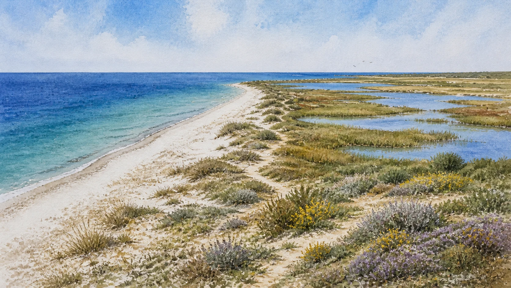
The site is ecologically valuable but not a manicured reserve circuit. Water levels, vegetation, tracks and access vary, and fragile ground can be damaged by vehicles or off-trail walking. Reeds, Mediterranean scrub, remnant woodland and agricultural edges support changing birdlife through migration and winter.
The historical chapter
Regional protection dates include the 1977 wildlife oasis and later landscape and Natura 2000 measures. The wetland's alternating inundation and drying are natural characteristics, while canals and surrounding development also influence its hydrology. The basins were historically known as the lakes of Cantarro.
What to notice
- The Region lists Capo Feto among wetlands in a designation process; do not state that it already has the same final Ramsar status as Vendicari or Trapani's salt pans.
- Season, water level and migration determine sightings, so promotional species lists are not promises.
THREE DAYS KEEP PORT LABOUR, HISTORIC LAYERS, MUSEUMS AND NATURE FROM COLLAPSING INTO ONE WALK
A Complete Mazara Route from River Dawn to the Wetlands
A complete route follows the river and harbour, gives the historic centre and museums their own time, then reaches coast and wetlands without treating them as urban annexes.

The place today
Begin at the Mazaro when the port is active, cross the cathedral and Casbah quarters before midday, reserve proper time for the Satyr and smaller museums, and use a separate morning or late afternoon for San Nicolo, Tonnarella or the wetland reserve.
The historical chapter
The route deliberately moves through overlapping layers instead of following a march of conquerors. It returns repeatedly to river, labour, worship and exchange, the structures that allowed Mazara to absorb political change while remaining connected to the sea.
What to notice
- Verify every museum, church, theatre and reserve opening on its responsible institutional site shortly before travel.
- Use the old centre as a residential city, the port as a workplace and the wetlands as protected habitat; each demands a different kind of attention.
The city through time
Ten turning points in a port that repeatedly changed language and government
The dates mark shifts in settlement, political authority, institutions and cultural memory. They do not suggest that one population vanished whenever a new power arrived.
Settlement and burial sites across the territory precede the documented river-port city.
A Phoenician landing place and fortified emporium serve the western Sicilian coast and Selinunte's maritime system.
After the fall of Selinunte, Mazara remains active within Punic-controlled western Sicily and later Roman rule.
Mosaics, sarcophagi and Greek Christian evidence document a prosperous Roman, paleochristian and Byzantine settlement.
The Aghlabid expedition led by Asad ibn al-Furat lands at Mazara and begins the long Islamic conquest of Sicily.
Norman conquest establishes castle and Christian institutions; Count Roger creates the Diocese of Mazara in 1093.
Antonello Gagini completes the cathedral's great marble Transfiguration group.
The cathedral is extensively rebuilt in Baroque form and formally dedicated in 1714.
The Belice earthquake damages the historic fabric; the cathedral closes for consolidation in 1973 and reopens in 1980.
The Dancing Satyr is recovered in two stages, restored in Rome and returned to Mazara as the centre of a new museum.
Before your visit
Practical information,
without turning it into promises
Give Mazara two full days
Use the first for the river port, San Nicolo Regale, cathedral quarter, Casbah, San Francesco, San Michele, Teatro Garibaldi and the Satyr Museum. Use the second for smaller museums, San Vito a Mare, Tonnarella and a pre-booked wetland visit. A rushed half-day turns the city back into three slogans.
Verify monuments individually
The regional park controls the Satyr Museum, the diocese controls living churches and collections, the municipality manages civic spaces, and WWF manages guided access to Lago Preola-Gorghi Tondi. Festival openings and works at San Nicolo do not imply permanent hours.
Treat port and Casbah as inhabited places
Stay behind port barriers, never handle equipment and ask before photographing workers. In residential alleys, distinguish public art from private doors and avoid turning Arabic signs, worship or families into an exotic photo hunt.
Plan for heat, wind and seasonal ecology
The low city has little shade on the waterfront, while wetlands require water, sun protection, closed shoes and binoculars. Spring and autumn are strong for migration and walking, but wildlife, water levels and sea conditions remain variable.
Sources
This guide cross-checks the Municipality of Mazara del Vallo, the Diocese of Mazara, the Sicilian Region and its archaeological park, University of Palermo research, Treccani, ISTAT, WWF Italy and the Italian Ministry responsible for fisheries. It separates prehistoric territory from the later city, Phoenician landing place from a fully excavated colony, Roman and Byzantine continuity from the claim that Mazara began in 827, Islamic urban development from an unchanged modern Casbah, the Val di Mazara from a natural valley, Norman conquest from total population replacement, traditional foundations from visible fabric, the cathedral's Norman shell from its Baroque interior, the Dancing Satyr's certain recovery from debated date and attribution, modern Tunisian migration from medieval continuity, a historic deep-sea fleet from unverified current rankings, contemporary project announcements from confirmed operation, and Capo Feto's conservation status from an already completed Ramsar designation.
- Municipality of Mazara del Vallo · current institutional site ↗
- Municipality of Mazara del Vallo · territorial planning and heritage agreement ↗
- University of Palermo · Mazara, city and territory in Byzantine and medieval history ↗
- University of Palermo · Sicilian cities in the Islamic period ↗
- University of Palermo · interaction and active citizenship in Mazara ↗
- Sicilian Region · archaeological landscape inventory ↗
- Sicilian Region archaeological park · Museum of the Satyr ↗
- Sicilian Region · Dancing Satyr object record ↗
- Sicilian Region · underwater archaeology of western Sicily ↗
- Treccani · Mazara del Vallo history ↗
- Treccani · medieval art and Islamic-Norman Sicily ↗
- Diocese of Mazara del Vallo · institutional history ↗
- Diocese of Mazara del Vallo · cathedral dedication and artworks ↗
- Diocese of Mazara del Vallo · San Vito documentary history ↗
- Municipality of Mazara del Vallo · Norman Arch ↗
- Municipality of Mazara del Vallo · San Nicolo Regale excavation ↗
- Municipality of Mazara del Vallo · Teatro Garibaldi ↗
- Municipality of Mazara del Vallo · historic-centre heritage route ↗
- ISTAT · historical analysis of foreign residents in Mazara ↗
- Italian Ministry of Agriculture and Fisheries · Sicilian Channel fleet plan ↗
- Sicilian Region · Mazara port-channel dredging ↗
- WWF Italy · Lago Preola and Gorghi Tondi oasis ↗
- Sicilian Region ORBS · Ramsar wetlands and Capo Feto status ↗
Institutional opening hours, church access, excavation visibility, theatre use, port works, guided wetland visits, fishing rules and cultural programmes can change. Historical claims are stated at the level supported by the cited sources; traditional foundations, urban continuity, the Satyr's date and attribution, present fleet ranking and current demographic figures remain qualified where evidence is uncertain or time-sensitive.