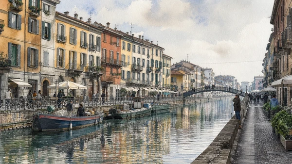
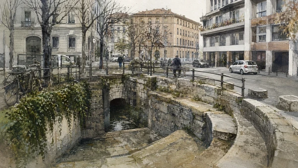
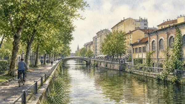
Original documentary watercolour panorama for Milan Navigli, Darsena and the Water City: Complete Guide, with accurate Lombardy architecture, landscape and lived context

Milan Guide 06 · Canal engineering, port basin, gates, workshops, churches, nightlife and resident access

Navigli, Darsena
& the Water City

A complete route through Milan’s surviving canal landscape, connecting the Darsena and Porta Ticinese to Naviglio Grande, Naviglio Pavese, working-water infrastructure, devotional landmarks and the contemporary pressures of leisure and nightlife.

Plan the route
Milan · Lombardy10 chapters · one complete route

Why this route must be read in layers

The Navigli are engineered infrastructure before they are a leisure district: water, locks, towpaths, goods, irrigation and maintenance explain the urban form that restaurants and evening crowds now occupy.

Milan’s canal system joined rivers, countryside and city through works developed over centuries. The surviving southern canals are fragments of a wider network once connected to internal waterways and productive territories.

The Darsena functioned as a port basin and interface between routes. Restoration and public-realm works shaped the embankments and promenades visible today.

Canalside buildings remain homes, workshops, churches, clubs and delivery addresses. Reading water history therefore requires restraint at private thresholds and an honest account of noise, tourism pressure and seasonal environmental conditions.

Walk in daylight before the night economy takes over, keep both canal banks in view and use official water-network evidence to distinguish historic function from contemporary branding.

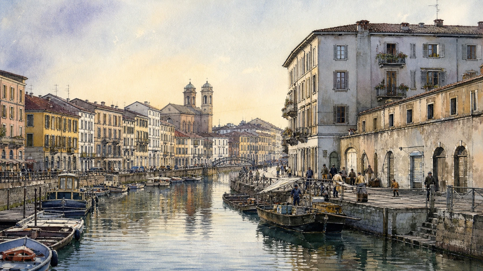
The route

Plan your visit

Begin at the Darsena and Porta Ticinese, follow Naviglio Grande through workshop and church landscapes, then compare Naviglio Pavese, surviving locks and the eastern canal memory.

Early morning

Darsena · Porta Ticinese · Naviglio Grande

Move in the documented order: Darsena: Milan’s port basin returned to public view; then Porta Ticinese: gate, piazza and canal threshold; then Naviglio Grande: transport corridor and inhabited bank. Recheck live access and transport before entering a controlled site.

Late morning

Vicolo dei Lavandai · San Cristoforo sul Naviglio · Courtyards and workshops

Move in the documented order: Vicolo dei Lavandai: labour behind a picturesque name; then San Cristoforo sul Naviglio: two churches on the water route; then Courtyards and workshops: productive fabric behind the bank. Recheck live access and transport before entering a controlled site.

Afternoon

Naviglio Pavese · Conca Fallata · Conca dell’Incoronata

Move in the documented order: Naviglio Pavese: engineered route toward Pavia; then Conca Fallata: lock, water level and industrial edge; then Conca dell’Incoronata: memory of the covered inner canal. Recheck live access and transport before entering a controlled site.

Late afternoon

Naviglio Martesana

Move in the documented order: Naviglio Martesana: water city beyond the nightlife district. Recheck live access and transport before entering a controlled site.

Ten chapters

Explore the places

The order follows terrain, institutions and present-day movement. Use the index to return to a chapter without reducing the route to isolated monuments.

  1. 01Darsena: Milan’s port basin returned to public view
  2. 02Porta Ticinese: gate, piazza and canal threshold
  3. 03Naviglio Grande: transport corridor and inhabited bank
  4. 04Vicolo dei Lavandai: labour behind a picturesque name
  5. 05San Cristoforo sul Naviglio: two churches on the water route
  6. 06Courtyards and workshops: productive fabric behind the bank
  7. 07Naviglio Pavese: engineered route toward Pavia
  8. 08Conca Fallata: lock, water level and industrial edge
  9. 09Conca dell’Incoronata: memory of the covered inner canal
  10. 10Naviglio Martesana: water city beyond the nightlife district
01

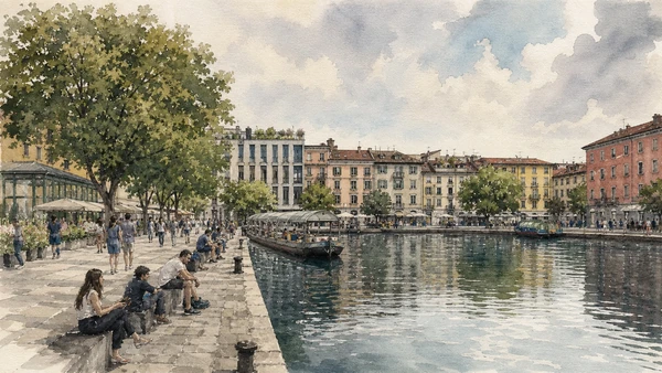
The basin joins the surviving canals at a former goods and transport interface now used as public waterfront.

Darsena: Milan’s port basin returned to public view

The basin joins the surviving canals at a former goods and transport interface now used as public waterfront. The site becomes clearer when its surviving fabric, later alterations and present use are read together.

Today

The area is inhabited and worked, not staged for visitors. Keep doorways, pavements, cycle lanes and deliveries clear, ask before photographing people and use current municipal mobility information.

History

Developed through Milan’s canal economy, the Darsena changed with rail and road transport, suffered decline and was substantially redesigned before Expo 2015.

How to read this place

Begin with the basin’s junction with incoming canals. Then compare retained hydraulic edges with new promenades and public structures; the differences are evidence, not visual noise.

What to notice

  • the basin’s junction with incoming canals
  • retained hydraulic edges
  • new promenades and public structures
Comune di Milano · Darsena event and public-space information
Original documentary watercolour of Darsena: Milan's port basin returned to public view in Milan · Lombardy, showing accurate architecture, landscape, people and present-day use
Darsena: Milan’s port basin returned to public viewOriginal Merlintravel documentary watercolour · 2026
02

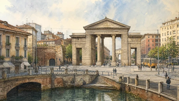
The neoclassical gate and medieval predecessor frame movement between the historic centre, Darsena and road toward Pavia.

Porta Ticinese: gate, piazza and canal threshold

The neoclassical gate and medieval predecessor frame movement between the historic centre, Darsena and road toward Pavia. The site becomes clearer when its surviving fabric, later alterations and present use are read together.

Today

The exterior can usually be read from public space, but events, works and crowd management may change circulation. Keep access routes open and verify any interior visit with the responsible institution.

History

Roman and medieval routes preceded the present gate designed in the Napoleonic period. Demolition and traffic changes opened the current relation with the canal district.

How to read this place

Begin with the neoclassical gate aligned with corso di porta ticinese. Then compare the surviving medieval gate with movement into piazza xxiv maggio; the differences are evidence, not visual noise.

What to notice

  • the neoclassical gate aligned with Corso di Porta Ticinese
  • the surviving medieval gate
  • movement into Piazza XXIV Maggio
Comune di Milano · Official city portal
Original documentary watercolour of Porta Ticinese: gate, piazza and canal threshold in Milan · Lombardy, showing accurate architecture, landscape, people and present-day use
Porta Ticinese: gate, piazza and canal thresholdOriginal Merlintravel documentary watercolour · 2026
04

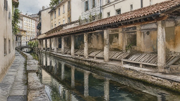
Stone washing structures and the narrow lane preserve evidence of organised manual work beside the canal.

Vicolo dei Lavandai: labour behind a picturesque name

Stone washing structures and the narrow lane preserve evidence of organised manual work beside the canal. The site becomes clearer when its surviving fabric, later alterations and present use are read together.

Today

The area is inhabited and worked, not staged for visitors. Keep doorways, pavements, cycle lanes and deliveries clear, ask before photographing people and use current municipal mobility information.

History

Washers used canal water and dedicated equipment within a broader service economy. Later preservation and tourist attention turned a working corner into an emblematic image.

How to read this place

Begin with the inclined washing stones. Then compare water access and shelter with residential doors immediately beside the site; the differences are evidence, not visual noise.

What to notice

  • the inclined washing stones
  • water access and shelter
  • residential doors immediately beside the site
Comune di Milano · Official city portal
Original documentary watercolour of Vicolo dei Lavandai: labour behind a picturesque name in Milan · Lombardy, showing accurate architecture, landscape, people and present-day use
Vicolo dei Lavandai: labour behind a picturesque nameOriginal Merlintravel documentary watercolour · 2026
05

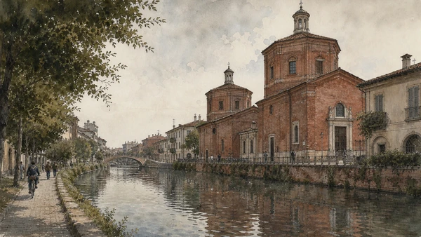
A small double church, bridge and canal bend create a historic threshold for travellers and working boats.

San Cristoforo sul Naviglio: two churches on the water route

A small double church, bridge and canal bend create a historic threshold for travellers and working boats. The site becomes clearer when its surviving fabric, later alterations and present use are read together.

Today

This is an active religious place as well as a historic building. Services, ceremonies and conservation can interrupt tourist access; dress appropriately, remain quiet and never treat a booked visit as priority over worship.

History

Medieval foundations and later ducal-period enlargement formed the present pair of connected spaces at an important approach to Milan.

How to read this place

Begin with the two adjoining façades. Then compare the bridge and towpath relation with painted and brick fabric inside; the differences are evidence, not visual noise.

What to notice

  • the two adjoining façades
  • the bridge and towpath relation
  • painted and brick fabric inside
Chiesa di Milano · San Cristoforo sul Naviglio
Original documentary watercolour of San Cristoforo sul Naviglio: two churches on the water route in Milan · Lombardy, showing accurate architecture, landscape, people and present-day use
San Cristoforo sul Naviglio: two churches on the water routeOriginal Merlintravel documentary watercolour · 2026
06

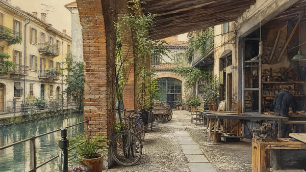
Low buildings, internal yards and former warehouses record craft and industrial uses increasingly adapted to hospitality and design.

Courtyards and workshops: productive fabric behind the bank

Low buildings, internal yards and former warehouses record craft and industrial uses increasingly adapted to hospitality and design. The site becomes clearer when its surviving fabric, later alterations and present use are read together.

Today

The area is inhabited and worked, not staged for visitors. Keep doorways, pavements, cycle lanes and deliveries clear, ask before photographing people and use current municipal mobility information.

History

Canal access supported deliveries and specialised work; railway and industrial expansion later reshaped the district before deindustrialisation encouraged new cultural and commercial uses.

How to read this place

Begin with large ground-floor openings. Then compare courtyard depth behind narrow fronts with evidence of current work rather than decorative reuse alone; the differences are evidence, not visual noise.

What to notice

  • large ground-floor openings
  • courtyard depth behind narrow fronts
  • evidence of current work rather than decorative reuse alone
Comune di Milano · Official city portal
Original documentary watercolour of Courtyards and workshops: productive fabric behind the bank in Milan · Lombardy, showing accurate architecture, landscape, people and present-day use
Courtyards and workshops: productive fabric behind the bankOriginal Merlintravel documentary watercolour · 2026
08

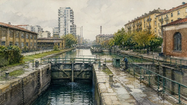
A surviving lock complex makes hydraulic control visible beyond the most photographed central banks.

Conca Fallata: lock, water level and industrial edge

A surviving lock complex makes hydraulic control visible beyond the most photographed central banks. The site becomes clearer when its surviving fabric, later alterations and present use are read together.

Today

The exterior can usually be read from public space, but events, works and crowd management may change circulation. Keep access routes open and verify any interior visit with the responsible institution.

History

Locks enabled boats to overcome level differences and supported regulated flows. Industry, utilities and later urban growth transformed the surrounding southern landscape.

How to read this place

Begin with the lock chamber and gates. Then compare change in water level with industrial and residential structures around the canal; the differences are evidence, not visual noise.

What to notice

  • the lock chamber and gates
  • change in water level
  • industrial and residential structures around the canal
Comune di Milano · Milan water network
Original documentary watercolour of Conca Fallata: lock, water level and industrial edge in Milan · Lombardy, showing accurate architecture, landscape, people and present-day use
Conca Fallata: lock, water level and industrial edgeOriginal Merlintravel documentary watercolour · 2026
09

A lock site near the centre preserves evidence of the former Cerchia dei Navigli after much of the urban waterway was covered.

Conca dell’Incoronata: memory of the covered inner canal

A lock site near the centre preserves evidence of the former Cerchia dei Navigli after much of the urban waterway was covered. The site becomes clearer when its surviving fabric, later alterations and present use are read together.

Today

The exterior can usually be read from public space, but events, works and crowd management may change circulation. Keep access routes open and verify any interior visit with the responsible institution.

History

The inner canal supported circulation and hydraulic management before progressive covering in the modern era. Conservation of the lock keeps part of the lost network legible.

How to read this place

Begin with surviving stone and hydraulic elements. Then compare street level above former water routes with the relationship to nearby urban blocks; the differences are evidence, not visual noise.

What to notice

  • surviving stone and hydraulic elements
  • street level above former water routes
  • the relationship to nearby urban blocks
Comune di Milano · Milan water network
Original documentary watercolour of Conca dell'Incoronata: memory of the covered inner canal in Milan · Lombardy, showing accurate architecture, landscape, people and present-day use
Conca dell’Incoronata: memory of the covered inner canalOriginal Merlintravel documentary watercolour · 2026
10

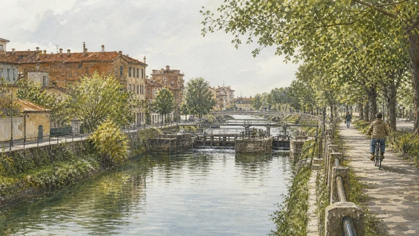
The northeastern canal joins cycling, residence, former industry and irrigation in a different urban landscape.

Naviglio Martesana: water city beyond the nightlife district

The northeastern canal joins cycling, residence, former industry and irrigation in a different urban landscape. The site becomes clearer when its surviving fabric, later alterations and present use are read together.

Today

The area is inhabited and worked, not staged for visitors. Keep doorways, pavements, cycle lanes and deliveries clear, ask before photographing people and use current municipal mobility information.

History

Constructed under Sforza rule and extended toward the city, the Martesana supplied movement and water before urban expansion enclosed long sections.

How to read this place

Begin with the towpath and continuous water line. Then compare industrial and residential adaptation with connections to parks and smaller hydraulic works; the differences are evidence, not visual noise.

What to notice

  • the towpath and continuous water line
  • industrial and residential adaptation
  • connections to parks and smaller hydraulic works
Comune di Milano · Milan water network
Original documentary watercolour of Naviglio Martesana: water city beyond the nightlife district in Milan · Lombardy, showing accurate architecture, landscape, people and present-day use
Naviglio Martesana: water city beyond the nightlife districtOriginal Merlintravel documentary watercolour · 2026

Milan through time

A short chronology

From Insubrian settlement and imperial Mediolanum to the ducal court, industrial metropolis, wartime rupture and contemporary redevelopment.

  1. An Insubrian settlement develops on the plain at the crossing of routes later absorbed by Roman Mediolanum.

  2. Roman forces take Mediolanum, which grows into a major Cisalpine administrative and commercial centre.

  3. Milan becomes an imperial residence in the western Roman Empire and gains palace, circus, baths and monumental infrastructure.

  4. The agreement associated with Constantine and Licinius establishes religious toleration and becomes inseparable from Milan’s Christian memory.

  5. Ambrose serves as bishop; basilicas, burial places and episcopal authority reshape the late-antique city.

  6. Frederick Barbarossa’s forces destroy much of Milan; reconstruction and communal institutions subsequently re-form the city.

  7. Visconti power becomes dominant, beginning a long phase of ducal patronage, fortification and territorial government.

  8. Construction of the Duomo begins, creating a building site and civic-religious institution that continue across centuries.

  9. Sforza rule renews the castle and court while artists, engineers and scholars, including Leonardo, work within ducal networks.

  10. Spanish Habsburg administration reshapes government, defence, religion and the social geography of the city.

  11. French and Napoleonic rule reorganises institutions, collections, ceremonial space and Milan’s role in northern Italy.

  12. Austrian rule ends and Milan enters the Kingdom of Italy, accelerating railway, industrial and civic expansion.

  13. The present Milano Centrale opens as a monumental transport complex within a rapidly expanding metropolis.

  14. Bombing, occupation, resistance and liberation damage monuments, housing and industry and leave a difficult memorial landscape.

  15. Post-war migration, design and manufacturing, deindustrialisation, Expo 2015 and metropolitan redevelopment repeatedly transform the city.

Before your visit

Practical information

01

Check the live page

Opening hours, reservation systems, restoration, exhibitions and transport can change. Recheck the linked official institution shortly before departure.

02

Separate worship and tourism

Churches and sanctuaries remain religious spaces. Services, funerals and community use take priority over visitor itineraries.

03

Plan real distances

Milan · Lombardy combines dense urban routes with lakes, valleys and dispersed towns. Do not compress distant chapters into an unsafe or superficial day.

04

Keep thresholds open

Arcades, station halls, markets, courtyards, workshops and residential streets must continue to function while you observe or photograph them.

05

Use current mobility data

Check the responsible rail, navigation, bus, road or park operator on the day; replacement services and weather can change an otherwise sound route.

06

Read change honestly

Restoration, reconstruction, adaptive reuse and new development have all shaped the landscape visible today.

Method and sources

Sources and image credits

This guide uses official museum, ministry, municipal, transport, park and UNESCO documentation checked on 29 August 2026. It separates durable historical interpretation from access details that can change, distinguishes surviving fabric from restoration or reconstruction, and treats worship, work, residence and public movement as part of the evidence. Every chapter links its principal institutional source; tickets, closures, weather and transport must always be verified again on the day of the visit.

All ten images are original Merlintravel editorial watercolours based on documented present-day conditions. They are illustrations, not substitutes for archaeological plans. Opening hours, tickets, accessible routes, temporary exhibitions and conservation work can change; consult the linked official pages shortly before visiting.