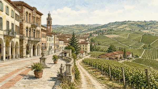
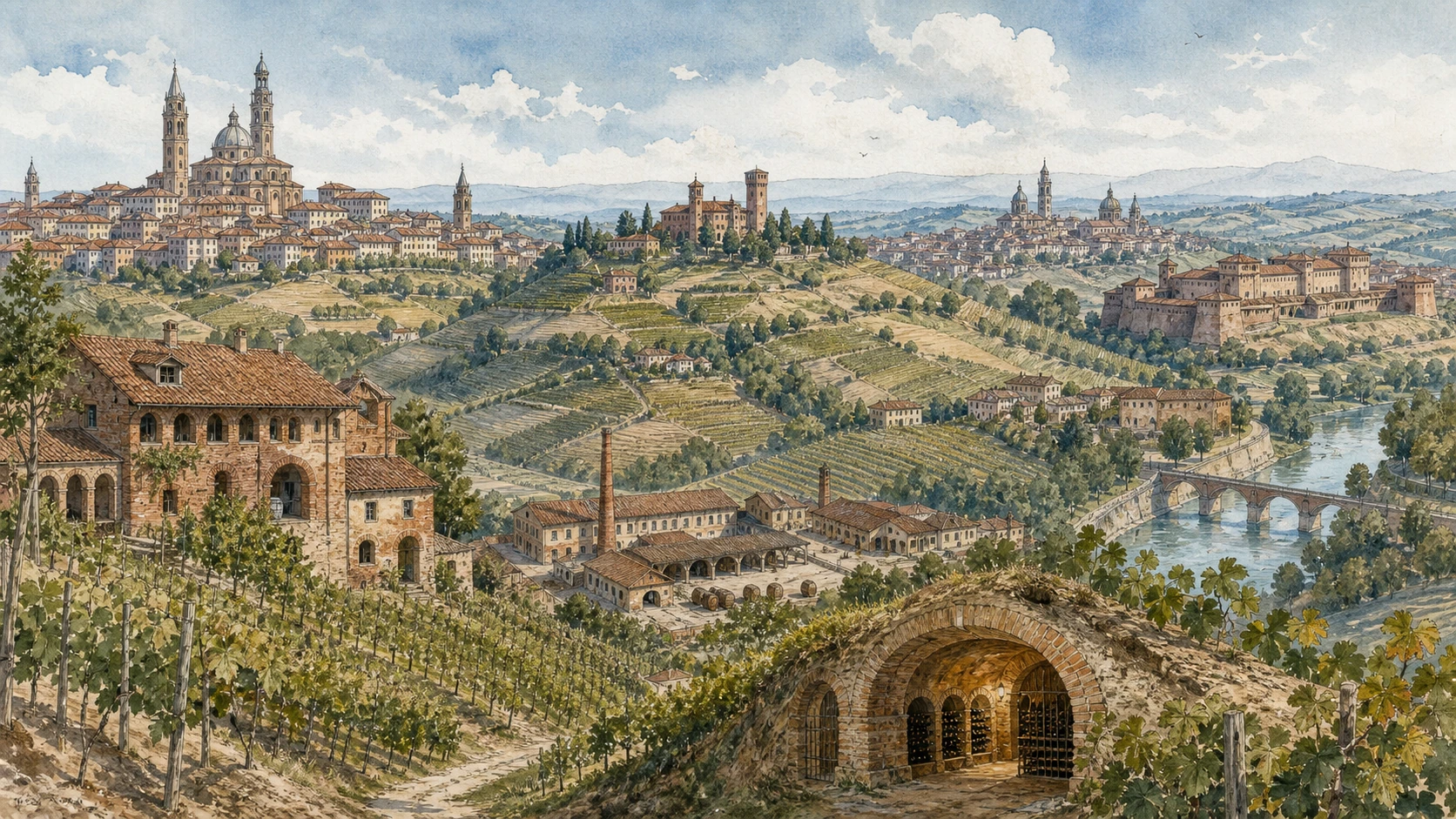
Original documentary watercolour panorama for Monferrato, Asti, Canelli and Alessandria: Complete Guide, with accurate Piedmont architecture, landscape and lived context

Piedmont Guide 03 · Communal city, Romanesque churches, underground wineries, infernot, Jewish heritage and fortress landscape

Monferrato, Asti,
Canelli & Alessandria

A multi-day guide joining Asti’s communal and religious centre to Canelli and Nizza’s wine-production systems, the infernot and castles of Monferrato, Casale’s Gonzaga-Paleologi city and Alessandria’s river fortress.

Plan the route
Monferrato, Asti and Alessandria · Piedmont10 chapters · one complete route

Why this route must be read in layers

Monferrato is a broad historical and geological territory, not one vineyard panorama. Communal towns, marquisate capitals, Jewish communities, parish landscapes, underground work and military corridors give its hills and plains different identities.

Asti’s towers and cathedral preserve the wealth and conflict of a medieval commune later absorbed into larger states. The Palio is a living event whose current arrangements cannot be assumed from historical description.

Canelli’s underground cellars and the Monferrato infernot are different architectural systems: commercial-scale wine tunnels are not interchangeable with small family chambers dug into pietra da cantoni.

Casale and Alessandria shift the route from hill production to strategic government and defence. Their Jewish, military and industrial histories prevent a wine-only account of the territory.

Divide the circuit into Asti, southern wine hills and eastern Monferrato days; underground visits require reservations and the Alessandria citadel depends on current event and safety access.

The route

Plan your visit

Begin in Asti, travel south to Canelli and Nizza through verified appointments, then move east through infernot and Casale before treating Alessandria as a separate urban day.

Early morning

Asti’s towers and medieval street system · Asti Cathedral · San Secondo and the civic square

Move in the documented order: Asti’s towers and medieval street system; then Asti Cathedral: Gothic scale and layered worship; then San Secondo and the civic square: patron saint, commune and market. Recheck live access and transport before entering a controlled site.

Late morning

Canelli’s underground cathedrals · Nizza Monferrato and Barbera hills · The infernot

Move in the documented order: Canelli’s underground cathedrals: industrial wine architecture; then Nizza Monferrato and Barbera hills: town within production landscape; then The infernot: family chambers cut into pietra da cantoni. Recheck live access and transport before entering a controlled site.

Afternoon

Casale Monferrato · Casale Synagogue · Sacro Monte di Crea

Move in the documented order: Casale Monferrato: marquisate and ducal capital; then Casale Synagogue: community, emancipation and preservation; then Sacro Monte di Crea: chapels in an inhabited hill sanctuary. Recheck live access and transport before entering a controlled site.

Late afternoon

Alessandria Citadel

Move in the documented order: Alessandria Citadel: star fortress between city and Tanaro. Recheck live access and transport before entering a controlled site.

Ten chapters

Explore the places

The order follows terrain, institutions and present-day movement. Use the index to return to a chapter without reducing the route to isolated monuments.

  1. 01Asti’s towers and medieval street system
  2. 02Asti Cathedral: Gothic scale and layered worship
  3. 03San Secondo and the civic square: patron saint, commune and market
  4. 04Canelli’s underground cathedrals: industrial wine architecture
  5. 05Nizza Monferrato and Barbera hills: town within production landscape
  6. 06The infernot: family chambers cut into pietra da cantoni
  7. 07Casale Monferrato: marquisate and ducal capital
  8. 08Casale Synagogue: community, emancipation and preservation
  9. 09Sacro Monte di Crea: chapels in an inhabited hill sanctuary
  10. 10Alessandria Citadel: star fortress between city and Tanaro
01

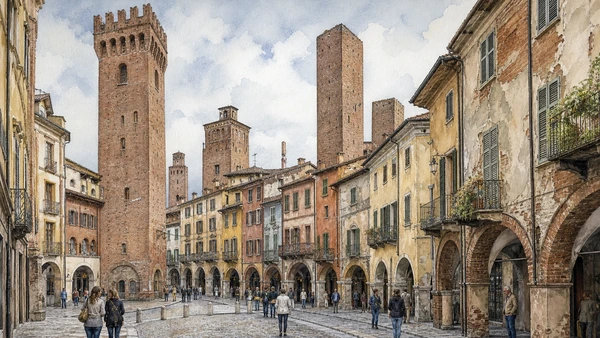
Brick towers and fortified houses survive within later blocks, recording merchant families and communal competition.

Asti’s towers and medieval street system

Brick towers and fortified houses survive within later blocks, recording merchant families and communal competition. The site becomes clearer when its surviving fabric, later alterations and present use are read together.

Today

The area is inhabited and worked, not staged for visitors. Keep doorways, pavements, cycle lanes and deliveries clear, ask before photographing people and use current municipal mobility information.

History

Asti prospered through trade and credit in the Middle Ages; elite families built towers that were later lowered, adapted or incorporated as political power changed.

How to read this place

Begin with tower bases inside current properties. Then compare brick construction and blocked openings with street routes linking former family districts; the differences are evidence, not visual noise.

What to notice

  • tower bases inside current properties
  • brick construction and blocked openings
  • street routes linking former family districts
Ente Turismo Langhe Monferrato Roero · Asti and Monferrato
Original documentary watercolour of Asti's towers and medieval street system in Monferrato, Asti and Alessandria · Piedmont, showing accurate architecture, landscape, people and present-day use
Asti’s towers and medieval street systemOriginal Merlintravel documentary watercolour · 2026
02

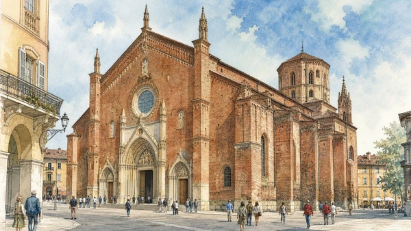
A vast brick church preserves medieval structure, later chapels and continuing diocesan use beyond the city’s famous secular towers.

Asti Cathedral: Gothic scale and layered worship

A vast brick church preserves medieval structure, later chapels and continuing diocesan use beyond the city’s famous secular towers. The site becomes clearer when its surviving fabric, later alterations and present use are read together.

Today

This is an active religious place as well as a historic building. Services, ceremonies and conservation can interrupt tourist access; dress appropriately, remain quiet and never treat a booked visit as priority over worship.

History

The cathedral of Santa Maria Assunta developed substantially in the fourteenth century over older sacred fabric and received later decoration and restoration.

How to read this place

Begin with brick exterior and side portals. Then compare nave structure and later surfaces with liturgical circulation kept distinct from viewing; the differences are evidence, not visual noise.

What to notice

  • brick exterior and side portals
  • nave structure and later surfaces
  • liturgical circulation kept distinct from viewing
Ente Turismo Langhe Monferrato Roero · Asti and Monferrato
Original documentary watercolour of Asti Cathedral: Gothic scale and layered worship in Monferrato, Asti and Alessandria · Piedmont, showing accurate architecture, landscape, people and present-day use
Asti Cathedral: Gothic scale and layered worshipOriginal Merlintravel documentary watercolour · 2026
03

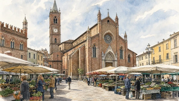
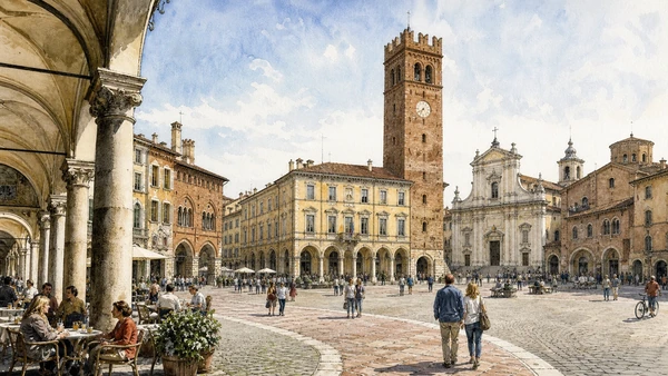
Church, town hall and arcades occupy a compact centre where civic identity and worship continually overlap.

San Secondo and the civic square: patron saint, commune and market

Church, town hall and arcades occupy a compact centre where civic identity and worship continually overlap. The site becomes clearer when its surviving fabric, later alterations and present use are read together.

Today

This is an active religious place as well as a historic building. Services, ceremonies and conservation can interrupt tourist access; dress appropriately, remain quiet and never treat a booked visit as priority over worship.

History

The collegiate church grew around devotion to Asti’s patron and was rebuilt through medieval phases while the surrounding square remained central to government and trade.

How to read this place

Begin with church façade and adjacent civic buildings. Then compare relic and liturgical context with market and event infrastructure; the differences are evidence, not visual noise.

What to notice

  • church façade and adjacent civic buildings
  • relic and liturgical context
  • market and event infrastructure
Ente Turismo Langhe Monferrato Roero · Asti and Monferrato
Original documentary watercolour of San Secondo and the civic square: patron saint, commune and market in Monferrato, Asti and Alessandria · Piedmont, showing accurate architecture, landscape, people and present-day use
San Secondo and the civic square: patron saint, commune and marketOriginal Merlintravel documentary watercolour · 2026
04

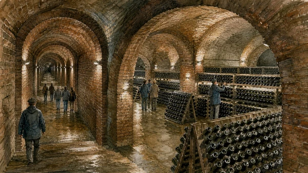
Kilometres of vaulted tunnels cut into the hills support temperature-controlled production beneath streets and buildings.

Canelli’s underground cathedrals: industrial wine architecture

Kilometres of vaulted tunnels cut into the hills support temperature-controlled production beneath streets and buildings. The site becomes clearer when its surviving fabric, later alterations and present use are read together.

Today

The area is inhabited and worked, not staged for visitors. Keep doorways, pavements, cycle lanes and deliveries clear, ask before photographing people and use current municipal mobility information.

History

Wine firms expanded underground cellars during the nineteenth and twentieth centuries as sparkling-wine methods and rail-connected commerce developed.

How to read this place

Begin with tunnel construction and branching levels. Then compare working bottles and equipment with guided access separated from active production; the differences are evidence, not visual noise.

What to notice

  • tunnel construction and branching levels
  • working bottles and equipment
  • guided access separated from active production
UNESCO · Vineyard Landscape of Piedmont
Original documentary watercolour of Canelli's underground cathedrals: industrial wine architecture in Monferrato, Asti and Alessandria · Piedmont, showing accurate architecture, landscape, people and present-day use
Canelli’s underground cathedrals: industrial wine architectureOriginal Merlintravel documentary watercolour · 2026
05

A market centre, farm roads and vineyard parcels represent a UNESCO component tied to Barbera cultivation and processing.

Nizza Monferrato and Barbera hills: town within production landscape

A market centre, farm roads and vineyard parcels represent a UNESCO component tied to Barbera cultivation and processing. The site becomes clearer when its surviving fabric, later alterations and present use are read together.

Today

Weather, water levels, trail conditions and seasonal services can alter the route. Use official transport and park information, remain on authorised paths and do not enter farms, vineyards or private gardens without permission.

History

Viticulture and commerce developed over centuries before modern appellations formalised varieties, boundaries and methods within a changing agricultural economy.

How to read this place

Begin with town edge meeting vineyard slopes. Then compare parcel and farm access with historic cellars versus new production buildings; the differences are evidence, not visual noise.

What to notice

  • town edge meeting vineyard slopes
  • parcel and farm access
  • historic cellars versus new production buildings
Association for the Heritage of the Vineyard Landscapes · Official site
Original documentary watercolour of Nizza Monferrato and Barbera hills: town within production landscape in Monferrato, Asti and Alessandria · Piedmont, showing accurate architecture, landscape, people and present-day use
Nizza Monferrato and Barbera hills: town within production landscapeOriginal Merlintravel documentary watercolour · 2026
06

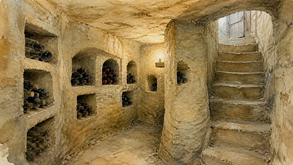
Small underground spaces extend beneath houses and courtyards, using local stone geology for storage without becoming industrial tunnels.

The infernot: family chambers cut into pietra da cantoni

Small underground spaces extend beneath houses and courtyards, using local stone geology for storage without becoming industrial tunnels. The site becomes clearer when its surviving fabric, later alterations and present use are read together.

Today

The area is inhabited and worked, not staged for visitors. Keep doorways, pavements, cycle lanes and deliveries clear, ask before photographing people and use current municipal mobility information.

History

Families excavated infernot in villages of Monferrato over generations; selected examples form part of the UNESCO serial vineyard landscape.

How to read this place

Begin with tool marks in exposed stone. Then compare access from domestic cellars with ventilation and storage features; the differences are evidence, not visual noise.

What to notice

  • tool marks in exposed stone
  • access from domestic cellars
  • ventilation and storage features
UNESCO · Vineyard Landscape of Piedmont
Original documentary watercolour of The infernot: family chambers cut into pietra da cantoni in Monferrato, Asti and Alessandria · Piedmont, showing accurate architecture, landscape, people and present-day use
The infernot: family chambers cut into pietra da cantoniOriginal Merlintravel documentary watercolour · 2026
07

Cathedral, civic streets, castle and palaces record a strategic Po town governed by Paleologi, Gonzaga and later states.

Casale Monferrato: marquisate and ducal capital

Cathedral, civic streets, castle and palaces record a strategic Po town governed by Paleologi, Gonzaga and later states. The site becomes clearer when its surviving fabric, later alterations and present use are read together.

Today

The area is inhabited and worked, not staged for visitors. Keep doorways, pavements, cycle lanes and deliveries clear, ask before photographing people and use current municipal mobility information.

History

Casale became a capital of Monferrato and a major fortified centre; repeated sieges, rebuilding and demolition reshaped its urban fabric.

How to read this place

Begin with cathedral and medieval street pattern. Then compare castle mass at the town edge with later civic buildings replacing lost fortifications; the differences are evidence, not visual noise.

What to notice

  • cathedral and medieval street pattern
  • castle mass at the town edge
  • later civic buildings replacing lost fortifications
Comune di Casale Monferrato · Official portal
Original documentary watercolour of Casale Monferrato: marquisate and ducal capital in Monferrato, Asti and Alessandria · Piedmont, showing accurate architecture, landscape, people and present-day use
Casale Monferrato: marquisate and ducal capitalOriginal Merlintravel documentary watercolour · 2026
08

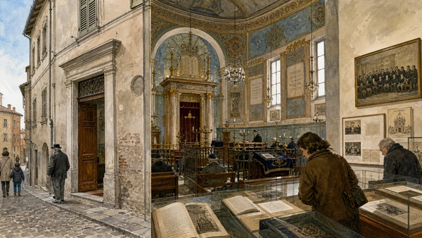
A richly decorated interior survives within an unobtrusive street building, with museum collections documenting Jewish life in Monferrato.

Casale Synagogue: community, emancipation and preservation

A richly decorated interior survives within an unobtrusive street building, with museum collections documenting Jewish life in Monferrato. The site becomes clearer when its surviving fabric, later alterations and present use are read together.

Today

Opening, ticketing, room access and temporary displays can change. Check the institution’s official notice shortly before visiting, use the designated entrance and allow for security or conservation controls.

History

The synagogue developed from the sixteenth century under restrictions on public visibility and was embellished across later phases, especially around nineteenth-century emancipation.

How to read this place

Begin with discreet exterior threshold. Then compare hebrew inscriptions and liturgical orientation with museum documentation of community history; the differences are evidence, not visual noise.

What to notice

  • discreet exterior threshold
  • Hebrew inscriptions and liturgical orientation
  • museum documentation of community history
Jewish Community of Casale Monferrato · Official museum
Original documentary watercolour of Casale Synagogue: community, emancipation and preservation in Monferrato, Asti and Alessandria · Piedmont, showing accurate architecture, landscape, people and present-day use
Casale Synagogue: community, emancipation and preservationOriginal Merlintravel documentary watercolour · 2026
09

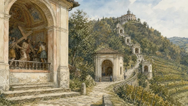
A devotional route climbs through woodland and vineyards to chapels combining sculpture, painting and landscape.

Sacro Monte di Crea: chapels in an inhabited hill sanctuary

A devotional route climbs through woodland and vineyards to chapels combining sculpture, painting and landscape. The site becomes clearer when its surviving fabric, later alterations and present use are read together.

Today

This is an active religious place as well as a historic building. Services, ceremonies and conservation can interrupt tourist access; dress appropriately, remain quiet and never treat a booked visit as priority over worship.

History

The complex developed from the late sixteenth century around an older Marian sanctuary and belongs to the UNESCO serial property of the Sacri Monti.

How to read this place

Begin with chapels positioned along the climb. Then compare sculpture viewed within staged interiors with vineyard and woodland context; the differences are evidence, not visual noise.

What to notice

  • chapels positioned along the climb
  • sculpture viewed within staged interiors
  • vineyard and woodland context
UNESCO · Sacri Monti of Piedmont and Lombardy
Original documentary watercolour of Sacro Monte di Crea: chapels in an inhabited hill sanctuary in Monferrato, Asti and Alessandria · Piedmont, showing accurate architecture, landscape, people and present-day use
Sacro Monte di Crea: chapels in an inhabited hill sanctuaryOriginal Merlintravel documentary watercolour · 2026
10

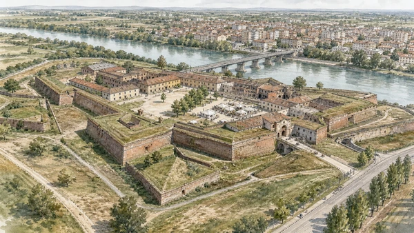
Bastions, gates and large internal spaces preserve a major eighteenth-century military complex separated from the modern city by river and infrastructure.

Alessandria Citadel: star fortress between city and Tanaro

Bastions, gates and large internal spaces preserve a major eighteenth-century military complex separated from the modern city by river and infrastructure. The site becomes clearer when its surviving fabric, later alterations and present use are read together.

Today

The exterior can usually be read from public space, but events, works and crowd management may change circulation. Keep access routes open and verify any interior visit with the responsible institution.

History

Savoy authorities built the citadel after acquiring the territory in the early eighteenth century, demolishing the settlement of Borgoglio and adapting the site through later military regimes.

How to read this place

Begin with bastion geometry and ditches. Then compare river and bridge relationship with current event zones versus restricted or unrestored areas; the differences are evidence, not visual noise.

What to notice

  • bastion geometry and ditches
  • river and bridge relationship
  • current event zones versus restricted or unrestored areas
Alexala · Official tourism board
Original documentary watercolour of Alessandria Citadel: star fortress between city and Tanaro in Monferrato, Asti and Alessandria · Piedmont, showing accurate architecture, landscape, people and present-day use
Alessandria Citadel: star fortress between city and TanaroOriginal Merlintravel documentary watercolour · 2026

Piedmont through time

A short chronology

From pre-Roman routes and Roman towns to communes, marquisates, Savoy government, industrialisation, heritage protection and climate-sensitive access.

  1. Alpine, lake, hill and plain communities leave settlements, tools, rock art and long-lived route systems.

  2. Ligurians, Celts, Salassi and other communities organise territories later drawn into Roman expansion.

  3. Roman colonies, municipia and roads connect the Po plain to Alpine passes and Ligurian approaches.

  4. Cities, farms, river transport and mountain routes integrate the region into imperial networks.

  5. Christian institutions, Lombard and Frankish powers, monasteries and fortified sites reshape late-Roman territories.

  6. Communes, bishoprics and marquisates develop distinct cities, markets, castles and religious landscapes.

  7. Savoy, Monferrato, Saluzzo, Milanese and local powers contest routes while towns expand civic institutions.

  8. The transfer of the Savoy capital to Turin accelerates centralisation, court construction and territorial administration.

  9. Baroque residences, sanctuaries, planned roads and fortified frontiers reorganise cities and countryside.

  10. French and Napoleonic rule suppresses institutions, reforms government and changes military and transport systems.

  11. Constitutional politics and wars led from Piedmont-Sardinia contribute decisively to Italian unification.

  12. Railways, canals, factories, wine markets and Alpine tourism connect previously separated economies.

  13. World wars, Fascism, resistance and civilian loss leave difficult evidence across towns, hills and valleys.

  14. Industrial expansion, migration, mechanised agriculture and mass tourism transform cities and working landscapes.

  15. Deindustrialisation, heritage recognition, rural reinvestment and climate pressure repeatedly alter access and identity.

Before your visit

Practical information

01

Check the live page

Opening hours, reservation systems, restoration, exhibitions and transport can change. Recheck the linked official institution shortly before departure.

02

Separate worship and tourism

Churches and sanctuaries remain religious spaces. Services, funerals and community use take priority over visitor itineraries.

03

Plan real distances

Monferrato, Asti and Alessandria · Piedmont combines dense urban routes with lakes, valleys and dispersed towns. Do not compress distant chapters into an unsafe or superficial day.

04

Keep thresholds open

Arcades, station halls, markets, courtyards, workshops and residential streets must continue to function while you observe or photograph them.

05

Use current mobility data

Check the responsible rail, navigation, bus, road or park operator on the day; replacement services and weather can change an otherwise sound route.

06

Read change honestly

Restoration, reconstruction, adaptive reuse and new development have all shaped the landscape visible today.

Method and sources

Sources and image credits

This guide uses official museum, ministry, municipal, transport, park and UNESCO documentation checked on 29 August 2026. It separates durable historical interpretation from access details that can change, distinguishes surviving fabric from restoration or reconstruction, and treats worship, work, residence and public movement as part of the evidence. Every chapter links its principal institutional source; tickets, closures, weather and transport must always be verified again on the day of the visit.

All ten images are original Merlintravel editorial watercolours based on documented present-day conditions. They are illustrations, not substitutes for archaeological plans. Opening hours, tickets, accessible routes, temporary exhibitions and conservation work can change; consult the linked official pages shortly before visiting.