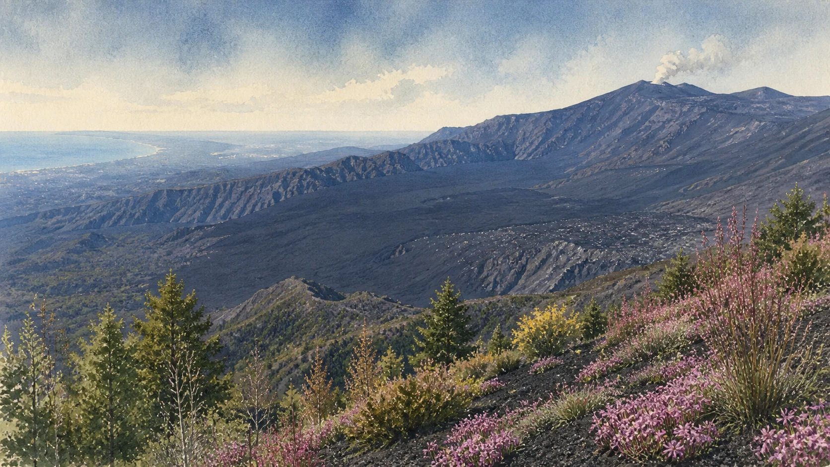
Documentary watercolour of Mount Etna from the eastern slopes, with a quiet summit plume, the dark floor of Valle del Bove, birch woodland and cultivated terraces

Illustrated guide · Sicily

A mountain that
never stands still

Ten landscapes through which to read Etna as an active volcano, a scientific observatory, a protected ecosystem and a mountain inhabited and cultivated around its edges.

Explore the places
Mount Etna · volcano, park and inhabited landscape

The mountain behind the family journeys

Etna was never only a day trip from Taormina.

During the journeys that connected our family holidays to the eastern coast of Sicily, the mountain belonged to the horizon before it became a destination. It appeared beyond the sea, above roads and behind towns, sometimes clear and sometimes hidden by weather or its own plume.

That familiarity can be deceptive. Etna is not one viewpoint, one cableway or one crater excursion. Its northern and southern approaches tell different stories; forests meet young lava, cultivated terraces stop at older flows, and inhabited towns live beside a landscape that can change while it is being described.

To understand the mountain, the journey must go around it as well as upward.

One destination

Etna,
a geography in motion.

Mount Etna is an active stratovolcano on the eastern side of Sicily. Its eruptive history reaches back roughly half a million years, while written and material records document at least 2,700 years of activity. Summit eruptions, flank fissures, lava fields and hundreds of secondary cones have repeatedly altered the mountain's outline and the routes across it.

The UNESCO property protects 19,237 hectares of the highest, uninhabited part of the volcano inside the larger regional park. This guide moves between that strictly protected core, the tourism gateways in the buffer zone, the wooded and cultivated lower slopes, and the communities that cannot be separated from Etna's history.

The selection

Ten landscapes,
one living volcano

The route begins at the changing summit, crosses the great eastern depression, compares the southern and northern gateways, then descends through cones, caves, forests, monitoring networks, communities and cultivated lava soils.

  1. 01The Summit Crater System
  2. 02Valle del Bove
  3. 03Rifugio Sapienza and the Monti Silvestri
  4. 04Piano Provenzana and the Northern Approach
  5. 05Monti Sartorius and the Birch Woods
  6. 06Lava Caves and Grotta del Gelo
  7. 07The High-Mountain Track, Forests and Dagale
  8. 08The Etna Observatory and Monitoring Network
  9. 09The Twenty Communities of the Park
  10. 10Terraces, Vineyards and Lava Agriculture
01

A summit made of active vents, not a single mouth

The Summit Crater System

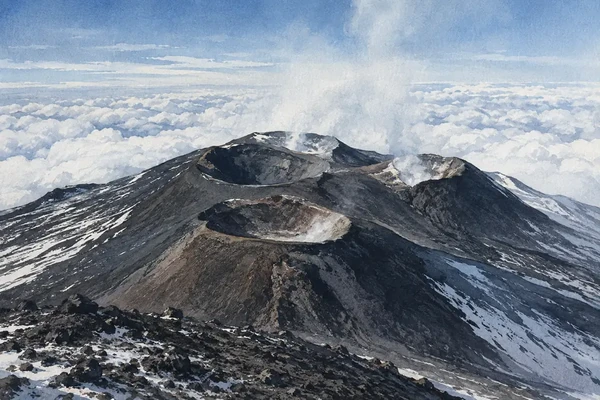
Voragine, Bocca Nuova and the north-east and south-east crater areas form a summit whose height and shape change through eruptions.

Watercolour view of the summit crater system of Mount Etna above the clouds
The Summit Crater System

The place today

From a distance the summit can look like one truncated cone. On the ground and in monitoring maps it is a compound system of crater depressions, rims, vents and overlapping deposits. Degassing is persistent, visibility can change quickly, and new eruptive material can remodel ridges or close familiar viewpoints. The exact maximum elevation is therefore a dated measurement rather than a permanent fact.

The historical chapter

Etna's present conical form developed mainly during the last hundred thousand years of an eruptive history about five times longer. The central crater was joined by the North-East Crater in 1911, Bocca Nuova in 1968 and the South-East crater complex from 1971 onward. The summit system demonstrates why Etna must be read as an evolving volcanic edifice rather than as a monument with a fixed silhouette.

What to notice

  • Several crater structures contributing to the summit profile
  • Dark fresh deposits laid over paler or weathered surfaces
  • Why the visible plume, wind and access boundary can differ from one day to the next
INGV · Mount Etna scientific profile
02

The eastern flank opened into a geological archive

Valle del Bove

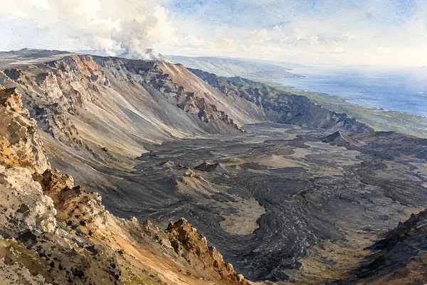
A vast horseshoe-shaped depression exposes older volcanic structures and receives many recent lava flows.

Watercolour panorama across the lava floor and steep walls of Valle del Bove
Valle del Bove

The place today

Valle del Bove opens on Etna's eastern side as a broad amphitheatre about seven kilometres by four and a half. Steep walls frame a floor largely covered by lava from flank eruptions of recent centuries. Routes such as Schiena dell'Asino reveal the depression from above, while the full scale is easier to understand by following the edges than by seeking a single panoramic stop.

The historical chapter

The valley developed through repeated flank collapses and erosion during the Holocene. Research published by INGV dated the beginning of its formation to a large collapse whose deposit formed between about 7478 and 7134 BC. Dikes and remnants exposed in the walls preserve parts of earlier volcanic edifices, while the dark floor records the later tendency of eastern flows to enter this natural containment area.

What to notice

  • The horseshoe plan and the break between steep walls and lava-covered floor
  • Vertical dikes and eroded remnants exposed by collapse
  • Different lava surfaces crossing and partly covering one another
INGV · Formation and age of Valle del Bove
03

The southern gateway beside the cones of 1892

Rifugio Sapienza and the Monti Silvestri

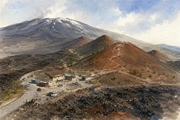
Tourism infrastructure and a chain of eruption cones occupy the same high southern landscape.

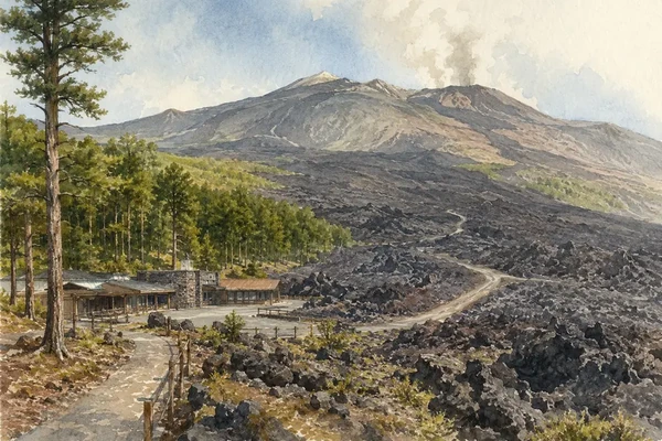
Watercolour view of Rifugio Sapienza and the red-brown Monti Silvestri craters
Rifugio Sapienza and the Monti Silvestri

The place today

The road from Nicolosi reaches the Rifugio Sapienza area near 1,900 metres, where parking, accommodation, food services and the cableway concentrate the most developed visitor gateway on the mountain. The lower and upper Silvestri cones begin close to this infrastructure, so even a short walk makes visible the loose scoria, crater rims and alignment of vents created by a fissure eruption.

The historical chapter

The Monti Silvestri formed during the long 1892 eruption. A fissure opened on the southern flank between roughly 2,025 and 1,800 metres; explosive activity built several cones while lava spread southward in a field about seven kilometres long. Later roads and tourism facilities grew around this accessible eruption landscape, but the cones are geological evidence, not decorative overlooks.

What to notice

  • The linear arrangement of cones along the former eruptive fissure
  • Red-brown oxidised scoria beside blacker lava and pale lichen
  • The abrupt meeting of volcanic landform, road, cableway and visitor services
INGV · Historical eruption database, 1892
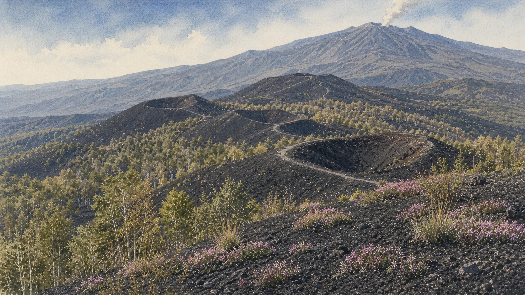
Documentary watercolour of Etna's Monti Sartorius with black scoria cones, rim paths, native birch woods, pink soapwort and the distant summit
CRATERS, BIRCHES AND PIONEER FLOWERSThe Sartorius cones show how dark scoria, native birch and low pioneer plants share one north-eastern volcanic landscape.
04

A gateway rebuilt inside the memory of 2002

Piano Provenzana and the Northern Approach

On the north side, pine forest gives way to open lava fields and facilities reconstructed after a destructive flank eruption.

Watercolour view of Piano Provenzana, birch woodland and the northern lava fields
Piano Provenzana and the Northern Approach

The place today

Piano Provenzana lies near 1,800–1,900 metres above Linguaglossa. The approach climbs through the Pineta Ragabo and then opens onto lava, cones and the rebuilt northern visitor area. Its atmosphere differs from the busier southern gateway: the forest edge is closer, the north-east rift is central to the terrain, and routes spread toward a sequence of historic and recent vents.

The historical chapter

On 27 October 2002 an eruptive fissure opened on the north-east flank. Lava fields extended east and north-east, destroyed the existing tourist facilities of Piano Provenzana, damaged part of the Linguaglossa pine forest and cut the Mareneve road. The rebuilt base therefore stands within an event still legible in young lava and interrupted forest rather than on a neutral platform.

What to notice

  • Where living pine forest ends against the 2002 lava field
  • Rebuilt facilities positioned in relation to the destroyed former station
  • The north-east rift expressed through aligned cones and fissure terrain
UNESCO Mount Etna site · Piano Provenzana
05

The 1865 buttonhole cones on the north-east flank

Monti Sartorius and the Birch Woods

An accessible ring route joins an aligned eruption chain, volcanic bombs and one of Etna's characteristic high woodlands.

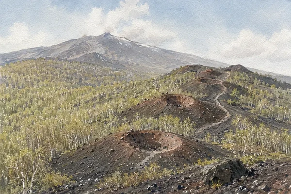
Watercolour view of the aligned Monti Sartorius craters among Etna birch woods
Monti Sartorius and the Birch Woods

The place today

The nature trail begins near Rifugio Citelli at about 1,660 metres and loops for roughly four kilometres. Low cones rise above clearings where Etna birch, grasses and cushion plants colonise volcanic ground. The route has modest overall height gain, but the lava is uneven and sharp; the apparent softness of the wooded landscape does not remove the mountain terrain.

The historical chapter

The cones were created by the 1865 eruption and named for Wolfgang Sartorius von Waltershausen, whose nineteenth-century mapping helped record Etna's principal eruptions. Several vents opened along the same fissure, producing the aligned form known locally as a bottoniera, or buttonhole chain. The associated lava field covers about eight square kilometres according to the park's trail record.

What to notice

  • Individual cones aligned along one eruptive fracture
  • Large volcanic bombs and rough scoriaceous blocks beside the trail
  • Etna birch recolonising the margins of the eruption landscape
Parco dell’Etna · Monti Sartorius nature trail
06

The volcano continues below the visible surface

Lava Caves and Grotta del Gelo

Lava tubes record the internal drainage of flows; Grotta del Gelo preserves a rare body of perennial ice.

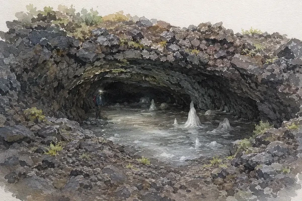
Watercolour view into a low lava tube with perennial ice at Grotta del Gelo
Lava Caves and Grotta del Gelo

The place today

Grotta del Gelo lies on the north-north-western side at about 2,030 metres. The lava tube extends for roughly 125 metres with a vertical difference of about thirty metres, and ice persists within its protected microclimate. Reaching it is a serious mountain journey over remote lava rather than a casual cave visit; equipment, conditions and authorised access must be checked before departure.

The historical chapter

Lava tubes form when the outer surface of a flow cools while molten lava continues to move inside, eventually leaving a conduit. Etna contains many such caves, each tied to an eruptive unit rather than to karst dissolution. Grotta del Gelo became especially significant because its permanent ice records delicate environmental conditions; monitoring of its microclimate has been carried out since 1997.

What to notice

  • The tube-shaped passage produced by flowing lava rather than water erosion
  • Layers and drips of ice responding to a fragile cave microclimate
  • The remoteness of the site and the difference between map distance and travel effort
UNESCO Mount Etna site · Grotta del Gelo
07

Life returns unevenly across lava of different ages

The High-Mountain Track, Forests and Dagale

Long routes through woods and lava islands reveal ecological succession at the scale of the mountain.

Watercolour view of the aligned Monti Sartorius craters among Etna birch woods
Monti Sartorius and the Birch Woods

The place today

The Pista Altomontana and connecting park trails cross the western and northern slopes through pine, beech, oak, chestnut and birch landscapes. Some sectors pass over bare historic flows; others enter dagale, islands of older vegetation surrounded but not consumed by younger lava. The route network changes in status, and an official listing marked non in esercizio means closed to public use.

The historical chapter

Vegetation follows altitude, exposure, moisture and the age and compactness of volcanic substrate. Lower belts combine cultivation with oak and chestnut; beech reaches an unusually high and southerly limit, and Etna birch is endemic to the volcano. Above woodland, cushion-forming astragalus shelters other mountain plants before the landscape thins into a high volcanic desert where stable vegetation cannot persist.

What to notice

  • Sharp boundaries where a younger lava flow divided older woodland
  • Changes from trees to low cushion plants with increasing altitude
  • How lichen, grasses, shrubs and trees represent different stages of recolonisation
Parco dell’Etna · Environment and territory
Documentary watercolour of terraced Etna vineyards with dry lava-stone walls, low vines, a small rural shelter and the broad volcano beyond
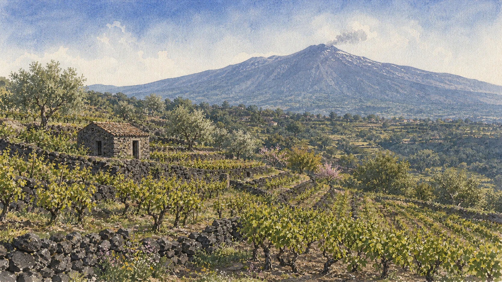
AGRICULTURE BUILT ON LAVADry lava walls, narrow vineyard terraces and a small rural shelter make cultivation part of Etna's geology rather than a separate scenic foreground.
08

A volcano translated into signals, maps and alerts

The Etna Observatory and Monitoring Network

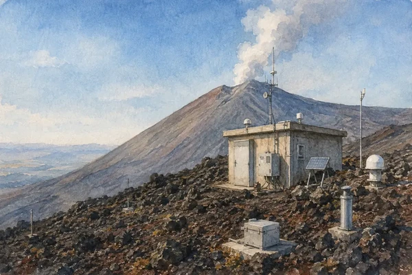
Scientific instruments connect gas, tremor, earthquakes, deformation, heat and visible activity across the mountain.

Watercolour view of a Mount Etna monitoring station and instruments on the lava slope
The Etna Observatory and Monitoring Network

The place today

Monitoring is distributed rather than confined to one public building. Seismic stations, cameras, deformation instruments, gas measurements, satellite observations and field surveys feed the INGV Etna Observatory. The UNESCO core contains more than fifty small seismic stations and a scientific observatory, while operational bulletins turn changing data into the shared language used by researchers and civil-protection authorities.

The historical chapter

Etna has one of the world's longest documented eruption records, but modern observation transformed narrative chronology into continuous measurement. The network is essential because the volcano produces different signals: summit degassing, lava fountains, flank fissures, earthquakes and the slow seaward movement of the eastern flank. No single instrument predicts the mountain; interpretation depends on multiple measurements and repeated field verification.

What to notice

  • Small scientific installations placed within a very large landscape
  • The distinction between activity observations and public access decisions
  • How maps and bulletins preserve the time and location of events that later change the terrain
UNESCO World Heritage Centre · Mount Etna
09

Etna is encircled by towns, not isolated from them

The Twenty Communities of the Park

Nicolosi, Zafferana, Linguaglossa, Randazzo and sixteen other municipalities meet the volcano from different slopes and histories.

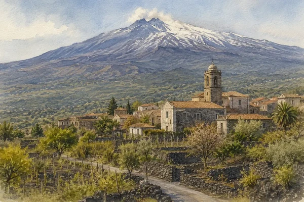
Watercolour view of a lava-stone village, orchards and vineyards on the inhabited slopes of Mount Etna
The Communities of the Park

The place today

The regional park includes territory from twenty municipalities around the mountain. Southern Nicolosi is the principal approach to Rifugio Sapienza; Linguaglossa opens the northern route; Zafferana faces the eastern sector and Valle del Bove; Randazzo joins lava-built architecture, rail and agriculture on the north-west. These are examples within a ring of communities, not interchangeable gateways to one identical excursion.

The historical chapter

Settlement has repeatedly negotiated fertility and hazard. Lava has destroyed or threatened villages, fields, roads and railways, most dramatically when the 1669 flow reached western Catania and when the 1928 eruption destroyed Mascali. Reconstruction did not erase those events: town plans, shrines, lava boundaries, place names and agricultural walls preserve local responses to the mountain in forms that differ from one flank to another.

What to notice

  • Dark lava stone used in streets, walls, churches and rural buildings
  • Views of the summit changing as the route circles the mountain
  • Historic lava margins embedded in present roads, neighbourhoods and fields
Parco dell’Etna · The twenty municipalities
10

The cultivated mountain below the volcanic desert

Terraces, Vineyards and Lava Agriculture

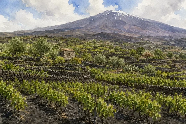
Vines, olives, pistachios, hazelnuts and fruit trees form a human-made mosaic between woods and lava.

Watercolour view of vineyards and orchards on dry-stone lava terraces beneath Mount Etna
Terraces, Vineyards and Lava Agriculture

The place today

On the lower and middle slopes, dry-stone terraces hold thin volcanic soils and divide vineyards, orchards and groves. Exposure and altitude create marked differences around the cone: pistachios are associated especially with the west, hazelnuts and orchards enter other belts, and terraced vineyards often include palmenti and cellars built for processing grapes. The landscape is productive, inhabited and historically constructed.

The historical chapter

Agriculture has occupied Etna's fertile weathered lava for millennia. Terracing, farm buildings, storage rooms, presses and cellars represent accumulated labour rather than a natural consequence of volcanic soil. The Etna wine denomination was recognised in 1968, but the deeper cultural landscape lies in local varieties and mountain practices that long preceded it. Park protection treats compatible farming as part of conserving the volcano's inhabited lower slopes.

What to notice

  • Dry-stone walls turning steep or irregular ground into narrow cultivation bands
  • Old palmenti and cellars embedded within vineyard plots
  • The edge where tended land stops against an uncultivated or younger lava flow
Parco dell’Etna · Agriculture and viticulture

The city through time

Ten dates for orientation

A selective chronology linking the mountain's long construction to collapses, documented eruptions, scientific mapping, environmental protection and World Heritage recognition.

  1. The eruptive history from which the Etna volcanic complex developed begins; the present cone belongs to much later phases.

  2. A major eastern-flank collapse initiates the formation of Valle del Bove, according to radiocarbon and paleomagnetic research.

  3. Human observations create one of the world's longest documented records of historical volcanic activity.

  4. A 122-day southern-flank eruption builds the Monti Rossi and sends a lava field about seventeen kilometres toward and into western Catania.

  5. A north-eastern flank eruption creates the aligned Monti Sartorius cones now crossed by the park nature trail.

  6. A long southern-flank eruption forms the five principal Monti Silvestri cones and a lava field extending southward.

  7. An eastern-flank lava flow reaches low elevation and destroys the town of Mascali before cutting the Catania–Messina road.

  8. The Sicilian Region establishes Parco dell’Etna, the first of Sicily's regional parks, protecting roughly 59,000 hectares.

  9. Eruptions on the north-east and south flanks destroy Piano Provenzana facilities, damage forest, affect Rifugio Sapienza and disrupt eastern Sicily with ash.

  10. UNESCO inscribes Mount Etna on the World Heritage List for its outstanding geological processes and global scientific importance.

Before your visit

Practical information,
without turning it into promises

01

Check the mountain today

Etna is active. Before travel, consult INGV bulletins, park notices, municipal ordinances and the operator responsible for the exact route; yesterday's access limit is not a promise for today.

02

Choose a flank

Rifugio Sapienza in the south and Piano Provenzana in the north are distinct gateways with different roads, landscapes and services. A visit planned for one should not silently substitute the other.

03

Treat altitude seriously

Wind, cold, sun, ash, uneven scoria and rapid weather changes can occur even when the coast is warm. Footwear, layers, water and route difficulty matter more than apparent distance.

04

Use authorised guidance

Summit and high-altitude access may be restricted or require qualified guides. Never cross barriers, enter closed trails or assume that visible footprints indicate a legal and safe route.

Sources

The guide uses UNESCO's World Heritage record for the protected core and international significance, INGV for volcanic processes, Valle del Bove and the historical-eruption record, and the official Parco dell’Etna and UNESCO park portal for trails, vegetation, communities, caves and visitor landscapes. Changing summit height and access are deliberately described without fixed promises.

The hero image is an illustration, not a photograph or an eruption forecast. Etna's activity, summit morphology, weather, trail status, ordinances, guided-access rules and transport operations can change rapidly; verify all current conditions with INGV, the park and the relevant municipalities immediately before visiting.