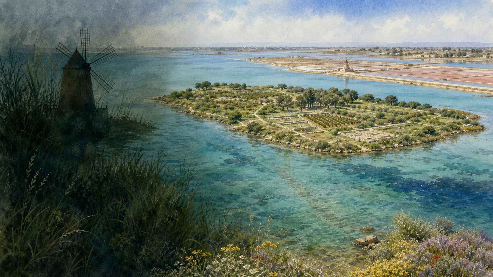
Documentary watercolour of Mozia in the shallow Stagnone lagoon, archaeological walls, salt pans, windmill and western Sicilian light

Illustrated guide · Sicily

An island city,
a gateway to Africa
and salt shaped by wind

Twenty-five substantial chapters connect Phoenician Motya, Punic and Roman Lilybaeum, medieval Marsala, shipwrecks, wine, salt production and the living Stagnone.

Explore the places
Mozia and Marsala · island archaeology, Lilybaeum, wine, salt and lagoon

Where a family journey through Sicily reaches the island's western threshold

This project began with Sicily as family geography: relatives in different parts of the island, journeys made since childhood and summers in Taormina.

Mozia and Marsala carry that personal route to the far west, where the island faces Africa and where shallow water, islands and channels made movement more important than any modern boundary between land and sea.

The guide keeps the Phoenician island, Punic-Roman city, medieval centre, Risorgimento, wine economy and protected lagoon connected but never interchangeable. A salt-pan sunset cannot replace the history of Motya; a Punic ship cannot stand for all of Lilybaeum; the name Marsala does not describe one wine style or one historical period.

The aim is a landscape read through archaeology, water, labour and exchange: an island that became a fortified city, survivors who founded a new stronghold, ships built and lost, streets layered beneath Capo Boeo, vineyards transformed by trade and salt crystallised through controlled movement of wind and water.

One destination

Twenty-five chapters across an island city, a mainland gateway and a living lagoon

Mozia occupies the small island of San Pantaleo inside the Stagnone, while Marsala stands on Capo Boeo beyond the lagoon's southern reach. The two places are historically linked but not spatially continuous: Motya was destroyed in 397 BC, and Punic Lilybaeum developed on the mainland as a new fortified city and African gateway.

Recent research has changed familiar interpretations. The rectangular basin long called the Kothon is now understood by the Sapienza mission as a sacred freshwater pool within a circular sanctuary, not simply a military harbour. Houses, temples, gates, cemeteries and workshops make Mozia a complete island city; at Marsala, the 28-hectare Capo Boeo park preserves streets, baths, domus, sanctuaries and fortifications because the medieval and modern centre retreated from the ancient shoreline.

The Stagnone is also a protected ecological and productive system. Posidonia, halophytic plants and migratory birds share space with historic salt pans, causeways, boat routes, vineyards and contemporary recreation. Conditions change with wind, weather, transport and conservation, so practical information is deliberately linked to current institutions rather than frozen into permanent promises.

The selection

Twenty-five chapters from sacred water to working salt pans

The route consolidates connected structures without confusing Motya with Lilybaeum, archaeological evidence with reconstruction, or the protected lagoon with a postcard landscape.

  1. 01The Stagnone Lagoon and its Four Islands
  2. 02San Pantaleo before and during the Phoenician City
  3. 03Walls, Towers and the Island Perimeter
  4. 04The North Gate and the Submerged Road to Birgi
  5. 05Cappiddazzu and the Northern Sanctuary
  6. 06The Archaic Necropolis
  7. 07The Tophet: Evidence and Debate
  8. 08The Kothon, Sacred Pool and Circular Temenos
  9. 09South Gate, Western Fortress and Waterfront
  10. 10Workshops, Houses and the Productive City
  11. 11The Young Man of Mozia
  12. 12The Siege of 397 BC
  13. 13Whitaker, the Island Museum and Continuing Excavation
  14. 14Lilybaeum on Capo Boeo
  15. 15Walls, Ditch and the Long Roman Siege
  16. 16Roman Lilybaeum and its African Gateway
  17. 17Plateia Aelia, the Imperial Domus and Urban Life
  18. 18Public Baths and the Sanctuary of Healing Deities
  19. 19The Necropolis and the World of Crispia Salvia
  20. 20The Punic Ship and Later Wrecks
  21. 21Medieval Marsala, its Name and the Duomo
  22. 22Porta Garibaldi and the Landing of the Thousand
  23. 23Marsala Wine, Bagli and Mediterranean Trade
  24. 24Salt Pans, Windmills and Managed Brine
  25. 25The Living Stagnone
01

SHALLOW WATER, ISLANDS AND CHANNELS FORMED A PRODUCTIVE MARITIME LANDSCAPE

The Stagnone Lagoon and its Four Islands

Mozia begins inside a living lagoon whose ecology, salt economy and navigation shaped every later settlement.

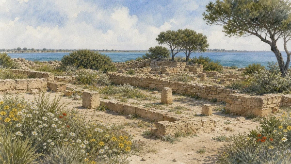
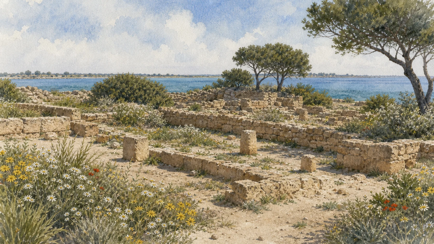
Documentary watercolour of low limestone foundations and short column fragments among spring flowers on Mozia with the shallow blue-green Stagnone beyond
THE LOW ISLAND CITY

The place today

The reserve covers more than 2,000 hectares and includes San Pantaleo or Mozia, Schola, Santa Maria and Isola Lunga. The long outer island separates shallow internal water from the open Mediterranean. Wind and tides drive circulation through the lagoon, while boats, salt pans and low shorelines make distances deceptive.

The historical chapter

Protected water, landing points, salt, fish and routes toward western Sicily helped make the Stagnone attractive long before the Phoenician city. Motya used the lagoon defensively and commercially but still depended on navigable channels and mainland connections. Later silting, sea-level change and human intervention altered the coast, so the ancient water map cannot be copied directly from today's shoreline.

What to notice

  • Do not describe the Stagnone as stagnant water; wind, tides and channels sustain circulation and biodiversity.
  • Keep the four-island geography clear: Mozia is San Pantaleo, while Isola Lunga forms the lagoon's outer barrier.
Sicilian Region ORBS · Stagnone nature reserve
Documentary watercolour of low limestone foundations and short column fragments among spring flowers on Mozia with the shallow blue-green Stagnone beyond
THE LOW ISLAND CITYFoundations, paths, vineyards and spring vegetation preserve Mozia at its real archaeological scale, without rebuilding a lost Phoenician skyline.
02

A SMALL ISLAND HELD PREHISTORIC USE, EARLY LANDINGS AND A COMPLETE URBAN SYSTEM

San Pantaleo before and during the Phoenician City

Deep occupation sequences and the compact island plan should be read together without inventing a single foundation moment.

Documentary watercolour of low limestone foundations and short column fragments among spring flowers on Mozia with the shallow blue-green Stagnone beyond
THE LOW ISLAND CITY

The place today

Paths circle and cross an island where vineyards, trees and modern estate buildings interrupt the archaeological sectors. Early levels appear beneath later temples, houses and fortifications and are normally understood through museum displays and excavation publications.

The historical chapter

Phoenician settlement expanded from the early first millennium BC over land with earlier prehistoric occupation. Research records prehistoric activity on San Pantaleo and identifies a flourishing Phoenician harbour-city from the eighth to fourth centuries BC.

What to notice

  • Read unexcavated fields as part of the ancient city, not proof that buildings were absent.
  • Phoenician settlement did not erase local exchange partners or the island's prehistoric past.
Whitaker Foundation · island and museum of Mozia
03

FORTIFICATION TURNED THE SHORE INTO A CONTROLLED URBAN EDGE

Walls, Towers and the Island Perimeter

Several construction phases defended landings and movement, while erosion and rebuilding now make the circuit discontinuous.

Documentary watercolour of low limestone foundations and short column fragments among spring flowers on Mozia with the shallow blue-green Stagnone beyond
THE LOW ISLAND CITY

The place today

Wall stretches and towers survive best in selected northern and eastern sectors. Shore erosion, vegetation and rebuilding make the circuit discontinuous. Gates at the north and south organise the clearest routes, while other entrances and waterfront structures require excavation plans.

The historical chapter

A monumental circuit was established around the mid-sixth century BC and modified as military technology and the city's needs changed. Regular towers, curtains and reinforced entrances defended landings but also controlled movement of people and goods. Destruction layers from 397 BC are important, yet not every collapsed block belongs to Dionysius' assault.

What to notice

  • Distinguish construction phases before using one wall date for the whole perimeter.
  • The island shore has changed; ancient waterfront masonry may now appear inland or submerged.
Sapienza University · Mozia walls research
04

THE MAINLAND CONNECTION IS ANCIENT INFRASTRUCTURE, NOT A MODERN WALKWAY

The North Gate and the Submerged Road to Birgi

Gate, road, changing water level and lagoon safety belong to one archaeological and environmental reading.

Documentary watercolour of low limestone foundations and short column fragments among spring flowers on Mozia with the shallow blue-green Stagnone beyond
THE LOW ISLAND CITY

The place today

At low water a stone alignment can be perceived between the North Gate and the Birgi coast. Depth, mud, protected habitats, boat traffic and changing conditions make it unsuitable as an improvised pedestrian route. The gate itself preserves multiple construction phases.

The historical chapter

A causeway or road connected Motya to the mainland, allowing controlled movement across the lagoon and access to mainland zones. Its relation to gates, channels and water level changed over time. Modern submergence reflects environmental history as well as ancient engineering.

What to notice

  • Seeing the road under water does not authorise walking it; follow reserve and transport rules.
  • Do not depict the road as a permanently dry monumental avenue or assign its present depth to one sudden event.
Visit Sicily · official Mozia route overview
05

ARRIVAL, CULT AND CIVIC IDENTITY MET BESIDE THE LANDWARD APPROACH

Cappiddazzu and the Northern Sanctuary

Successive sacred buildings require plans and qualified identifications rather than a single timeless temple label.

Documentary watercolour of low limestone foundations and short column fragments among spring flowers on Mozia with the shallow blue-green Stagnone beyond
THE LOW ISLAND CITY

The place today

Low walls and successive rooms stand near the North Gate. Their phases are difficult to read without plans because later rebuilding cuts across earlier structures. The conventional site name should not be mistaken for an ancient inscription.

The historical chapter

The northern sacred area developed with the Phoenician settlement and was rebuilt as the city changed. Current Sapienza research compares its temple with the Kothon sanctuaries and interprets cultural mediation through architecture and cult. Greek Herakles and Phoenician Melqart could be related without becoming identical in every ritual context.

What to notice

  • Use Melqart or Herakles as a qualified scholarly identification, not an unquestioned dedication label.
  • Separate the sanctuary from the nearby gate even though movement and ritual were closely connected.
Sapienza Museum of the Near East · Mozia research synthesis
06

CREMATION BURIALS RECORD FAMILIES, EXCHANGE AND CHANGING RITUAL

The Archaic Necropolis

The cemetery provides social evidence distinct from the nearby tophet and from later mainland burial grounds.

Documentary watercolour of low limestone foundations and short column fragments among spring flowers on Mozia with the shallow blue-green Stagnone beyond
THE LOW ISLAND CITY

The place today

The excavated necropolis occupies the north-western part of the island. Many graves are small and their contents have been removed for study and conservation, so museum objects and publications are necessary to restore context.

The historical chapter

More than 350 burials, mainly secondary cremations, are known from campaigns beginning with Joseph Whitaker and continuing with modern University of Palermo work. Recent excavation added over one hundred graves dating from the colony's foundation to the period of fortification. Anthropological, botanical and stratigraphic study reveals varied rituals rather than one fixed Phoenician formula.

What to notice

  • Do not merge the archaic necropolis with the tophet; location, age groups and ritual contexts require separate analysis.
  • A cremation urn is only meaningful when associated grave goods and deposition sequence are recorded.
University of Palermo · new data from Mozia's archaic necropolis
07

URN BURIALS, STELAE AND A SACRED ENCLOSURE DEMAND CAREFUL LANGUAGE

The Tophet: Evidence and Debate

Archaeology, osteology and ancient texts do not support either sensational certainty or simple denial.

Documentary watercolour of low limestone foundations and short column fragments among spring flowers on Mozia with the shallow blue-green Stagnone beyond
THE LOW ISLAND CITY

The place today

Urns, stelae and sanctuary structures occupy a north-western sector. Museum displays preserve carved monuments and finds whose original grouping matters. The open area should be visited as a cemetery and cult place, not staged as a scene of violence.

The historical chapter

The tophet developed within western Phoenician religious tradition and received cremated remains, dedications and buildings through several phases. Recent work applies archaeology, physical anthropology and biomolecular methods to age, species and deposition. Ancient texts, inscriptions and osteology do not always answer the same question, so claims of universal child sacrifice or complete absence of sacrifice both exceed parts of the evidence.

What to notice

  • Use qualified language and distinguish individual deposits, phases and scientific results.
  • Do not describe every stele as a gravestone for one named child; many carry formulaic dedications and complex reuse.
Sapienza University · renewed tophet research
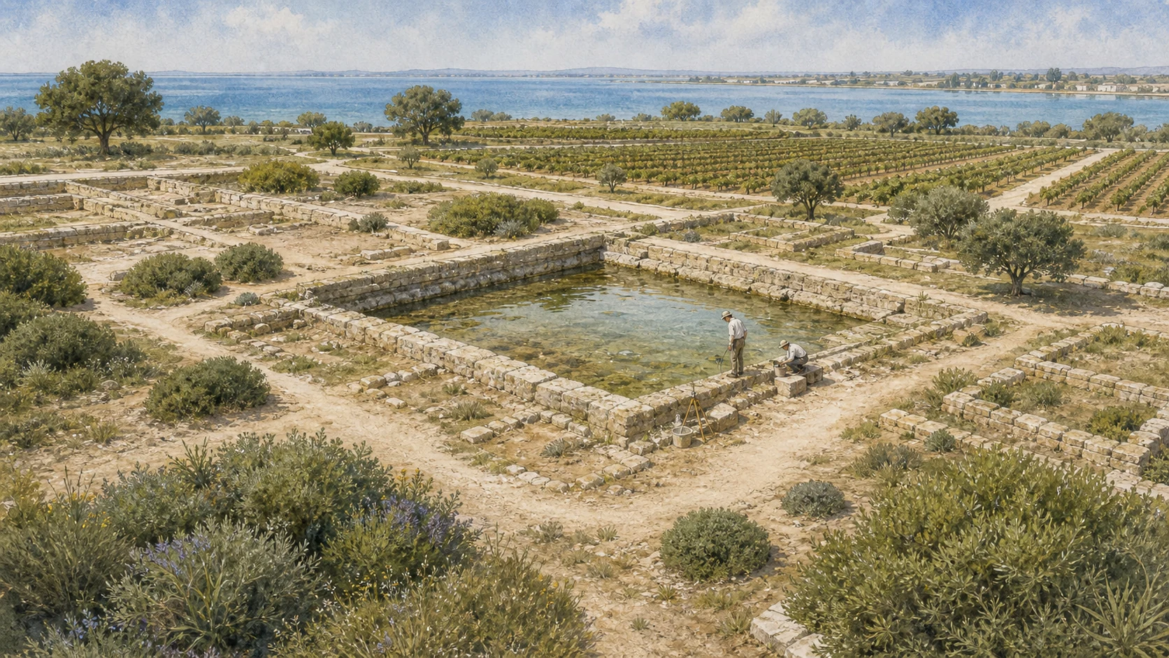
Documentary watercolour of Mozia's low rectangular Kothon sacred pool within excavated stone foundations, vineyards and the Stagnone landscape
SACRED WATER, NOT A WAR HARBOURExcavation replaced the fleet-filled Kothon imagined by older accounts with a freshwater pool inside a broad sacred enclosure.
08

FRESHWATER, TEMPLES AND A GREAT ENCLOSURE REPLACED THE OLD MILITARY-HARBOUR MODEL

The Kothon, Sacred Pool and Circular Temenos

Basin and surrounding sanctuaries form one cultic landscape while the traditional name Kothon remains useful only when its reinterpretation is stated.

Documentary watercolour of Mozia's low rectangular Kothon sacred pool within excavated stone foundations, vineyards and the Stagnone landscape
SACRED WATER, NOT A WAR HARBOUR

The place today

The basin measures roughly 52.5 by 36.5 metres and occupies the centre of a broad sacred area. Foundations around the basin represent several temples and rebuilding phases, not one simultaneous pristine complex.

The historical chapter

Early excavators compared the feature to Carthage's cothon and identified a harbour. From the sixth century BC a monumental circular enclosure organised the springs and temples.

What to notice

  • State the reinterpretation explicitly instead of silently repeating 'military harbour'.
  • Treat Baal-Poseidon and Astarte-Demeter equations as ancient and modern processes of interpretation, not exact identity.
Sapienza University · sacred pool of Baal research
09

DEFENCE AND LANDING CONTROL CONTINUED AROUND THE SOUTHERN SHORE

South Gate, Western Fortress and Waterfront

Low remains connect urban access, military adaptation and a shoreline that no longer matches its ancient position.

Documentary watercolour of Mozia's low rectangular Kothon sacred pool within excavated stone foundations, vineyards and the Stagnone landscape
SACRED WATER, NOT A WAR HARBOUR

The place today

Wall foundations and gate structures lie near the Kothon sector. Their proximity can encourage visitors to merge them into one port installation. Shore change and later damage further complicate the original water edge.

The historical chapter

The southern and western defences protected access to the sacred district and the city. Towers, a western fortress and a small Astarte shrine were built and modified across the Phoenician period. Military architecture used the island's edge while ritual structures claimed adjacent ground.

What to notice

  • Keep defensive landing control separate from the sacred-pool interpretation of the Kothon.
  • Do not draw a continuous modern quay where excavation preserves only sectors and ancient sea level differed.
Sapienza University · Mozia excavation programme
10

AMPHORAE, MOSAICS, COURTYARDS AND CULT BELONGED TO ORDINARY URBAN LIFE

Workshops, Houses and the Productive City

Production and domestic space prevent Mozia from being reduced to gates, temples and the final siege.

Documentary watercolour of Mozia's low rectangular Kothon sacred pool within excavated stone foundations, vineyards and the Stagnone landscape
SACRED WATER, NOT A WAR HARBOUR

The place today

Kiln remains, waste deposits, tools and concentrations of containers appear in different sectors and museum cases. The House of the Mosaics and residences near the acropolis preserve room plans, decorated floors and ritual features at low level.

The historical chapter

Potters, builders, metalworkers and food producers supplied an urban population and maritime exchange. Elite houses used courtyards, storage, water facilities, mosaics and small sacred installations.

What to notice

  • Distinguish an imported amphora from a locally made imitation through fabric analysis, not silhouette alone.
  • A 'house of' name usually describes a find or feature, not an ancient owner known by inscription.
Sapienza University · technology and hybridisation research
11

A GREEK-SPEAKING SCULPTURAL LANGUAGE ENTERED A PHOENICIAN CITY

The Young Man of Mozia

The celebrated figure should remain inside its uncertain archaeological and cultural context rather than being assigned a convenient identity.

Documentary watercolour of Mozia's low rectangular Kothon sacred pool within excavated stone foundations, vineyards and the Stagnone landscape
SACRED WATER, NOT A WAR HARBOUR

The place today

The marble figure discovered in 1979 is displayed in the Whitaker Museum. Its clinging garment, stance and missing limbs have inspired labels such as charioteer, magistrate or deity, none universally accepted. Museum lighting reveals carving that reproductions flatten.

The historical chapter

Created in a Greek sculptural tradition around the mid-fifth century BC, the work reached or was made for a Phoenician urban context. Its find near industrial and defensive sectors after ancient displacement complicates original placement. The statue records trade, capture, commission or cultural exchange as possibilities rather than one settled biography.

What to notice

  • Use 'Young Man of Mozia' as the neutral name; 'charioteer' remains an interpretation.
  • Greek style does not automatically make the statue war booty from a named Greek city.
Whitaker Foundation · Mozia museum collections
12

DIONYSIUS I BROKE THE ISLAND CITY AFTER A COMPLEX ASSAULT

The Siege of 397 BC

Destruction layers illuminate warfare but do not explain every collapse or end every later use of Mozia.

Documentary watercolour of Mozia's low rectangular Kothon sacred pool within excavated stone foundations, vineyards and the Stagnone landscape
SACRED WATER, NOT A WAR HARBOUR

The place today

Burnt layers, collapsed defences, weapons and repairs are identified through excavation rather than dramatic standing ruins. Many objects were moved in antiquity or by early digs. Quiet vineyards conceal the density of the siege landscape.

The historical chapter

Dionysius I of Syracuse attacked Motya with major siege works in 397 BC. The city's fall reshaped Punic strategy in western Sicily and helped drive the foundation of Lilybaeum on a more defensible mainland promontory. Limited activity continued on San Pantaleo, but the island did not recover its former urban role.

What to notice

  • Do not assign every destruction deposit to 397 BC without stratigraphic dating.
  • Link Motya's fall to Lilybaeum's foundation without calling the mainland city a simple physical relocation of every inhabitant.
Lilibeo Archaeological Park · history of the Punic city
13

COLLECTION, LANDOWNERSHIP AND RESEARCH SHAPED THE MODERN ARCHAEOLOGICAL LANDSCAPE

Whitaker, the Island Museum and Continuing Excavation

The museum and excavations must be read with the history of early collecting and present conservation together.

Documentary watercolour of Mozia's low rectangular Kothon sacred pool within excavated stone foundations, vineyards and the Stagnone landscape
SACRED WATER, NOT A WAR HARBOUR

The place today

The Giuseppe Whitaker Museum occupies the family's island residence and displays the Young Man, stelae, pottery, sculpture and finds from generations of excavation. Tickets include island and museum access but not ferry transport; weather can suspend crossings and the museum has its own midday closure.

The historical chapter

Joseph Whitaker purchased and explored the island in the early twentieth century, establishing collections and a research tradition. Modern missions from Sapienza and Palermo work with the Foundation and public heritage authorities, applying stratigraphy and scientific analysis absent from pioneer campaigns. Re-reading notebooks and storerooms is as important as opening new trenches.

What to notice

  • Credit Whitaker's preservation role while also recognising that early excavation standards differ from current practice.
  • Check ferry, island and museum conditions separately; one ticket does not guarantee transport in bad weather.
Whitaker Foundation · current Mozia visit and museum
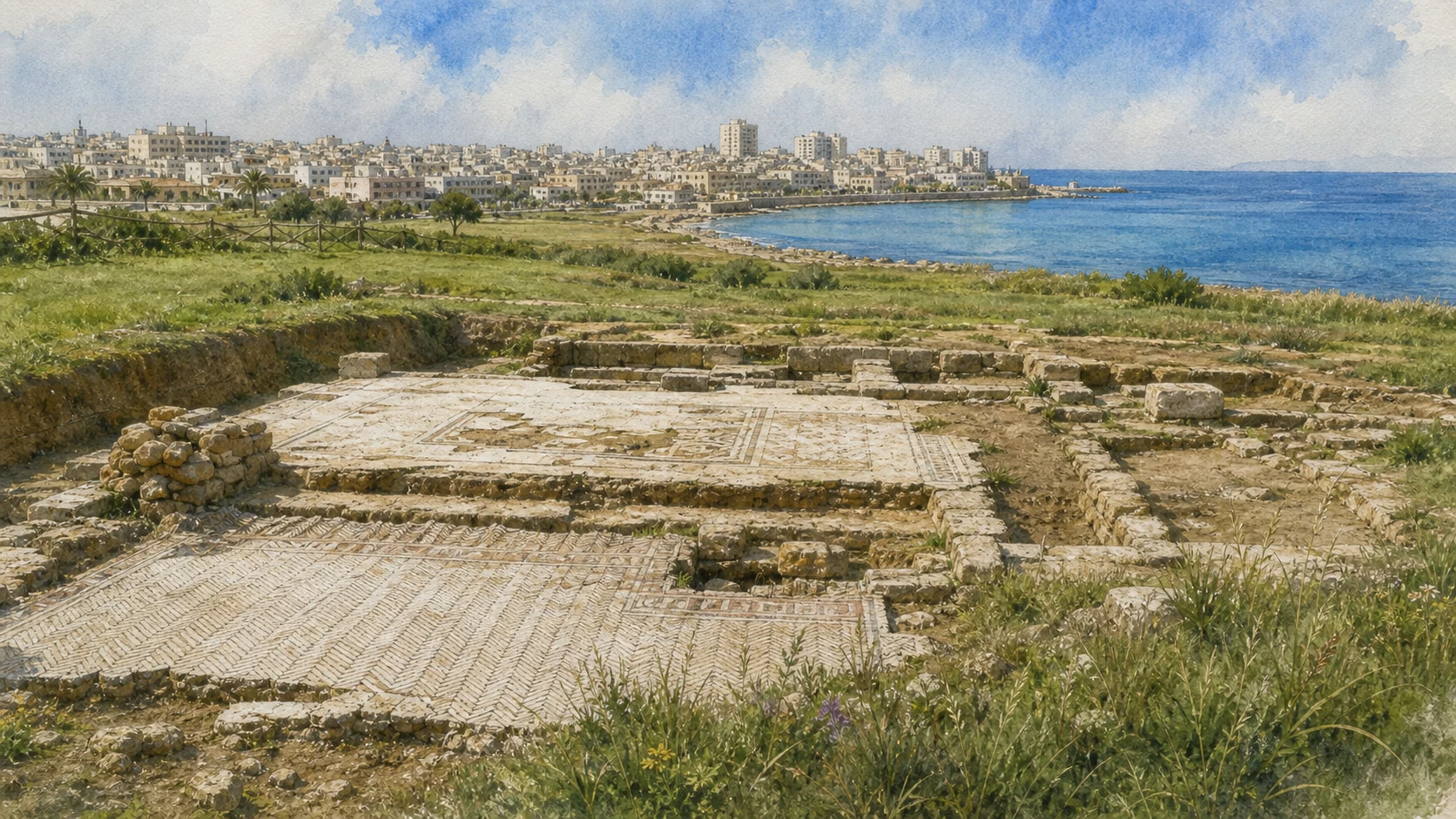
Documentary watercolour of the Lilibeo archaeological park at Capo Boeo with low Roman walls, geometric mosaic pavement, modern Marsala and the sea beyond
LILYBAEUM AT CAPO BOEORoman streets and mosaic floors survive inside a coastal archaeological park whose edges meet both modern Marsala and the open sea.
14

SURVIVORS AND PUNIC POWER BUILT A MAINLAND STRONGHOLD FACING AFRICA

Lilybaeum on Capo Boeo

Lilybaeum followed Motya historically but occupied a different geography, defensive system and maritime horizon.

Documentary watercolour of the Lilibeo archaeological park at Capo Boeo with low Roman walls, geometric mosaic pavement, modern Marsala and the sea beyond
LILYBAEUM AT CAPO BOEO

The place today

Capo Boeo projects from the western edge of Marsala toward the Sicilian Channel. The archaeological park occupies about 28 hectares between the museum, shoreline and Porta Nuova. Medieval and modern settlement shifted inland, leaving a rare broad area of the ancient coastal city unbuilt.

The historical chapter

After Motya's destruction in 397 BC, Punic authorities and survivors established Lilybaeum as the principal stronghold of western Sicily. The site controlled open-sea traffic toward Cape Bon and could receive fleets while maintaining land connections. Its name, plan and population developed independently even as Motyan memory and people contributed to the foundation.

What to notice

  • Do not place Lilybaeum inside the Stagnone; it occupies Capo Boeo south of the lagoon.
  • Treat 'founded by survivors' as a historical connection, not proof that the entire island population moved in one organised event.
Lilibeo Archaeological Park · Capo Boeo area
15

A GREAT LANDWARD DEFENCE RESISTED ROME FOR NINE YEARS

Walls, Ditch and the Long Roman Siege

Fortification and siege belong together, while the Battle of the Egadi remained a separate naval conclusion to the First Punic War.

Documentary watercolour of the Lilibeo archaeological park at Capo Boeo with low Roman walls, geometric mosaic pavement, modern Marsala and the sea beyond
LILYBAEUM AT CAPO BOEO

The place today

North-western fortifications preserve double wall lines and a tower within Capo Boeo. No single trench represents the entire siege.

The historical chapter

Punic builders enclosed a large quadrilateral and used the promontory's sea edges as part of defence. Roman forces besieged Lilybaeum from around 250 BC.

What to notice

  • Do not turn surviving wall segments into one uniformly preserved fortress perimeter.
  • A museum ship connected to the war is not automatically the exact vessel described in one ancient episode.
Lilibeo Archaeological Park · official history and walls
16

PORT, ADMINISTRATION AND AGRICULTURAL ROUTES SUSTAINED A MAJOR PROVINCIAL CITY

Roman Lilybaeum and its African Gateway

Cicero's praise belongs to a functioning Mediterranean centre rather than an empty successor to Punic history.

Documentary watercolour of the Lilibeo archaeological park at Capo Boeo with low Roman walls, geometric mosaic pavement, modern Marsala and the sea beyond
LILYBAEUM AT CAPO BOEO

The place today

Port finds and museum displays document traffic toward Africa. Roman streets, houses and baths spread through Capo Boeo. Later coastal change means the ancient harbour cannot be read only from the present marina.

The historical chapter

Under Rome Lilybaeum served as naval base and departure point for Cape Bon and Carthage. Cicero was quaestor here in 76–75 BC and later called it a splendid city while prosecuting Verres for provincial abuses. It became a municipium and later a colony, maintaining a mixed Punic, Greek and Latin inheritance.

What to notice

  • Use Cicero's praise as a rhetorical historical source, not an objective modern ranking.
  • Roman political status did not instantly erase Punic language, cult or family traditions.
Lilibeo Archaeological Park · Roman city history
17

STREET LEVELS, MOSAICS AND PRIVATE BATHS REVEAL A CITY REBUILT OVER TIME

Plateia Aelia, the Imperial Domus and Urban Life

Road and house remain distinct archaeological contexts but together show how Roman Lilybaeum organised movement and elite residence.

Documentary watercolour of the Lilibeo archaeological park at Capo Boeo with low Roman walls, geometric mosaic pavement, modern Marsala and the sea beyond
LILYBAEUM AT CAPO BOEO

The place today

Plateia Aelia crosses the archaeological area and connects exposed buildings. Insula I preserves a substantial domus with mosaic floors and a bath installation.

The historical chapter

The street formed part of Lilybaeum's regular plan and structured access to houses, baths and public zones. Imperial owners invested in reception, bathing and coloured pavements using styles closely connected to North African workshops and markets.

What to notice

  • Do not call every visible slab Punic or assign the whole street to one construction campaign.
  • Do not walk on exposed mosaics or infer a room's function only from one image.
Lilibeo Archaeological Park · Capo Boeo monuments
18

BATHING, WATER AND CULT SHARED A MONUMENTAL QUARTER

Public Baths and the Sanctuary of Healing Deities

Excavated structures and inscriptions support a connected reading without fixing every room to one ritual function.

Documentary watercolour of the Lilibeo archaeological park at Capo Boeo with low Roman walls, geometric mosaic pavement, modern Marsala and the sea beyond
LILYBAEUM AT CAPO BOEO

The place today

Public baths retain a furnace and a heated pool supported on suspensurae. Nearby sanctuary finds refer to Asclepius, Salus-Hygieia and Isis-Aphrodite, including an inscription to Isis of innumerable names. Not every sculpture remains in situ.

The historical chapter

Roman bathing combined hygiene, sociability and civic display. The sanctuary's divine associations show how healing, protection and maritime cosmopolitanism could be expressed through overlapping names and images. Syncretism did not erase difference; worshippers selected forms for particular needs.

What to notice

  • Distinguish the public baths from the private bath suite in the imperial domus.
  • Do not collapse Asclepius, Salus, Hygieia, Isis and Aphrodite into one deity; the evidence records association and translation.
Lilibeo Archaeological Park · baths and sanctuary
19

TOMBS, INSCRIPTIONS AND PAINTED CHAMBERS EXTEND THE CITY BEYOND ITS WALLS

The Necropolis and the World of Crispia Salvia

Individual monuments open onto wider funerary landscapes whose chronology and accessibility vary.

Documentary watercolour of the Lilibeo archaeological park at Capo Boeo with low Roman walls, geometric mosaic pavement, modern Marsala and the sea beyond
LILYBAEUM AT CAPO BOEO

The place today

The Via del Fante area contains burials from the later third century BC to the second century AD on several levels. Other hypogea, including Crispia Salvia, preserve painted and inscribed contexts with separate access conditions. Many sites require current Park information or special opening.

The historical chapter

Cremation was common, sometimes performed within the grave, but inhumation in pits and stone cists also occurred. Small stepped-pyramid markers used dressed calcarenite and white plaster. Family, status, age and changing belief produced variation across centuries rather than a single Punic or Roman rite.

What to notice

  • Do not promise routine access to every hypogeum; conservation and ownership conditions vary.
  • Keep the named tomb of Crispia Salvia distinct from the whole necropolis and from anonymous burial groups.
Lilibeo Archaeological Park · Hellenistic-Roman necropolis
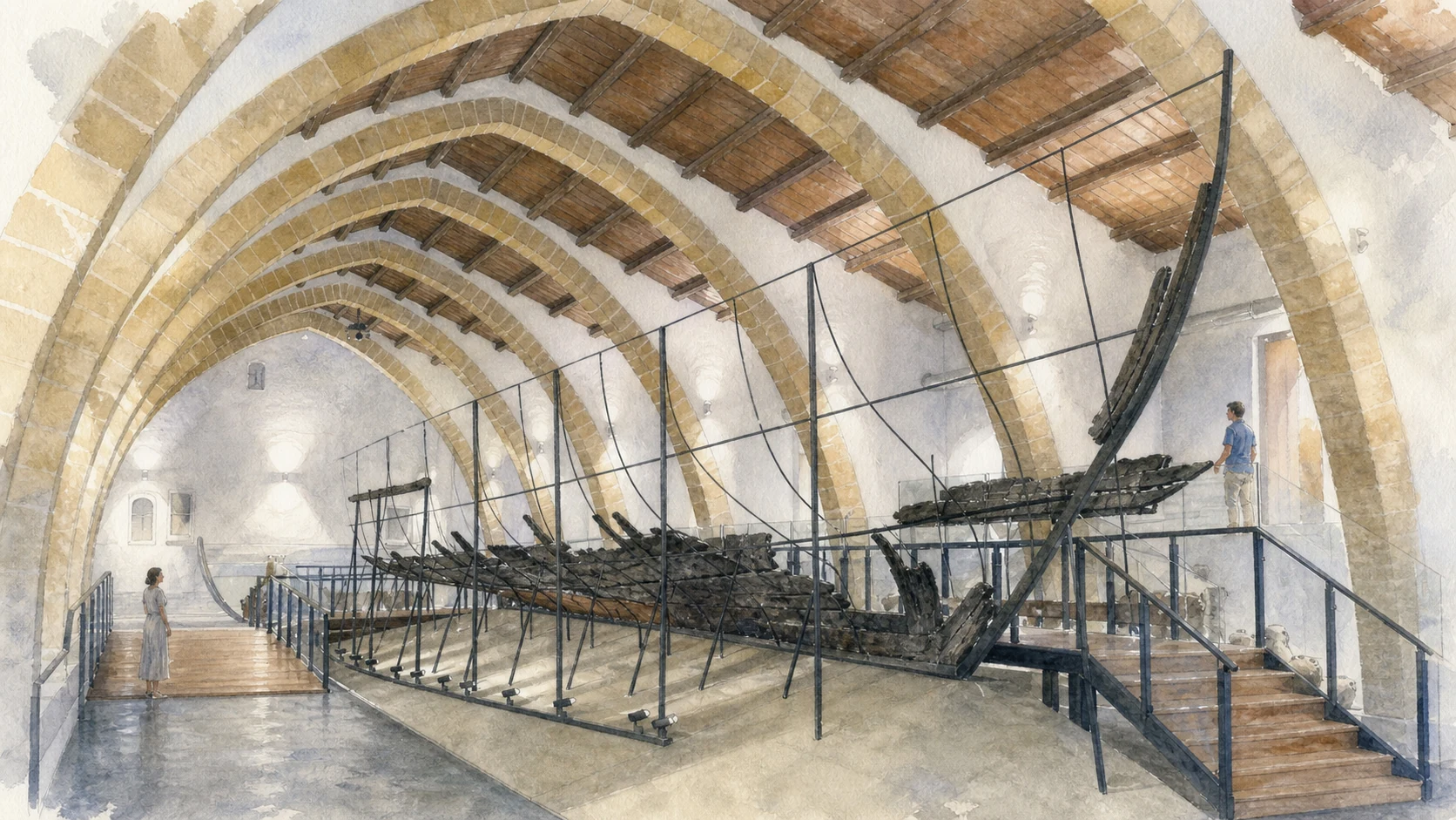
Documentary watercolour inside Baglio Anselmi showing the conserved dark timber remains of the Punic ship on a modern support cradle beneath pale stone arches
TIMBERS UNDER CONSERVATIONThe Punic ship is encountered as fragile original timber held by a modern support system, not as a complete vessel reconstructed for spectacle.
20

CONSERVATION CONNECTS NAVAL TECHNOLOGY TO CENTURIES OF MARITIME LOSS

The Punic Ship and Later Wrecks

The Punic remains and medieval wrecks require separate dates and functions, joined by the museum's work of preserving fragile hulls.

Documentary watercolour inside Baglio Anselmi showing the conserved dark timber remains of the Punic ship on a modern support cradle beneath pale stone arches
TIMBERS UNDER CONSERVATION

The place today

The Regional Archaeological Museum occupies Baglio Anselmi and presents the Punic ship on a close viewing walkway. The museum displays the late Roman cargo ship recovered near the former Birgi estuary, with one side reconstructed and the other shown as found, plus medieval wreck material and small wine amphorae from Marsala's southern coast.

The historical chapter

Honor Frost directed recovery between 1971 and 1974 after remains emerged near Punta Scario. The Marausa vessel records late Roman transport and estuarine navigation centuries after Lilybaeum's Punic foundation.

What to notice

  • Distinguish original timber from supports and reconstructed outlines.
  • A reconstructed side is an explanatory model paired with original material, not a second preserved half.
Lilibeo Archaeological Park · Punic ship and museum
21

A CHANGING CITY CENTRE REUSED THE LONG AFTERLIFE OF LILYBAEUM

Medieval Marsala, its Name and the Duomo

Urban contraction, the debated name Marsala and the Cathedral's many phases belong to a layered centre rather than a single Arab or Norman foundation.

Documentary watercolour inside Baglio Anselmi showing the conserved dark timber remains of the Punic ship on a modern support cradle beneath pale stone arches
TIMBERS UNDER CONSERVATION

The place today

The historic centre lies east of much of the archaeological park, organised by gates, narrow streets and Piazza della Repubblica. The Duomo dominates Piazza della Repubblica, also called Piazza della Loggia.

The historical chapter

After late antiquity and Byzantine rule, Arabic-speaking administration and maritime culture reshaped the port and name traditionally explained through marsa, harbour. Tradition and documentation place the church's beginnings in the Norman period and connect its dedication to Thomas Becket.

What to notice

  • Do not derive every modern street from Lilybaeum's grid; the centre and ancient park overlap only partly.
  • Respect services and distinguish devotional objects from museum exhibits.
Lilibeo Archaeological Park · museum city sequence
22

A CITY GATE BECAME A NATIONAL MEMORY SITE WITHOUT LOSING ITS URBAN HISTORY

Porta Garibaldi and the Landing of the Thousand

The 1860 landing is one layer within a rebuilt gateway, harbour city and museum landscape.

Documentary watercolour inside Baglio Anselmi showing the conserved dark timber remains of the Punic ship on a modern support cradle beneath pale stone arches
TIMBERS UNDER CONSERVATION

The place today

The gate built as Porta Mare in 1685 stands in the historic centre with the crowned Spanish Habsburg eagle above its arch. The San Pietro complex houses the municipal museum, including the Risorgimento-Garibaldian section, library and archive.

The historical chapter

Garibaldi and the Thousand landed at Marsala and entered through the sea gate on 11 May 1860. Renaming converted the monument into a national memorial, while local collections assembled uniforms, weapons, documents, images and personal relics. The episode belongs both to Italian unification and to Marsala's port history.

What to notice

  • Call the gate seventeenth-century Spanish architecture before calling it Garibaldi's monument.
  • Check current museum hours; municipal listings can change and an outdoor gate does not share the museum schedule.
Municipality of Marsala · Porta Garibaldi
23

FORTIFICATION, OXIDATION AND ATLANTIC COMMERCE CREATED MANY STYLES, NOT ONE SWEET WINE

Marsala Wine, Bagli and Mediterranean Trade

Vineyards, cellars, regulations and trade should be read as a living production system whose categories remain precise.

Documentary watercolour inside Baglio Anselmi showing the conserved dark timber remains of the Punic ship on a modern support cradle beneath pale stone arches
TIMBERS UNDER CONSERVATION

The place today

Historic bagli and working cellars connect the city to vineyards inland. DOC Marsala includes oro, ambra and rubino categories, different sugar levels and ageing terms governed by the production specification. Individual tours require booking and do not define the whole denomination.

The historical chapter

Wine existed in western Sicily long before the modern product. From the late eighteenth century John Woodhouse, Benjamin Ingham, Vincenzo Florio and other firms organised fortification, ageing and export for international markets. Phylloxera, economic crisis, regulation and changing taste reshaped production. The DOC protects rules established in modern law, not an unchanged ancient formula.

What to notice

  • Do not define all Marsala as sweet; read colour, sugar, ageing and production category on the label.
  • Separate general wine history from the marketing story of any single cellar.
Italian Ministry of Agriculture · consolidated Marsala DOC specification (2025)
24

WIND AND LABOUR MOVE WATER THROUGH A PRODUCTIVE GEOMETRY

Salt Pans, Windmills and Managed Brine

The salt landscape is working infrastructure as well as heritage and habitat, not an unrestricted sunset stage.

Documentary watercolour inside Baglio Anselmi showing the conserved dark timber remains of the Punic ship on a modern support cradle beneath pale stone arches
TIMBERS UNDER CONSERVATION

The place today

Shallow pans, embankments, sluices, salt heaps and traditional windmills line parts of the lagoon. Colours change with salinity, microorganisms, weather and production phase. Some areas are active workplaces or private property rather than unrestricted scenic platforms.

The historical chapter

Centuries of salt production adapted the Stagnone's sun, wind and shallow coast through engineered water circulation. Windmills powered pumping or grinding according to type. Industrial change reduced some operations, while heritage, tourism and renewed artisanal production preserved others.

What to notice

  • Do not enter pans, embankments or windmills without the operator's authorised route.
  • A pink colour is seasonal biology and chemistry, not a permanent filter or guaranteed sunset condition.
Sicilian Region ORBS · salt pans within the Stagnone system
25

POSIDONIA, BIRDS, SALT AND RECREATION COMPETE WITHIN A PROTECTED LAGOON

The Living Stagnone

The guide closes by returning archaeology and tourism to the ecological system that made Mozia and Marsala possible.

Documentary watercolour inside Baglio Anselmi showing the conserved dark timber remains of the Punic ship on a modern support cradle beneath pale stone arches
TIMBERS UNDER CONSERVATION

The place today

Posidonia meadows, fish, molluscs, algae, salicornia, limonium and rare coastal plants support a rich wetland. Flamingos, spoonbills, stilts, avocets, egrets and waterfowl use the lagoon seasonally. Recreation is visible but subject to reserve zones, weather and habitat rules.

The historical chapter

The reserve was established in the 1980s and forms part of the Natura 2000 network. Conservation recognises that salt production and traditional cultivation can belong to the protected landscape, while unmanaged access, pollution, dredging and disturbance threaten its ecological function. Climate and sea-level change add pressures that a picturesque image conceals.

What to notice

  • Observe birds at distance and never approach feeding or nesting groups for a photograph.
  • Do not equate abundant recreation with permission everywhere; consult reserve and operator rules for zones and conditions.
Sicilian Region ORBS · habitats and species of the Stagnone

The city through time

Ten passages through island settlement, fortified cities and working water

The chronology keeps Motya and Lilybaeum distinct, then follows Marsala through medieval transformation, global wine trade and modern protection of the lagoon.

  1. Prehistoric communities use San Pantaleo and the Stagnone before the Phoenician island city; later building preserves and disturbs these early levels.

  2. Phoenician settlement expands across Motya, with houses, sanctuaries, necropolis, workshops and eventually a monumental wall circuit.

  3. North and south sacred districts, the tophet, circular Kothon sanctuary, gates and elite houses are repeatedly monumentalised.

  4. Dionysius I of Syracuse captures and destroys Motya; Punic strategy shifts to the new mainland stronghold of Lilybaeum.

  5. Lilybaeum withstands a long Roman siege until defeat near the Egadi ends the First Punic War and transfers western Sicily to Rome.

  6. Roman Lilybaeum prospers as African gateway, municipium and later colony, with streets, domus, baths, sanctuaries and port traffic.

  7. Christian, Byzantine, Islamic and Norman phases reshape the city inland; graves and worship reuse the ancient urban landscape.

  8. Porta Mare rises under Spanish rule; wine commerce transforms Marsala, and Garibaldi's 1860 landing turns the gate into a national symbol.

  9. Whitaker's excavations establish Mozia's museum; Honor Frost recovers the Punic ship, and the Young Man of Mozia is discovered.

  10. The Stagnone reserve, regional archaeological park and continuing university research protect and reinterpret an active cultural and ecological landscape.

Before your visit

Practical information,
without turning it into promises

01

Treat Mozia transport, island admission and museum hours separately

The Whitaker ticket covers the island and museum but not ferry transport. Weather can suspend crossings, and the museum has a midday closure; verify the Foundation and boat operator the day before.

02

Give Capo Boeo and Baglio Anselmi their own half-day

The museum, Punic ship, 28-hectare archaeological park, streets, domus, baths and shoreline cannot be responsibly compressed into a quick stop after Mozia. Check the Park's current entrances and seasonal hours.

03

Use special-access sites only when officially open

Hypogea, necropolis sectors, restoration areas and underwater routes have different conservation and safety conditions. Do not promise routine access or enter closed archaeology.

04

Respect the reserve and working salt landscape

Follow authorised boat, birdwatching, salt-pan and watersport routes. Wind, heat, shallow water and habitat rules affect every plan; active production areas are not public shortcuts.

Sources

This guide cross-checks the Whitaker Foundation, Sapienza University and University of Palermo research, the Sicilian Region's Lilibeo-Marsala Archaeological Park and ORBS nature-reserve portal, the Municipality of Marsala and the current Marsala DOC record. It distinguishes Motya from Lilybaeum, the submerged road from a modern walking route, the traditional Kothon label from its sacred-pool reinterpretation, tophet evidence from sensational certainty, Greek-form art from Greek ownership, destruction in 397 BC from total later absence, original ship timbers from reconstruction, Punic siege from the Battle of the Egadi, ancient Lilybaeum from the complete medieval street plan, protected wine categories from one commercial style and salt-pan scenery from unrestricted natural terrain.

The hero is an original documentary illustration, not an official photograph or archaeological reconstruction. Ferry operations, island and museum hours, archaeological entrances, restoration access, hypogeum openings, boat routes, salt-pan visits and reserve conditions can change; consult the linked institutions shortly before travelling. The Kothon reinterpretation, tophet evidence, divine identifications, statue identity, ship dimensions and historical name etymologies remain qualified where research does not permit certainty.