Original documentary watercolour panorama for Naples Santa Lucia, Castel dell'Ovo and Chiaia Waterfront: Complete Guide, with accurate Naples architecture and lived urban context

Naples Guide 09 · Castle-islet, fishing quarter, royal promenade, public gardens and western bay

Santa Lucia, Castel dell’Ovo
& Chiaia Waterfront

A coastal route from the former fishing quarter and Castel dell’Ovo to Borgo Marinari, the Lungomare, Villa Comunale, Chiaia and Mergellina, reading land reclamation, leisure, science and coastal risk together.

Plan the route
Naples · Campania10 chapters · one full day

Why this Naples district must be read in layers

Naples’s waterfront is constructed terrain: islets, quays, roads, gardens, marinas and neighbourhoods repeatedly shifted the line between city and bay.

Castel dell’Ovo occupies the islet of Megaride, associated with Greek settlement, Roman elite residence, monastic use and medieval fortification. Its popular name and Virgilian legend are cultural history, not archaeological proof.

Santa Lucia and Borgo Marinari preserve maritime identity but were transformed by embankment, road building, tourism and real-estate change. The present promenade is not an untouched fishing shore.

Villa Comunale, the Aquarium and Chiaia connect royal public landscape to science and urban leisure. Farther west, Mergellina and Piedigrotta open toward transport, harbour and volcanic territory.

Check Castel dell’Ovo’s live reopening status before depending on entry, then walk west with the changing shoreline in mind and treat the promenade as civic infrastructure, not a stage set.

The route

Plan your visit

Start around Megaride and Santa Lucia, continue along the Lungomare into Villa Comunale and Chiaia, then finish at Mergellina where rail, road, harbour and cliff routes meet.

Early morning

Santa Lucia · Megaride · Castel dell’Ovo

Move in the documented order: Santa Lucia: a maritime quarter transformed by the new waterfront; then Megaride: settlement, villa and monastic island; then Castel dell’Ovo: layered fortress at the bay entrance. Check live access before entering ticketed or liturgical spaces.

Late morning

Borgo Marinari · The Lungomare · Villa Comunale

Move in the documented order: Borgo Marinari: harbour life inside the monument; then The Lungomare: promenade on reclaimed and engineered ground; then Villa Comunale: royal promenade becomes public park. Check live access before entering ticketed or liturgical spaces.

Afternoon

Anton Dohrn Aquarium · Chiaia · Villa Pignatelli

Move in the documented order: Anton Dohrn Aquarium: marine science in a public garden; then Chiaia: palaces, commerce and residential city behind the park; then Villa Pignatelli: aristocratic residence and museum garden. Check live access before entering ticketed or liturgical spaces.

Late afternoon

Mergellina

Move in the documented order: Mergellina: harbour, railway and the western opening. Check live access before entering ticketed or liturgical spaces.

Ten chapters

Explore the places

The order follows terrain, institutions and present-day movement. Use the index to return to a chapter without reducing the district to isolated monuments.

  1. 01Santa Lucia: a maritime quarter transformed by the new waterfront
  2. 02Megaride: settlement, villa and monastic island
  3. 03Castel dell’Ovo: layered fortress at the bay entrance
  4. 04Borgo Marinari: harbour life inside the monument
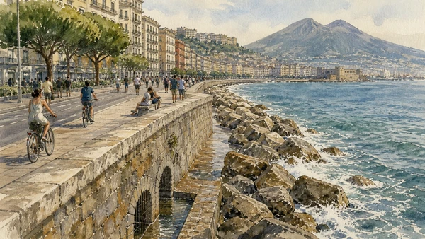
  5. 05The Lungomare: promenade on reclaimed and engineered ground
  6. 06Villa Comunale: royal promenade becomes public park
  7. 07Anton Dohrn Aquarium: marine science in a public garden
  8. 08Chiaia: palaces, commerce and residential city behind the park
  9. 09Villa Pignatelli: aristocratic residence and museum garden
  10. 10Mergellina: harbour, railway and the western opening
01

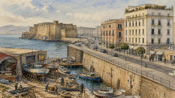
A former shoreline community now faces an embanked road, hotels and harbour infrastructure

Santa Lucia: a maritime quarter transformed by the new waterfront

Memory of fishing and boat work survives within major physical change.

Today

The promenade is busy with pedestrians, cycles, service traffic and events. Keep crossing points and local business access clear.

History

The district grew beside the royal and military zone, with fishing, boat services and dense housing. Nineteenth- and twentieth-century reclamation and redevelopment altered both population and shoreline.

How to read this place

Compare old maps with the current distance between buildings and water. Remaining place names and institutions preserve only part of the former maritime system.

What to notice

  • Embanked road replacing a closer shoreline
  • Maritime services surviving beside hotels
  • Royal and military monuments framing the district
UNESCO World Heritage Centre · Historic Centre of Naples
Original documentary watercolour of Santa Lucia: a maritime quarter transformed by the new waterfront in Naples, showing architecture, people and present-day urban context
Santa Lucia: a maritime quarter transformed by the new waterfrontOriginal Merlintravel documentary watercolour · 2026
02

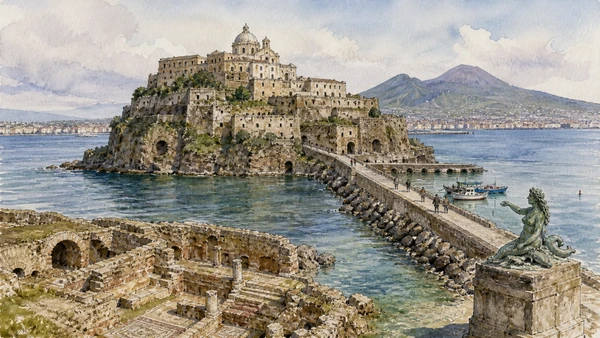
The small tuff islet beneath Castel dell’Ovo carries several origin stories and documented occupations

Megaride: settlement, villa and monastic island

Archaeology and legend must be kept in productive tension.

Today

Public access follows the castle approach and can be restricted during works. View the islet from open quays when entry is closed.

History

The site is associated with early Greek presence and with the Roman villa of Lucullus; later monastic and fortified uses transformed the topography. Evidence survives unevenly beneath later construction.

How to read this place

Use the shape of rock and causeway to imagine an island before embankment. Label the Parthenope and Virgil traditions as traditions, not established excavation results.

What to notice

  • Tuff islet embedded in later harbour works
  • Multiple occupations beneath medieval fortification
  • Legend contributing to civic identity
Comune di Napoli · Castel dell’Ovo
Original documentary watercolour of Megaride: settlement, villa and monastic island in Naples, showing architecture, people and present-day urban context
Megaride: settlement, villa and monastic islandOriginal Merlintravel documentary watercolour · 2026
03

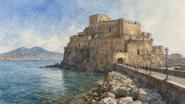
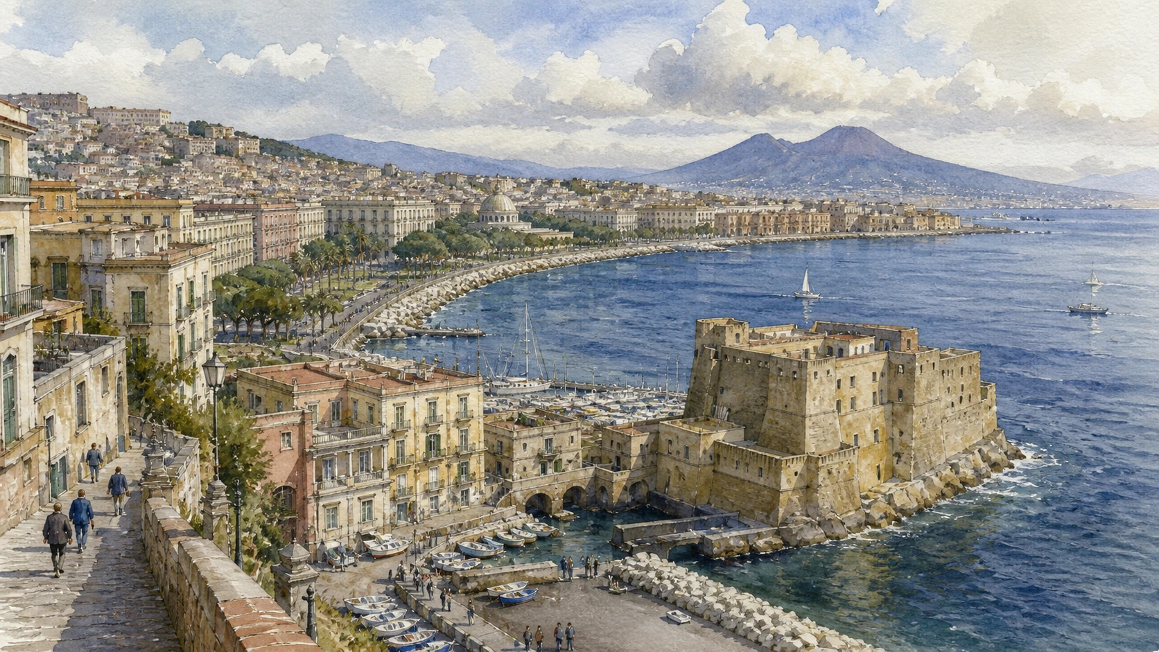
Irregular walls and terraces follow the tuff islet rather than imposing the geometry of a later gunpowder fort

Castel dell’Ovo: layered fortress at the bay entrance

Its long closure and restoration history must be checked live.

Today

Access has changed during conservation campaigns; consult the Comune before planning interior entry. Quays and Borgo Marinari remain a useful exterior route.

History

Monastic and ducal fortifications preceded Norman and Angevin use. The castle served royal, military and prison functions and was repeatedly altered by earthquakes and artillery needs.

How to read this place

Walk the base first and observe how walls grow from rock. If open, use terraces to connect fortification to harbour and royal centre.

What to notice

  • Walls adapting to an irregular tuff islet
  • Causeway creating controlled approach
  • Terraces commanding bay and city
Comune di Napoli · Castel dell’Ovo
Original documentary watercolour of Castel dell'Ovo: layered fortress at the bay entrance in Naples, showing architecture, people and present-day urban context
Castel dell’Ovo: layered fortress at the bay entranceOriginal Merlintravel documentary watercolour · 2026
04

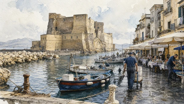
A small marina and dense cluster of buildings occupy the sheltered edge beneath the castle

Borgo Marinari: harbour life inside the monument

Restaurants and leisure boats coexist with working access and resident space.

Today

Narrow quays can congest quickly. Keep mooring and emergency routes open and do not treat boats as public seating or photo platforms.

History

Maritime and service uses developed around the fortified islet and were reshaped by modern harbour works and tourism. The settlement’s present appearance is relatively recent within a much longer site history.

How to read this place

Observe mooring systems, service deliveries and the relation between breakwater and castle. The borgo is operational, not merely picturesque.

What to notice

  • Small harbour protected by castle and breakwater
  • Moorings organising narrow public quays
  • Food and tourism layered over maritime work
Comune di Napoli · Borgo Marinari
Original documentary watercolour of Borgo Marinari: harbour life inside the monument in Naples, showing architecture, people and present-day urban context
Borgo Marinari: harbour life inside the monumentOriginal Merlintravel documentary watercolour · 2026
05

A celebrated bay view depends on seawalls, traffic policy, paving and continuous maintenance

The Lungomare: promenade on reclaimed and engineered ground

Public access and coastal defence are inseparable.

Today

Events, weather and mobility policy can alter lanes and closures. Share space with runners, families, cyclists and workers.

History

Road and embankment projects changed the nineteenth- and twentieth-century waterfront, separating some buildings from direct water access while creating a long public promenade.

How to read this place

Look down at seawall, drains and wave exposure, then inland at the urban fronts. Infrastructure enables the scenic experience.

What to notice

  • Seawall holding a constructed urban edge
  • Promenade distributing multiple public uses
  • Bay view framed by modern mobility policy
Comune di Napoli · Lungomare
Original documentary watercolour of The Lungomare: promenade on reclaimed and engineered ground in Naples, showing architecture, people and present-day urban context
The Lungomare: promenade on reclaimed and engineered groundOriginal Merlintravel documentary watercolour · 2026
06

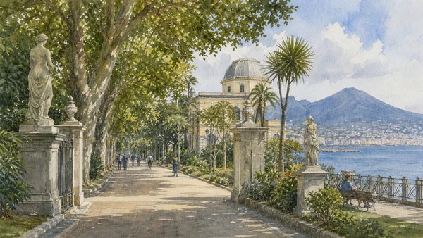
A long coastal garden combines formal avenues, sculpture, plantings and scientific institutions

Villa Comunale: royal promenade becomes public park

Its history reflects changing ideas of controlled and public leisure.

Today

Sections can close for maintenance and planting recovery. Stay off protected beds and check current access to buildings within the park.

History

The garden developed from a Bourbon royal promenade and was altered through later extensions, landscape design and the changing coastline. Public use expanded after political transition.

How to read this place

Follow an avenue and compare gates, sculpture, shade and sea relation. Maintenance condition is part of present civic history.

What to notice

  • Long formal avenues paralleling the coast
  • Sculpture and planting structuring public leisure
  • Scientific buildings embedded in the garden
Comune di Napoli · Villa Comunale
Original documentary watercolour of Villa Comunale: royal promenade becomes public park in Naples, showing architecture, people and present-day urban context
Villa Comunale: royal promenade becomes public parkOriginal Merlintravel documentary watercolour · 2026
07

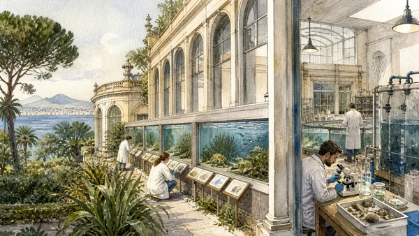
One of Europe’s historic marine research institutions joins living displays to long-term study of the Gulf

Anton Dohrn Aquarium: marine science in a public garden

The aquarium should be read as part of a research station, not only as family entertainment.

Today

Admission, timed access and exhibition status follow the official foundation. Respect animal welfare rules and do not use flash where prohibited.

History

Anton Dohrn founded the zoological station in the nineteenth century to support international marine research. Aquarium, laboratories and collections connected the Gulf’s biodiversity to modern science.

How to read this place

Read tanks by habitat and research question. Look for explanation of collection, water systems and conservation rather than only dramatic species.

What to notice

  • Historic aquarium galleries within the park
  • Gulf habitats represented through living systems
  • Research institution extending beyond public display
Stazione Zoologica Anton Dohrn · Official institution
Original documentary watercolour of Anton Dohrn Aquarium: marine science in a public garden in Naples, showing architecture, people and present-day urban context
Anton Dohrn Aquarium: marine science in a public gardenOriginal Merlintravel documentary watercolour · 2026
08

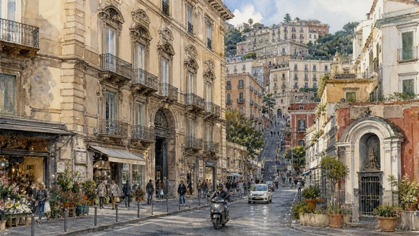
A district associated with elite expansion also contains dense housing, churches, shops and public routes toward the hills

Chiaia: palaces, commerce and residential city behind the park

Its identity cannot be reduced to luxury retail.

Today

Sidewalks, deliveries and resident access remain busy. Read upper floors and courtyards without entering private buildings.

History

Suburban villas and gardens developed west of the old centre before urbanisation intensified under Bourbon and later governments. New streets and transport linked Chiaia to the expanding city.

How to read this place

Walk one coastal-parallel street and one uphill connection. Compare palace scale, later apartment buildings and small sacred thresholds.

What to notice

  • Palace fronts absorbed into a dense commercial district
  • Uphill streets exposing the terrain
  • Residential and retail uses sharing historic buildings
UNESCO World Heritage Centre · Historic Centre of Naples
Original documentary watercolour of Chiaia: palaces, commerce and residential city behind the park in Naples, showing architecture, people and present-day urban context
Chiaia: palaces, commerce and residential city behind the parkOriginal Merlintravel documentary watercolour · 2026
09

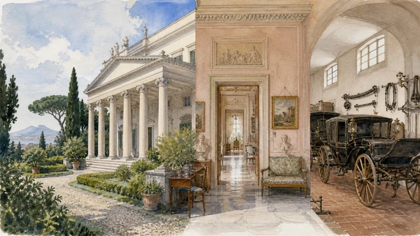
A neoclassical villa preserves a different scale of elite life within urban Chiaia

Villa Pignatelli: aristocratic residence and museum garden

Interiors, carriage collection and garden form one managed museum site.

Today

The museum follows MiC opening and ticket rules; some rooms or the garden can close for conservation or weather.

History

The villa was built in the nineteenth century for a cosmopolitan elite and passed through prominent owners before donation to the state. Furnishings and collections present selected domestic histories.

How to read this place

Compare portico, room sequence and garden boundary. Use labels to distinguish original setting from later museum arrangement.

What to notice

  • Neoclassical portico facing a private garden
  • Domestic rooms preserved through state museum care
  • Carriage collection documenting mobility and status
Museo Diego Aragona Pignatelli Cortes · MiC
Original documentary watercolour of Villa Pignatelli: aristocratic residence and museum garden in Naples, showing architecture, people and present-day urban context
Villa Pignatelli: aristocratic residence and museum gardenOriginal Merlintravel documentary watercolour · 2026
10

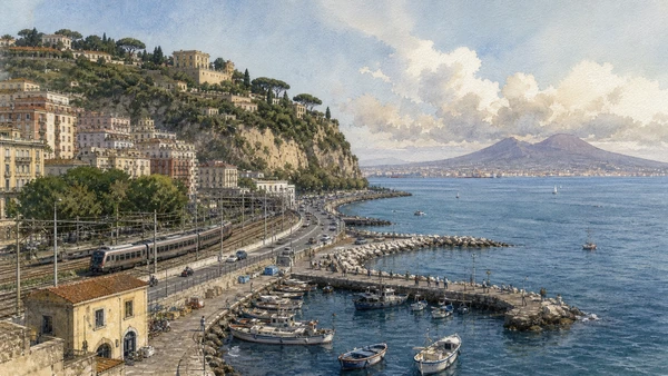
A small harbour and transport node face the bay where city, Posillipo and volcanic coast begin to separate

Mergellina: harbour, railway and the western opening

It is both destination and interchange.

Today

Harbour operations, trains and road crossings require attention. Verify ferry or local transport services on the day and remain outside controlled docks.

History

Fishing and coastal settlement were transformed by the railway, embankment, road building and urban expansion. Nearby Piedigrotta added religious and festival traditions to the transport landscape.

How to read this place

Use the harbour edge to identify Posillipo slope, Villa Comunale and Vesuvius across the bay. Modern transport explains the present shoreline.

What to notice

  • Small harbour meeting rail and road infrastructure
  • Posillipo cliff rising beyond the urban coast
  • Bay geography opening toward volcanic territory
Autorità di Sistema Portuale del Mar Tirreno Centrale
Original documentary watercolour of Mergellina: harbour, railway and the western opening in Naples, showing architecture, people and present-day urban context
Mergellina: harbour, railway and the western openingOriginal Merlintravel documentary watercolour · 2026

Naples through time

A short chronology

From Greek Neapolis and Roman infrastructure to dynastic capitals, wartime rupture, UNESCO care and a living metropolitan centre.

  1. Greek settlements and Neapolis establish the coastal and gridded urban foundations later absorbed by Roman Naples.

  2. Walls, streets, sanctuaries and civic spaces consolidate the ancient city on the tuff plateau.

  3. Roman Naples expands its theatres, baths, water systems, port functions and elite residences.

  4. Christian worship, burial and episcopal institutions reshape the ancient city and its edges.

  5. The Duchy of Naples maintains a distinct Mediterranean political and cultural identity.

  6. Norman and Swabian rule integrate Naples into larger southern kingdoms while reusing existing institutions.

  7. Angevin rule makes Naples a royal capital and begins major castle, church and urban commissions.

  8. Aragonese rule adds court culture, fortification and monumental Renaissance patronage.

  9. Spanish viceregal government extends Via Toledo, military quarters, religious houses and administrative power.

  10. Bourbon rule restores Naples as a dynastic capital and expands royal, cultural and infrastructural projects.

  11. The brief Parthenopean Republic and its repression expose deep political and social conflict.

  12. French-period government reforms streets, institutions and public administration.

  13. Naples enters the unified Kingdom of Italy and its capital functions are reorganised.

  14. Bombing, occupation, the Four Days and post-war rebuilding transform the city and port.

  15. UNESCO inscription, restoration, tourism pressure and resident-led cultural work renew debate over a living historic centre.

Before your visit

Practical information

01

Reserve constrained interiors

Timed museums, underground routes and major chapels can sell out; use only their current official booking channels.

02

Respect worship

Church access can pause for liturgy, funerals or community events; a visitor ticket never overrides religious use.

03

Walk the terrain

Tuff ridges, steep stairs, uneven paving and dense traffic are part of the city; keep a shorter accessible alternative.

04

Do not turn residents into scenery

Keep doorways, workshops, market lanes and courtyards clear; photograph people only with consent.

05

Check live transport

Metro, funicular, port and bus service can change; verify the same-day operator notice before relying on a connection.

06

Read layers, not clichés

Religious devotion, poverty, theatricality and danger are not interchangeable labels for Naples; use documented sites and institutions.

Method and sources

Sources and image credits

This guide uses official museum, ministry, church, transport and UNESCO documentation checked on 29 August 2026. It separates durable historical interpretation from access details that can change; distinguishes surviving fabric from reconstruction, restoration and legend; and treats worship, work, residence and public movement as part of the evidence rather than visual interference. Every chapter links its principal institutional source, while current tickets, closures and transport must always be verified again on the day of the visit.

All ten images are original Merlintravel editorial watercolours based on documented present-day conditions. They are illustrations, not substitutes for archaeological plans. Opening hours, tickets, accessible routes, temporary exhibitions and conservation work can change; consult the linked official pages shortly before visiting.