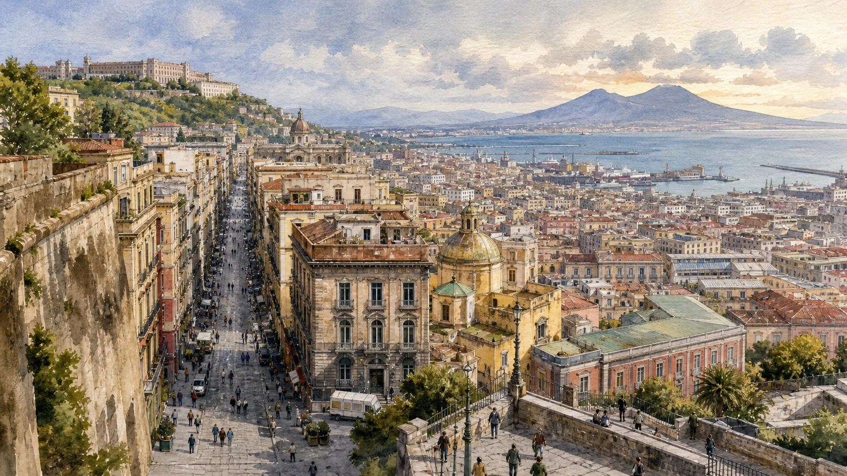
Original documentary watercolour panorama for Naples Via Toledo, Quartieri Spagnoli and the Spanish City: Complete Guide, with accurate Naples architecture and lived urban context

Naples Guide 06 · Viceregal avenue, military grid, markets, churches, metro art and inhabited slopes

Via Toledo
& the Spanish City

A street-and-neighbourhood guide from the old city wall to the Bourbon and modern centre, connecting Via Toledo, the Quartieri Spagnoli, Pignasecca, Montecalvario, cultural institutions and the steep routes toward San Martino.

Plan the route
Naples · Campania10 chapters · one full day

Why this Naples district must be read in layers

Via Toledo and the Quartieri Spagnoli were produced by Spanish viceregal government but have never remained one administrative or military landscape: commerce, worship, housing and repeated reinvention made them central to modern Naples.

Via Toledo was laid out in the sixteenth century along the western edge of the older city and became an address for palaces, banks, shops, theatres and public movement. Its apparent straightness contrasts with the steep, dense grid behind it.

The Quartieri originated in a planned zone associated with the housing of Spanish troops, but the present neighbourhood cannot be reduced to that origin. Courtyards, bassi, churches, workshops, street shrines and resident networks form a complex inhabited district under intense tourism pressure.

Metro art, restored palaces and visitor businesses add recent layers. Responsible reading keeps working markets and residential thresholds visible and refuses to turn laundry, poverty or private interiors into picturesque props.

Walk Via Toledo as an urban edge, enter the Quartieri on a small number of respectful cross-routes and finish by climbing or using public transport toward the hill that makes the district’s terrain legible.

The route

Plan your visit

Start at Dante and Pignasecca, follow Toledo south, cross the Quartieri through Montecalvario, then use a controlled underground or hillside route to understand infrastructure and elevation.

Early morning

Piazza Dante · Pignasecca market · Via Toledo

Move in the documented order: Piazza Dante: wall, forum and modern threshold; then Pignasecca market: food, household goods and neighbourhood supply; then Via Toledo: a viceregal line through the modern city. Check live access before entering ticketed or liturgical spaces.

Late morning

Toledo Metro station · Montecalvario · Quartieri Spagnoli

Move in the documented order: Toledo Metro station: public infrastructure as contemporary art; then Montecalvario: parish, square and neighbourhood centre; then Quartieri Spagnoli: grid, slope and domestic thresholds. Check live access before entering ticketed or liturgical spaces.

Afternoon

Street shrines · Galleria Borbonica · Palazzo Piacentini and Gallerie d’Italia

Move in the documented order: Street shrines: devotion, memory and neighbourhood maintenance; then Galleria Borbonica: royal escape project and wartime shelter; then Palazzo Piacentini and Gallerie d’Italia: bank, city and collections. Check live access before entering ticketed or liturgical spaces.

Late afternoon

Pedamentina and the hill routes

Move in the documented order: Pedamentina and the hill routes: stairs as urban infrastructure. Check live access before entering ticketed or liturgical spaces.

Ten chapters

Explore the places

The order follows terrain, institutions and present-day movement. Use the index to return to a chapter without reducing the district to isolated monuments.

  1. 01Piazza Dante: wall, forum and modern threshold
  2. 02Pignasecca market: food, household goods and neighbourhood supply
  3. 03Via Toledo: a viceregal line through the modern city
  4. 04Toledo Metro station: public infrastructure as contemporary art
  5. 05Montecalvario: parish, square and neighbourhood centre
  6. 06Quartieri Spagnoli: grid, slope and domestic thresholds
  7. 07Street shrines: devotion, memory and neighbourhood maintenance
  8. 08Galleria Borbonica: royal escape project and wartime shelter
  9. 09Palazzo Piacentini and Gallerie d’Italia: bank, city and collections
  10. 10Pedamentina and the hill routes: stairs as urban infrastructure
01

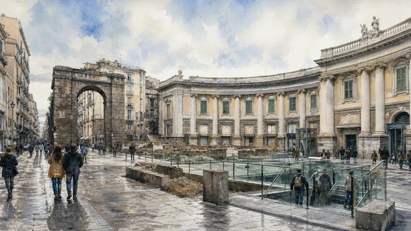
A large eighteenth-century hemicycle reframed the western edge of the ancient city and now distributes metro, school and pedestrian movement

Piazza Dante: wall, forum and modern threshold

The square links old centre, Via Toledo and later urban expansion.

Today

Traffic patterns and event barriers change. Use crossings, keep school entrances clear and observe the hemicycle from the central pedestrian area.

History

The site lay near the old city wall and Port’Alba. Luigi Vanvitelli redesigned the Foro Carolino with a curved façade and royal programme; later political change renamed and reused it.

How to read this place

Compare the curved institutional front with Port’Alba and the straight beginning of Toledo. Metro entrances add a new circulation layer.

What to notice

  • Vanvitelli hemicycle framing a broad public room
  • Port’Alba preserving the older city threshold
  • Metro access reorganising modern movement
Comune di Napoli · Piazza Dante
Original documentary watercolour of Piazza Dante: wall, forum and modern threshold in Naples, showing architecture, people and present-day urban context
Piazza Dante: wall, forum and modern thresholdOriginal Merlintravel documentary watercolour · 2026
02

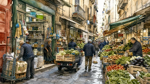
A compact market corridor remains a working service for nearby residents while absorbing heavy visitor attention

Pignasecca market: food, household goods and neighbourhood supply

Its value lies in everyday exchange, not staged folklore.

Today

Keep stall fronts and delivery paths open, ask before photographing vendors and avoid peak shopping congestion with groups.

History

The market developed near the western city edge and routes toward the hills. Its name and stories have several traditions, but documented commercial continuity matters more than picturesque etymology.

How to read this place

Notice product categories, storage and movement from shop to street. Compare permanent premises with temporary displays and transport needs.

What to notice

  • Stalls extending from permanent neighbourhood shops
  • Narrow route shared by deliveries and pedestrians
  • Food systems serving residents before tourism
Comune di Napoli · Markets
Original documentary watercolour of Pignasecca market: food, household goods and neighbourhood supply in Naples, showing architecture, people and present-day urban context
Pignasecca market: food, household goods and neighbourhood supplyOriginal Merlintravel documentary watercolour · 2026
03

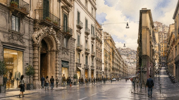
The avenue created a powerful north-south edge that later became Naples’s commercial and institutional spine

Via Toledo: a viceregal line through the modern city

Its façades record several regimes rather than one Spanish period.

Today

The street is heavily pedestrianised in sections but crossings and side traffic remain. Read upper façades as well as shopfronts and do not stop in metro flows.

History

Viceroy Pedro de Toledo promoted the road in the sixteenth century beside new fortifications and development. Palaces, theatres, banks and retail repeatedly transformed its edges.

How to read this place

Follow the line and mark changes in block depth toward the Quartieri. Building entrances reveal former palaces behind contemporary commerce.

What to notice

  • Long avenue defining the western historic edge
  • Palace portals surviving within retail frontage
  • Side streets climbing into a denser grid
UNESCO World Heritage Centre · Historic Centre of Naples
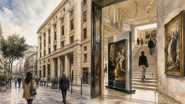
Original documentary watercolour of Via Toledo: a viceregal line through the modern city in Naples, showing architecture, people and present-day urban context
Via Toledo: a viceregal line through the modern cityOriginal Merlintravel documentary watercolour · 2026
04

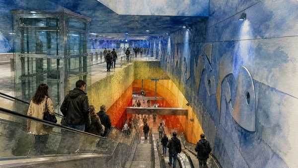
A deep transit station combines excavation, circulation, light and commissioned art within an active transport system

Toledo Metro station: public infrastructure as contemporary art

It should be experienced first as infrastructure, not as a free museum that can be obstructed.

Today

A valid transport ticket and current ANM service rules apply. Keep stairs, escalators and platforms clear; photography must never interfere with passengers.

History

The station opened as part of Naples’s modern metro expansion and Art Stations programme. Design responds to deep geology, archaeological work and the descent toward sea level.

How to read this place

Move with passenger flow and notice how colour and light change by depth. Technical systems, signs and lifts remain part of the design.

What to notice

  • Deep vertical descent through changing colour
  • Art integrated with wayfinding and circulation
  • Daily commuters retaining priority
ANM · Metro and Art Stations
Original documentary watercolour of Toledo Metro station: public infrastructure as contemporary art in Naples, showing architecture, people and present-day urban context
Toledo Metro station: public infrastructure as contemporary artOriginal Merlintravel documentary watercolour · 2026
05

A religious and civic node interrupts the military-era grid with worship, social services and daily gathering

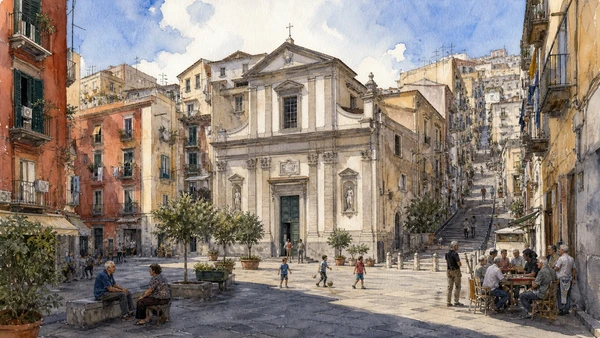
Montecalvario: parish, square and neighbourhood centre

The Quartieri are legible through such institutions, not only through narrow lanes.

Today

The church and community spaces have their own schedules. Keep the square and entrances open for residents and local activities.

History

The area developed within the Spanish-period expansion and took shape around church, confraternities and dense housing. Later social and cultural projects reused buildings without eliminating local needs.

How to read this place

Stand in the square and map routes toward Toledo and the hill. Notice how a wider room creates orientation inside the tight grid.

What to notice

  • Parish façade anchoring a dense residential grid
  • Small square providing light and orientation
  • Community use continuing beside visitor routes
Comune di Napoli · Municipalità 2
Original documentary watercolour of Montecalvario: parish, square and neighbourhood centre in Naples, showing architecture, people and present-day urban context
Montecalvario: parish, square and neighbourhood centreOriginal Merlintravel documentary watercolour · 2026
06

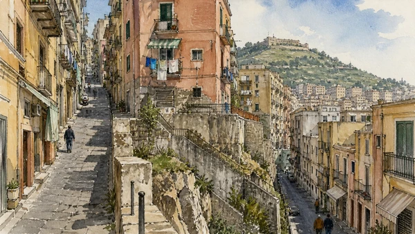
Regular blocks on steep terrain produced short cross streets, stairs and intense contact between homes and public space

Quartieri Spagnoli: grid, slope and domestic thresholds

Urban form explains much of the neighbourhood’s visual density.

Today

Do not photograph inside bassi or homes without consent, keep doorways clear and avoid tours that overwhelm narrow lanes. Scooters and deliveries remain normal traffic.

History

The sixteenth-century expansion was associated with military accommodation and later filled through dense residential, craft and commercial use. Infrastructure and social conditions changed unevenly over time.

How to read this place

Use one uphill and one cross-slope route. Compare block regularity with elevation, stair insertion and extensions into the street.

What to notice

  • Regular grid distorted by steep elevation
  • Domestic thresholds opening directly to public lanes
  • Stairs and retaining walls making terrain visible
UNESCO World Heritage Centre · Historic Centre of Naples
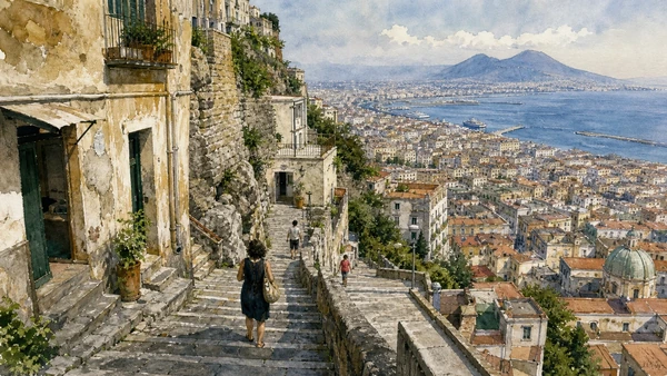
Original documentary watercolour of Quartieri Spagnoli: grid, slope and domestic thresholds in Naples, showing architecture, people and present-day urban context
Quartieri Spagnoli: grid, slope and domestic thresholdsOriginal Merlintravel documentary watercolour · 2026
07

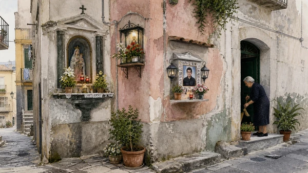
Small sacred installations turn walls and corners into cared-for community sites

Street shrines: devotion, memory and neighbourhood maintenance

They range from historic aedicules to recent memorials and cannot be treated as interchangeable decoration.

Today

Observe without touching offerings or blocking residents who maintain the shrine. Ask before close photography when people or private names are involved.

History

Catholic devotional practice placed images at thresholds and dangerous or meaningful points. Families and neighbourhood groups continue to repair, illuminate and reinterpret many shrines.

How to read this place

Look for date, dedication, materials and evidence of maintenance. Distinguish formal religious images from personal memorials.

What to notice

  • Lights and flowers signalling active care
  • Shrines located at corners and thresholds
  • Historic devotion joined to contemporary memory
Arcidiocesi di Napoli
Original documentary watercolour of Street shrines: devotion, memory and neighbourhood maintenance in Naples, showing architecture, people and present-day urban context
Street shrines: devotion, memory and neighbourhood maintenanceOriginal Merlintravel documentary watercolour · 2026
08

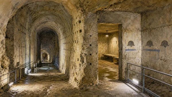
A nineteenth-century tunnel was later reused for water, storage and civilian protection

Galleria Borbonica: royal escape project and wartime shelter

Its discontinuous functions must be separated by date and evidence.

Today

Visits are guided, ticketed and physically constrained; routes differ in stairs, narrowness and equipment. Use the official operator and choose the appropriate itinerary.

History

Ferdinand II commissioned a tunnel toward the military and waterfront zone, but the project remained incomplete. Existing cavities later served multiple uses, including air-raid shelter during the Second World War.

How to read this place

Identify excavation technique, later partitions, shelter traces and modern access works. Avoid collapsing all underground Naples into one connected network.

What to notice

  • Bourbon-period tunnel cutting through tuff
  • Wartime shelter markings as a later layer
  • Modern safety infrastructure enabling access
Galleria Borbonica · Official route
Original documentary watercolour of Galleria Borbonica: royal escape project and wartime shelter in Naples, showing architecture, people and present-day urban context
Galleria Borbonica: royal escape project and wartime shelterOriginal Merlintravel documentary watercolour · 2026
09

A twentieth-century institutional building on Via Toledo now houses art spanning Naples and Italy

Palazzo Piacentini and Gallerie d’Italia: bank, city and collections

Its modern architecture belongs to the avenue’s changing centres of power.

Today

The museum is ticketed and exhibitions rotate. Check official opening, security and temporary gallery information.

History

The site was transformed for banking functions in the twentieth century and later adapted as a public gallery. Collections include works connected to Naples alongside broader modern holdings.

How to read this place

Read the urban façade and internal circulation before the galleries. Compare artworks made for churches or private settings with their current museum display.

What to notice

  • Modern institutional façade on historic Toledo
  • Banking architecture adapted for museum use
  • Rotating exhibitions changing the collection route
Gallerie d’Italia Napoli · Official museum
Original documentary watercolour of Palazzo Piacentini and Gallerie d'Italia: bank, city and collections in Naples, showing architecture, people and present-day urban context
Palazzo Piacentini and Gallerie d’Italia: bank, city and collectionsOriginal Merlintravel documentary watercolour · 2026
10

Long stairways connect the dense lower districts to San Martino and reveal Naples’s vertical geography

Pedamentina and the hill routes: stairs as urban infrastructure

The climb is a public route, not a hidden attraction isolated from residents.

Today

Steps can be uneven, exposed and quiet at some times. Check local conditions, avoid walking alone late, carry water and use the funicular as an accessible alternative.

History

Historic hillside routes linked monasteries, military sites, gardens and neighbourhoods before modern roads and rail systems. Their maintenance and safety remain civic issues.

How to read this place

Pause at landings to compare roofs, street grid and bay. Notice retaining walls, drainage and household entrances along the route.

What to notice

  • Extended stair sequence crossing steep tuff terrain
  • Landings opening views over the grid
  • Residential entrances sharing a through route
Comune di Napoli · Urban stairs
Original documentary watercolour of Pedamentina and the hill routes: stairs as urban infrastructure in Naples, showing architecture, people and present-day urban context
Pedamentina and the hill routes: stairs as urban infrastructureOriginal Merlintravel documentary watercolour · 2026

Naples through time

A short chronology

From Greek Neapolis and Roman infrastructure to dynastic capitals, wartime rupture, UNESCO care and a living metropolitan centre.

  1. Greek settlements and Neapolis establish the coastal and gridded urban foundations later absorbed by Roman Naples.

  2. Walls, streets, sanctuaries and civic spaces consolidate the ancient city on the tuff plateau.

  3. Roman Naples expands its theatres, baths, water systems, port functions and elite residences.

  4. Christian worship, burial and episcopal institutions reshape the ancient city and its edges.

  5. The Duchy of Naples maintains a distinct Mediterranean political and cultural identity.

  6. Norman and Swabian rule integrate Naples into larger southern kingdoms while reusing existing institutions.

  7. Angevin rule makes Naples a royal capital and begins major castle, church and urban commissions.

  8. Aragonese rule adds court culture, fortification and monumental Renaissance patronage.

  9. Spanish viceregal government extends Via Toledo, military quarters, religious houses and administrative power.

  10. Bourbon rule restores Naples as a dynastic capital and expands royal, cultural and infrastructural projects.

  11. The brief Parthenopean Republic and its repression expose deep political and social conflict.

  12. French-period government reforms streets, institutions and public administration.

  13. Naples enters the unified Kingdom of Italy and its capital functions are reorganised.

  14. Bombing, occupation, the Four Days and post-war rebuilding transform the city and port.

  15. UNESCO inscription, restoration, tourism pressure and resident-led cultural work renew debate over a living historic centre.

Before your visit

Practical information

01

Reserve constrained interiors

Timed museums, underground routes and major chapels can sell out; use only their current official booking channels.

02

Respect worship

Church access can pause for liturgy, funerals or community events; a visitor ticket never overrides religious use.

03

Walk the terrain

Tuff ridges, steep stairs, uneven paving and dense traffic are part of the city; keep a shorter accessible alternative.

04

Do not turn residents into scenery

Keep doorways, workshops, market lanes and courtyards clear; photograph people only with consent.

05

Check live transport

Metro, funicular, port and bus service can change; verify the same-day operator notice before relying on a connection.

06

Read layers, not clichés

Religious devotion, poverty, theatricality and danger are not interchangeable labels for Naples; use documented sites and institutions.

Method and sources

Sources and image credits

This guide uses official museum, ministry, church, transport and UNESCO documentation checked on 29 August 2026. It separates durable historical interpretation from access details that can change; distinguishes surviving fabric from reconstruction, restoration and legend; and treats worship, work, residence and public movement as part of the evidence rather than visual interference. Every chapter links its principal institutional source, while current tickets, closures and transport must always be verified again on the day of the visit.

All ten images are original Merlintravel editorial watercolours based on documented present-day conditions. They are illustrations, not substitutes for archaeological plans. Opening hours, tickets, accessible routes, temporary exhibitions and conservation work can change; consult the linked official pages shortly before visiting.