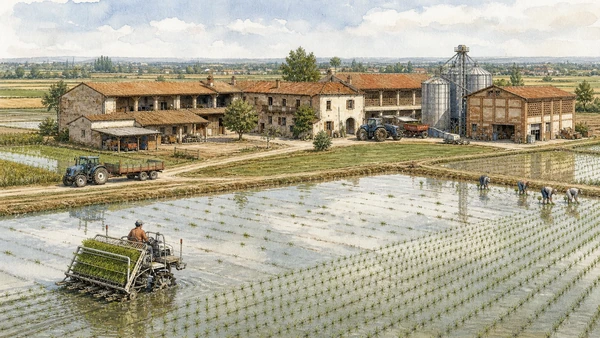
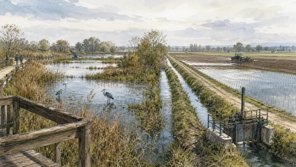
Original documentary watercolour panorama for Novara, Vercelli and the Rice Plain: Complete Guide, with accurate Piedmont architecture, landscape and lived context

Piedmont Guide 05 · Cathedral cities, Romanesque abbeys, irrigation, cascine, rice labour, wetlands and rail corridors

Novara, Vercelli
& the Rice Plain

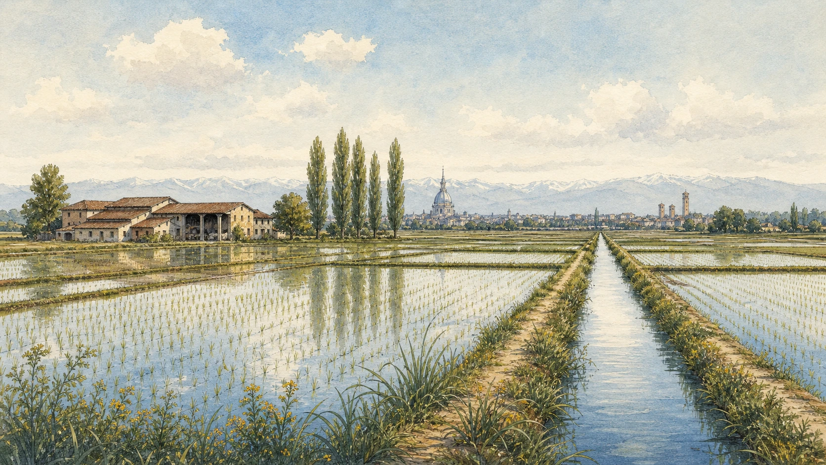
A multi-day guide connecting Novara’s cathedral complex and Antonelli skyline to Vercelli’s Romanesque, Gothic and civic institutions, then reading canals, farmsteads, rice fields and protected wetlands as engineered working landscape.

Plan the route
Novara, Vercelli and the rice plain · Piedmont10 chapters · one complete route

Why this route must be read in layers

Eastern Piedmont is not an empty plain between Turin and Milan. Cities, abbeys, railways, irrigation consortia, agricultural labour and seasonal water create a precise territory whose apparent horizontality is heavily constructed.

Novara’s cathedral-baptistery group and San Gaudenzio dome combine early Christian, medieval and nineteenth-century layers. Antonelli’s skyline belongs to an industrialising city, not to an unchanged historic centre.

Vercelli’s Sant’Andrea and cathedral institutions connect pilgrimage, law, manuscript culture and civic power. Museums are essential for evidence dispersed by rebuilding.

Rice cultivation depends on canals, levelling, seed, machinery and labour. Field edges and cascine are workplaces; flooding schedules, pesticides, birds and water competition complicate the photogenic mirror landscape.

Give Novara and Vercelli separate city days, then enter the agricultural plain only on public roads, marked routes or authorised visits without obstructing machinery or irrigation.

The route

Plan your visit

Begin in Novara, continue by rail to Vercelli, then follow a verified rural circuit through canals, farm settlements and protected wetlands rather than improvising across private tracks.

Early morning

Novara Cathedral · Novara Baptistery · San Gaudenzio and Antonelli’s dome

Move in the documented order: Novara Cathedral: neoclassical rebuilding over an older sacred centre; then Novara Baptistery: early Christian geometry beside later architecture; then San Gaudenzio and Antonelli’s dome: parish, engineering and skyline. Recheck live access and transport before entering a controlled site.

Late morning

Novara Broletto · Sant’Andrea at Vercelli · Vercelli Cathedral and the cathedral treasury

Move in the documented order: Novara Broletto: civic buildings around a shared court; then Sant’Andrea at Vercelli: Gothic experiment on a pilgrimage route; then Vercelli Cathedral and the cathedral treasury. Recheck live access and transport before entering a controlled site.

Afternoon

Vercelli’s civic centre · Cavour Canal · Rice fields and cascine

Move in the documented order: Vercelli’s civic centre: towers, piazzas and market routes; then Cavour Canal: infrastructure that reorganised the plain; then Rice fields and cascine: production, residence and labour. Recheck live access and transport before entering a controlled site.

Late afternoon

Wetlands, herons and agricultural water

Move in the documented order: Wetlands, herons and agricultural water: ecology inside production. Recheck live access and transport before entering a controlled site.

Ten chapters

Explore the places

The order follows terrain, institutions and present-day movement. Use the index to return to a chapter without reducing the route to isolated monuments.

  1. 01Novara Cathedral: neoclassical rebuilding over an older sacred centre
  2. 02Novara Baptistery: early Christian geometry beside later architecture
  3. 03San Gaudenzio and Antonelli’s dome: parish, engineering and skyline
  4. 04Novara Broletto: civic buildings around a shared court
  5. 05Sant’Andrea at Vercelli: Gothic experiment on a pilgrimage route
  6. 06Vercelli Cathedral and the cathedral treasury
  7. 07Vercelli’s civic centre: towers, piazzas and market routes
  8. 08Cavour Canal: infrastructure that reorganised the plain
  9. 09Rice fields and cascine: production, residence and labour
  10. 10Wetlands, herons and agricultural water: ecology inside production
01

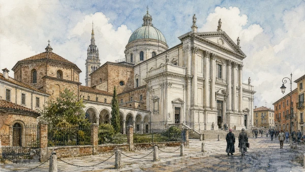
A monumental nineteenth-century church occupies the site of earlier cathedrals while preserving links to cloister, baptistery and episcopal institutions.

Novara Cathedral: neoclassical rebuilding over an older sacred centre

A monumental nineteenth-century church occupies the site of earlier cathedrals while preserving links to cloister, baptistery and episcopal institutions. The site becomes clearer when its surviving fabric, later alterations and present use are read together.

Today

This is an active religious place as well as a historic building. Services, ceremonies and conservation can interrupt tourist access; dress appropriately, remain quiet and never treat a booked visit as priority over worship.

History

Alessandro Antonelli designed the present cathedral during a long nineteenth-century campaign that replaced much medieval fabric but retained selected chapels and adjoining structures.

How to read this place

Begin with new nave scale versus older fragments. Then compare cathedral relationship to the cloister with active diocesan circulation; the differences are evidence, not visual noise.

What to notice

  • new nave scale versus older fragments
  • cathedral relationship to the cloister
  • active diocesan circulation
ATL Terre dell’Alto Piemonte · Novara
Original documentary watercolour of Novara Cathedral: neoclassical rebuilding over an older sacred centre in Novara, Vercelli and the rice plain · Piedmont, showing accurate architecture, landscape, people and present-day use
Novara Cathedral: neoclassical rebuilding over an older sacred centreOriginal Merlintravel documentary watercolour · 2026
02

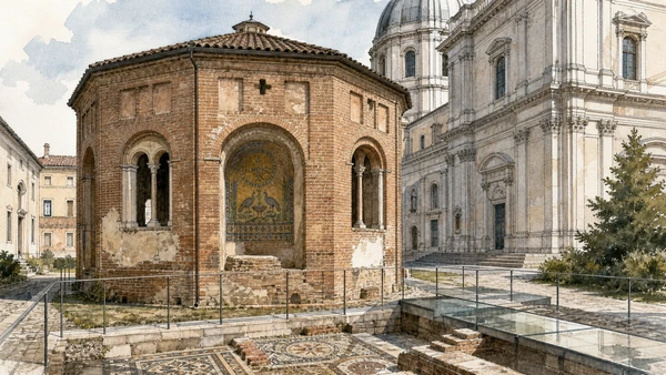
An octagonal late-antique building preserves mosaic and structural phases within the cathedral complex.

Novara Baptistery: early Christian geometry beside later architecture

An octagonal late-antique building preserves mosaic and structural phases within the cathedral complex. The site becomes clearer when its surviving fabric, later alterations and present use are read together.

Today

This is an active religious place as well as a historic building. Services, ceremonies and conservation can interrupt tourist access; dress appropriately, remain quiet and never treat a booked visit as priority over worship.

History

The baptistery originated in late antiquity and changed through medieval and modern restoration, surviving major rebuilding that transformed the surrounding sacred precinct.

How to read this place

Begin with octagonal plan and alternating niches. Then compare mosaic fragments and floor levels with physical contrast with antonelli’s cathedral; the differences are evidence, not visual noise.

What to notice

  • octagonal plan and alternating niches
  • mosaic fragments and floor levels
  • physical contrast with Antonelli’s cathedral
ATL Terre dell’Alto Piemonte · Novara
Original documentary watercolour of Novara Baptistery: early Christian geometry beside later architecture in Novara, Vercelli and the rice plain · Piedmont, showing accurate architecture, landscape, people and present-day use
Novara Baptistery: early Christian geometry beside later architectureOriginal Merlintravel documentary watercolour · 2026
03

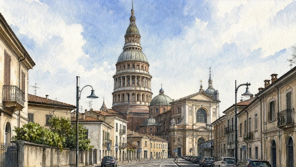
A tall nineteenth-century masonry dome rises above a much older basilica and remains both structural achievement and active religious landmark.

San Gaudenzio and Antonelli’s dome: parish, engineering and skyline

A tall nineteenth-century masonry dome rises above a much older basilica and remains both structural achievement and active religious landmark. The site becomes clearer when its surviving fabric, later alterations and present use are read together.

Today

This is an active religious place as well as a historic building. Services, ceremonies and conservation can interrupt tourist access; dress appropriately, remain quiet and never treat a booked visit as priority over worship.

History

The basilica developed from the sixteenth century; Antonelli designed the dome, completed in the nineteenth century through complex construction above the existing church.

How to read this place

Begin with dome structure and staged ascent. Then compare older basilica beneath the tower with weather and access controls treated as live; the differences are evidence, not visual noise.

What to notice

  • dome structure and staged ascent
  • older basilica beneath the tower
  • weather and access controls treated as live
ATL Terre dell’Alto Piemonte · Novara
Original documentary watercolour of San Gaudenzio and Antonelli's dome: parish, engineering and skyline in Novara, Vercelli and the rice plain · Piedmont, showing accurate architecture, landscape, people and present-day use
San Gaudenzio and Antonelli’s dome: parish, engineering and skylineOriginal Merlintravel documentary watercolour · 2026
04

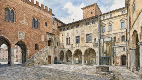
Medieval and later palaces enclose a courtyard that makes changing communal government visible through mismatched façades.

Novara Broletto: civic buildings around a shared court

Medieval and later palaces enclose a courtyard that makes changing communal government visible through mismatched façades. The site becomes clearer when its surviving fabric, later alterations and present use are read together.

Today

Opening, ticketing, room access and temporary displays can change. Check the institution’s official notice shortly before visiting, use the designated entrance and allow for security or conservation controls.

History

The civic complex accumulated buildings for consuls, podestà and public functions from the medieval period onward before restoration and museum use.

How to read this place

Begin with different palace fronts and dates. Then compare arcades controlling access to the court with museum insertions within civic fabric; the differences are evidence, not visual noise.

What to notice

  • different palace fronts and dates
  • arcades controlling access to the court
  • museum insertions within civic fabric
ATL Terre dell’Alto Piemonte · Novara
Original documentary watercolour of Novara Broletto: civic buildings around a shared court in Novara, Vercelli and the rice plain · Piedmont, showing accurate architecture, landscape, people and present-day use
Novara Broletto: civic buildings around a shared courtOriginal Merlintravel documentary watercolour · 2026
05

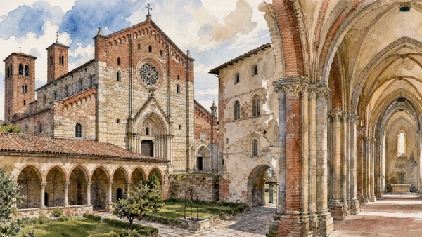
Brick, stone, towers and a rib-vaulted interior join northern Gothic forms to local building traditions.

Sant’Andrea at Vercelli: Gothic experiment on a pilgrimage route

Brick, stone, towers and a rib-vaulted interior join northern Gothic forms to local building traditions. The site becomes clearer when its surviving fabric, later alterations and present use are read together.

Today

This is an active religious place as well as a historic building. Services, ceremonies and conservation can interrupt tourist access; dress appropriately, remain quiet and never treat a booked visit as priority over worship.

History

Cardinal Guala Bicchieri founded the abbey in the early thirteenth century, drawing on international religious and architectural networks connected to Vercelli and the Via Francigena.

How to read this place

Begin with façade materials and portals. Then compare vaults and clustered supports with cloister and monastic spaces; the differences are evidence, not visual noise.

What to notice

  • façade materials and portals
  • vaults and clustered supports
  • cloister and monastic spaces
ATL Terre dell’Alto Piemonte · Vercelli and Valsesia
Original documentary watercolour of Sant'Andrea at Vercelli: Gothic experiment on a pilgrimage route in Novara, Vercelli and the rice plain · Piedmont, showing accurate architecture, landscape, people and present-day use
Sant’Andrea at Vercelli: Gothic experiment on a pilgrimage routeOriginal Merlintravel documentary watercolour · 2026
06

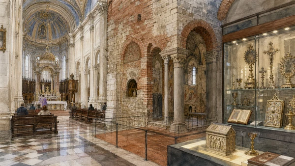
A heavily transformed church and controlled collection preserve early Christian, medieval and later episcopal histories.

Vercelli Cathedral and the cathedral treasury

A heavily transformed church and controlled collection preserve early Christian, medieval and later episcopal histories. The site becomes clearer when its surviving fabric, later alterations and present use are read together.

Today

This is an active religious place as well as a historic building. Services, ceremonies and conservation can interrupt tourist access; dress appropriately, remain quiet and never treat a booked visit as priority over worship.

History

The cathedral site has ancient origins but the visible building reflects repeated rebuilding; manuscripts and liturgical objects survived through the connected capitular institution.

How to read this place

Begin with later nave versus older chapels. Then compare object provenance in the treasury with worship separated from collection access; the differences are evidence, not visual noise.

What to notice

  • later nave versus older chapels
  • object provenance in the treasury
  • worship separated from collection access
ATL Terre dell’Alto Piemonte · Vercelli and Valsesia
Original documentary watercolour of Vercelli Cathedral and the cathedral treasury in Novara, Vercelli and the rice plain · Piedmont, showing accurate architecture, landscape, people and present-day use
Vercelli Cathedral and the cathedral treasuryOriginal Merlintravel documentary watercolour · 2026
07

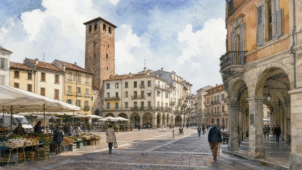
Piazza Cavour, Torre dell’Angelo and surrounding streets retain a communal scale shaped by later façades and commerce.

Vercelli’s civic centre: towers, piazzas and market routes

Piazza Cavour, Torre dell’Angelo and surrounding streets retain a communal scale shaped by later façades and commerce. The site becomes clearer when its surviving fabric, later alterations and present use are read together.

Today

The area is inhabited and worked, not staged for visitors. Keep doorways, pavements, cycle lanes and deliveries clear, ask before photographing people and use current municipal mobility information.

History

Medieval Vercelli was a major commune and ecclesiastical centre before Visconti and Savoy rule; property change absorbed much fortified family architecture.

How to read this place

Begin with square geometry and arcades. Then compare tower fabric embedded in later blocks with market use and resident routes; the differences are evidence, not visual noise.

What to notice

  • square geometry and arcades
  • tower fabric embedded in later blocks
  • market use and resident routes
ATL Terre dell’Alto Piemonte · Vercelli and Valsesia
Original documentary watercolour of Vercelli's civic centre: towers, piazzas and market routes in Novara, Vercelli and the rice plain · Piedmont, showing accurate architecture, landscape, people and present-day use
Vercelli’s civic centre: towers, piazzas and market routesOriginal Merlintravel documentary watercolour · 2026
08

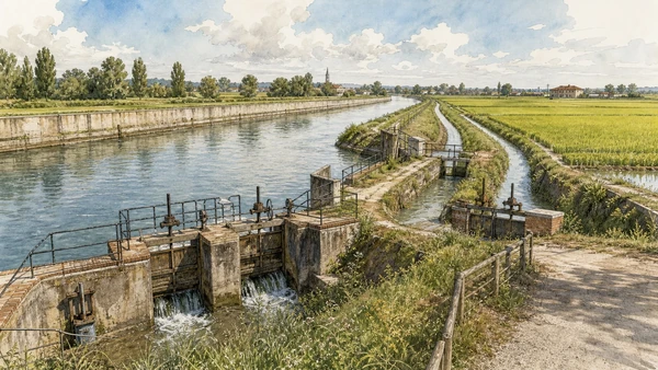
A large nineteenth-century canal distributes river water through a network of channels, gates and secondary ditches essential to agriculture.

Cavour Canal: infrastructure that reorganised the plain

A large nineteenth-century canal distributes river water through a network of channels, gates and secondary ditches essential to agriculture. The site becomes clearer when its surviving fabric, later alterations and present use are read together.

Today

Weather, water levels, trail conditions and seasonal services can alter the route. Use official transport and park information, remain on authorised paths and do not enter farms, vineyards or private gardens without permission.

History

Completed after Italian unification and named for Cavour, the canal joined earlier irrigation systems and helped intensify rice cultivation across Vercelli and Novara territories.

How to read this place

Begin with canal section and engineered banks. Then compare control gates and branch channels with safe public viewpoints outside operating works; the differences are evidence, not visual noise.

What to notice

  • canal section and engineered banks
  • control gates and branch channels
  • safe public viewpoints outside operating works
Ente Nazionale Risi · Official site
Original documentary watercolour of Cavour Canal: infrastructure that reorganised the plain in Novara, Vercelli and the rice plain · Piedmont, showing accurate architecture, landscape, people and present-day use
Cavour Canal: infrastructure that reorganised the plainOriginal Merlintravel documentary watercolour · 2026
09

Levelled fields, farm compounds, dryers and machinery create a seasonal landscape of flooding, growth and harvest.

Rice fields and cascine: production, residence and labour

Levelled fields, farm compounds, dryers and machinery create a seasonal landscape of flooding, growth and harvest. The site becomes clearer when its surviving fabric, later alterations and present use are read together.

Today

Weather, water levels, trail conditions and seasonal services can alter the route. Use official transport and park information, remain on authorised paths and do not enter farms, vineyards or private gardens without permission.

History

Rice expanded over centuries through irrigation and estate organisation, relying on arduous manual labour including women seasonal workers before mechanisation transformed tasks and settlement.

How to read this place

Begin with field levelling and water depth. Then compare cascina hierarchy and work spaces with machinery and road access kept unobstructed; the differences are evidence, not visual noise.

What to notice

  • field levelling and water depth
  • cascina hierarchy and work spaces
  • machinery and road access kept unobstructed
Ente Nazionale Risi · Official site
Original documentary watercolour of Rice fields and cascine: production, residence and labour in Novara, Vercelli and the rice plain · Piedmont, showing accurate architecture, landscape, people and present-day use
Rice fields and cascine: production, residence and labourOriginal Merlintravel documentary watercolour · 2026
10

Flooded fields and protected river areas support birds and aquatic life while remaining dependent on managed water, chemicals and crop schedules.

Wetlands, herons and agricultural water: ecology inside production

Flooded fields and protected river areas support birds and aquatic life while remaining dependent on managed water, chemicals and crop schedules. The site becomes clearer when its surviving fabric, later alterations and present use are read together.

Today

Weather, water levels, trail conditions and seasonal services can alter the route. Use official transport and park information, remain on authorised paths and do not enter farms, vineyards or private gardens without permission.

History

Ticino and Sesia environments were altered by extraction, canals and agriculture; protected areas and changing practices now negotiate habitat with intensive production.

How to read this place

Begin with natural wetland versus cultivated field. Then compare birds observed from authorised paths with channels connecting farms to river systems; the differences are evidence, not visual noise.

What to notice

  • natural wetland versus cultivated field
  • birds observed from authorised paths
  • channels connecting farms to river systems
Parco del Ticino piemontese · Official site
Original documentary watercolour of Wetlands, herons and agricultural water: ecology inside production in Novara, Vercelli and the rice plain · Piedmont, showing accurate architecture, landscape, people and present-day use
Wetlands, herons and agricultural water: ecology inside productionOriginal Merlintravel documentary watercolour · 2026

Piedmont through time

A short chronology

From pre-Roman routes and Roman towns to communes, marquisates, Savoy government, industrialisation, heritage protection and climate-sensitive access.

  1. Alpine, lake, hill and plain communities leave settlements, tools, rock art and long-lived route systems.

  2. Ligurians, Celts, Salassi and other communities organise territories later drawn into Roman expansion.

  3. Roman colonies, municipia and roads connect the Po plain to Alpine passes and Ligurian approaches.

  4. Cities, farms, river transport and mountain routes integrate the region into imperial networks.

  5. Christian institutions, Lombard and Frankish powers, monasteries and fortified sites reshape late-Roman territories.

  6. Communes, bishoprics and marquisates develop distinct cities, markets, castles and religious landscapes.

  7. Savoy, Monferrato, Saluzzo, Milanese and local powers contest routes while towns expand civic institutions.

  8. The transfer of the Savoy capital to Turin accelerates centralisation, court construction and territorial administration.

  9. Baroque residences, sanctuaries, planned roads and fortified frontiers reorganise cities and countryside.

  10. French and Napoleonic rule suppresses institutions, reforms government and changes military and transport systems.

  11. Constitutional politics and wars led from Piedmont-Sardinia contribute decisively to Italian unification.

  12. Railways, canals, factories, wine markets and Alpine tourism connect previously separated economies.

  13. World wars, Fascism, resistance and civilian loss leave difficult evidence across towns, hills and valleys.

  14. Industrial expansion, migration, mechanised agriculture and mass tourism transform cities and working landscapes.

  15. Deindustrialisation, heritage recognition, rural reinvestment and climate pressure repeatedly alter access and identity.

Before your visit

Practical information

01

Check the live page

Opening hours, reservation systems, restoration, exhibitions and transport can change. Recheck the linked official institution shortly before departure.

02

Separate worship and tourism

Churches and sanctuaries remain religious spaces. Services, funerals and community use take priority over visitor itineraries.

03

Plan real distances

Novara, Vercelli and the rice plain · Piedmont combines dense urban routes with lakes, valleys and dispersed towns. Do not compress distant chapters into an unsafe or superficial day.

04

Keep thresholds open

Arcades, station halls, markets, courtyards, workshops and residential streets must continue to function while you observe or photograph them.

05

Use current mobility data

Check the responsible rail, navigation, bus, road or park operator on the day; replacement services and weather can change an otherwise sound route.

06

Read change honestly

Restoration, reconstruction, adaptive reuse and new development have all shaped the landscape visible today.

Method and sources

Sources and image credits

This guide uses official museum, ministry, municipal, transport, park and UNESCO documentation checked on 29 August 2026. It separates durable historical interpretation from access details that can change, distinguishes surviving fabric from restoration or reconstruction, and treats worship, work, residence and public movement as part of the evidence. Every chapter links its principal institutional source; tickets, closures, weather and transport must always be verified again on the day of the visit.

All ten images are original Merlintravel editorial watercolours based on documented present-day conditions. They are illustrations, not substitutes for archaeological plans. Opening hours, tickets, accessible routes, temporary exhibitions and conservation work can change; consult the linked official pages shortly before visiting.