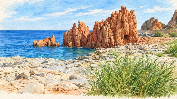
Watercolour: Gulf of Orosei and Ogliastra establishing view

Sardinia · Guide 07

Gulf of Orosei

Limestone coasts, inhabited towns and ancient settlements connect the Gulf of Orosei with the landscapes of Ogliastra.

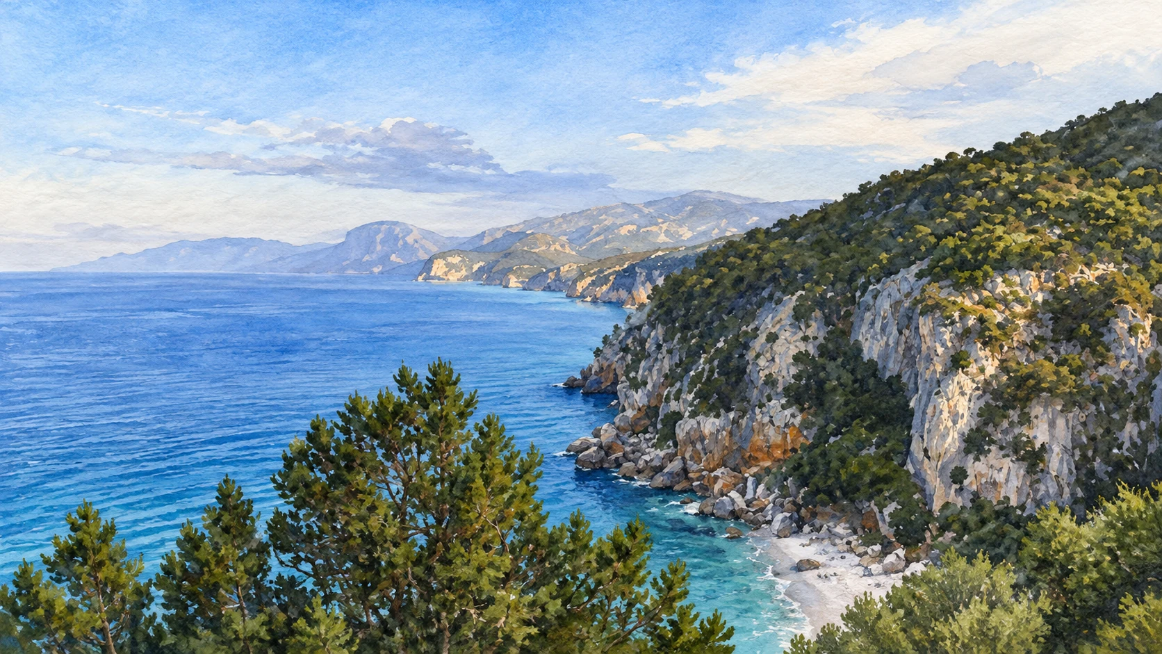
Plan the route
Gulf of Orosei and Ogliastra10 chapters · history, culture and landscape

Why this place matters

Plan around terrain, weather and the time each place needs.

The eastern coast changes character between the lowlands of Orosei, the harbour of Cala Gonone and the cliffs beneath the Baunei plateau. Inland, caves and a Nuragic settlement reveal processes and communities that cannot be understood from a beach alone. This guide connects those settings with rural churches and the working coast at Arbatax. It is a collection of separate outings: a boat excursion, a managed cave visit and a mountain walk require different arrangements.

The guide separates documented history from suggestions for reading the site. Named buildings and landscape relationships follow institutional sources; the illustrations are editorial interpretations, not measured surveys or records of current access.

Limestone coasts, inhabited towns and ancient settlements connect the Gulf of Orosei with the landscapes of Ogliastra.
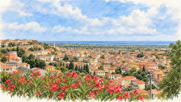
The route

Plan your visit

From Orosei or Dorgali, group the town, Cala Gonone, Ispinigoli and Serra Orrios across several visits. Give Bue Marino its own weather-dependent sea excursion and Gorropu a properly planned walking day. From Baunei or Santa Maria Navarrese, separate the Golgo church visit from the demanding Goloritzè hike. Arbatax is a further coastal stop.

Northern coast

Orosei and Cala Gonone

From Orosei or Dorgali, group the town, Cala Gonone, Ispinigoli and Serra Orrios across several visits.

Underground and ancient

Bue Marino, Ispinigoli and Serra Orrios

Mountain outings

Gorropu and Golgo

Ogliastra coast

Goloritzè, Santa Maria Navarrese and Arbatax

Ten chapters

Explore the places

The chapters connect history and terrain. Use the route notes to choose visits and plan transfers between separate sites.

  1. 01Orosei: a town behind the coast
  2. 02Cala Gonone and Spiaggia Centrale
  3. 03Bue Marino: a sea entrance to the karst
  4. 04Ispinigoli: descending into a limestone chamber
  5. 05Serra Orrios: houses and communal spaces
  6. 06Gorropu: a gorge shaped by water
  7. 07San Pietro on the Golgo plateau
  8. 08Cala Goloritzè: a coast reached on foot
  9. 09The church of Santa Maria Navarrese
  10. 10Arbatax and the Rocce Rosse
01

The inhabited landscape

Orosei: a town behind the coast

Tiled roofs, church towers and cultivated lowlands fill the view from above the town. The historic centre sits inland from the beaches associated with its name.

Today

This remains an inhabited place. Use pedestrian routes, keep entrances clear and check municipal mobility notices for any restricted area.

History

Orosei developed as an important centre of the Baronia, with religious buildings and substantial houses recording successive periods of prosperity. San Giacomo presents a richly articulated Baroque presence, while Sant’Antonio preserves older architectural and painted layers. The historic prison and local collections add different perspectives on the town.

How to read this place

Begin with the streets and public spaces rather than driving directly to the coast. Compare the scale of houses, churches and courtyards. The panorama shows the relationship between the town and its surrounding plain; it does not place every beach within walking distance of the centre.

What to notice

  • Begin with the streets and public spaces rather than driving directly to the coast.
  • Compare the scale of houses, churches and courtyards.
  • The panorama shows the relationship between the town and its surrounding plain; it does not place every beach within walking distance of the centre.
Orosei | SardegnaTurismo – Sito ufficiale del turismo della Regione Sardegna
Watercolour: Orosei, elevated panorama over tiled roofs and church towers toward the coastal plain
Orosei: a town behind the coastEditorial watercolour · AI-generated · 2026
02

The inhabited landscape

Cala Gonone and Spiaggia Centrale

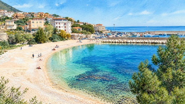
The central beach curves beside houses and the harbour. Its urban setting distinguishes it from the more isolated coves reached on excursions along the gulf.

Today

This remains an inhabited place. Use pedestrian routes, keep entrances clear and check municipal mobility notices for any restricted area.

History

The waterfront expresses the growth of a coastal community in which boating, tourism and everyday services share limited space between sea and hillside. Nearby beaches have different landforms: Palmasera is broad, while smaller coves occupy breaks in the rocky shore. They should not be treated as interchangeable stops.

How to read this place

Use the central waterfront to orient yourself and confirm the actual departure point for any booked boat. A beach visit and a gulf excursion are separate plans. The illustration follows Spiaggia Centrale with the harbour beyond; check sea conditions and local notices before entering the water.

What to notice

  • Use the central waterfront to orient yourself and confirm the actual departure point for any booked boat.
  • A beach visit and a gulf excursion are separate plans.
  • The illustration follows Spiaggia Centrale with the harbour beyond; check sea conditions and local notices before entering the water.
Spiagge a Dorgali e Cala Gonone
Watercolour: Cala Gonone, Spiaggia Centrale curving toward the small harbour
Cala Gonone and Spiaggia CentraleEditorial watercolour · AI-generated · 2026
03

Terrain and access

Bue Marino: a sea entrance to the karst

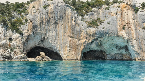
Dark openings at the foot of a limestone cliff lead into a much larger underground system. The sea approach makes the connection between cave and coast immediately visible.

Today

Conditions depend on the exact route and the day. Check the responsible operator, weather and local access notices; use the designated routes and confirm the return journey.

History

Tourist visits began in the 1950s, while exploration has continued to reveal an extensive karst network. The cave’s name recalls the Mediterranean monk seal, historically associated with these shores; it is not a promise of a wildlife sighting. Ordinary guided visits use part of the southern branch.

How to read this place

The current operator describes access to the normal visitor route by sea, with an approximately one-hour guided visit. Arrange transport and cave admission explicitly. Northern-branch speleology and cave diving are specialist activities, not extensions of the ordinary ticket. Sea conditions can prevent the approach.

What to notice

  • The current operator describes access to the normal visitor route by sea, with an approximately one-hour guided visit.
  • Arrange transport and cave admission explicitly.
  • Northern-branch speleology and cave diving are specialist activities, not extensions of the ordinary ticket.
LA GROTTA DEL BUE MARINO
Watercolour: Bue Marino, paired dark sea entrances below the limestone cliff
Bue Marino: a sea entrance to the karstEditorial watercolour · AI-generated · 2026
04

Terrain and access

Ispinigoli: descending into a limestone chamber

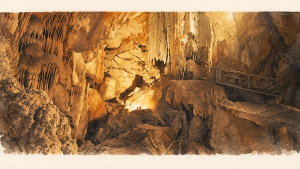
Warm lighting reveals mineral curtains and a great vertical formation inside the cave. The visitor path offers selected views of a complex underground environment.

Today

Conditions depend on the exact route and the day. Check the responsible operator, weather and local access notices; use the designated routes and confirm the return journey.

History

Opened to visitors in 1974, Ispinigoli is known for a roughly 38-metre calcite column. Such formations develop through mineral deposition associated with water moving through limestone. The wider cave system includes spaces used for specialist exploration, distinct from the managed public route.

How to read this place

Expect a substantial stair descent and climb back, and check suitability before booking if steps are difficult. Stay on the guided route and avoid touching formations. The illustration records a documented illuminated interior; it does not turn the cave into an unrestricted walking area.

What to notice

  • Expect a substantial stair descent and climb back, and check suitability before booking if steps are difficult.
  • Stay on the guided route and avoid touching formations.
  • The illustration records a documented illuminated interior; it does not turn the cave into an unrestricted walking area.
Ispinigoli | SardegnaTurismo – Sito ufficiale del turismo della Regione Sardegna
Watercolour: Ispinigoli, illuminated mineral formations and the managed visitor railing
Ispinigoli: descending into a limestone chamberEditorial watercolour · AI-generated · 2026
05

Evidence and interpretation

Serra Orrios: houses and communal spaces

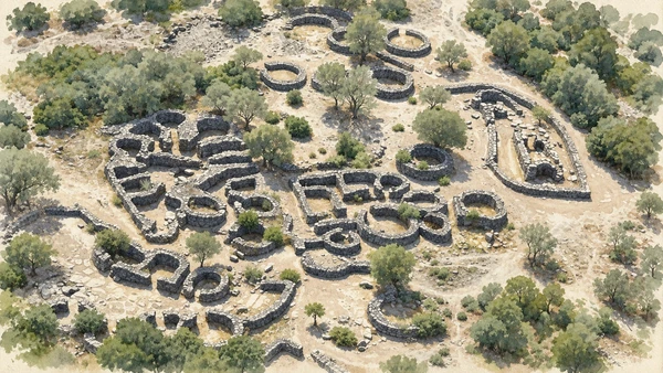
Low circular walls cluster around open areas in a scrub-covered landscape. Seen from above, the relationships between rooms and courts become clearer than any single surviving wall.

Today

Check the institution’s current opening, booking arrangements and accessible route. Individual rooms, exhibitions and approaches may have separate conditions.

History

This Nuragic settlement developed through the Bronze Age and into the early first millennium BC. Circular dwellings coexist with two rectangular temple buildings, wells and communal spaces. Finds connected with domestic life and production help archaeologists interpret the settlement; the architecture alone does not reveal every activity or belief.

How to read this place

Look for entrances, shared courts and changes in wall form. Distinguish circular houses from rectangular buildings identified as temples. The illustration shows roofless excavated remains, not a reconstruction of a complete village; use on-site interpretation to understand phases and proposed functions.

What to notice

  • Look for entrances, shared courts and changes in wall form.
  • Distinguish circular houses from rectangular buildings identified as temples.
  • The illustration shows roofless excavated remains, not a reconstruction of a complete village; use on-site interpretation to understand phases and proposed functions.
Serra Orrios | SardegnaTurismo – Sito ufficiale del turismo della Regione Sardegna
Watercolour: Serra Orrios, elevated view of excavated circular basalt houses and courts
Serra Orrios: houses and communal spacesEditorial watercolour · AI-generated · 2026
06

Terrain and access

Gorropu: a gorge shaped by water

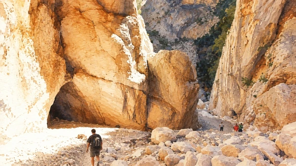
High limestone walls narrow around a floor of pale boulders. Small figures in the documented view convey scale without making the terrain look easy.

Today

Check the concessionaire’s current access notices, route advice and weather restrictions before travelling. Ordinary entrance and separately booked transfers or excursions are different services.

History

The Flumineddu and long-term processes of erosion shaped the gorge within the Supramonte limestone. Water, rockfall and vegetation continue to affect the landscape. Modern visitor management regulates access to a place whose geological form does not correspond to a simple, level promenade.

How to read this place

Choose an approach suited to your experience and allow for the return journey. Follow weather closures and staff limits inside the gorge. The current concessionaire sells ordinary entrance tickets on site; transfers and guided excursions have separate booking arrangements. Consult the operator for the route and payment details before departure.

What to notice

  • Choose an approach suited to your experience and allow for the return journey.
  • Follow weather closures and staff limits inside the gorge.
  • The current concessionaire sells ordinary entrance tickets on site; transfers and guided excursions have separate booking arrangements.
Gola Gorropu | SardegnaTurismo – Sito ufficiale del turismo della Regione Sardegna
Watercolour: Gorropu, towering limestone walls and boulder-strewn passage with hikers for scale
Gorropu: a gorge shaped by waterEditorial watercolour · AI-generated · 2026
07

Worship and memory

San Pietro on the Golgo plateau

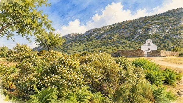
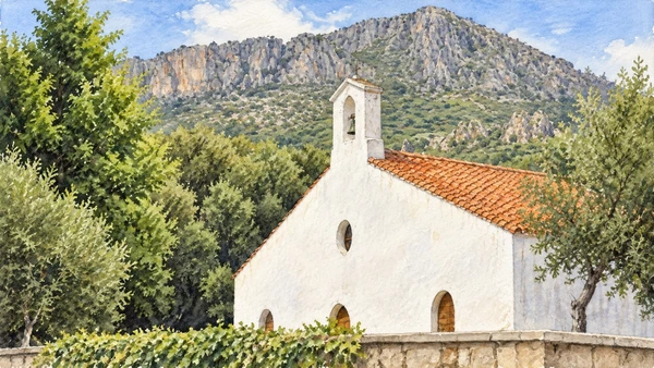
A small white church stands within a low enclosure beyond flowering scrub. Its rural setting is central to understanding the building.

Today

Worship and local religious life continue here. Visitor access may pause for services; consult the church or managing institution before planning an interior visit.

History

The local tourism office records a festival reference from 1606 and traditions connecting the church with the pastoral community. The complex developed through later centuries, including spaces around the enclosure used during celebrations. These documentary and architectural layers are firmer ground than stories that assign a precise origin to every feature.

How to read this place

Observe the simple facade, enclosure and relationship with the plateau. Religious festivities have their own calendar; a normal visit will not reproduce them. The illustration follows a documented landscape view, with the church kept at its actual modest scale.

What to notice

  • Observe the simple facade, enclosure and relationship with the plateau.
  • Religious festivities have their own calendar; a normal visit will not reproduce them.
  • The illustration follows a documented landscape view, with the church kept at its actual modest scale.
La Chiesa di San Pietro
Watercolour: San Pietro di Golgo, white rural church beyond stone enclosure and flowering scrub
San Pietro on the Golgo plateauEditorial watercolour · AI-generated · 2026
08

Terrain and access

Cala Goloritzè: a coast reached on foot

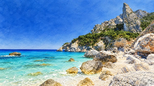
Pale boulders meet clear water beneath a slender limestone pinnacle. The small shore is the end of a mountain descent, not a roadside beach.

Today

Conditions depend on the exact route and the day. Check the responsible operator, weather and local access notices; use the designated routes and confirm the return journey.

History

Punta Caroddi and the nearby natural arch express the limestone landforms of the Baunei coast. Protection and managed access respond to the pressure that visitation places on this confined setting. The view illustrated here centres on the pinnacle and rocky shore; not every landmark is visible from one viewpoint.

How to read this place

Reserve through the current official system and follow its requirements for closed footwear with grip and sufficient water. The route from Su Porteddu includes a demanding descent and an uphill return. The municipal information directs visitors to land access and prohibits close mooring; do not plan on a boat landing at the beach.

What to notice

  • Reserve through the current official system and follow its requirements for closed footwear with grip and sufficient water.
  • The route from Su Porteddu includes a demanding descent and an uphill return.
  • The municipal information directs visitors to land access and prohibits close mooring; do not plan on a boat landing at the beach.
Il sentiero per Cala Goloritzè
Watercolour: Cala Goloritzè, limestone pinnacle and boulders above turquoise shallows
Cala Goloritzè: a coast reached on footEditorial watercolour · AI-generated · 2026
10

Terrain and access

Arbatax and the Rocce Rosse

Jagged red rock rises directly beside the sea. Nearby port activity reminds visitors that this is a working coastal settlement as well as a scenic stop.

Today

Conditions depend on the exact route and the day. Check the responsible operator, weather and local access notices; use the designated routes and confirm the return journey.

History

Arbatax occupies the Bellavista promontory in the territory of Tortolì. Its coastal history includes defensive structures such as the sixteenth-century San Miguel tower and the later development of harbour functions. At the Rocce Rosse, red porphyry contrasts with darker rocks and the surrounding water.

How to read this place

Give the geology and the town equal attention. Keep clear of exposed edges and working harbour areas, and respect any barriers around the rocks. The illustration follows a documented shoreline view; its calm water does not establish swimming access or conditions on another day.

What to notice

  • Give the geology and the town equal attention.
  • Keep clear of exposed edges and working harbour areas, and respect any barriers around the rocks.
  • The illustration follows a documented shoreline view; its calm water does not establish swimming access or conditions on another day.
Arbatax | SardegnaTurismo – Sito ufficiale del turismo della Regione Sardegna
Watercolour: Arbatax, jagged red porphyry beside the sea and pale rocky shore
Arbatax and the Rocce RosseEditorial watercolour · AI-generated · 2026

The territory through time

A short chronology

A concise chronology linking the documented sites to the wider story.

  1. Water and erosion shape the limestone caves and gorges.

  2. Serra Orrios develops as a Nuragic settlement.

  3. Occupation continues at Serra Orrios.

  4. A Pisan record documents Santa Maria di Ogliastro.

  5. A festival reference attests devotion to San Pietro at Golgo.

  6. Tourist visits begin at Bue Marino.

  7. Ispinigoli opens to visitors.

  8. Managed access, sea conditions and conservation shape visits to the coast.

Before your visit

Practical information

01

Plan separate days

Choose a manageable set of visits and allow for transport, booked entries and the return journey.

02

Use the exact place name

Sardinia contains separate cities, hill routes and coastal approaches. Confirm the precise locality and route rather than treating nearby names as one destination.

03

Check the institution

Opening hours, tickets, exhibitions and religious access change. Use the linked managing institution shortly before visiting.

04

Check the actual terrain

Steps, gradients and uneven ground vary between the individual sites. Use current route information, weather and closures for the option you choose.

05

Arrange accessible visits

Historic interiors and outdoor approaches can include steps, gradients or uneven surfaces. Ask about the specific route instead of assuming an entire destination is step-free.

06

Respect work and residence

Farms, workshops, churches and historic streets remain in use. Follow signs, keep entrances clear and ask permission before entering private spaces.

Method and sources

Sources and image credits

Prepared on 9 September 2026 from the institutional sources linked below. Historical claims are separated from editorial observations and itinerary suggestions. Older institutional brochures are used for stable cultural context, never as current timetables. Prices, transport schedules, trail status and admission are deliberately left to the responsible operators. Illustrations are not photographs, measured reconstructions or evidence of current conditions.

The eleven images are AI-generated editorial watercolours guided by photographic references. They interpret named places and are not photographs or substitutes for measured plans. Opening hours, tickets, accessible routes, temporary exhibitions and conservation work can change; consult the linked official pages shortly before visiting.

Illustration references and credits