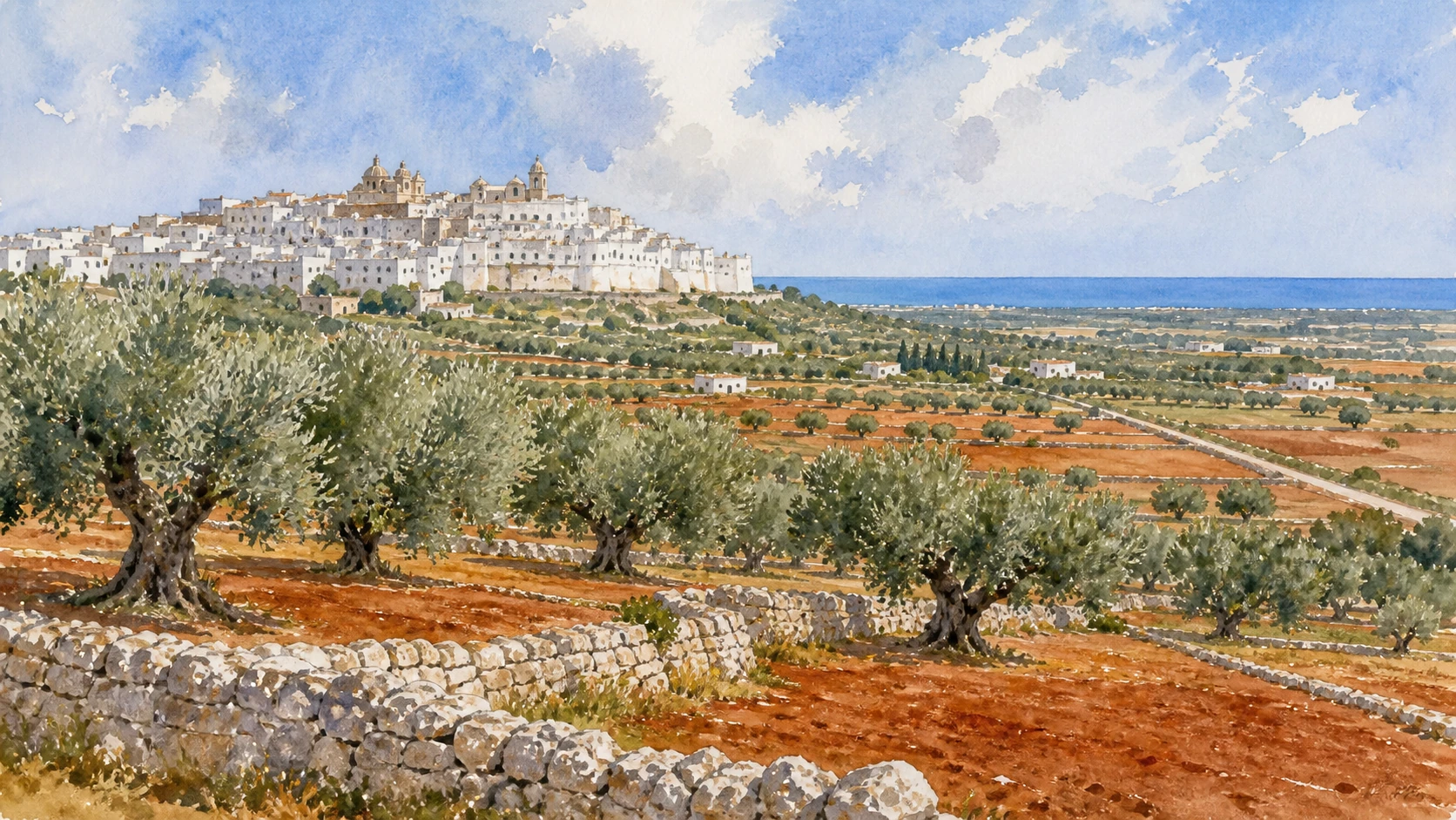
Original documentary watercolour panorama for Ostuni, Brindisi and the Olive Plain: Complete Guide, with accurate Puglian architecture, landscape and lived context

Puglia Guide 06 · Archaeology, architecture, working landscapes and contemporary access

The
plain reaches the Adriatic

A two-day route through white hill towns, monumental olive groves, protected dunes, Roman harbour memory, coastal cities and the Via Traiana landscape.

Plan the route
Central Adriatic Puglia10 chapters · one complete route

Why this route must be read in layers

The central Adriatic plain is productive land and infrastructure between towns and sea, not an empty foreground for white architecture.

The route begins with documented fabric and institutional collections rather than a list of photogenic surfaces. Each chapter separates what survives, what was rebuilt and what remains in use.

Puglia’s ports, pilgrimage sites, farms, forests, archaeological parks and inhabited centres operate under different access conditions. Current notices therefore belong to the route rather than an appendix.

Each chapter includes an illustration of the place described. The images are watercolours rather than photographs.

A two-day route through white hill towns, monumental olive groves, protected dunes, Roman harbour memory, coastal cities and the Via Traiana landscape.

The route

Plan your visit

A two-day route through white hill towns, monumental olive groves, protected dunes, Roman harbour memory, coastal cities and the Via Traiana landscape.

Early morning

Ostuni · Monumental olive groves · Torre Guaceto

Move in the documented order: Ostuni: white streets above the olive plain; then Monumental olive groves: production, disease and care; then Torre Guaceto: dunes, wetland and protected sea. Recheck live access and transport before entering a controlled site.

Late morning

Brindisi harbour and the Roman column · San Giovanni al Sepolcro · Museo Ribezzo

Move in the documented order: Brindisi harbour and the Roman column; then San Giovanni al Sepolcro: medieval forms and eastern references; then Museo Ribezzo: archaeology of harbour and territory. Recheck live access and transport before entering a controlled site.

Afternoon

Monopoli · Polignano a Mare · San Vito

Move in the documented order: Monopoli: old harbour, castle and inhabited waterfront; then Polignano a Mare: cliff town and Lama Monachile; then San Vito: abbey, tower and small harbour. Recheck live access and transport before entering a controlled site.

Late afternoon

Via Traiana landscape

Move in the documented order: Via Traiana landscape: roads, bridges and coastal continuity. Recheck live access and transport before entering a controlled site.

Ten chapters

Explore the places

The order follows terrain, institutions and present-day movement. Use the index to return to a chapter without reducing the route to isolated monuments.

  1. 01Ostuni: white streets above the olive plain
  2. 02Monumental olive groves: production, disease and care
  3. 03Torre Guaceto: dunes, wetland and protected sea
  4. 04Brindisi harbour and the Roman column
  5. 05San Giovanni al Sepolcro: medieval forms and eastern references
  6. 06Museo Ribezzo: archaeology of harbour and territory
  7. 07Monopoli: old harbour, castle and inhabited waterfront
  8. 08Polignano a Mare: cliff town and Lama Monachile
  9. 09San Vito: abbey, tower and small harbour
  10. 10Via Traiana landscape: roads, bridges and coastal continuity
01

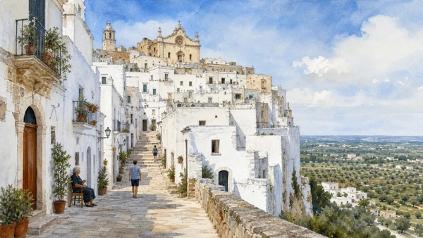
A dense hill town uses whitewash, stone stairs and defensive edges to command a broad agricultural and coastal view.

Ostuni: white streets above the olive plain

A dense hill town uses whitewash, stone stairs and defensive edges to command a broad agricultural and coastal view. The place becomes clearer when surviving fabric, later change and present use are read together.

Today

This is an inhabited place, not a visitor set. Keep doorways, pavements and deliveries clear, and use current municipal mobility information.

History

Medieval and early modern fabric accumulated inside walls while later suburbs and tourism expanded beyond them.

How to read this place

Read street gradients, inhabited houses and cathedral ridge before using viewpoints to connect town, olive plain and Adriatic.

What to notice

  • street width and building materials
  • residential use behind historic facades
  • later infrastructure and adaptation
Italia.it · Ostuni and Valle d’Itria
Original documentary watercolour of Ostuni: white streets above the olive plain in Central Adriatic Puglia, showing accurate architecture, landscape and present-day use
Ostuni: white streets above the olive plainOriginal Merlintravel documentary watercolour · 2026
02

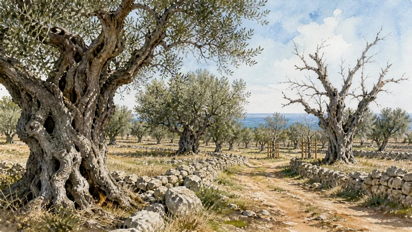
Ancient trees, mills, wells and field walls form a working landscape now under severe ecological and economic pressure.

Monumental olive groves: production, disease and care

Ancient trees, mills, wells and field walls form a working landscape now under severe ecological and economic pressure. The place becomes clearer when surviving fabric, later change and present use are read together.

Today

Weather, heat, fire risk, sea state and seasonal restrictions can alter access. Use official park or reserve information and remain on authorised routes.

History

Olive cultivation developed over long periods through changing landholding and processing systems; Xylella has transformed large parts of the region.

How to read this place

Observe only from public routes or authorised farms; distinguish living, damaged and replaced groves without romanticising abandonment.

What to notice

  • geology and native vegetation
  • authorised paths and protected habitats
  • working land or water beside conservation zones
Regione Puglia · Agricoltura
Original documentary watercolour of Monumental olive groves: production, disease and care in Central Adriatic Puglia, showing accurate architecture, landscape and present-day use
Monumental olive groves: production, disease and careOriginal Merlintravel documentary watercolour · 2026
03

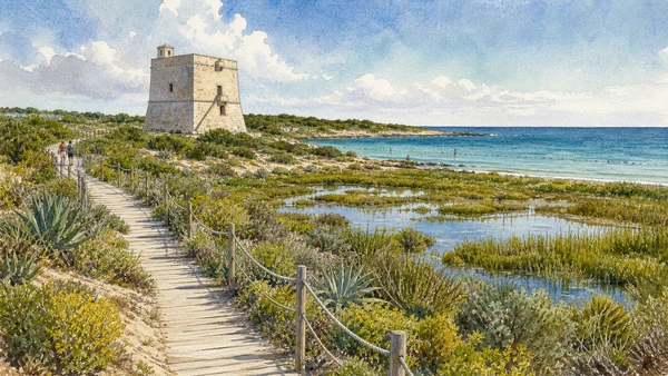
A coastal tower stands within a reserve of dunes, marsh, Mediterranean vegetation, seagrass and managed agriculture.

Torre Guaceto: dunes, wetland and protected sea

A coastal tower stands within a reserve of dunes, marsh, Mediterranean vegetation, seagrass and managed agriculture. The place becomes clearer when surviving fabric, later change and present use are read together.

Today

Weather, heat, fire risk, sea state and seasonal restrictions can alter access. Use official park or reserve information and remain on authorised routes.

History

Long-used coastal land and water became a protected reserve whose conservation depends on zoning and visitor management.

How to read this place

Follow reserve access rules, boardwalks and bathing zones; the tower is one element within a functioning habitat system.

What to notice

  • geology and native vegetation
  • authorised paths and protected habitats
  • working land or water beside conservation zones
Riserva Naturale di Torre Guaceto
Original documentary watercolour of Torre Guaceto: dunes, wetland and protected sea in Central Adriatic Puglia, showing accurate architecture, landscape and present-day use
Torre Guaceto: dunes, wetland and protected seaOriginal Merlintravel documentary watercolour · 2026
04

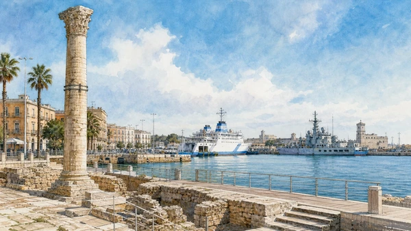
The natural inlet, monumental stair and surviving Roman column concentrate the city’s long role as an eastern-facing port.

Brindisi harbour and the Roman column

The natural inlet, monumental stair and surviving Roman column concentrate the city’s long role as an eastern-facing port. The place becomes clearer when surviving fabric, later change and present use are read together.

Today

Public use, traffic, events and works can change circulation. Keep access routes open and verify any controlled interior with the responsible institution.

History

Brundisium became a Roman terminal connected to the Appian road; medieval, modern naval and commercial phases repeatedly changed the harbour.

How to read this place

Read the column as one surviving monument, not a complete gateway, and compare it with ferry, naval and urban infrastructure still in use.

What to notice

  • the relation between public space and movement
  • historic fabric beside later additions
  • present-day work and residence
Italia.it · Brindisi
Original documentary watercolour of Brindisi harbour and the Roman column in Central Adriatic Puglia, showing accurate architecture, landscape and present-day use
Brindisi harbour and the Roman columnOriginal Merlintravel documentary watercolour · 2026
05

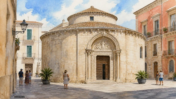
The small circular church demonstrates how pilgrimage and crusading-era connections entered Brindisi’s urban fabric.

San Giovanni al Sepolcro: medieval forms and eastern references

The small circular church demonstrates how pilgrimage and crusading-era connections entered Brindisi’s urban fabric. The place becomes clearer when surviving fabric, later change and present use are read together.

Today

This is an active religious place. Services, ceremonies and conservation can interrupt tourist access; dress appropriately, remain quiet and verify the official notice.

History

The building is generally dated to the Norman period and has undergone abandonment, restoration and changing civic use.

How to read this place

Compare the plan, carved portal and surviving frescoes; later restoration and missing elements must remain visible in the reading.

What to notice

  • the relationship between worship and visitor circulation
  • older fabric and later rebuilding
  • objects still used in liturgy
Comune di Brindisi
Original documentary watercolour of San Giovanni al Sepolcro: medieval forms and eastern references in Central Adriatic Puglia, showing accurate architecture, landscape and present-day use
San Giovanni al Sepolcro: medieval forms and eastern referencesOriginal Merlintravel documentary watercolour · 2026
06

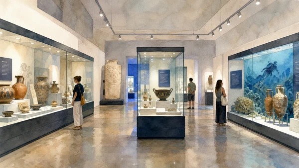
Collections connect Messapian communities, Roman Brundisium and underwater finds to the city’s wider region.

Museo Ribezzo: archaeology of harbour and territory

Collections connect Messapian communities, Roman Brundisium and underwater finds to the city’s wider region. The place becomes clearer when surviving fabric, later change and present use are read together.

Today

Opening, ticketing, room access and temporary displays can change. Check the museum’s official notice shortly before visiting and allow for security or conservation controls.

History

The provincial museum developed through local archaeological research and collecting and occupies a modern cultural complex near the cathedral.

How to read this place

Follow provenances and chronology; maritime objects should be tied to excavated or recovered contexts rather than displayed as generic treasure.

What to notice

  • the chronological order of the displays
  • finds tied to documented excavation contexts
  • modern conservation and interpretation
Polo Biblio-Museale di Brindisi
Original documentary watercolour of Museo Ribezzo: archaeology of harbour and territory in Central Adriatic Puglia, showing accurate architecture, landscape and present-day use
Museo Ribezzo: archaeology of harbour and territoryOriginal Merlintravel documentary watercolour · 2026
07

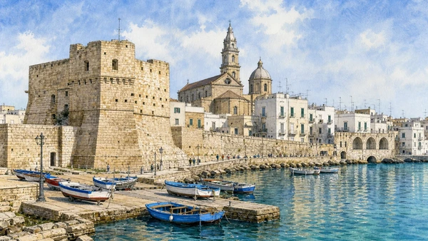
Fishing boats and the compact historic centre meet a small fortress on an Adriatic harbour still used every day.

Monopoli: old harbour, castle and inhabited waterfront

Fishing boats and the compact historic centre meet a small fortress on an Adriatic harbour still used every day. The place becomes clearer when surviving fabric, later change and present use are read together.

Today

This is an inhabited place, not a visitor set. Keep doorways, pavements and deliveries clear, and use current municipal mobility information.

History

The port town accumulated Byzantine, Norman, Venetian, Spanish and later phases; the Charles V castle incorporated earlier defensive fabric.

How to read this place

Keep quays and boat work clear, then compare the castle, cathedral and residential streets without treating the harbour as a decorative basin.

What to notice

  • street width and building materials
  • residential use behind historic facades
  • later infrastructure and adaptation
Italia.it · Monopoli
Original documentary watercolour of Monopoli: old harbour, castle and inhabited waterfront in Central Adriatic Puglia, showing accurate architecture, landscape and present-day use
Monopoli: old harbour, castle and inhabited waterfrontOriginal Merlintravel documentary watercolour · 2026
08

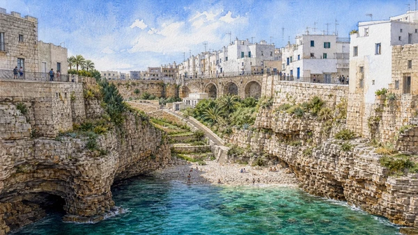
Houses, terraces, caves and a narrow beach occupy a limestone edge crossed by an old route and modern bridge.

Polignano a Mare: cliff town and Lama Monachile

Houses, terraces, caves and a narrow beach occupy a limestone edge crossed by an old route and modern bridge. The place becomes clearer when surviving fabric, later change and present use are read together.

Today

This is an inhabited place, not a visitor set. Keep doorways, pavements and deliveries clear, and use current municipal mobility information.

History

Settlement above the cliff developed through medieval and early modern phases; the route over Lama Monachile preserves the logic of the Via Traiana corridor.

How to read this place

Use public belvederes and stairs, respect crowd limits and read cave erosion, bridge and inhabited cliff as one changing system.

What to notice

  • street width and building materials
  • residential use behind historic facades
  • later infrastructure and adaptation
Italia.it · Polignano a Mare
Original documentary watercolour of Polignano a Mare: cliff town and Lama Monachile in Central Adriatic Puglia, showing accurate architecture, landscape and present-day use
Polignano a Mare: cliff town and Lama MonachileOriginal Merlintravel documentary watercolour · 2026
09

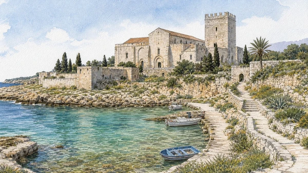
A coastal abbey complex and watchtower frame a working inlet north of Polignano.

San Vito: abbey, tower and small harbour

A coastal abbey complex and watchtower frame a working inlet north of Polignano. The place becomes clearer when surviving fabric, later change and present use are read together.

Today

This is an active religious place. Services, ceremonies and conservation can interrupt tourist access; dress appropriately, remain quiet and verify the official notice.

History

Monastic presence developed in the medieval period; later defensive and agricultural functions changed the complex and shore.

How to read this place

View from public areas unless access is authorised, and distinguish the private historic complex from the open coastal route.

What to notice

  • the relationship between worship and visitor circulation
  • older fabric and later rebuilding
  • objects still used in liturgy
Comune di Polignano a Mare
Original documentary watercolour of San Vito: abbey, tower and small harbour in Central Adriatic Puglia, showing accurate architecture, landscape and present-day use
San Vito: abbey, tower and small harbourOriginal Merlintravel documentary watercolour · 2026
10

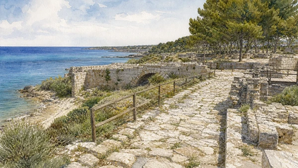
Fragments of ancient road logic survive through bridges, field alignments and settlements rather than one uninterrupted pavement.

Via Traiana landscape: roads, bridges and coastal continuity

Fragments of ancient road logic survive through bridges, field alignments and settlements rather than one uninterrupted pavement. The place becomes clearer when surviving fabric, later change and present use are read together.

Today

Archaeological access can change because of conservation, excavation, weather or staffing. Stay outside barriers and verify the official opening notice.

History

Trajan’s route provided a more easterly connection toward Brundisium and reused or reorganised older movement corridors.

How to read this place

Museums and documented road segments explain the ancient route; surviving stone paths may also belong to later periods.

What to notice

  • original masonry and later support work
  • the relation between excavation and modern surroundings
  • areas intentionally left unexcavated
Direzione regionale Musei Puglia · Egnazia
Original documentary watercolour of Via Traiana landscape: roads, bridges and coastal continuity in Central Adriatic Puglia, showing accurate architecture, landscape and present-day use
Via Traiana landscape: roads, bridges and coastal continuityOriginal Merlintravel documentary watercolour · 2026

Puglia through time

A short chronology

From Daunian, Peucetian and Messapian landscapes to Greek Taras, Roman roads, medieval ports, modern cities, protected parks and contemporary cultural recovery.

  1. Coastal landings, cave occupation and Bronze Age communities connect Adriatic, Ionian and inland routes.

  2. Daunian, Peucetian and Messapian societies develop distinct settlements, funerary customs and material cultures.

  3. Greek Taras expands on the Ionian coast while Indigenous centres negotiate trade and conflict across the region.

  4. Fortified towns, sanctuaries and rural systems change under pressure from Taranto, neighbouring peoples and Roman expansion.

  5. Roman colonies, estates, ports and the Via Appia and Via Traiana reorganise Apulia’s movement and production.

  6. Byzantine, Lombard and local powers contest a frontier shaped by ports, cave settlements, bishoprics and monastic networks.

  7. Norman rule, pilgrimage and maritime commerce support cathedrals, castles and new Latin institutions.

  8. Frederick II and his administration reshape castles, towns and royal landscapes across the region.

  9. Angevin and Aragonese power changes fortified towns, estates and relations with the Adriatic and Balkan coasts.

  10. The Ottoman capture of Otranto and its aftermath become a lasting element of Salento’s civic and religious memory.

  11. Coastal towers, masserie, olive estates and urban rebuilding respond to insecurity, trade and landholding systems.

  12. Feudal abolition, Bourbon reforms and Italian unification alter institutions without resolving rural inequality.

  13. Ports, railways, industry, war and migration transform cities while archaeology and heritage protection acquire new public roles.

  14. Land reform, industrial development, tourism and mass mobility reshape plains, coastlines and historic centres.

  15. UNESCO sites, national parks and museum networks expand while overtourism, industrial transition, olive disease and climate risk demand new care.

Before your visit

Practical information

01

Check the live page

Opening hours, reservations, restoration, worship and seasonal services can change. Recheck the linked institution shortly before departure.

02

Plan the long geography

Puglia is a long region. Do not compress distant cities, headlands and archaeological parks into an unsafe or superficial day.

03

Separate worship and tourism

Basilicas, cathedrals, sanctuaries and chapels remain religious places. Services and community use take priority.

04

Protect inhabited centres

Old towns, trulli districts, fishing quarters and working ports are not stage sets. Keep access, homes and deliveries clear.

05

Use current environmental notices

Heat, fire risk, sea state, coastal erosion, forest restrictions and protected habitats can alter a route at short notice.

06

Read reconstruction honestly

Restoration, adaptive reuse, modern infrastructure and contemporary art are part of the documented landscape, not defects to hide.

Method and sources

Sources and image credits

This guide uses official museum, ministry, municipal, park, UNESCO and regional-tourism documentation checked on 1 September 2026. It distinguishes Daunian, Peucetian, Messapian, Greek, Roman, Byzantine, Lombard, Norman, Swabian and later phases rather than treating Puglia as one timeless Mediterranean image. Every chapter links its principal institutional source; tickets, services, worship, closures, heat, fire risk, sea conditions and transport must always be verified again on the day of the visit.

All ten images are original Merlintravel editorial watercolours based on documented present-day conditions. They are illustrations, not substitutes for archaeological plans. Opening hours, tickets, accessible routes, temporary exhibitions and conservation work can change; consult the linked official pages shortly before visiting.