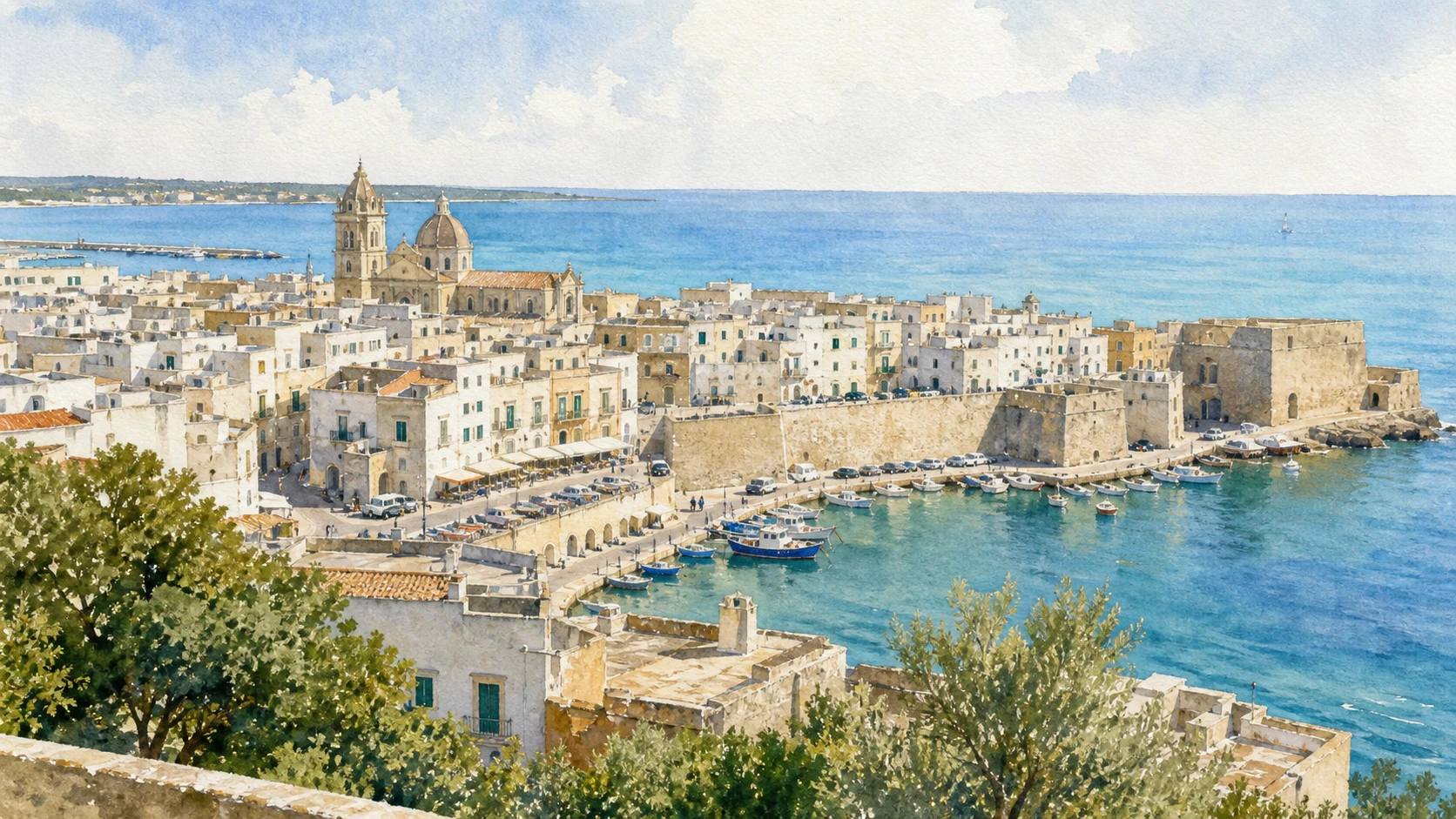
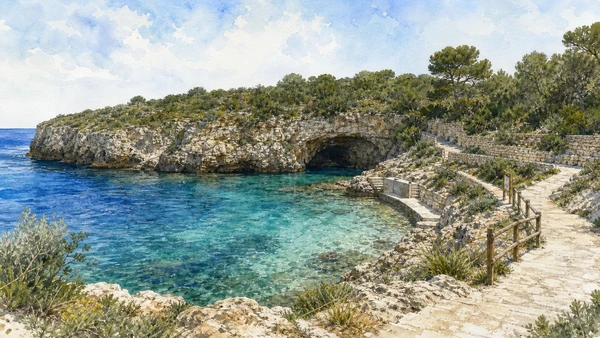
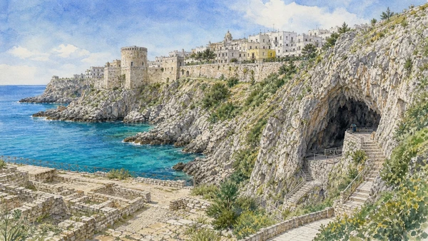
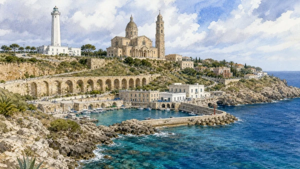
Original documentary watercolour panorama for Otranto and Eastern Salento: Complete Guide, with accurate Puglian architecture, landscape and lived context

Puglia Guide 07 · Archaeology, architecture, working landscapes and contemporary access

Otranto
looks across the Adriatic

A two-day route through cathedral mosaic, fortified harbour, Ottoman memory, coastal towers, lighthouse landscapes, caves and the meeting of Adriatic and Ionian routes.

Plan the route
Eastern Salento · Puglia10 chapters · one complete route

Why this route must be read in layers

Otranto’s eastern horizon is geographic and historical, but the city and coast must not be reduced to a romantic border myth.

The route begins with documented fabric and institutional collections rather than a list of photogenic surfaces. Each chapter separates what survives, what was rebuilt and what remains in use.

Puglia’s ports, pilgrimage sites, farms, forests, archaeological parks and inhabited centres operate under different access conditions. Current notices therefore belong to the route rather than an appendix.

Each chapter includes an illustration of the place described. The images are watercolours rather than photographs.

A two-day route through cathedral mosaic, fortified harbour, Ottoman memory, coastal towers, lighthouse landscapes, caves and the meeting of Adriatic and Ionian routes.

The route

Plan your visit

A two-day route through cathedral mosaic, fortified harbour, Ottoman memory, coastal towers, lighthouse landscapes, caves and the meeting of Adriatic and Ionian routes.

Early morning

Otranto Cathedral · Chapel of the Martyrs · Aragonese Castle

Move in the documented order: Otranto Cathedral: Pantaleone’s mosaic floor; then Chapel of the Martyrs: devotion and the memory of 1480; then Aragonese Castle: fortification after 1480. Recheck live access and transport before entering a controlled site.

Late morning

Walls and port · Punta Palascia · Torre Sant’Emiliano

Move in the documented order: Walls and port: the inhabited eastern threshold; then Punta Palascia: lighthouse and exposed headland; then Torre Sant’Emiliano: coastal warning in a broken network. Recheck live access and transport before entering a controlled site.

Afternoon

The former bauxite quarry · Porto Badisco · Castro and Grotta Zinzulusa

Move in the documented order: The former bauxite quarry: industry becoming a fragile landscape; then Porto Badisco: inlet, cave archaeology and living coast; then Castro and Grotta Zinzulusa: fortified town above karst coast. Recheck live access and transport before entering a controlled site.

Late afternoon

Santa Maria di Leuca

Move in the documented order: Santa Maria di Leuca: sanctuary, villas and the meeting of routes. Recheck live access and transport before entering a controlled site.

Ten chapters

Explore the places

The order follows terrain, institutions and present-day movement. Use the index to return to a chapter without reducing the route to isolated monuments.

  1. 01Otranto Cathedral: Pantaleone’s mosaic floor
  2. 02Chapel of the Martyrs: devotion and the memory of 1480
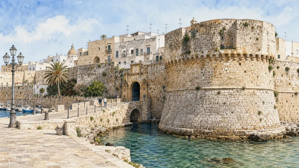
  3. 03Aragonese Castle: fortification after 1480
  4. 04Walls and port: the inhabited eastern threshold
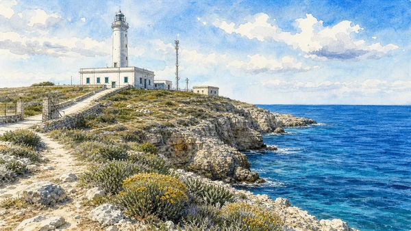
  5. 05Punta Palascia: lighthouse and exposed headland
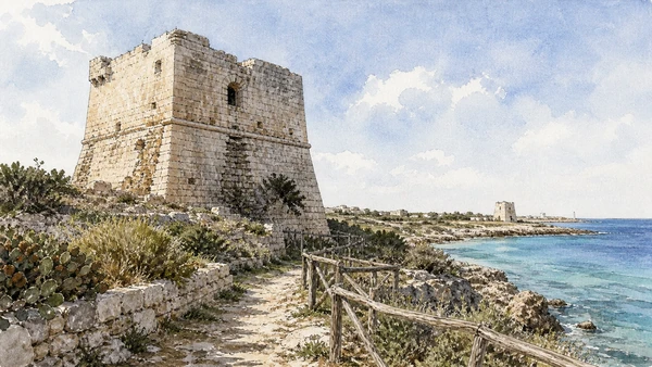
  6. 06Torre Sant’Emiliano: coastal warning in a broken network
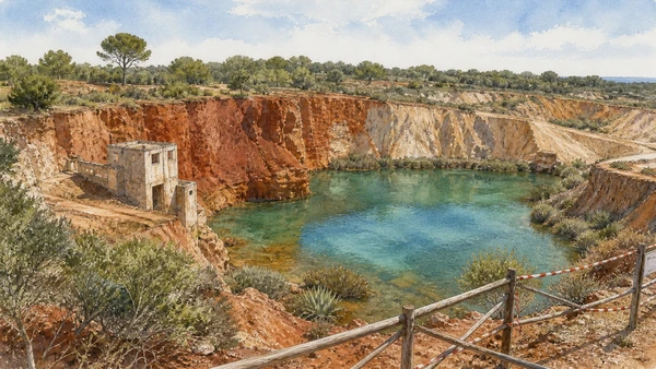
  7. 07The former bauxite quarry: industry becoming a fragile landscape
  8. 08Porto Badisco: inlet, cave archaeology and living coast
  9. 09Castro and Grotta Zinzulusa: fortified town above karst coast
  10. 10Santa Maria di Leuca: sanctuary, villas and the meeting of routes
01

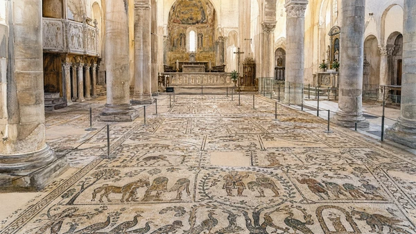
A vast twelfth-century pavement combines biblical, legendary, calendrical and moral imagery inside an active cathedral.

Otranto Cathedral: Pantaleone’s mosaic floor

A vast twelfth-century pavement combines biblical, legendary, calendrical and moral imagery inside an active cathedral. The place becomes clearer when surviving fabric, later change and present use are read together.

Today

This is an active religious place. Services, ceremonies and conservation can interrupt tourist access; dress appropriately, remain quiet and verify the official notice.

History

The mosaic was created under the monk Pantaleone in the 1160s and survives within a church repeatedly altered after medieval construction.

How to read this place

Follow the pavement’s physical axes and episodes without claiming one total interpretation; worship and conservation control movement.

What to notice

  • the relationship between worship and visitor circulation
  • older fabric and later rebuilding
  • objects still used in liturgy
Arcidiocesi di Otranto
Original documentary watercolour of Otranto Cathedral: Pantaleone's mosaic floor in Eastern Salento · Puglia, showing accurate architecture, landscape and present-day use
Otranto Cathedral: Pantaleone’s mosaic floorOriginal Merlintravel documentary watercolour · 2026
02

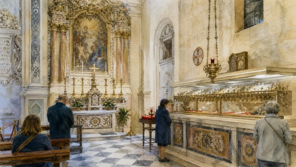
Relics and later display frame Catholic memory of those killed after the Ottoman capture of Otranto.

Chapel of the Martyrs: devotion and the memory of 1480

Relics and later display frame Catholic memory of those killed after the Ottoman capture of Otranto. The place becomes clearer when surviving fabric, later change and present use are read together.

Today

This is an active religious place. Services, ceremonies and conservation can interrupt tourist access; dress appropriately, remain quiet and verify the official notice.

History

The events of 1480 and subsequent recovery became a powerful civic and religious narrative, later shaped by canonisation and rebuilding.

How to read this place

Distinguish the historical siege, later devotional arrangement and present worship; avoid turning contested detail into spectacle.

What to notice

  • the relationship between worship and visitor circulation
  • older fabric and later rebuilding
  • objects still used in liturgy
Arcidiocesi di Otranto
Original documentary watercolour of Chapel of the Martyrs: devotion and the memory of 1480 in Eastern Salento · Puglia, showing accurate architecture, landscape and present-day use
Chapel of the Martyrs: devotion and the memory of 1480Original Merlintravel documentary watercolour · 2026
03

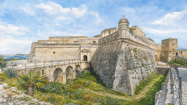
Bastions, ditch and underground routes express a defensive system rebuilt for artillery and Adriatic threat.

Aragonese Castle: fortification after 1480

Bastions, ditch and underground routes express a defensive system rebuilt for artillery and Adriatic threat. The place becomes clearer when surviving fabric, later change and present use are read together.

Today

Interior routes, exhibitions and controlled areas can change. Check the managing institution, respect barriers and distinguish surviving fabric from restoration.

History

The present fortress took shape mainly under Aragonese rule after the Ottoman occupation, with later military and civic adaptations.

How to read this place

Read bastion geometry and controlled approaches before exhibitions; literary associations are later reception, not construction history.

What to notice

  • defensive geometry and controlled approaches
  • different masonry phases
  • present cultural or civic use
Comune di Otranto · Castello Aragonese
Original documentary watercolour of Aragonese Castle: fortification after 1480 in Eastern Salento · Puglia, showing accurate architecture, landscape and present-day use
Aragonese Castle: fortification after 1480Original Merlintravel documentary watercolour · 2026
04

Town gates, walls, harbour and ordinary homes compress defence, fishing, tourism and ferry movement into a small area.

Walls and port: the inhabited eastern threshold

Town gates, walls, harbour and ordinary homes compress defence, fishing, tourism and ferry movement into a small area. The place becomes clearer when surviving fabric, later change and present use are read together.

Today

This is an inhabited place, not a visitor set. Keep doorways, pavements and deliveries clear, and use current municipal mobility information.

History

Otranto’s harbour supported ancient and medieval connections and was repeatedly fortified and modified.

How to read this place

Follow the relationship between gates, quay and street level, keeping working access clear. Gaps in the surviving walls reveal the limits of what remains.

What to notice

  • street width and building materials
  • residential use behind historic facades
  • later infrastructure and adaptation
Comune di Otranto
Original documentary watercolour of Walls and port: the inhabited eastern threshold in Eastern Salento · Puglia, showing accurate architecture, landscape and present-day use
Walls and port: the inhabited eastern thresholdOriginal Merlintravel documentary watercolour · 2026
05

The lighthouse marks a windy limestone cape commonly described as Italy’s easternmost point.

Punta Palascia: lighthouse and exposed headland

The lighthouse marks a windy limestone cape commonly described as Italy’s easternmost point. The place becomes clearer when surviving fabric, later change and present use are read together.

Today

Weather, heat, fire risk, sea state and seasonal restrictions can alter access. Use official park or reserve information and remain on authorised routes.

History

Modern navigation infrastructure occupies a coast long used for observation, fishing and movement across the Adriatic.

How to read this place

Use authorised approach paths, respect weather and cliff safety, and read the lighthouse as modern infrastructure rather than a medieval tower.

What to notice

  • geology and native vegetation
  • authorised paths and protected habitats
  • working land or water beside conservation zones
Comune di Otranto
Original documentary watercolour of Punta Palascia: lighthouse and exposed headland in Eastern Salento · Puglia, showing accurate architecture, landscape and present-day use
Punta Palascia: lighthouse and exposed headlandOriginal Merlintravel documentary watercolour · 2026
06

A solitary sixteenth-century tower survives above a steep coast once watched through a chain of signals.

Torre Sant’Emiliano: coastal warning in a broken network

A solitary sixteenth-century tower survives above a steep coast once watched through a chain of signals. The place becomes clearer when surviving fabric, later change and present use are read together.

Today

Interior routes, exhibitions and controlled areas can change. Check the managing institution, respect barriers and distinguish surviving fabric from restoration.

History

Coastal towers responded to early modern raiding and communication needs; many now survive in altered or inaccessible condition.

How to read this place

Observe from safe public routes and follow the sightlines to neighbouring towers. The surviving walls offer a fragmentary view of the former defences.

What to notice

  • defensive geometry and controlled approaches
  • different masonry phases
  • present cultural or civic use
Puglia tourism · official regional agency
Original documentary watercolour of Torre Sant'Emiliano: coastal warning in a broken network in Eastern Salento · Puglia, showing accurate architecture, landscape and present-day use
Torre Sant’Emiliano: coastal warning in a broken networkOriginal Merlintravel documentary watercolour · 2026
07

Red earth, water and vegetation occupy an extraction site whose striking colour can obscure its industrial origin and safety limits.

The former bauxite quarry: industry becoming a fragile landscape

Red earth, water and vegetation occupy an extraction site whose striking colour can obscure its industrial origin and safety limits. The place becomes clearer when surviving fabric, later change and present use are read together.

Today

Weather, heat, fire risk, sea state and seasonal restrictions can alter access. Use official park or reserve information and remain on authorised routes.

History

Twentieth-century mining altered the ground before abandonment and later informal tourism changed how the area is approached.

How to read this place

Stay behind restrictions, distinguish quarry faces from natural geology and avoid presenting the water body as a managed bathing lake.

What to notice

  • geology and native vegetation
  • authorised paths and protected habitats
  • working land or water beside conservation zones
Comune di Otranto
Original documentary watercolour of The former bauxite quarry: industry becoming a fragile landscape in Eastern Salento · Puglia, showing accurate architecture, landscape and present-day use
The former bauxite quarry: industry becoming a fragile landscapeOriginal Merlintravel documentary watercolour · 2026
08

A small bay connects coastal use with nearby prehistoric evidence that remains protected and not freely accessible.

Porto Badisco: inlet, cave archaeology and living coast

A small bay connects coastal use with nearby prehistoric evidence that remains protected and not freely accessible. The place becomes clearer when surviving fabric, later change and present use are read together.

Today

Weather, heat, fire risk, sea state and seasonal restrictions can alter access. Use official park or reserve information and remain on authorised routes.

History

Grotta dei Cervi preserves major Neolithic paintings; its conservation requires closure rather than routine tourist entry.

How to read this place

Read the accessible bay and landscape without implying cave access; protected archaeology can be important precisely because it remains unseen.

What to notice

  • geology and native vegetation
  • authorised paths and protected habitats
  • working land or water beside conservation zones
Soprintendenza ABAP Brindisi Lecce
Original documentary watercolour of Porto Badisco: inlet, cave archaeology and living coast in Eastern Salento · Puglia, showing accurate architecture, landscape and present-day use
Porto Badisco: inlet, cave archaeology and living coastOriginal Merlintravel documentary watercolour · 2026
09

A historic hill settlement, sanctuary archaeology and a managed sea cave occupy different levels of the same coast.

Castro and Grotta Zinzulusa: fortified town above karst coast

A historic hill settlement, sanctuary archaeology and a managed sea cave occupy different levels of the same coast. The place becomes clearer when surviving fabric, later change and present use are read together.

Today

This is an inhabited place, not a visitor set. Keep doorways, pavements and deliveries clear, and use current municipal mobility information.

History

Castro preserves Messapian, Roman, medieval and later phases; the cave belongs to a much longer geological history.

How to read this place

Keep the town, archaeological areas and cave visit distinct; use authorised access and do not combine separate monuments into one scene.

What to notice

  • street width and building materials
  • residential use behind historic facades
  • later infrastructure and adaptation
Comune di Castro
Original documentary watercolour of Castro and Grotta Zinzulusa: fortified town above karst coast in Eastern Salento · Puglia, showing accurate architecture, landscape and present-day use
Castro and Grotta Zinzulusa: fortified town above karst coastOriginal Merlintravel documentary watercolour · 2026
10

A pilgrimage sanctuary, lighthouse, monumental stair and nineteenth-century villas occupy the southern cape’s modern and sacred landscape.

Santa Maria di Leuca: sanctuary, villas and the meeting of routes

A pilgrimage sanctuary, lighthouse, monumental stair and nineteenth-century villas occupy the southern cape’s modern and sacred landscape. The place becomes clearer when surviving fabric, later change and present use are read together.

Today

Public use, traffic, events and works can change circulation. Keep access routes open and verify any controlled interior with the responsible institution.

History

The sanctuary’s traditions are older than the present complex; harbour, aqueduct terminus and resort villas reshaped the cape in modern times.

How to read this place

Compare religious, hydraulic and leisure architecture, and treat the meeting of seas as a geographic convention influenced by weather and currents.

What to notice

  • the relation between public space and movement
  • historic fabric beside later additions
  • present-day work and residence
Italia.it · Santa Maria di Leuca
Original documentary watercolour of Santa Maria di Leuca: sanctuary, villas and the meeting of routes in Eastern Salento · Puglia, showing accurate architecture, landscape and present-day use
Santa Maria di Leuca: sanctuary, villas and the meeting of routesOriginal Merlintravel documentary watercolour · 2026

Puglia through time

A short chronology

From Daunian, Peucetian and Messapian landscapes to Greek Taras, Roman roads, medieval ports, modern cities, protected parks and contemporary cultural recovery.

  1. Coastal landings, cave occupation and Bronze Age communities connect Adriatic, Ionian and inland routes.

  2. Daunian, Peucetian and Messapian societies develop distinct settlements, funerary customs and material cultures.

  3. Greek Taras expands on the Ionian coast while Indigenous centres negotiate trade and conflict across the region.

  4. Fortified towns, sanctuaries and rural systems change under pressure from Taranto, neighbouring peoples and Roman expansion.

  5. Roman colonies, estates, ports and the Via Appia and Via Traiana reorganise Apulia’s movement and production.

  6. Byzantine, Lombard and local powers contest a frontier shaped by ports, cave settlements, bishoprics and monastic networks.

  7. Norman rule, pilgrimage and maritime commerce support cathedrals, castles and new Latin institutions.

  8. Frederick II and his administration reshape castles, towns and royal landscapes across the region.

  9. Angevin and Aragonese power changes fortified towns, estates and relations with the Adriatic and Balkan coasts.

  10. The Ottoman capture of Otranto and its aftermath become a lasting element of Salento’s civic and religious memory.

  11. Coastal towers, masserie, olive estates and urban rebuilding respond to insecurity, trade and landholding systems.

  12. Feudal abolition, Bourbon reforms and Italian unification alter institutions without resolving rural inequality.

  13. Ports, railways, industry, war and migration transform cities while archaeology and heritage protection acquire new public roles.

  14. Land reform, industrial development, tourism and mass mobility reshape plains, coastlines and historic centres.

  15. UNESCO sites, national parks and museum networks expand while overtourism, industrial transition, olive disease and climate risk demand new care.

Before your visit

Practical information

01

Check the live page

Opening hours, reservations, restoration, worship and seasonal services can change. Recheck the linked institution shortly before departure.

02

Plan the long geography

Puglia is a long region. Do not compress distant cities, headlands and archaeological parks into an unsafe or superficial day.

03

Separate worship and tourism

Basilicas, cathedrals, sanctuaries and chapels remain religious places. Services and community use take priority.

04

Protect inhabited centres

Old towns, trulli districts, fishing quarters and working ports are not stage sets. Keep access, homes and deliveries clear.

05

Use current environmental notices

Heat, fire risk, sea state, coastal erosion, forest restrictions and protected habitats can alter a route at short notice.

06

Read reconstruction honestly

Restoration, adaptive reuse, modern infrastructure and contemporary art are part of the documented landscape, not defects to hide.

Method and sources

Sources and image credits

This guide uses official museum, ministry, municipal, park, UNESCO and regional-tourism documentation checked on 1 September 2026. It distinguishes Daunian, Peucetian, Messapian, Greek, Roman, Byzantine, Lombard, Norman, Swabian and later phases rather than treating Puglia as one timeless Mediterranean image. Every chapter links its principal institutional source; tickets, services, worship, closures, heat, fire risk, sea conditions and transport must always be verified again on the day of the visit.

All ten images are original Merlintravel editorial watercolours based on documented present-day conditions. They are illustrations, not substitutes for archaeological plans. Opening hours, tickets, accessible routes, temporary exhibitions and conservation work can change; consult the linked official pages shortly before visiting.