Illustrated guide · Sicily
Two cities
one Hyblaean plateau
Ten places through which to read Akrai and Palazzolo Acreide together: Greek urbanism, theatre and cult, medieval resettlement, Baroque reconstruction and the memory of rural Sicily.
Explore the placesAn ancient city and a later town in direct conversation
Palazzolo Acreide has two founding dates and neither cancels the other.
In 664 BC, Syracuse established Akrai on a strategic plateau between the Anapo and Tellaro valleys. Its theatre, streets, council building, sanctuaries and rock-cut burial landscapes show an inland polis connected to the ambitions and cultures of the Greek coast.
The medieval and modern settlement developed on adjacent ground after ancient Akrai had lost its urban role. The earthquake of 1693 then gave churches and palaces their most visible late-Baroque form, but the rebuilt town never became a copy of Noto or Ragusa.
The complete guide must therefore cross the archaeological boundary and return to living memory: religious rivalries, highland agriculture, craft, domestic objects and the museum created by Antonino Uccello to preserve a rural world transformed by migration.

One destination
Palazzolo and Akrai,
two ways of occupying the height.
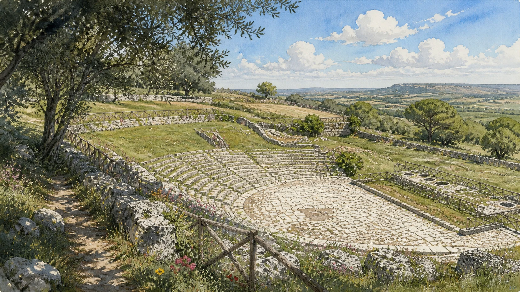
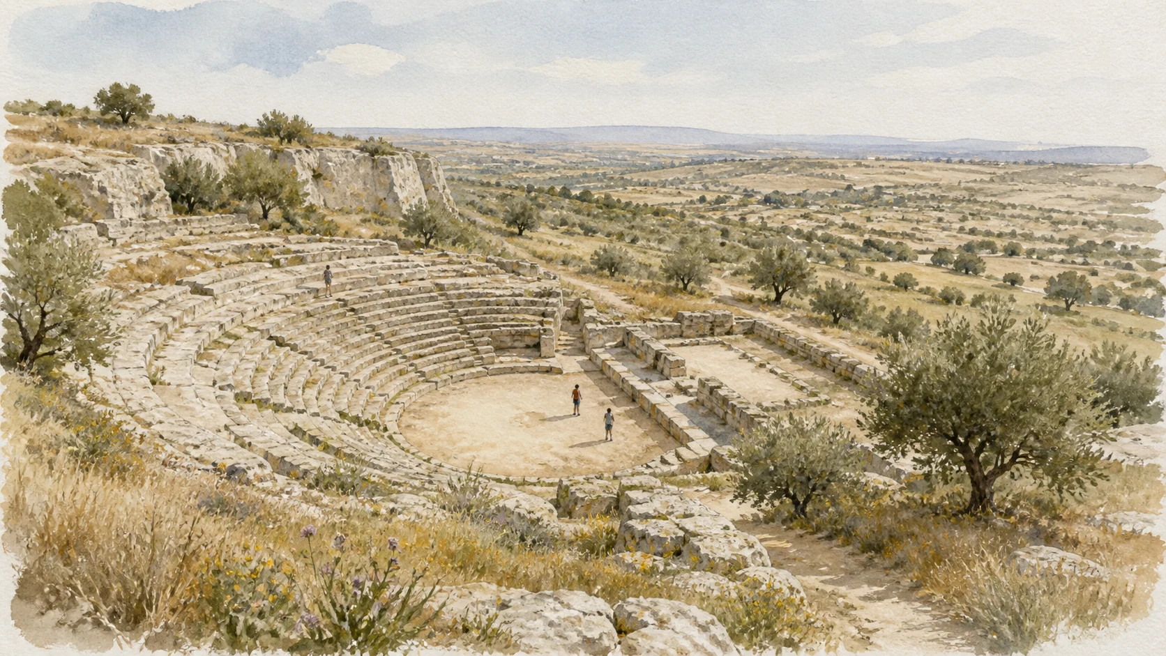
Akrai occupies the Colle dell'Acromonte above the modern town, controlling routes through the Hyblaean interior. The archaeological park identifies an east-west road, a comb-like secondary network, a theatre and bouleuterion from the third century BC, an archaic temple foundation and later funerary and Christian use of former quarries. The remains are dispersed across a living plateau of grass, dry-stone walls and trees rather than enclosed in a monumental urban excavation.
Palazzolo Acreide belongs to UNESCO's serial property of the Late Baroque Towns of the Val di Noto. Its reconstruction after 1693 produced several strong centres: San Paolo, San Sebastiano and Piazza del Popolo, the Annunziata and Immacolata, Corso Vittorio Emanuele and noble residences. Their coexistence reflects institutions and devotions that retained separate identities inside one highland community.
The selection
Ten places,
from polis to living memory
The route begins with Akrai's plan and public monuments, follows quarry, burial and cult landscapes, crosses the medieval shift and then reads the reconstructed town through its two great basilicas, streets, palaces, churches and museums.
- 01Akrai's Plateau, Street Grid and Acropolis
- 02The Greek Theatre of Akrai
- 03Bouleuterion, Agora and the Public Centre
- 04The Intagliata, Intagliatella and Early Christian Burials
- 05The Santoni and Templi Ferali
- 06Medieval Palazzolo, the Castle Ridge and the New Settlement
- 07The Basilica of San Paolo
- 08San Sebastiano and Piazza del Popolo
- 09Corso Vittorio Emanuele, Noble Palaces and the Annunziata
- 10Casa Museo Antonino Uccello and Museo Gabriele Judica
A strategic foundation organised between two river valleys
Akrai's Plateau, Street Grid and Acropolis
Roads, gates and an archaic sanctuary reveal Akrai as a planned inland polis rather than a theatre standing alone.

The place today
The archaeological area extends across a limestone plateau west of modern Palazzolo. An east-west street once linked city gates, while narrower streets followed a comb-like arrangement. Low walls, cut rock and changes in level make the plan legible only gradually. On the acropolis, foundations associated with an archaic temple—identified with Aphrodite through inscriptional evidence—survive without standing columns or a reconstructed cella.
The historical chapter
According to Thucydides, Syracuse founded Akrai in 664 BC, the earliest of its inland subcolonies. The site controlled movement between the Anapo and Tellaro valleys and supported Syracusan expansion into the Hyblaean interior. The road system and sanctuary indicate civic planning and religious investment by the sixth century BC. Later Hellenistic and Roman phases modified the city, but the surviving ground plan should not be treated as a perfect snapshot of its foundation year.
What to notice
- The principal east-west route distinguished from later paths and fences
- Foundation cuts and wall lines rather than imagined standing temple architecture
- Long views across the plateau explaining the strategic choice of the site

A compact civic theatre cut into the highland slope
The Greek Theatre of Akrai
The third-century-BC cavea is intimate in scale and inseparable from Akrai's public centre and landscape.

The place today
The theatre uses the natural slope with a semicircular cavea of low limestone seating around the paved orchestra. The stage building survives only in foundations and cuts, leaving the landscape visually open. Trees, grass, flowers and dry-stone boundaries now frame the monument. Its modest dimensions allow the relationship between seating, orchestra and nearby civic structures to be understood at close range.
The historical chapter
The archaeological park dates the theatre to the third century BC, when Akrai's public centre also included the bouleuterion. Its form reflects Greek performance and assembly culture, while alterations and long reuse complicate a single-phase reconstruction. Tommaso Fazello identified the ancient site in the sixteenth century; systematic excavation began in the nineteenth under Baron Gabriele Judica, whose work brought the theatre back into scholarly and public attention.
What to notice
- The theatre's small capacity compared with Syracuse's monumental cavea
- Stone seats following the slope instead of a freestanding structure
- Absence of a complete stage façade, preserving rather than disguising what is lost
Council, market and circulation formed a civic system
Bouleuterion, Agora and the Public Centre
A smaller meeting building and adjacent remains show that Akrai's political life extended well beyond theatrical performance.

The place today
Near the theatre stands the compact semicircular seating of the bouleuterion, the council building of the polis. Low foundations and paved areas around it relate to the agora and public circulation. A late-Hellenistic structure with a circular central room has been interpreted as a probable bath building. Because walls rarely rise above knee height, the visitor must read alignments and spatial relationships rather than isolated architectural silhouettes.
The historical chapter
The bouleuterion belongs to the third-century-BC reorganisation of Akrai's public area. Council meetings, decrees, exchange and festival movement placed different civic functions close together. Later building and reuse altered the area, while excavation history selected some structures for clearer display than others. Calling every open surface the agora would overstate the evidence; the more reliable conclusion is that theatre, council house, street and other public buildings formed one connected centre.
What to notice
- The council chamber's scale compared with the larger theatre
- Paving and wall lines joining buildings into an urban sequence
- Modern paths and railings separated mentally from ancient circulation
Quarries became roads of the dead and spaces of later faith
The Intagliata, Intagliatella and Early Christian Burials
Stone extraction, Hellenistic funerary use and Christian catacombs occupy the same cut landscape.

The place today
The Intagliata and Intagliatella are large former quarries whose rock faces, passages and chambers create an enclosed environment unlike the open theatre. Tombs and funerary hypogea cut into their walls belong to different periods. Early Christian catacomb use added galleries and burials inside spaces first created through stone extraction. Lighting, access and footing vary, so not every cavity is continuously visitable.
The historical chapter
Akrai's builders extracted local limestone and left voids that later communities adapted. Hellenistic and Roman burial practices occupied quarry margins; Christian groups subsequently created catacomb and funerary spaces. This sequence is central to the site because it demonstrates transformation rather than sudden disappearance after the classical city. The quarries were economic infrastructure before they became places of memory, and later religious use did not erase their earlier material logic.
What to notice
- Tool marks and quarry faces distinguished from burial niches
- Routes narrowing as open extraction zones become enclosed funerary spaces
- Different tomb forms revealing repeated use rather than one necropolis plan
Rock-cut cults connect Akrai to eastern Mediterranean religion
The Santoni and Templi Ferali
Reliefs of Cybele and a nearby sanctuary for heroic dead reveal ritual landscapes beyond the formal civic centre.

The place today
On the southern slope, twelve rock-cut panels known as the Santoni extend for about fifty metres beneath protective structures. Most show Cybele enthroned with attributes, lions and associated figures; erosion and past damage make some details difficult to recognise. Nearby, the so-called Templi Ferali occupy a former quarry whose walls contain votive cuttings associated with the cult of the dead as heroes. Access may be more restricted than the main archaeological area.
The historical chapter
The Santoni belong to the third century BC and represent a mystery cult of Anatolian origin that spread through the Greek world and Sicily. Their repeated image of the Great Mother does not make the complex a conventional built temple: sacred presence was organised through the living rock. The Templi Ferali show another ritual relationship with quarry space and the dead. Together they expand Akrai's cultural geography beyond civic institutions and demonstrate exchange across the Mediterranean.
What to notice
- Ten panels retaining the enthroned goddess despite varying preservation
- Lions, Attis, Hermes and torch-bearing figures appearing around the main image
- Protective roofs and grilles recording the modern conservation history of fragile reliefs
The town returned on adjacent ground rather than simply reoccupying Akrai
Medieval Palazzolo, the Castle Ridge and the New Settlement
Ruins and street gradients mark the centre that developed after ancient urban life on the Acromonte had ended.

The place today
Between the archaeological plateau and the Baroque centres, upper streets follow older contours around the site of a medieval castle, surviving walls and long-altered neighbourhoods. The remains are fragmentary and integrated into later terrain; no complete fortress crowns the town. Views toward Akrai make the physical proximity clear while also showing that modern Palazzolo occupies a distinct urban focus.
The historical chapter
Akrai declined across late antiquity and the early medieval period. A later settlement developed under Byzantine, Islamic, Norman and feudal rule on adjacent lower ground, known through forms of the name Palatiolum. A castle and churches organised the medieval community. The 1693 earthquake damaged this inherited town, after which rebuilding reshaped several centres instead of imposing one entirely new grid. The result is a sequence of relocations within a shared highland territory.
What to notice
- Fragmentary defensive masonry distinguished from later retaining walls
- Streets bending with the ridge rather than following Akrai's excavated east-west axis
- Sightlines that place ancient, medieval and Baroque centres near one another without merging them

A convex façade-tower gives one patronal community its stage
The Basilica of San Paolo
Portico, stair and rising bell front transform a confined street into Palazzolo's most forceful Baroque approach.

The place today
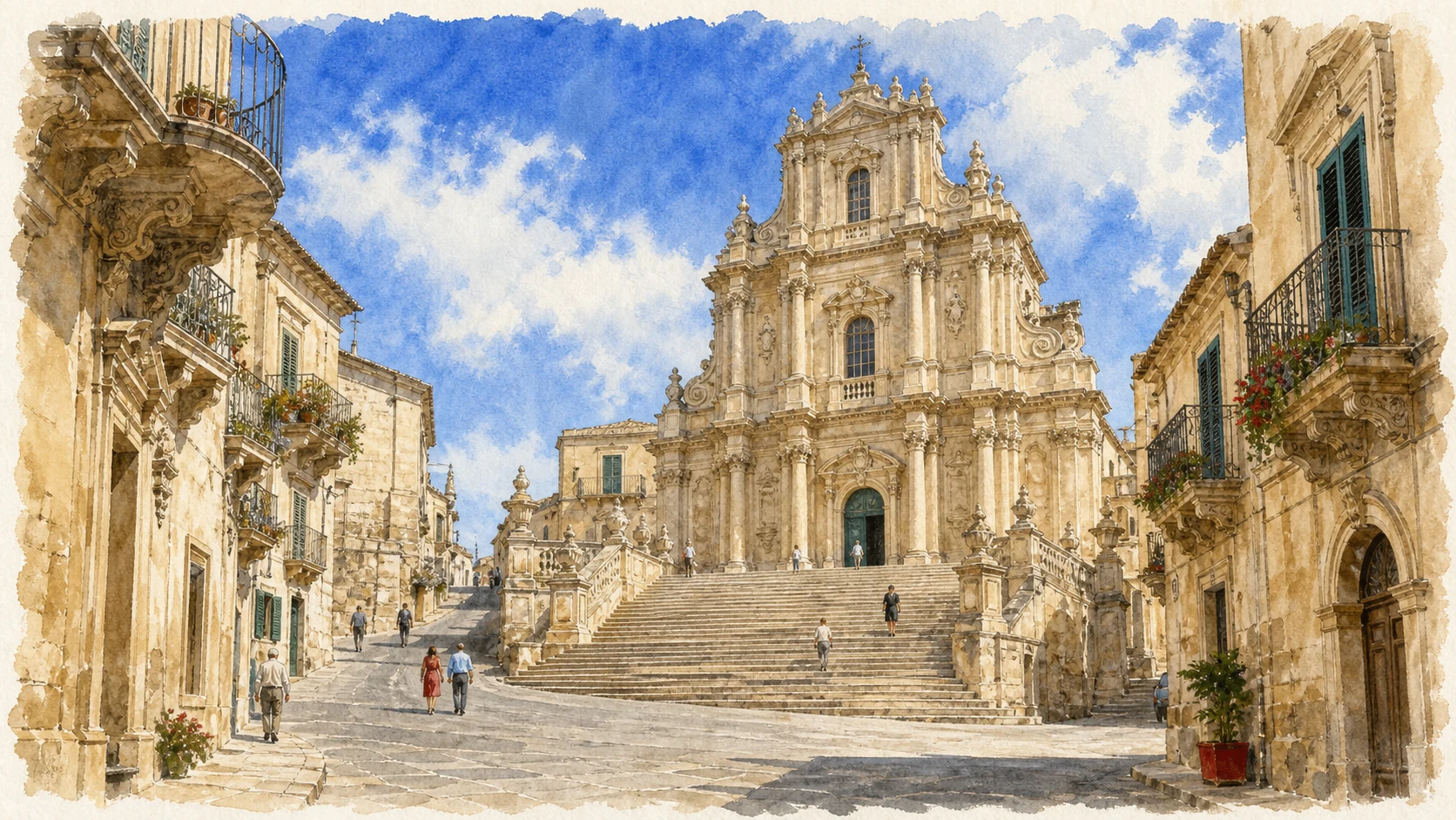
San Paolo stands above a short single-flight stair and a three-arched portico. Its façade rises through three narrowing levels, with paired columns, curved corner elements, volutes and a bulbous crown. The lower arches create depth before entry, while the tower gathers sculpture and bells into one vertical front. The church remains tied to active devotion and feast practice, not merely to UNESCO architectural status.
The historical chapter
A church dedicated to Santa Sofia previously occupied the site. San Paolo became patron of Palazzolo in 1688, shortly before the earthquake destroyed or severely damaged the existing building. Reconstruction began in the early eighteenth century and the institutional consortium attributes the mature façade to Vincenzo Sinatra, with work extending toward 1780. The building records both post-seismic design and a patronal identity whose processions and rivalries shaped the town's social map.
What to notice
- The portico's three openings creating a shadowed base below the pale tower
- Curved outer elements directing the eye toward the convex centre
- Religious use and festival apparatus changing how the façade is occupied through the year
A broad civic square answers San Paolo with another monumental front
San Sebastiano and Piazza del Popolo
The white stone basilica, long stair, Town Hall and surrounding façades create Palazzolo's principal public theatre.

The place today
The Basilica of San Sebastiano dominates one side of Piazza del Popolo behind a broad stair. Its three-level façade uses paired pilasters, broken pediments, volutes and a central bell opening; pale stone intensifies the height. The square also contains the Town Hall and connects to Corso Vittorio Emanuele, allowing civic movement, cafés, worship and festivals to occupy the same space.
The historical chapter
A pre-earthquake church dedicated to San Sebastiano was rebuilt and enlarged after 1693. The institutional consortium associates the façade with Mario Diamanti and dates major work across the eighteenth century. San Sebastiano became a basilica in 1828 and a parish in 1859. Its relationship with San Paolo is often framed as rivalry, but the documented urban fact is more useful: two patronal centres invested in distinct monumental settings within a relatively small town.
What to notice
- The stair extending the architecture into the everyday square
- Paired vertical elements narrowing toward the single upper bay
- The Town Hall and domestic fronts completing a public space rather than a church-only precinct
Civil façades and smaller churches carry the Baroque language beyond two basilicas
Corso Vittorio Emanuele, Noble Palaces and the Annunziata
Balconies, portals and street corners demonstrate how reconstruction became an urban fabric rather than a pair of isolated monuments.

The place today
Corso Vittorio Emanuele and nearby streets pass Palazzo Iudica, Palazzo Ferla and other residences with carved corbels and wrought-iron balconies. The Annunziata is distinguished by a portal of paired twisted columns covered with vines and rural motifs. The Immacolata and San Michele add further church fronts and artworks, while ordinary shopfronts and homes keep the centre inhabited.
The historical chapter
Noble families, confraternities and parishes rebuilt within inherited property and street relationships after 1693. The result was not one architect's comprehensive plan: workshops and patrons adapted a shared late-Baroque vocabulary to different corners and institutions. A 1474 contract had commissioned Antonello da Messina to paint an Annunciation for the older Annunziata, evidence of the town's artistic networks before the earthquake; the contract should not be confused with a claim that the original panel remains in the rebuilt church.
What to notice
- Agricultural vines and foliage carved into the Annunziata portal
- Balcony corbels viewed from below as part of pedestrian street movement
- Modern uses and repairs showing that UNESCO fabric remains a working town
Rural life and archaeological discovery receive separate, complementary archives
Casa Museo Antonino Uccello and Museo Gabriele Judica
Two museums connect the highland community to domestic labour, migration and the rediscovery of ancient Akrai.

The place today
Casa Museo Antonino Uccello preserves tools, furniture, ceramics, textiles, food traditions and reconstructed work environments from rural Sicily inside a historic house. It was conceived as a lived and interpreted ethnographic collection, not a memorial apartment. Palazzo Cappellani houses the Gabriele Judica archaeological museum, presenting finds and research connected to Akrai and the territory. Their schedules and collections should be checked independently.
The historical chapter
Antonino Uccello opened his Casa Museo in September 1971 after decades of collecting material endangered by rapid social change and emigration; the Region acquired it in 1983. Baron Gabriele Judica had led nineteenth-century excavation at Akrai, forming a foundational archaeological collection and publishing the site. Together the museums make an important methodological point: stones do not explain a polis alone, and objects do not explain rural society without the labour, language and relationships that gave them meaning.
What to notice
- Objects arranged by use and cultural context rather than by decorative value alone
- Domestic rooms functioning as an ethnographic argument, not simply period atmosphere
- Archaeological finds reconnecting the excavated plateau with the history of its rediscovery
The city through time
Ten thresholds
across the highland
The chronology moves from a Syracusan foundation to a transformed medieval settlement, post-earthquake reconstruction, archaeological rediscovery and the preservation of rural memory.
Syracuse founds Akrai on the plateau between the Anapo and Tellaro valleys, controlling inland routes through the Hyblaean landscape.
An archaic sanctuary identified with Aphrodite occupies the acropolis as the planned city consolidates its religious and civic structure.
The theatre, bouleuterion, Santoni and other public or ritual complexes express Akrai's mature Hellenistic urban life.
The city and its quarries undergo new uses; funerary hypogea and catacombs occupy the Intagliata and Intagliatella.
Urban life shifts toward adjacent Palazzolo, where a castle, churches and feudal institutions form a distinct settlement.
The earthquake devastates Palazzolo and the Val di Noto, initiating prolonged reconstruction of churches, homes and civic spaces.
Major campaigns shape San Paolo, San Sebastiano and other late-Baroque monuments while separate patronal centres remain active.
Gabriele Judica excavates and publishes Akrai, beginning the modern archaeological recovery of the theatre and public centre.
Antonino Uccello opens his Casa Museo to preserve and interpret a rural material culture threatened by migration and social change.
UNESCO inscribes the Late Baroque Towns of the Val di Noto, including selected monuments and urban fabric of Palazzolo Acreide.
Before your visit
Practical information,
without turning it into promises
Give Akrai half a day
The theatre is only the beginning. Streets, acropolis foundations, bouleuterion, quarries and external cult sites require distance, uneven ground and careful reading. Do not reduce the park to a quick photo stop.
Verify separate access areas
Akrai, the Santoni, Palazzo Cappellani and Casa Museo Uccello may follow different tickets, closures and schedules. Check the exact official page rather than assuming one archaeological ticket covers everything.
Keep churches and festivals distinct
San Paolo and San Sebastiano are active devotional centres with independent liturgical and feast calendars. Respect worship and temporary processional arrangements while reading their architectural relationship.
Prepare for the highland climate
The plateau is exposed to sun, wind and rapid weather changes, while archaeological stone and quarry paths are uneven. Carry water and suitable footwear and follow current route restrictions.
Sources
This guide cross-checks the official archaeological park and current regional museum information against UNESCO, ICOMOS, the Italian Ministry of Culture's Val di Noto study, Italia.it and the institutional south-east UNESCO consortium. It distinguishes ancient Akrai from later Palazzolo, standing remains from scholarly reconstruction and living religious practice from architectural spectacle.
- UNESCO World Heritage Centre · Late Baroque Towns of the Val di Noto ↗
- UNESCO / ICOMOS · Advisory evaluation 1024rev ↗
- Regione Siciliana · Akrai archaeological area ↗
- Regione Siciliana · Theatre of Akrai ↗
- Regione Siciliana · Santoni of Akrai ↗
- Italia.it · Palazzolo Acreide ↗
- Siti UNESCO Sicilia Sud Est · San Paolo and San Sebastiano ↗
- Regione Siciliana · Casa Museo Antonino Uccello ↗
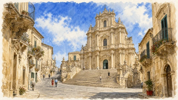
The hero image is an illustration, not a photograph. Opening hours, tickets, worship, events, excavation and access to the Santoni or quarries can change; consult the linked official pages shortly before visiting. Never leave marked archaeological routes to approach a relief, tomb or wall.