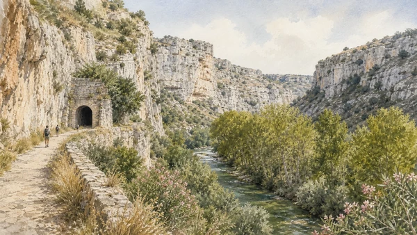
Illustrated guide · Sicily
Five thousand tombs
inside a living canyon
Ten landscapes through which to understand Pantalica as a Bronze Age centre, a chain of rock-cut necropolises, a Byzantine refuge and a protected river reserve between Ferla and Sortino.
Explore the placesA city whose houses disappeared
Pantalica asks the visitor to reconstruct a community from its edges.
The wooden dwellings of the prehistoric settlement have largely vanished, while thousands of tomb chambers remain cut into the limestone walls below the plateau. The inhabited centre is therefore read indirectly: through cemeteries, paths, defensive thresholds, metalworking traces and one exceptional stone building.
Centuries later, people returned to the same cliffs and reshaped caves into houses, oratories and small Christian villages. Rivers, springs, plane trees and karst cavities continued their own history around them.
This is not a ruin placed inside scenery. Archaeology and canyon are one landscape, and every route makes that relationship physical.
One destination
Pantalica,
a plateau written from below.
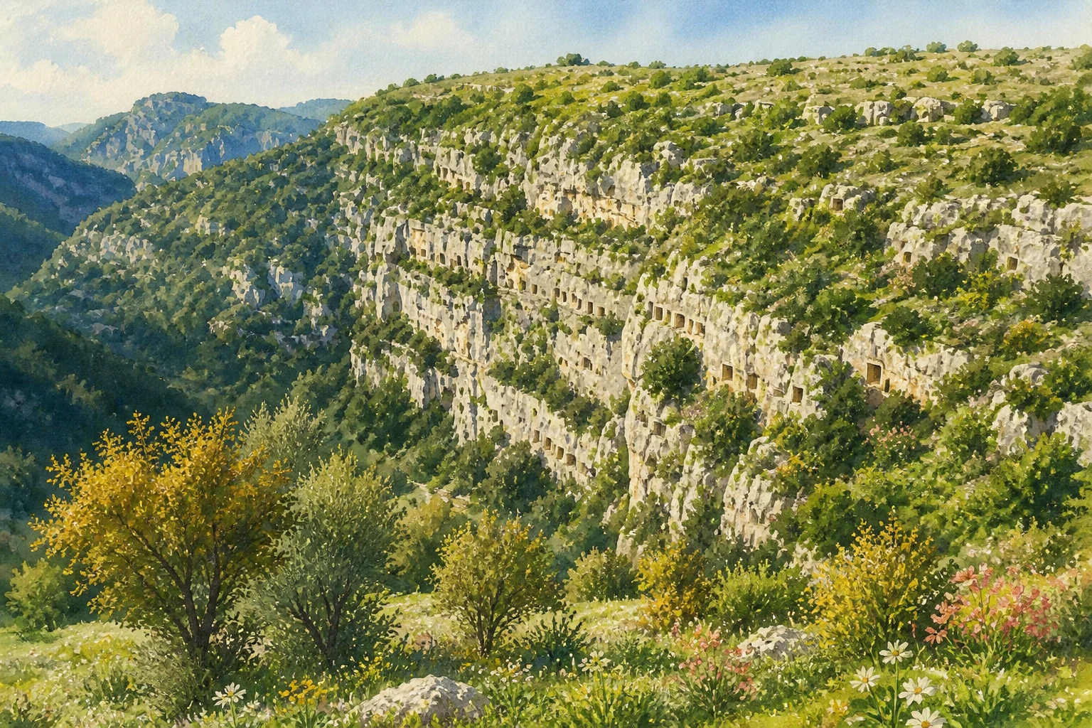
Pantalica occupies a long limestone spur where the Calcinara valley meets the Anapo valley, between the territories of Ferla and Sortino. UNESCO describes more than five thousand tombs distributed along a ridge roughly 1,200 metres long and 500 metres wide. The oldest major groups belong to the late Bronze Age; later cemeteries, Greek-period transformations and Byzantine rock settlements record repeated changes in the use of the same defensible terrain.
The site cannot be reduced to a single viewpoint or a single 'necropolis'. Its burial areas differ in date, density and position; the Anaktoron stands on the plateau rather than in the cliff; Christian villages occupy other cavities; and the river reserve extends far beyond the archaeological core. A complete reading therefore separates the ten principal landscapes instead of treating Pantalica as one spectacular photograph.
The selection
Ten landscapes,
one rock city
The sequence begins at the Ferla-side threshold, crosses the plateau to its exceptional stone building, distinguishes the principal necropolises, descends into the Byzantine layers and finishes with the rivers, karst environment and former railway corridor that make Pantalica a living protected landscape.
- 01Sella di Filiporto and the Pantalica Gate
- 02The Anaktoron
- 03The North-West Necropolis
- 04The North Necropolis and Calcinara View
- 05The Cavetta Necropolis
- 06Filiporto and the South Necropolis
- 07San Micidiario, San Nicolicchio and the Grotta del Crocifisso
- 08The Anapo Valley
- 09The Calcinara Canyon and Karst Cavities
- 10The Former Railway and the Two Gateways
The narrow western threshold of a natural fortress
Sella di Filiporto and the Pantalica Gate
The Ferla approach reveals why the plateau was defensible and how later walls formalised its most accessible entrance.

The place today
The road from Ferla reaches the broad saddle known as Sella di Filiporto before continuing onto the Pantalica plateau. On either side, the ground falls toward deeply cut valleys; paths branch toward the Filiporto necropolis, Byzantine cavities and the central ridge. Low stone remains near this approach are easy to overlook because the power of the setting comes from the relationship between a narrow land entrance and the surrounding ravines rather than from a tall surviving monument.
The historical chapter
Communities settling Pantalica in the later second millennium BC exploited a spur already protected on most sides by the Anapo and Calcinara canyons. The nomination dossier identifies fortifications at the Pantalica Gate among the visible evidence associated with the period of Greek colonisation, when access and control of the plateau were reorganised. The present remains should therefore not be imagined as an intact prehistoric gateway: they belong to a landscape whose defensive use changed over time.
What to notice
- The saddle's comparatively gentle approach between much steeper canyon edges
- Low masonry and cut-rock traces rather than a reconstructed monumental gate
- The way paths toward necropolis, plateau and valley separate from the same threshold
A singular stone building on the central ridge
The Anaktoron
The so-called Prince's Palace is the clearest surviving architectural trace of the settlement that once occupied the plateau.

The place today
The Anaktoron survives as a compact rectangular ground plan of large, carefully fitted stone blocks on the plateau's median ridge. Several rooms can be traced, including the substantial southern chamber and a regular row along the western side. Its low walls demand close attention: the importance lies in the unusual plan, masonry and commanding position, not in scenic height. The surrounding open ground also helps distinguish this building from the cliff tombs below.
The historical chapter
Traditionally called the palace of the anax or 'Prince's Palace', the structure belongs to the late Bronze Age settlement. Paolo Orsi identified evidence connected with bronze working, including fragments and casting material, within the building. Its regular rooms and megalithic construction encouraged comparisons with Aegean-Mycenaean architecture, but the safest interpretation is cultural contact or technical influence rather than a claim that Pantalica was a transplanted Mycenaean court. Byzantine occupants later altered and reused the ancient remains.
What to notice
- The precise rectangular rooms defined by large blocks rather than cave excavation
- Its central position above the valleys and apart from the burial cliffs
- Differences between original masonry, later adaptation and modern consolidation

Early tomb groups above the western approaches
The North-West Necropolis
Around six hundred chambers preserve one of the earliest great burial concentrations at Pantalica.

The place today
The north-western slopes carry clusters of small artificial caves, often arranged in compact groups across ledges and rock faces. Vegetation, weathering and the angle of light can make individual openings appear and disappear as the route changes elevation. The chambers are usually modest and were never meant to read like temple façades; their cumulative number and difficult placement create the monument.
The historical chapter
The UNESCO nomination dossier assigns roughly six hundred tombs to the North-West Necropolis and dates the oldest groups principally to about the twelfth and eleventh centuries BC, within the early Pantalica sequence. Burial was by inhumation. Bodies and grave goods once occupied chambers that were reopened for successive depositions, while later disturbance and looting separated many objects from their original contexts. The surviving rock pattern is therefore both cemetery and incomplete archaeological archive.
What to notice
- Groups of openings related to one another rather than an even decorative grid
- Small entrances leading to chambers whose internal form is not visible from the path
- Natural fissures and karst holes that must not be confused automatically with tombs
The largest concentration above the northern canyon
The North Necropolis and Calcinara View
About fifteen hundred tombs turn the limestone wall above the Calcinara into Pantalica's most extensive funerary landscape.

The place today
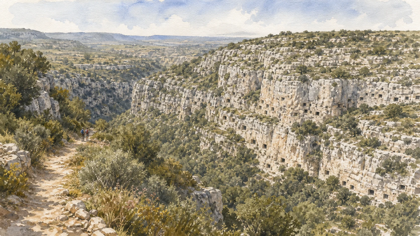
From northern viewpoints and descending paths, hundreds of dark openings puncture pale rock above the Calcinara. The canyon is narrow, vegetated and visually complex: some tombs sit high on sheer faces, others occupy terraces closer to the path, and still others are concealed by shrubs. This density makes the relationship between settlement plateau, cemetery slope and watercourse especially clear.
The historical chapter
With approximately fifteen hundred chambers, the North Necropolis is the largest of Pantalica's principal burial groups. The UNESCO dossier places much of it around 1200–1100 BC, contemporary with the oldest north-western concentration. Tomb form and grave goods helped archaeologists define the Pantalica North cultural phase, marked by burnished red ceramics, bronze tools and ornaments, and connections that reached beyond the local valleys. The cliff preserves the demographic scale of a centre whose houses have disappeared.
What to notice
- Changes in tomb density across separate rock bands and terraces
- The extreme vertical distance between some chambers and the modern path
- Calcinara water and vegetation forming part of the archaeological view, not a backdrop
Later burials crossed by a modern road cutting
The Cavetta Necropolis
Cavetta concentrates several hundred tombs and exposes how ancient chambers, Byzantine reuse and modern access intersect.

The place today
Along the road cutting through the plateau, tomb openings occur at different heights in the vertical limestone. Some are approached from short paths while others remain suspended above the carriageway. A Byzantine rock oratory and traces of later habitation add another chronological layer. The modern cut provides unusual visibility but also reminds the visitor that today's route is not an ancient neutral viewpoint.
The historical chapter
The nomination dossier counts about three hundred tombs in the Cavetta group and associates much of it with the later ninth- and eighth-century-BC expansion, alongside Filiporto and sectors of the South Necropolis. The cemetery thus belongs to a renewed period shortly before Greek Syracuse transformed the political geography of south-eastern Sicily. In late antiquity and the Byzantine era, selected cavities were enlarged or repurposed for dwelling and worship, changing their entrances and interiors.
What to notice
- Tombs revealed in section by the road and others still embedded in continuous cliff
- Entrances modified by later occupation rather than preserved in one ancient state
- The close passage from open plateau to confined rock corridor
The last great flowering before Syracuse
Filiporto and the South Necropolis
Later burial fields show Pantalica expanding and reorganising during the centuries immediately before Greek colonisation.

The place today
The Filiporto side descends from the western saddle, while the South Necropolis spreads across cliffs overlooking the Anapo. Together they are too extensive to read from one stop. Different paths reveal separate clusters, rock-cut chambers and long views toward the river valley. At sunset the openings become especially visible, but uneven ground and exposed edges require attention before photography.
The historical chapter
The UNESCO dossier identifies about five hundred tombs at Filiporto and a much larger, multi-phase South Necropolis. Central southern groups belong to the older Pantalica North horizon; other sections expanded during the ninth and eighth centuries BC, when the settlement experienced renewed prosperity. The foundation of Syracuse in 733 BC did not erase Pantalica in a single event, but it progressively altered inland networks, settlement and power. The burial sequence is evidence for that transition rather than a simple end date.
What to notice
- Older and later sectors sharing one broad southern landscape
- Chambers placed on both sides of routes descending toward the Anapo
- The geographical line toward the coast where Greek Syracuse would emerge
Three Christian communities inside an older rock landscape
San Micidiario, San Nicolicchio and the Grotta del Crocifisso
Rock churches and neighbouring dwellings record Pantalica's substantial reoccupation in late antiquity and the Byzantine period.

The place today
The three principal Byzantine nuclei are distributed rather than grouped into one monument. San Micidiario combines an oratory with cavities of a larger rock village; San Nicolicchio preserves a small worship space on another slope; the Grotta del Crocifisso contains two chambers and faint painted remains. Access and visibility vary, and surviving colour can be extremely fragile. The value of each church lies in its settlement context as much as in isolated fresco fragments.
The historical chapter
After the protohistoric centre declined, Pantalica was occupied again during late antiquity and the Byzantine centuries. Existing tombs and natural cavities offered shelter, but inhabitants also cut new rooms and organised villages around oratories. Christian images and spatial arrangements transformed a funerary landscape into one of worship and daily life. The regional archaeological park identifies these three villages explicitly; later reuse, erosion and past disturbance make their dates and functions more complex than the convenient label 'Byzantine caves' suggests.
What to notice
- Clusters of domestic cavities around a worship space rather than solitary hermit caves
- Very faint painted surfaces that should never be touched or lit aggressively
- Cut benches, apses and altered doorways distinguishing later Christian use from older tombs

Water, plane trees and the southern boundary of the plateau
The Anapo Valley
The Anapo is both a protected river ecosystem and the geographical structure that made Pantalica defensible.

The place today
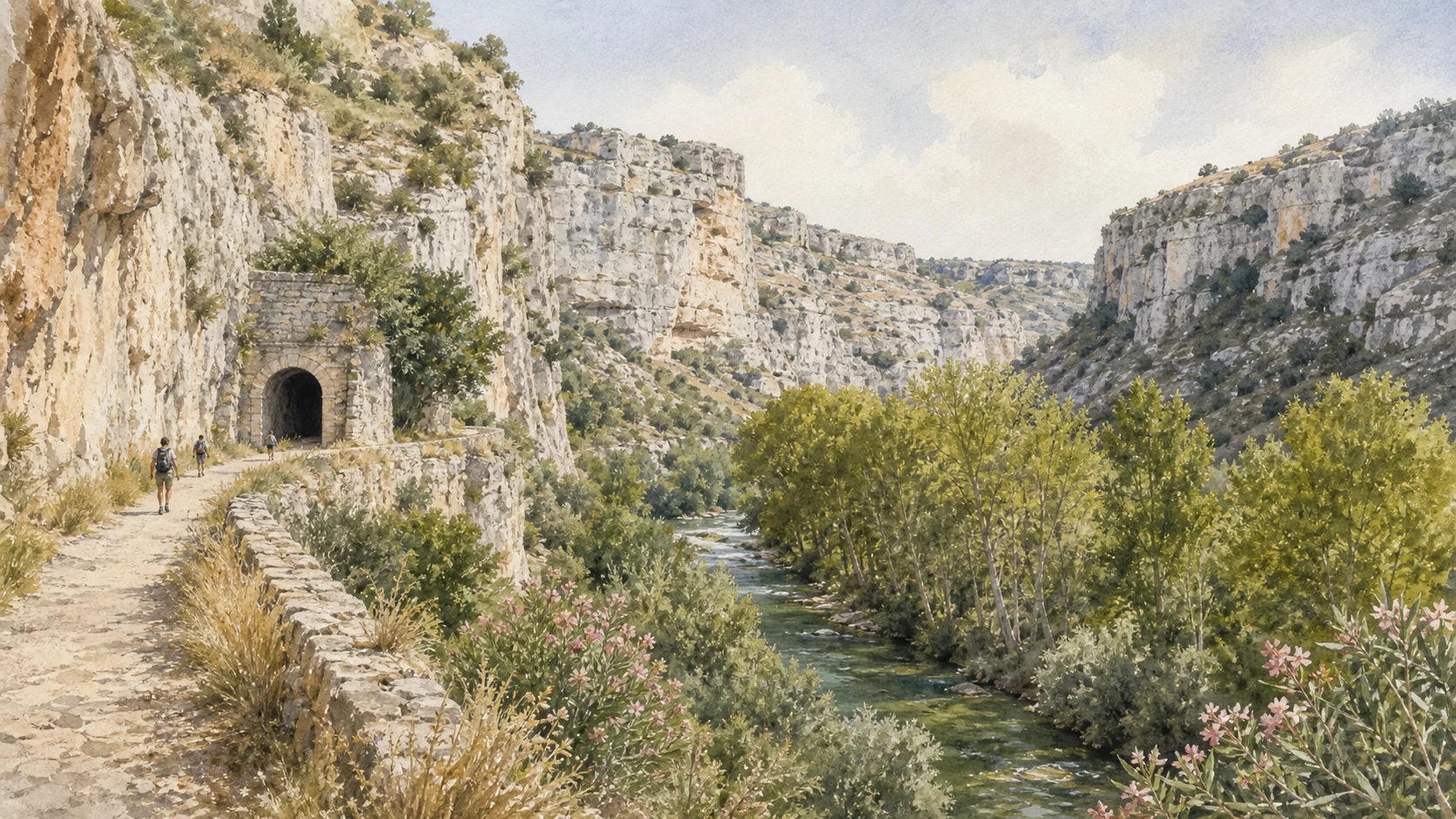
Below the southern cliffs, the Anapo follows a shaded valley of oriental plane trees, willows, poplars and wetland vegetation. Its course alternates between enclosed sections, small open spaces and infrastructure inherited from the former railway. Birdlife, amphibians and river plants can be as present as archaeology. Seasonal water, fallen trees, fire risk and maintenance work can change which parts of the valley are safely accessible.
The historical chapter
The river cut one of the two principal canyons isolating the Pantalica spur. It supplied a wider landscape of movement and subsistence while cliffs above carried the South Necropolis. In the modern period, the valley became a transport corridor for the narrow-gauge railway between Syracuse and the inland Hyblaean towns; after closure, parts of that alignment became a path. The 1997 nature reserve protects humid biocenoses, spontaneous oriental plane and other species as well as the archaeological environment.
What to notice
- Oriental plane trunks and water-loving vegetation close to the riverbed
- Tomb cliffs visible intermittently through a dense valley canopy
- Railway structures showing a modern layer of movement through the ancient landscape
The northern river, springs and a limestone world shaped by water
The Calcinara Canyon and Karst Cavities
Calcinara reveals the geological process underlying both natural caves and the human excavation of thousands of chambers.

The place today
The Calcinara flows through the narrower northern gorge below the North Necropolis. Clear water, steep pale rock, riparian plants and shaded pools create a different scale from the open plateau. Natural cavities appear among the cliffs, including habitats used by bats; the reserve specifically notes the Grotta dei Pipistrelli. River access may involve steep descents, slippery surfaces and temporary restrictions, so the view from above remains a legitimate part of the visit.
The historical chapter
Water acting on permeable limestone created joints, cavities, springs and the deeply incised canyon. Human communities worked within that geology, selecting rock faces for tomb chambers and later adapting caves for habitation and worship. The reserve protects the Calcinara together with the Anapo and Cava Grande because the waterways support wet habitats and species that cannot be separated from the archaeological scenery. Not every opening is therefore cultural, and not every natural cave is safe or open to visitors.
What to notice
- Differences between irregular karst hollows and deliberately cut rectangular entrances
- Water-loving plants at valley level versus dry Mediterranean vegetation above
- The North Necropolis occupying the same limestone mass shaped by the river
A modern valley route connecting Ferla-side and Sortino-side readings
The Former Railway and the Two Gateways
The abandoned railway corridor and the distinct approaches from Ferla and Sortino explain why Pantalica requires route planning, not a single pin on a map.

The place today
The former Syracuse–Ragusa–Vizzini railway alignment follows long sections of the Anapo valley through cuttings, tunnels, bridges and the area of Pantalica station. Above it, Ferla offers the clearest approach to Filiporto and the plateau; Sortino approaches the northern and river landscapes from another direction. These gateways are not interchangeable entrances to a compact park. Distances, elevation and any closures determine which archaeological groups can sensibly be combined.
The historical chapter
The railway brought a new engineered line through a territory previously organised by rivers, ridges and footpaths. After rail service ended, its relatively gentle gradient supported walking and cycling access within the reserve, while bridges and tunnels became part of the protected modern landscape. Official notices show that individual structures can be closed or reopened independently. The route should therefore be understood historically and checked operationally rather than promoted as a permanently uninterrupted trail.
What to notice
- Tunnel portals, retaining walls and bridgework belonging to the industrial-age corridor
- The contrast between the valley's gentle rail gradient and steep archaeological paths
- Direction signs and official notices distinguishing the Ferla, Sortino and station sectors
The city through time
Ten dates for orientation
A chronology from the late Bronze Age settlement through later cemeteries, Greek transformation, Byzantine return, archaeological research, environmental protection and World Heritage recognition.
A major settlement develops on the defensible Pantalica plateau at the beginning of the cultural sequence conventionally called Pantalica North.
The North and North-West necropolises expand; thousands of rock-cut chambers preserve the most visible evidence for the early community.
The Cassibile cultural phase links the older Pantalica North horizon to the renewed southern and western burial landscapes.
Filiporto, Cavetta and large sectors of the South Necropolis document a new period of prosperity and funerary activity.
The Corinthian foundation of Syracuse begins a long reorganisation of settlement, exchange and political power between the coast and inland south-eastern Sicily.
Pantalica is substantially reoccupied; rock villages and oratories develop at San Micidiario, San Nicolicchio and the Grotta del Crocifisso.
Paolo Orsi systematically investigates the necropolises and Anaktoron, creating the archaeological sequence and recovering materials now held in Syracuse.
The narrow-gauge railway through the Anapo valley introduces tunnels, bridges and Pantalica station into the canyon landscape.
The Sicilian Region establishes the Pantalica, Valle dell'Anapo and Torrente Cava Grande oriented nature reserve, today covering 3,712.07 hectares.
UNESCO inscribes Syracuse and the Rocky Necropolis of Pantalica on the World Heritage List under criteria ii, iii, iv and vi.
Before your visit
Practical information,
without turning it into promises
Choose a side first
Ferla and Sortino lead to different sectors. Decide whether the priority is the plateau and Filiporto, the North Necropolis and Calcinara, or the Anapo railway corridor before setting out.
Check the same day
Archaeological access, reserve paths, bridges and tunnels can be restricted separately because of weather, fire danger, maintenance or conservation. Consult both the Archaeological Park and reserve authorities.
Expect real terrain
Many routes include exposed limestone, steep descents, limited shade and slippery river sections. Carry water, use suitable footwear and do not enter unmarked tombs or caves.
Protect the evidence
Do not touch paintings, climb façades, move stones or leave marked paths. Rock chambers are archaeological contexts and some natural caves are wildlife habitats, not informal shelters.
Sources
The guide uses the UNESCO World Heritage description and nomination dossier for the property's extent, five necropolises and archaeological sequence; the Sicilian Region's Archaeological Park for the official account of the Anaktoron, material culture and Byzantine villages; the regional ORBS portal and reserve decree for geology, biodiversity, protection date and area; regional access notices for the former railway; and the municipalities of Ferla and Sortino for the two local gateways and museum context.
- UNESCO World Heritage Centre · Syracuse and Pantalica ↗
- UNESCO · Pantalica nomination dossier ↗
- Sicilian Region · Archaeological Park, Pantalica ↗
- Sicilian Region · Pantalica visitor information ↗
- Sicilian Region · Pantalica and Anapo Nature Reserve ↗
- Sicilian Region · Reserve establishment decree ↗
- Municipality of Ferla · Gateway to Pantalica ↗
- Municipality of Sortino · Antiquarium and Pantalica finds ↗
The hero image is an illustration, not a photograph or archaeological reconstruction. Tombs and painted surfaces are fragile; paths, river crossings, tunnels, bridges, fire restrictions, opening arrangements and guided access can change. Check the linked regional authorities shortly before visiting and follow instructions on site.