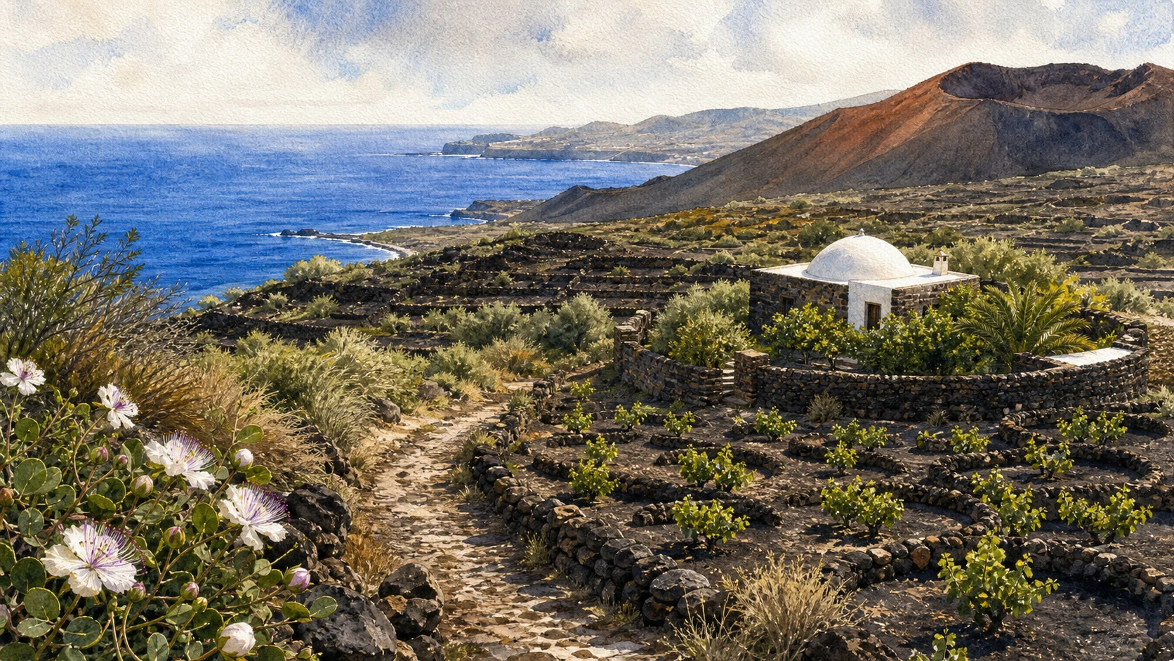
Documentary watercolour of Pantelleria with terraced alberello vineyards, a white-domed dammuso, black lava ridges and the blue Mediterranean

Illustrated guide · Sicily

An island shaped
by fire and wind

Eighteen chapters through a volcanic island where Bronze Age walls, Punic routes, thermal water, dry-stone farming and African weather belong to one landscape.

Explore the places
Pantelleria · volcano, archaeology and cultivated stone

The island between Sicily and Africa

Pantelleria is not a detached beach chapter.

Its black rock rises from the route between Sicily and North Africa, and almost every part of island life answers that position: fortified Bronze Age settlement, Punic and Roman occupation, coastal watchfulness, low houses built against the wind, cisterns that conserve water and vines trained close to the ground.

To move through Pantelleria is to alternate sea and interior. A thermal lake occupies a volcanic depression; fumaroles breathe among mountain paths; terraced fields continue into lava flows; small harbours and bathing places depend on weather more than on postcard seasons.

This guide therefore treats archaeology, agriculture and geology as one long human adaptation to an active island.

One destination

Pantelleria,
a volcanic cultural landscape.

Pantelleria is the emerged part of a volcanic system in the Strait of Sicily. Caldera structures, lava domes, obsidian, fumaroles and thermal springs explain the island's terrain, while its position made it a strategic stop along Mediterranean routes from prehistory to the modern period.

Human occupation did not flatten that geology. The fortified village of Mursia and its megalithic sesi, the Punic and Roman acropolis, rural cisterns, dammusi, gardens and thousands of dry-stone terraces all use local rock to manage defence, heat, wind, soil and scarce water.

The selection

Eighteen chapters,
one volcanic island

The route moves from the volcanic interior to prehistoric and Punic sites, then follows settlements, rural architecture, cultivated terraces and the coast. The chapters are grouped so that nearby places can be visited together rather than treated as isolated stops.

  1. 01The Volcanic Island and Its Calderas
  2. 02Lake Venus and the Thermal Basin
  3. 03Montagna Grande and Kuddia Mida
  4. 04Benikulà, Favara Grande and the Breathing Ground
  5. 05Gelfiser and Khaggiar Lava Landscapes
  6. 06Mursia and the Bronze Age Fortified Village
  7. 07The Sesi of Cimillia
  8. 08San Marco and Santa Teresa: The Punic-Roman Acropolis
  9. 09Castello Barbacane and the Archaeological Museum
  10. 10Pantelleria Town, Port and Rebuilt Centre
  11. 11Khamma, Tracino, Scauri and the Contrade
  12. 12Dammusi, Cisterns and Pantescan Gardens
  13. 13Dry-Stone Walls and Terraced Ground
  14. 14Alberello Vines and Zibibbo
  15. 15Capers, Citrus and the Rural Calendar
  16. 16Punta Spadillo, Laghetto delle Ondine and Gadir
  17. 17Arco dell'Elefante, Nikà and the Southern Cliffs
  18. 18War, Airfield and Modern Island Memory
01

A landscape of domes, flows, depressions and secondary activity

The Volcanic Island and Its Calderas

Pantelleria's roads and settlements occupy the visible structure of a volcano rather than a neutral island surface.

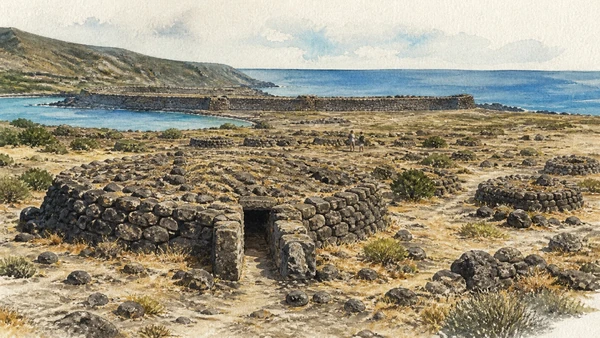
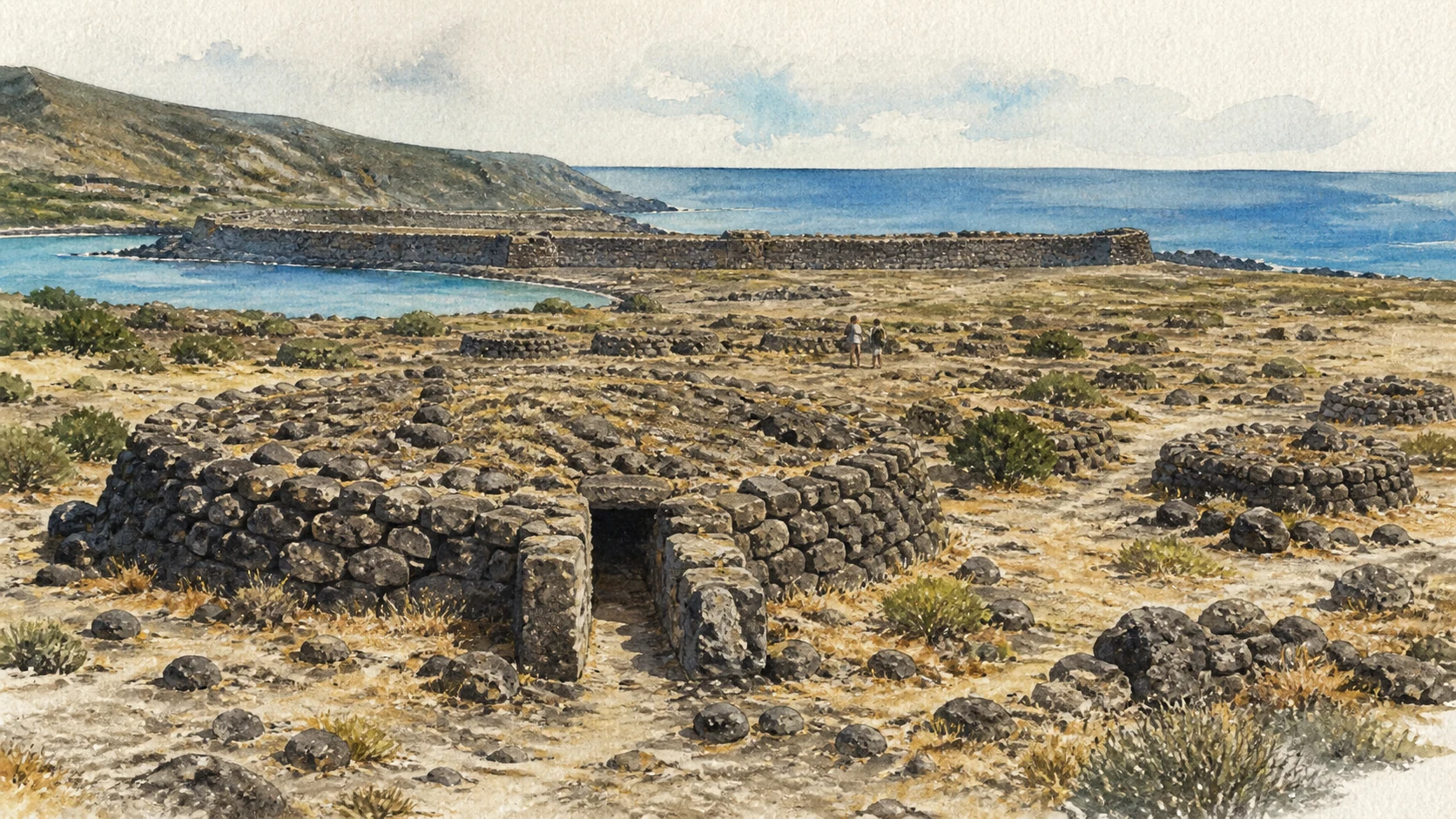
Documentary watercolour of a low Pantellerian sese, smaller burial mounds and the fortified Bronze Age settlement of Mursia above the sea
Mursia and Cimillia · settlement in volcanic stone

The place today

From elevated roads, the island reads as overlapping ridges, rounded volcanic heights, old flows and cultivated depressions. Dark rock changes colour with oxidation and lichen; marine cliffs expose successive materials, while thermal springs and fumaroles show that heat still reaches the surface.

The historical chapter

Volcanic phases created the large caldera and later eruptive centres that organise the modern terrain. Obsidian made Pantelleria part of prehistoric exchange networks, while later communities selected stable shelves, defensible promontories and deeper soils within the same geological framework.

What to notice

  • Changes from glassy black lava to red and yellow altered rock
  • How roads bend around domes and older flow fronts
Pantelleria National Park · Geosites and trails
02

Water, heat and endemic plants inside a volcanic depression

Lake Venus and the Thermal Basin

The Specchio di Venere is simultaneously a lake, a thermal system, a bird stop and a fragile habitat.

Documentary watercolour of a low Pantellerian sese, smaller burial mounds and the fortified Bronze Age settlement of Mursia above the sea
Mursia and Cimillia · settlement in volcanic stone

The place today

The blue-green basin sits only slightly above sea level and is fed by rain and thermal springs. Reed and salt-tolerant plant communities occupy changing margins, while migratory birds use the water as a resting place. Visitor pressure is most visible along the accessible southern and eastern shore.

The historical chapter

The lake formed within a volcanic depression rather than a coastal lagoon. Archaeological material around the basin shows that it was not separate from settlement and movement, but its modern importance lies equally in conservation: endemic plants and shallow thermal margins are vulnerable to trampling and intensive bathing.

What to notice

  • The thermal spring area on the south-eastern margin
  • Seasonal changes in water level, vegetation and bird presence
Pantelleria National Park · Lake Venus itinerary
03

Forest, high viewpoints and fumaroles above the cultivated island

Montagna Grande and Kuddia Mida

Pantelleria's highest sector carries woodland, mountain paths and visible secondary volcanic activity.

Documentary watercolour of a low Pantellerian sese, smaller burial mounds and the fortified Bronze Age settlement of Mursia above the sea
Mursia and Cimillia · settlement in volcanic stone

The place today

Trails from Sibà enter pine, holm-oak scrub and higher vegetation before reaching broad views over the Gelfiser flow, Lake Venus and the coast. At Kuddia Mida, coloured ground and weak vapour emissions make the island's residual heat perceptible without spectacle.

The historical chapter

The mountain became a refuge for vegetation and a strategic observation point while lower depressions were intensively cultivated. Modern forestry, firebreaks and paths have altered parts of the cover, so today's green summit is both natural habitat and managed landscape.

What to notice

  • The transition from dry maquis to cooler woodland
  • Weather and cloud changing visibility within minutes
Pantelleria National Park · Montagna Grande itinerary
04

Natural steam and old paths through the southern interior

Benikulà, Favara Grande and the Breathing Ground

A rock shelter used as a natural sauna and the Favare vents reveal how islanders approached volcanic heat.

Documentary watercolour of a low Pantellerian sese, smaller burial mounds and the fortified Bronze Age settlement of Mursia above the sea
Mursia and Cimillia · settlement in volcanic stone

The place today

The Grotta di Benikulà, often called Bagno Asciutto, releases warm humid air within a modest rock cavity. Farther across the Zighidì-Favare routes, vapour escapes from fractures among scrub and terraced fields. Neither place is a controlled spa environment.

The historical chapter

Local use transformed natural phenomena into practical knowledge without monumental architecture. Routes between Sibà, Monastero, Zighidì and Tracino also linked farm plots and contrade; the thermal stops belong to that working network rather than to a separate resort tradition.

What to notice

  • Condensation and slippery rock inside the cavity
  • Wind direction changing how fumaroles are perceived
Pantelleria National Park · Zighidì, Sauna and Favare
05

Young-looking stone crossed by paths, walls and cultivated pockets

Gelfiser and Khaggiar Lava Landscapes

The island's lava fields are not empty wilderness: they hold vegetation, cisterns, routes and rural buildings.

Documentary watercolour of a low Pantellerian sese, smaller burial mounds and the fortified Bronze Age settlement of Mursia above the sea
Mursia and Cimillia · settlement in volcanic stone

The place today

Jagged flows, fractures and small canyons appear especially clearly around Gelfiser and Khaggiar. Pioneer plants establish colour in protected cracks, while old mule tracks and dry walls find narrow passages through ground that resists regular cultivation.

The historical chapter

Successive eruptions created surfaces of different ages and fertility. Islanders learned to distinguish unworkable stone from pockets where transported soil, shelter and painstaking wall construction could support vines or capers, producing the close interweaving of geology and agriculture visible today.

What to notice

  • Pioneer plants occupying cracks before deeper soil develops
  • Cisterns and walls placed where the lava permits construction
Pantelleria National Park · Kaggiar itinerary
Documentary watercolour of a low Pantellerian sese, smaller burial mounds and the fortified Bronze Age settlement of Mursia above the sea
Mursia and Cimillia · settlement in volcanic stoneThe low sese, fortified village edge and dark coastal rock are shown at human scale, without turning Pantelleria's Bronze Age landscape into a monumental fantasy.
06

Houses and a massive wall facing the passage to Africa

Mursia and the Bronze Age Fortified Village

Mursia preserves one of Pantelleria's clearest early settlements on the north-western coast.

Documentary watercolour of a low Pantellerian sese, smaller burial mounds and the fortified Bronze Age settlement of Mursia above the sea
Mursia and Cimillia · settlement in volcanic stone

The place today

Low oval house plans occupy the seaward shelf behind a thick fortification built from large volcanic blocks. The site remains exposed to wind and salt, and its relationship to the coast is easier to understand from the perimeter than by imagining a reconstructed village.

The historical chapter

The settlement flourished in the Bronze Age, generally placed in the early second millennium BC. Its community participated in Mediterranean contacts and used a strongly defended position; nearby, the necropolis developed a distinct megalithic funerary architecture in the form of the sesi.

What to notice

  • The scale and curved course of the fortification wall
  • House clusters organised inside a limited defended surface
Sicilian Region · Archaeological island of Pantelleria
07

Megalithic tombs built as low stone mounds

The Sesi of Cimillia

The sesi form a funerary landscape beside Mursia rather than a collection of mysterious isolated monuments.

Documentary watercolour of a low Pantellerian sese, smaller burial mounds and the fortified Bronze Age settlement of Mursia above the sea
Mursia and Cimillia · settlement in volcanic stone

The place today

The largest preserved mounds are constructed from concentric or layered dry-stone masses with narrow passages leading to burial cells. Their low profiles merge into the rough volcanic ground, and several are fragmentary enough to require careful reading.

The historical chapter

The necropolis served the Bronze Age community of Mursia. The monuments demonstrate collective labour and an expert command of dry construction centuries before the island's later rural walls and dammusi; formal resemblance does not mean every pantescan stone building had the same function or date.

What to notice

  • Narrow access passages within a much larger stone mass
  • The visual relationship between tombs, fortification and sea
Sicilian Region · Mursia and the sesi
08

Terraces controlling the port and the northern plain

San Marco and Santa Teresa: The Punic-Roman Acropolis

The two hills preserve urban, defensive and residential evidence from Punic and Roman Cossyra.

Documentary watercolour of a low Pantellerian sese, smaller burial mounds and the fortified Bronze Age settlement of Mursia above the sea
Mursia and Cimillia · settlement in volcanic stone

The place today

Walls, cisterns, terraces and building remains spread across the heights above Pantelleria town. The site is extensive and uneven; views toward the port explain its strategic position more immediately than any single surviving structure.

The historical chapter

Punic occupation organised the acropolis with strong water-storage and defensive systems. After Rome took the island during the First Punic War, the settlement continued and changed; celebrated imperial portrait heads found here are evidence of Roman public representation, not proof that the entire visible site belongs to one phase.

What to notice

  • Bell-shaped cistern mouths and water-management traces
  • Different masonry and terraces belonging to successive phases
Sicilian Region · Acropolis of San Marco
09

A coastal stronghold reused as the island's historical archive

Castello Barbacane and the Archaeological Museum

The castle links medieval and early-modern defence to archaeological finds from across Pantelleria.

Documentary watercolour of a low Pantellerian sese, smaller burial mounds and the fortified Bronze Age settlement of Mursia above the sea
Mursia and Cimillia · settlement in volcanic stone

The place today

The dark compact fortress stands beside the modern harbour and contains exhibition spaces whose displays may change. Its masonry and enclosed court contrast with the open archaeological landscapes of Mursia and San Marco.

The historical chapter

The building accumulated defensive phases under successive Mediterranean powers and later served administrative and custodial uses. Its museum role gathers objects displaced from their findspots, including material that helps connect prehistoric, Punic and Roman Pantelleria to wider trade and political systems.

What to notice

  • Volcanic masonry adapted through repeated repairs
  • How portable finds restore colour and chronology to low ruins
Municipality of Pantelleria · Cultural heritage
10

The island's principal arrival point shaped by war and reconstruction

Pantelleria Town, Port and Rebuilt Centre

The harbour quarter is a lived service centre, not simply the gateway to rural and coastal scenery.

Documentary watercolour of a low Pantellerian sese, smaller burial mounds and the fortified Bronze Age settlement of Mursia above the sea
Mursia and Cimillia · settlement in volcanic stone

The place today

Ferries, fishing craft, civic buildings, shops and the castle occupy a waterfront repeatedly modified by harbour works. The modern centre is lower and more open than many historic Sicilian towns, while nearby streets still reveal volcanic stone and post-war rebuilding.

The historical chapter

The port inherited the strategic role of ancient Cossyra and later fortified settlements. Heavy bombardment in 1943 damaged the town before the island's surrender, and reconstruction changed its appearance; surviving older fabric must therefore be read beside deliberate modern planning and infrastructure.

What to notice

  • The castle's position relative to the altered harbour edge
  • Post-war street scale beside older volcanic masonry
Municipality of Pantelleria
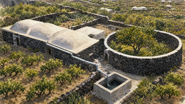
Documentary watercolour of Pantelleria dammusi with domed roofs, rainwater collection, a circular stone citrus garden and low vineyards
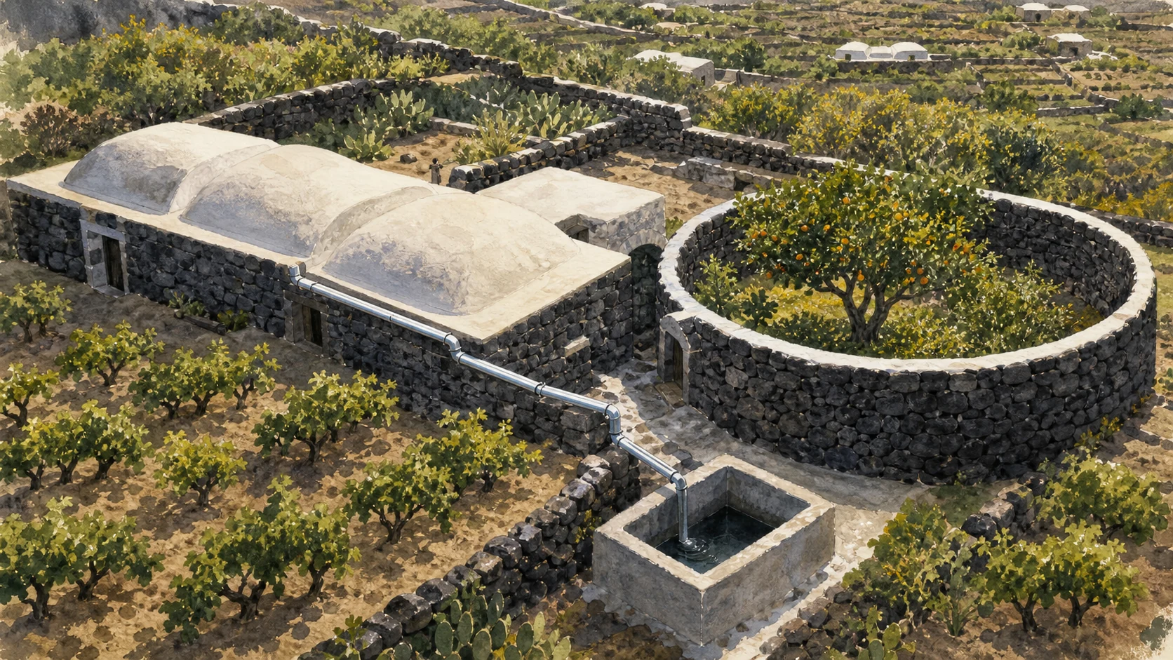
The inhabited countryside · roof, cistern and gardenA dammuso, rainwater channel, cistern, circular citrus garden and low alberello vines explain how domestic architecture and cultivation answer heat, wind and scarce water together.
11

A dispersed island organised through rural neighbourhoods

Khamma, Tracino, Scauri and the Contrade

Pantelleria is not one town with a scenic hinterland; its contrade form a network of distinct inhabited landscapes.

Documentary watercolour of Pantelleria dammusi with domed roofs, rainwater collection, a circular stone citrus garden and low vineyards
The inhabited countryside · roof, cistern and garden

The place today

Khamma and Tracino sit among eastern terraces and domes, while Scauri connects a sheltered south-western settlement to harbour and coastal routes. Sibà, Rekhale, Bukkuram and smaller localities give services, churches and gathering points to a widely dispersed population.

The historical chapter

Dispersed settlement allowed households to remain close to cultivated plots, cisterns and sheltered ground. Toponyms preserve layers of Arabic and later linguistic history, but modern roads, schools and seasonal tourism have altered the practical relationships among the contrade.

What to notice

  • Small civic centres emerging within continuous terracing
  • Different exposure to prevailing winds on the island's sides
Pantelleria National Park · Contrade and places
12

Architecture designed for heat, wind and water scarcity

Dammusi, Cisterns and Pantescan Gardens

The dammuso is a working environmental system of thick walls, domed roofs, collected rainwater and protected cultivation.

Documentary watercolour of Pantelleria dammusi with domed roofs, rainwater collection, a circular stone citrus garden and low vineyards
The inhabited countryside · roof, cistern and garden

The place today

Traditional rural complexes combine thick volcanic walls with pale domed roofs that channel rain toward cisterns. Enclosed circular gardens shelter citrus trees from wind and drought, while terraces and service spaces adapt each building to slope and field.

The historical chapter

The familiar form developed through long local refinement and is strongly associated with the island's Arab-period inheritance, though surviving buildings often contain later rebuilding. Converting dammusi into accommodation can preserve fabric, but it can also obscure agricultural function and water systems.

What to notice

  • Roof profiles directing rain toward cistern channels
  • The contrast between an exposed vineyard and an enclosed citrus garden
Pantelleria National Park · Rural landscape
13

Thousands of small acts of construction holding soil in place

Dry-Stone Walls and Terraced Ground

Walls divide property, slow erosion, create shelter and make steep volcanic ground cultivable.

Documentary watercolour of Pantelleria dammusi with domed roofs, rainwater collection, a circular stone citrus garden and low vineyards
The inhabited countryside · roof, cistern and garden

The place today

Terraces follow contour lines across valleys and coastal slopes. Their walls vary from carefully faced courses to rough field construction, and gaps quickly expose soil to runoff. Paths, plot boundaries and windbreaks are part of the same connected system.

The historical chapter

Generations of farmers moved and reset volcanic stone without mortar, creating infrastructure on an island with limited level ground. UNESCO recognition of the art of dry-stone walling across several countries helps frame the technique, but Pantelleria's patterns remain locally tied to vines, capers and cisterns.

What to notice

  • Drainage spaces within walls rather than sealed masonry
  • Abandoned terraces where vegetation and erosion reveal lost maintenance
Pantelleria National Park · Agricultural landscape
14

A low agricultural form taught, pruned and harvested by hand

Alberello Vines and Zibibbo

The pantescan vine survives close to the ground through a community practice recognised by UNESCO.

Documentary watercolour of Pantelleria dammusi with domed roofs, rainwater collection, a circular stone citrus garden and low vineyards
The inhabited countryside · roof, cistern and garden

The place today

Each vine grows within a shallow hollow that conserves moisture and reduces wind exposure. Low branches are trained outward, and cultivation remains highly manual across small terraced plots. Grapes may become fresh fruit, dried raisins or wines including Passito di Pantelleria.

The historical chapter

The practice embodies accumulated knowledge of drought, wind and volcanic soil. Its 2014 UNESCO inscription recognises the community's techniques and rituals, not a claim that every vineyard is ancient or that one producer represents the whole tradition.

What to notice

  • The hollow around each low vine
  • Hand-built access paths necessary for cultivation and harvest
UNESCO Intangible Heritage · Vite ad alberello of Pantelleria
15

An agricultural island beyond the vineyard image

Capers, Citrus and the Rural Calendar

Capers, olives, citrus and kitchen gardens diversify a difficult farming environment and its seasonal labour.

Documentary watercolour of Pantelleria dammusi with domed roofs, rainwater collection, a circular stone citrus garden and low vineyards
The inhabited countryside · roof, cistern and garden

The place today

Caper bushes root in dry plots and wall edges, producing buds collected repeatedly before flowering. Citrus survives most visibly inside protected gardens, while olives and vegetables occupy suitable pockets. Rural life depends on maintenance outside the short visitor season.

The historical chapter

These crops reflect exchanges across the central Mediterranean and centuries of local selection. Their present reputation supports food culture and small producers, yet abandoned plots and water constraints show why landscape preservation requires active work rather than scenic branding alone.

What to notice

  • Caper plants spreading from field margins and walls
  • Protected microclimates created by enclosures and depressions
Pantelleria National Park · Territory and agriculture
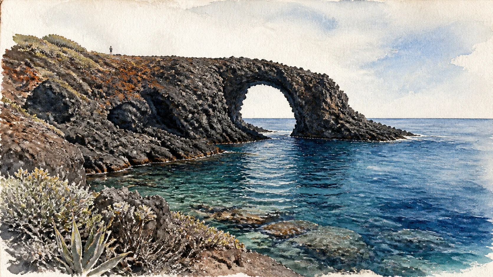
Documentary watercolour of Arco dell'Elefante on Pantelleria, a dark lava headland and natural arch above clear blue water
Eastern coast · lava meeting open waterArco dell'Elefante is kept as a weathered lava headland and natural sea arch, framed by clear water and the island's dry coastal vegetation.
16

A north-eastern coast of lighthouse, lava pools and thermal water

Punta Spadillo, Laghetto delle Ondine and Gadir

Three nearby stops explain how erosion, volcanic rock and springs structure access to the sea.

Documentary watercolour of Arco dell'Elefante on Pantelleria, a dark lava headland and natural arch above clear blue water
Eastern coast · lava meeting open water

The place today

Punta Spadillo's lighthouse marks a stark lava headland; the Ondine pool occupies a natural coastal depression reached on foot; Gadir gathers small basins where thermal water meets the shore. Sea state determines whether any rock platform is safe.

The historical chapter

The lighthouse belongs to modern navigation, while the pools and springs reflect much older geology and local use. Their current popularity has increased pressure on narrow paths and fragile shore edges, making conditions and conservation more important than fixed itinerary promises.

What to notice

  • Basalt forms directing waves into and around the pools
  • The difference between thermal seepage and open-sea temperature
Pantelleria National Park · Coastal localities
17

Sea access defined by rock, exposure and small landing places

Arco dell'Elefante, Nikà and the Southern Cliffs

Pantelleria's coast is a sequence of lava formations and weather-dependent entries rather than a ring of beaches.

Documentary watercolour of Arco dell'Elefante on Pantelleria, a dark lava headland and natural arch above clear blue water
Eastern coast · lava meeting open water

The place today

The elephant-shaped arch is a recognisable eastern lava formation, while Nikà and south-western coves offer warmer water and small platforms beneath steep ground. Balata dei Turchi and remote cliffs require more time, reliable information and cautious access.

The historical chapter

Natural inlets supported fishing, landing and coastal movement long before modern bathing. Names preserve maritime memory, but stories of raids or fleets should not substitute for evidence; the coast's lasting historical fact is its exposure between African and Sicilian routes.

What to notice

  • Landing platforms built into narrow volcanic inlets
  • Wind and swell differing sharply between island exposures
Pantelleria National Park · Coastal places
18

A strategic island reshaped by twentieth-century conflict

War, Airfield and Modern Island Memory

Military remains, the airport and the rebuilt town complete a history too often stopped at Punic Cossyra.

Documentary watercolour of Arco dell'Elefante on Pantelleria, a dark lava headland and natural arch above clear blue water
Eastern coast · lava meeting open water

The place today

Bunkers, road alignments and reused structures appear across the island, while the airport remains essential to transport and emergency connections. Much wartime evidence is dispersed or unsafe to enter and should be observed without trespass.

The historical chapter

Pantelleria became a heavily fortified Italian position during the Second World War and was subjected to intense Allied bombing before surrendering in June 1943. Civilian experience, displacement and reconstruction belong to the island's modern identity alongside the better-known military narrative.

What to notice

  • Fortified structures absorbed into later rural or transport landscapes
  • The distance between military viewpoints and civilian settlement
Municipality of Pantelleria · History and territory

The city through time

Ten dates for orientation

A chronology connecting volcanic formation, prehistoric settlement, Punic and Roman Cossyra, medieval rule, modern agriculture, war and landscape protection.

  1. Obsidian from Pantelleria circulates through central Mediterranean exchange networks long before the fortified settlement at Mursia.

  2. The Bronze Age community of Mursia builds its defended village and the nearby funerary landscape of the sesi.

  3. Punic Cossyra develops as a strategic island community with fortified heights, cisterns and strong links to North Africa.

  4. Rome captures the island during the First Punic War; control changes again before Pantelleria becomes firmly Roman.

  5. Settlement, agriculture and maritime connections continue while political and religious systems around the Strait of Sicily change.

  6. Byzantine, Islamic and Norman-Aragonese phases leave political, linguistic and architectural layers across the island.

  7. A modern museum and archaeological consciousness begin to develop through surveys that draw wider attention to Pantelleria's ancient sites.

  8. Pantelleria surrenders after an intense Allied air and naval campaign; wartime damage shapes the rebuilt town and modern memory.

  9. UNESCO inscribes the traditional agricultural practice of cultivating Pantelleria's vite ad alberello as intangible cultural heritage.

  10. The National Park of the Island of Pantelleria is established, giving unified protection to much of the volcanic and cultivated landscape.

Before your visit

Practical information,
without turning it into promises

01

Plan by exposure

Wind and swell can make one coast unsuitable while another remains calm. Decide sea stops only after checking same-day conditions and local access notices.

02

Treat heat as terrain

Many routes cross dark rock without shade. Carry more water than a map distance suggests, start early and avoid fumarole cavities or remote cliffs when alone.

03

Check heritage access

Mursia, the acropolis, the castle museum and small displays can have seasonal or project-related access. Verify official notices before building the day around an interior.

04

Respect working fields

Terraces, dammusi, cisterns and vineyards are often private and active. Stay on public paths, close gates and do not enter roof terraces or enclosed gardens without permission.

Sources

The guide combines the Pantelleria National Park's route and landscape records, the Sicilian Region's archaeological park for Mursia, the sesi and the acropolis, UNESCO's intangible-heritage record for alberello cultivation, and municipal material for the town and modern island. It distinguishes documented archaeology from traditional interpretation and treats access conditions as variable.

The images are original editorial watercolours, not photographs. Trail openings, thermal areas, museum hours, archaeological access, ferry and flight schedules, fire restrictions and coastal safety can change; consult the linked institutions and current local notices before visiting.