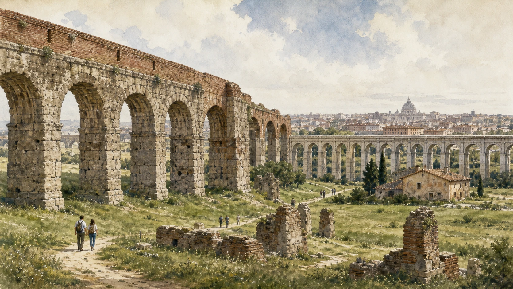
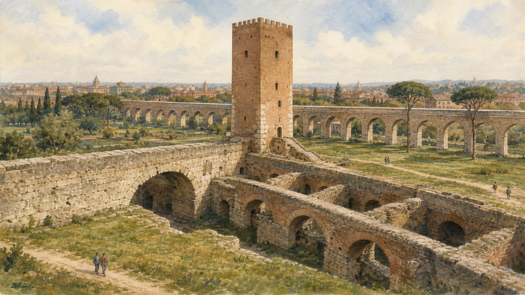
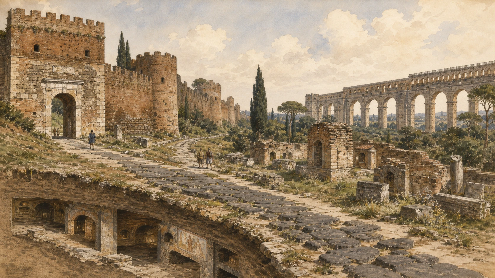
Original documentary watercolour joining Porta San Sebastiano, the Appian paving, underground catacombs and the arches of Aqua Claudia

Rome Guide 15 · Road, burial landscapes and water engineering

The Appian Way,
catacombs
and aqueducts

A full-day archaeological route from the Aurelian gate and Republican tombs to Christian cemeteries, imperial estates and the great water lines crossing Rome's south-eastern countryside.

Plan the route
Appia Antica · Catacombs · Aqueducts10 chapters · two connected landscapes

Why this district matters

This is not one picturesque road but a sequence of infrastructures built for movement, burial, imperial display and water.

The Via Appia began at Porta Capena in 312 BC, long before the Aurelian Wall and its Porta Appia, now Porta San Sebastiano. Outside the Republican city boundary, elite families placed tombs where names and achievements could face travellers. Later cemeteries, villas, farms, churches, towers and defensive enclosures accumulated beside the route. Ancient basalt paving survives in discontinuous stretches and has been repeatedly repaired; a straight-looking lane lined with ruins is therefore a historical landscape, not an intact frozen Roman street.

The catacombs of Saint Callixtus and Saint Sebastian were burial places and places of commemoration. They were not secret cities where all Christians hid from persecution. Galleries expanded because burial beyond the walls was normal, land was valuable and workable tuff allowed vertically organised cemeteries. At Callixtus, separate hypogea were joined under church administration; at Saint Sebastian, quarries, pagan mausoleums, Christian galleries, apostolic memory and a Constantinian basilica occupy different levels and dates.

The Park of the Aqueducts and Tor Fiscale form a second landscape east of the Appian road. Aqua Marcia, Aqua Claudia, Anio Novus and later Acqua Felice cross or reuse the same countryside, but they did not all carry water in one channel or belong to one period. Reaching them from the Appian monuments normally requires a deliberate transfer by bus, taxi or bicycle. Treating the two areas as one effortless continuous walk conceals distance, modern roads and the time needed for controlled underground visits.

Build the day around reservations first, then decide whether to continue far along the Appia or transfer to the aqueduct parks. The strongest reading comes from separating each system before connecting them across Rome's southern plain.

The route

Plan your visit

Start at Porta San Sebastiano and the Tomb of the Scipios, then use public transport or a measured walk to the catacomb zone. Continue past Saint Sebastian to the Villa of Maxentius, Cecilia Metella, Capo di Bove and—if time and ticketing allow—the Villa of the Quintili. The Aqueducts and Tor Fiscale are a separate final sector reached by transfer, not a casual extension of the same pedestrian line.

Morning I

Wall and Republican memory

Read Porta San Sebastiano as a late Roman intervention across an older road, then enter the Scipio tomb only with the current civic booking arrangement.

Morning II

Christian cemeteries

Reserve one catacomb carefully; attempting both guided systems can consume the middle of the day and should never be assumed without matching times.

Afternoon I

Imperial and medieval Appia

Compare Maxentius's dynastic complex with Cecilia Metella's older tomb, the Caetani fortress and the excavated estate at Capo di Bove.

Afternoon II

Villa or aqueduct transfer

Choose the Villa of the Quintili for a deep Appian continuation, or transfer to the Aqueducts and Tor Fiscale; doing both requires long summer hours and disciplined transport.

Ten chapters

Explore the places

The route follows the Appia south from wall and tombs to catacombs and imperial estates, then transfers east to the aqueduct landscape. Use the index to revisit one chapter without collapsing distinct roads, cemeteries, villas and water systems into a single picturesque ruin.

  1. 01Porta San Sebastiano and the Museo delle Mura
  2. 02The Tomb of the Scipios
  3. 03The Catacombs of Saint Callixtus
  4. 04Saint Sebastian: catacomb and basilica
  5. 05The Villa and Circus of Maxentius
  6. 06Cecilia Metella and the Caetani fortress
  7. 07Capo di Bove and the Appian paving
  8. 08The Villa of the Quintili and Santa Maria Nova
  9. 09The Park of the Aqueducts
  10. 10Tor Fiscale and the water intersections
01

A third-century gate and wall museum stand across a road already six centuries old

Porta San Sebastiano and the Museo delle Mura

The gate introduces the Appia by showing how late Roman defence, medieval use and modern museum interpretation altered an older route.

Today

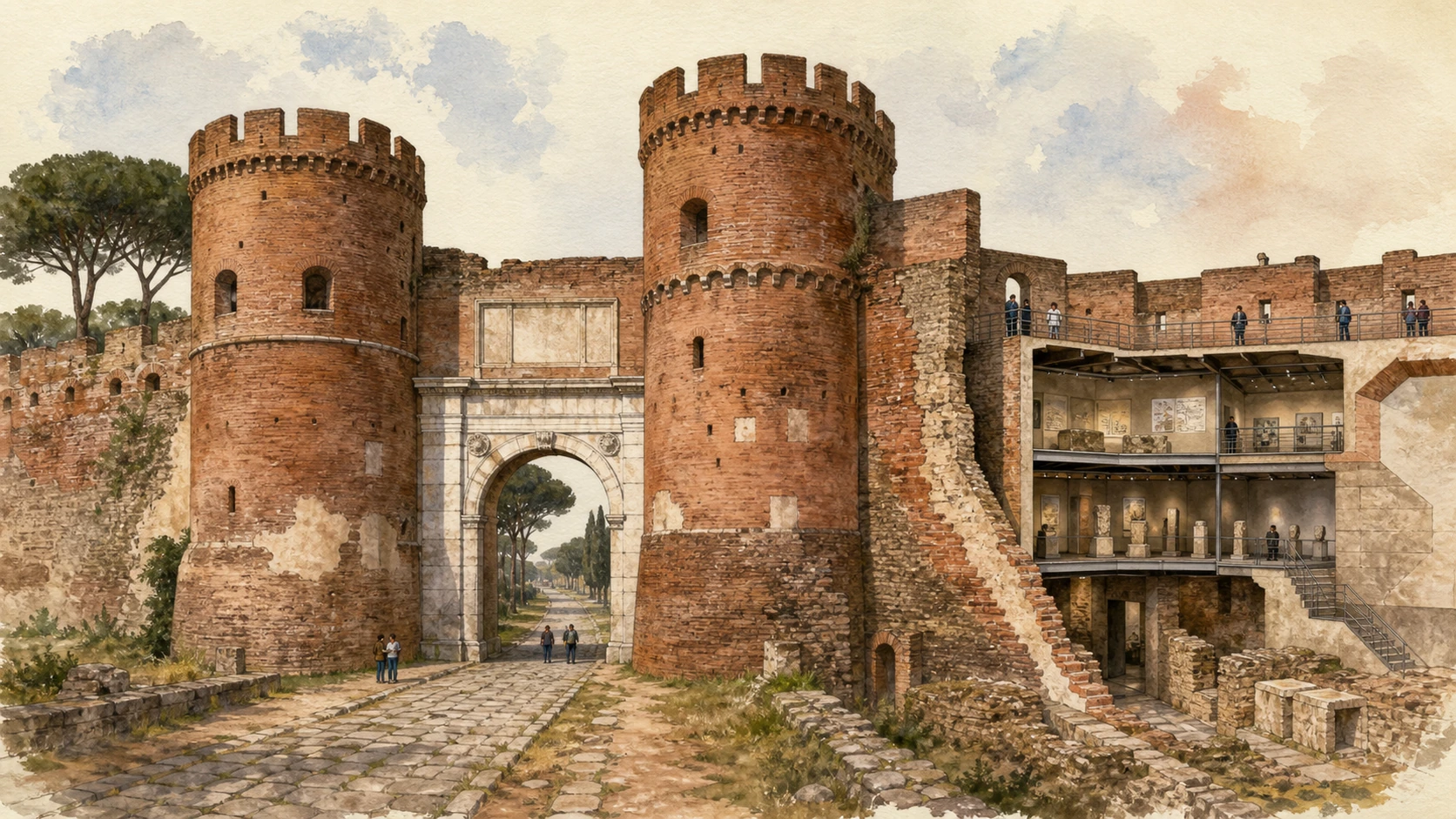
Porta San Sebastiano rises where two semicircular towers frame a central passage through the Aurelian Walls. Inside, the Museo delle Mura explains Roman construction, later repairs and the defensive circuit through models, drawings and surviving rooms; a section of wall walk extends from the gate when access conditions permit. Marble facings, brick towers, grooves, blocked openings and different masonry campaigns should be read separately. Traffic now divides the urban approach from the quieter road outside, so the monumental threshold no longer controls movement as it once did.

History

The Appian road left Republican Rome from Porta Capena. Around AD 270–275 Aurelian's new wall crossed it with Porta Appia; Honorius strengthened the structure in the early fifth century, reducing and controlling passages. The medieval dedication to Saint Sebastian gave the gate its present name. It saw factional fighting, ceremonial entries and changing residential uses. In 1536 it was decorated as a temporary triumphal entrance for Charles V. A civic wall museum was formally established in 1989 and the present didactic installation opened in 1990.

How to read this place

The Via Appia began closer to the Circus Maximus before this gate was built. The road predates it by centuries and began closer to the Circus Maximus. The towers are not a single untouched Aurelian design, and the museum rooms include twentieth-century alterations from their use as a private residence. Use the wall walk to study thickness, patrol circulation and the relationship between curtain and tower, but verify opening notices rather than assuming every stair or terrace is accessible.

What to notice

  • Masonry changes between curtain wall, towers and later repairs
  • The road axis passing through a defensive opening much younger than the Appia
  • Interior rooms adapted repeatedly before the current museum
Museo delle Mura · Porta San Sebastiano
Original documentary watercolour cutaway of Porta San Sebastiano, its twin towers, wall walk and Appian road
Porta San Sebastiano and the Museo delle MuraOriginal Merlintravel documentary watercolour · 2026
02

A Republican family tomb turned ancestry, office and military achievement into a public roadside statement

The Tomb of the Scipios

Rock-cut galleries, sarcophagus positions and inscriptions reveal an elite funerary programme earlier than the monumental tombs farther down the road.

Today

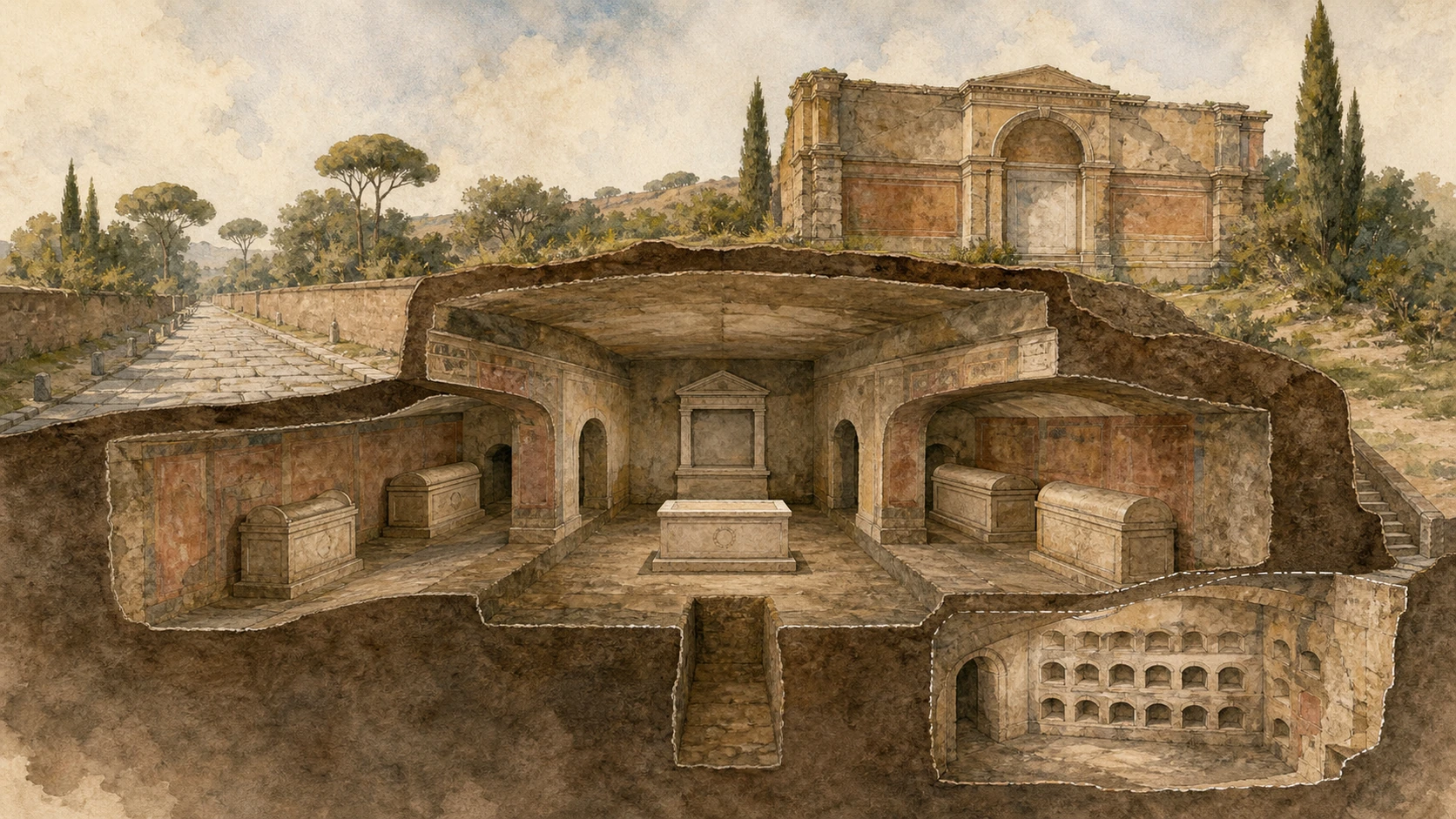
The archaeological area lies inside the Aurelian Walls at Via di Porta San Sebastiano 9. A square rock-cut chamber expands into intersecting galleries designed to hold as many as thirty-two sarcophagi. Copies and surviving settings help reconstruct the position of the sarcophagus of Lucius Cornelius Scipio Barbatus; the original inscription and sarcophagus are now in the Vatican Museums. The site also preserves an imperial-period painted columbarium and a small catacomb, evidence that this ground continued to receive very different forms of burial.

History

The tomb was cut into cappellaccio tuff in the early third century BC for the Cornelii Scipiones. Barbatus, consul in 298 BC, occupied the axial position. During the second century BC, Scipio Aemilianus remodelled the façade with a high podium, entrances and niches traditionally associated with Ennius, Scipio Africanus and Scipio Asiaticus. The monument made family identity legible to travellers on the Appia while burial chambers developed behind the public front. Rediscovery and excavation from the early modern period removed important elements and reshaped what visitors see.

How to read this place

The most famous Scipio, Africanus, was not buried here; ancient tradition places his burial at Liternum. Avoid treating the replica sarcophagus as the original or reconstructing every lost statue with certainty. The inscriptions combine compact biographical claims with an evolving Latin literary language, but modern visitors see them after centuries of collecting and relocation. Entry is controlled by Roma Capitale arrangements, so an exterior stop cannot substitute for an assumed walk-in visit.

What to notice

  • The axial place prepared for Barbatus within the gallery plan
  • Rough cut tuff contrasted with carefully inscribed sarcophagus fronts
  • Later columbarium niches belonging to a different funerary system
Parco Archeologico dell'Appia Antica · Tomb of the Scipios
Original documentary watercolour cutaway of the rock-cut Tomb of the Scipios with gallery plan and Barbatus sarcophagus setting
The Tomb of the ScipiosOriginal Merlintravel documentary watercolour · 2026
03

Separate burial areas became the official cemetery of the Roman Church and a major topography of martyr memory

The Catacombs of Saint Callixtus

The Crypt of the Popes and the Crypt of Saint Cecilia occupy only a small controlled route within an enormous multi-level cemetery.

Today

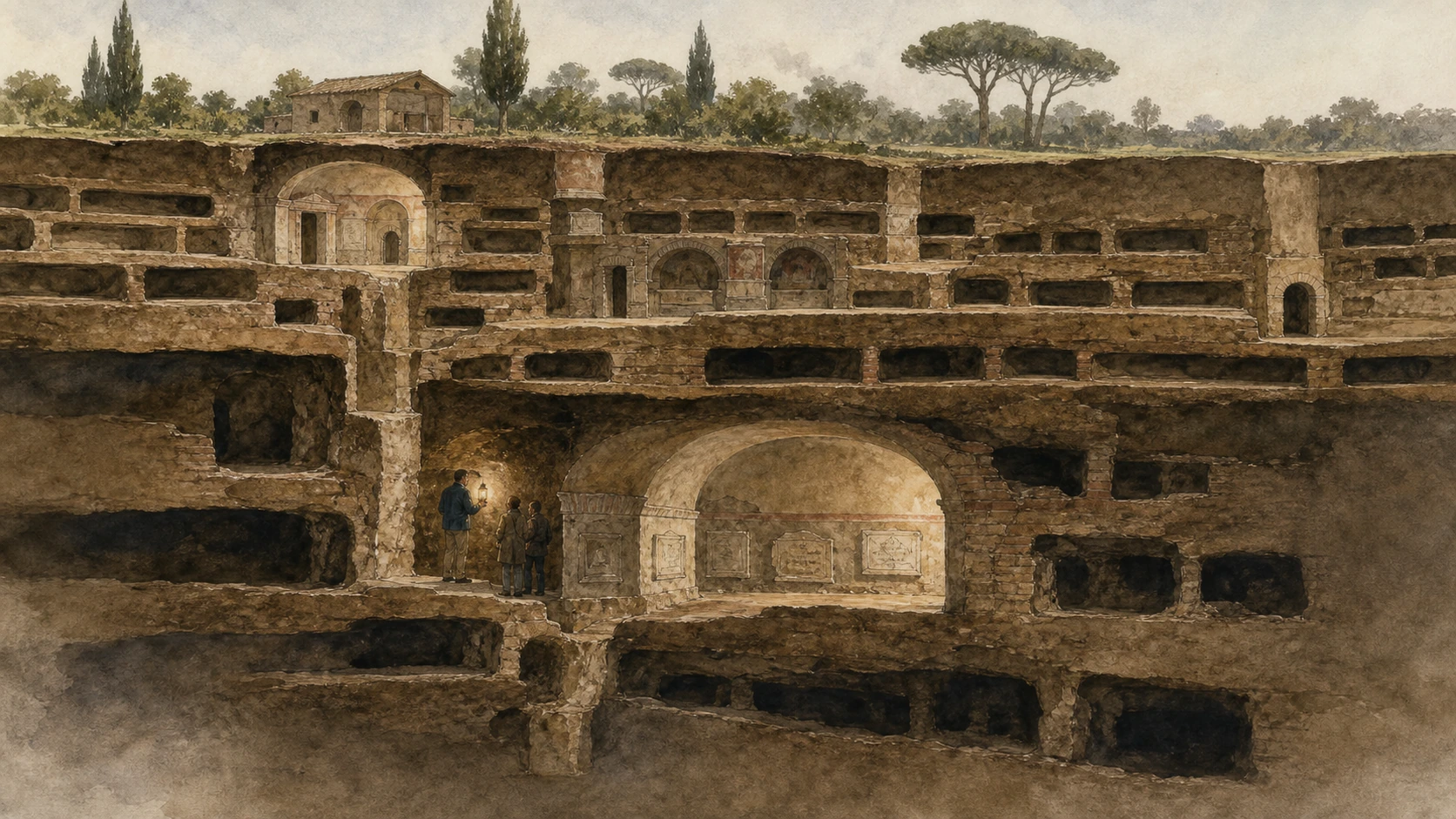
Visitors enter only in guided groups and follow a selected underground circuit rather than roaming the network. Stairs descend into cool, humid galleries with stacked loculi, family cubicles and inscriptions. The Crypt of the Popes preserves the burial setting of nine third-century bishops of Rome and probably other church dignitaries. Nearby, the Crypt of Saint Cecilia remembers the martyr whose body was transferred to Santa Cecilia in Trastevere in 821. The visible statue is a modern devotional copy and should not be confused with an excavated ancient portrait.

History

Burial began in independent hypogea from the middle or later second century AD. Callixtus administered the cemetery under Pope Zephyrinus before becoming bishop of Rome, and the complex developed as the official cemetery of the Roman Church. Excavation linked districts and descended through four principal levels, in places more than twenty metres deep. Popes, martyrs and many ordinary Christians were commemorated here. After relic translations and reduced use, entrances were lost; Giovanni Battista de Rossi's nineteenth-century work identified major areas and helped found scientific Christian archaeology.

How to read this place

Catacombs were not permanent hiding places from imperial police. Their primary function was burial and commemoration beyond the city walls. Empty loculi reflect ancient disturbance, relic translation and later damage, not a cemetery prepared but never used. The vast statistics describe the complete complex, not the portion open to tourists. Photography and independent wandering are prohibited; preserve silence, stay with the guide and expect uneven stairs, low light and a constant underground temperature.

What to notice

  • Greek and Latin fragments naming bishops in the Crypt of the Popes
  • Different tomb forms: narrow loculi, arcosolia and painted cubicles
  • Modern access passages separated from the much larger closed network
Catacombs of Saint Callixtus · Crypt of the Popes
Original documentary watercolour cutaway of Saint Callixtus galleries, loculi and the Crypt of the Popes without invented crowds
The Catacombs of Saint CallixtusOriginal Merlintravel documentary watercolour · 2026
04

Quarry, pagan mausoleums, apostolic commemoration, Christian cemetery and basilica form one layered complex

Saint Sebastian: catacomb and basilica

The name catacomb may derive from this place, but its history is wider than the underground cemetery that later inherited Saint Sebastian's cult.

Today

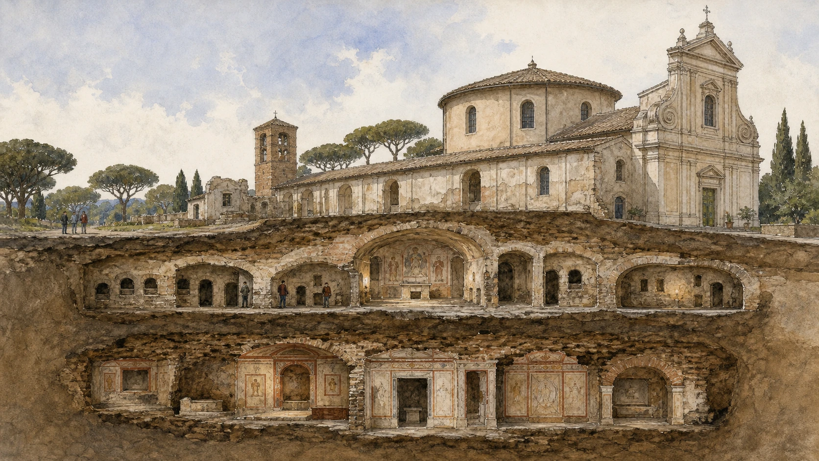
The official guided tour descends through part of a roughly twelve-kilometre, three-level network. It reaches decorated second-century mausoleums, burial galleries and the area of the Memoria Apostolorum, where ancient graffiti invoke Peter and Paul. Above, the basilica retains the outline of a fourth-century circiform foundation but was comprehensively renewed for Cardinal Scipione Borghese in 1608–1613. Its crypt of Saint Sebastian and Bernini's late Salvator Mundi belong to later devotional and artistic histories, not the original cemetery phase.

History

The area called ad catacumbas, probably referring to hollows or quarries, contained second-century mausoleums before an expanding Christian cemetery. Around the mid-third century, the triclia and numerous graffiti established a powerful commemoration of Peter and Paul; the exact nature and duration of any translation of their relics remains a subject requiring careful language. Constantine sponsored the Basilica Apostolorum in the fourth century. Devotion to the martyr Sebastian eventually renamed both basilica and cemetery. Franciscan friars have cared for the complex since 1826.

How to read this place

Do not merge the second-century pagan mausoleums, the third-century apostolic memoria, the Christian galleries and Constantine's basilica into one construction. The site's name helped generalise the term catacomb, but that does not make it Rome's only or automatically largest cemetery. Official visits are guided, currently about forty minutes, with roughly seventy irregular steps and high humidity. Book directly and check annual closures before building the day's route.

What to notice

  • Painted and stuccoed mausoleums below the later Christian complex
  • Graffiti addressed to Peter and Paul around the triclia
  • The seventeenth-century basilica interior contained within an older circiform lineage
Catacombs of Saint Sebastian · underground cemetery
Original documentary watercolour section through Saint Sebastian's mausoleums, apostolic memoria, galleries and basilica
Saint Sebastian: catacomb and basilicaOriginal Merlintravel documentary watercolour · 2026
05

Palace, private circus and dynastic mausoleum converted an older estate into an imperial commemorative machine

The Villa and Circus of Maxentius

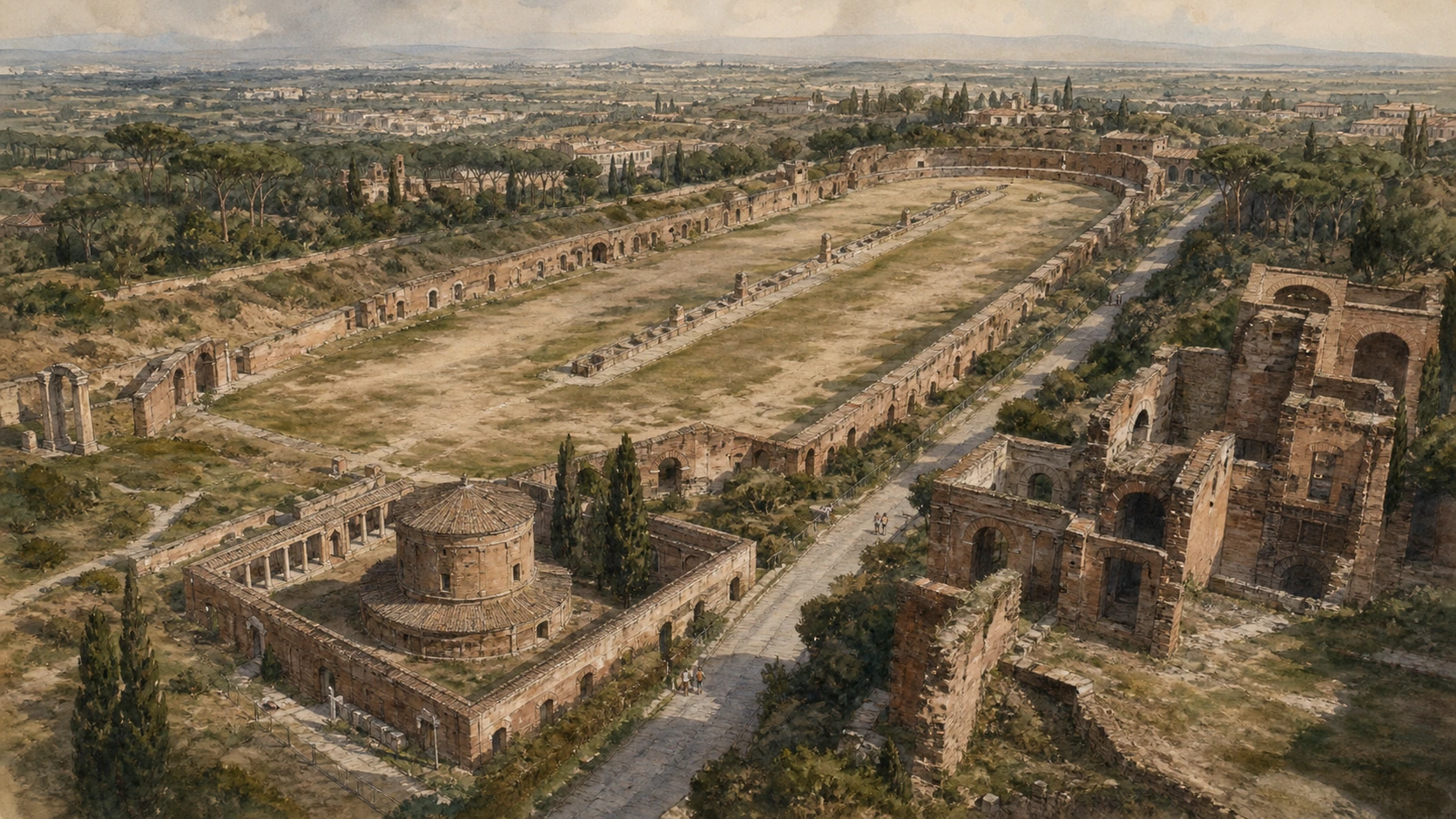
The best-preserved Roman circus plan in the city belongs to an early fourth-century estate built around power, ceremony and the death of an imperial son.

Today

The civic archaeological area extends between the second and third miles of the Appia. Long perimeter walls, starting gates, towers, a central spina and the seating outline make the circus unusually legible even without its vanished decoration. On higher ground stand remains of the palace; beside the road, a quadriporticus surrounds the circular dynastic mausoleum conventionally called the Tomb of Romulus. The nineteenth-century Torlonia farmhouse overlays part of the entrance sector. Admission arrangements and accessible paths should be checked on the official site.

History

A Republican rural villa occupied the hill from the second century BC and was later transformed within Herodes Atticus's Pago Triopio. Maxentius rebuilt the estate in the early fourth century AD as an integrated palace, circus and family mausoleum. His son Valerius Romulus died young and was probably buried in the dynastic tomb. After Maxentius was defeated by Constantine at the Milvian Bridge in 312, the complex lost its intended political future. Rome acquired the site in 1943; excavation and consolidation intensified for the 1960 Olympic Games.

How to read this place

The circus served a different setting and purpose from the public Circus Maximus. Its relatively intimate capacity and physical link to the residence point to imperial ceremonial use. The central obelisk now in Piazza Navona was moved away in antiquity and re-erected under Innocent X; the spina is now empty. Romulus’s burial is probable, not archaeologically proven beyond dispute.

What to notice

  • Starting gates angled to equalise the first run toward the central barrier
  • The spina and turning posts defining race circulation
  • Mausoleum, quadriporticus and palace aligned as one dynastic ensemble
Musei in Comune Roma · Villa of Maxentius
Original documentary watercolour aerial cutaway of Maxentius's palace, circus and Mausoleum of Romulus without the relocated obelisk
The Villa and Circus of MaxentiusOriginal Merlintravel documentary watercolour · 2026
06

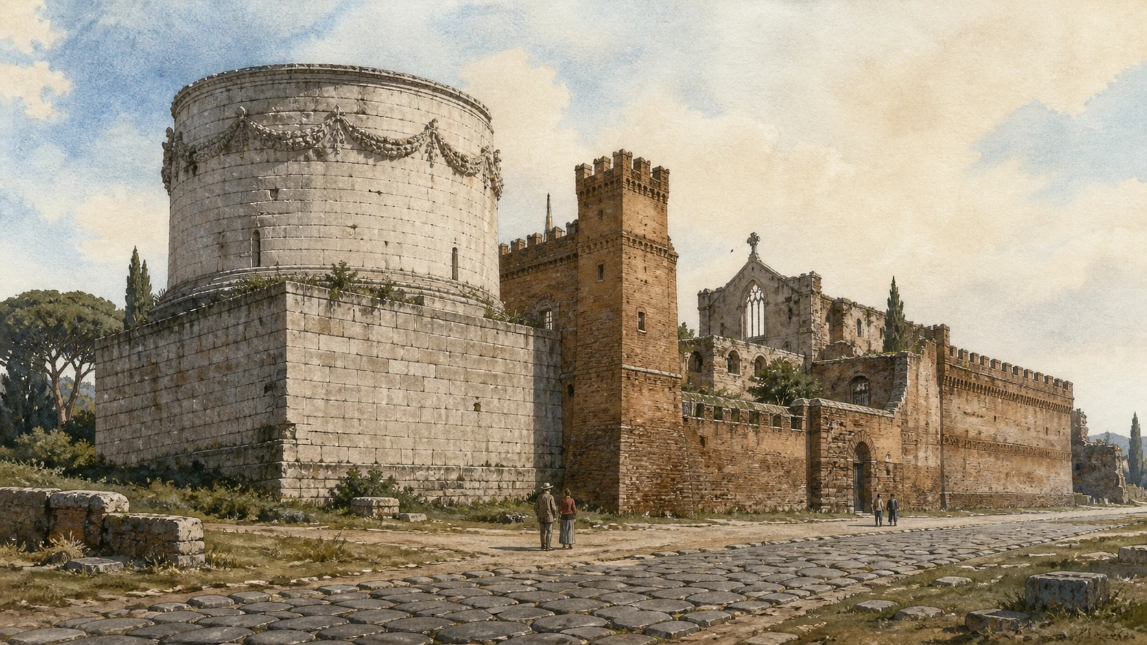
An Augustan cylindrical tomb became the keep and symbol of a fortified medieval village

Cecilia Metella and the Caetani fortress

The marble drum, funerary inscription, battlements, palace and ruined church disclose two monumental programmes separated by more than thirteen centuries.

Today

A square concrete podium supports the massive circular drum of Cecilia Metella's tomb, faced in travertine and decorated with an ox-skull frieze that gave the locality the name Capo di Bove. The inscription identifies Cecilia as daughter of Quintus Metellus Creticus and wife of Crassus, though not the triumvir Marcus Licinius Crassus himself. A medieval battlemented crown and Caetani palace attach the tomb to a fortified settlement. The roofless Gothic church of San Nicola stands within the enclosure.

History

The mausoleum was built in the later first century BC, probably in the Augustan period, for a woman whose family connections advertised elite status beside the Appia. In 1302 Pope Boniface VIII acquired the site for the Caetani. They incorporated the Roman drum as the strongpoint of a castrum controlling road traffic, added palace, walls and towers, and built San Nicola. Later families, stone removal and restoration altered the complex, but reuse helped preserve the tomb's exceptional mass and its position in the road landscape.

How to read this place

Do not describe the battlements as Roman or imagine the tomb's present open interior as its original burial chamber. Separate the concrete core, travertine revetment and Augustan frieze from medieval defensive work. The inscription gives genealogy, not a biography of Cecilia; almost nothing certain is known of her life. The Caetani did not simply vandalise the mausoleum: their reuse changed it profoundly while integrating it into another coherent architecture of authority.

What to notice

  • Marble inscription and garlanded ox-skull frieze on the Roman drum
  • Medieval battlements cutting a different silhouette above the ancient cylinder
  • San Nicola's Gothic walls and windows within the fortified enclosure
Parco Archeologico dell'Appia Antica · Cecilia Metella and Castrum Caetani
Original documentary watercolour of Cecilia Metella's Roman drum joined to Caetani battlements, palace and San Nicola
Cecilia Metella and the Caetani fortressOriginal Merlintravel documentary watercolour · 2026
07

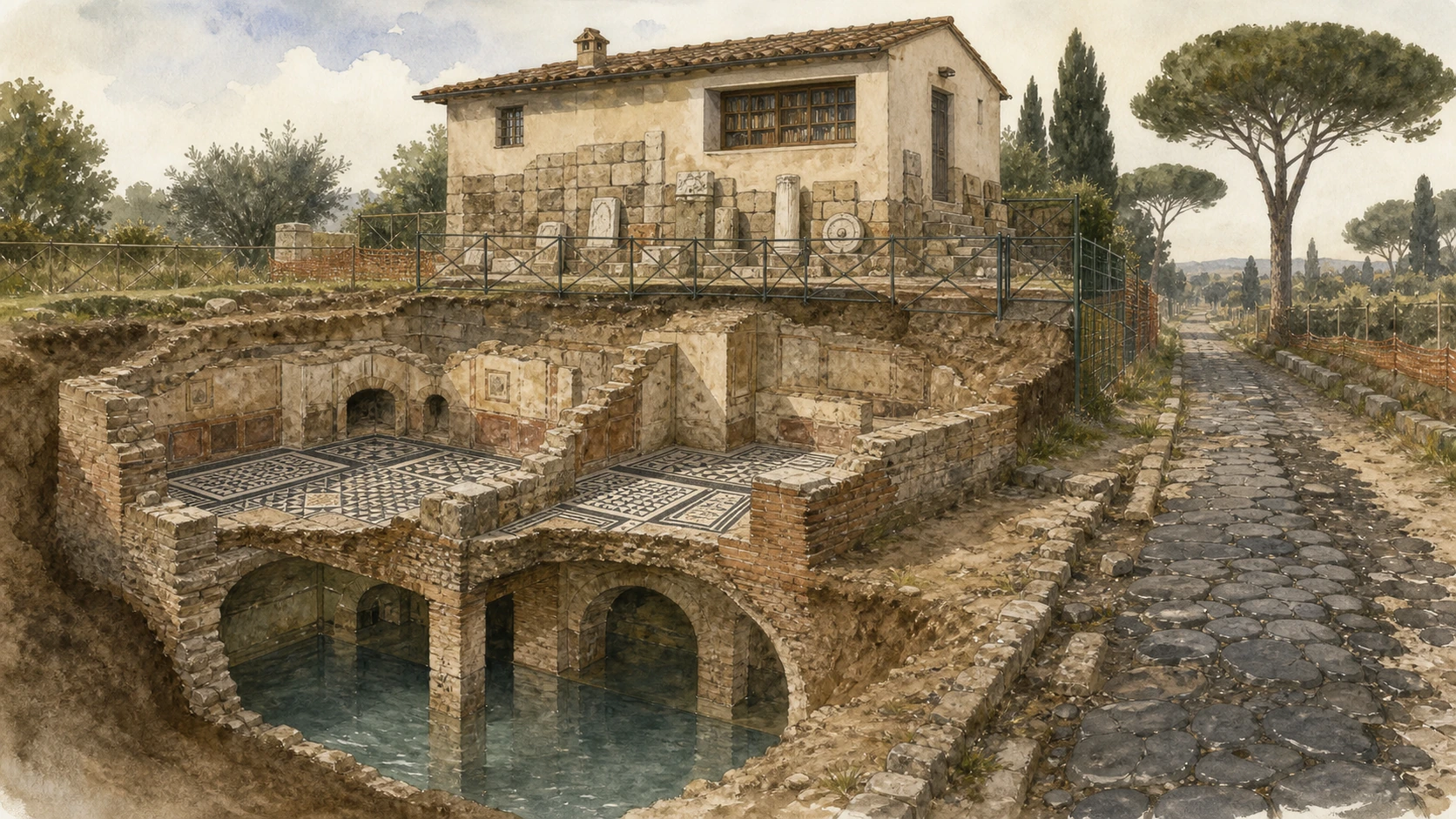
An imperial bath complex beneath a modern villa became a centre for archaeology and Antonio Cederna's preservation legacy

Capo di Bove and the Appian paving

Excavated mosaics, thermal rooms, a Roman cistern and a twentieth-century house show why the protected road is both archaeology and modern civic history.

Today

The 8,600-square-metre property at the fourth mile contains exposed rooms of an imperial bath complex with black-and-white mosaics, reused ancient materials in a 1950s residence and the archive and library of Antonio Cederna. The main house stands above the Roman cistern that supplied the baths. Immediately outside, the Appian carriageway combines dark basalt paving, later repairs and earthen verges. As of 27 August 2026 the official Park notice states that Capo di Bove has been temporarily closed since 22 June for restoration and visitor-service works.

History

The baths were built in the second century AD and remained in use through later alterations. Their exact relationship to a larger estate must be stated cautiously. Modern construction concealed the archaeology until state acquisition in 2002 enabled excavation and conversion to public use. Cederna's archive entered the site as a record of the journalist and campaigner's work to defend the Appia from speculative building and intrusive infrastructure. The property therefore joins ancient evidence with the twentieth-century history of preservation.

How to read this place

Do not use the closure as a reason to trespass or peer across unstable works. The road surface outside is not entirely original Roman paving; wheel-like grooves, replacements and maintenance belong to several phases. Basoli are large volcanic blocks laid for strength, not decorative cobbles. Cederna's presence matters because the landscape visitors admire survived through political choices and campaigns, not by archaeological inevitability.

What to notice

  • Geometric black-and-white mosaics marking rooms of the bath suite
  • The modern house built over a Roman cistern with reused stone
  • Basalt road blocks, earthen shoulders and protected verges outside the property
Parco Archeologico dell'Appia Antica · Capo di Bove
Original documentary watercolour cutaway of Capo di Bove baths, mosaic, cistern, Cederna house and Appian paving
Capo di Bove and the Appian pavingOriginal Merlintravel documentary watercolour · 2026
08

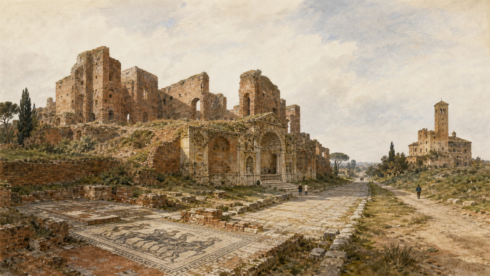
The suburb's largest residential complex passed from two senators to an emperor who had them executed

The Villa of the Quintili and Santa Maria Nova

Bath halls, residential courts, a monumental garden and recent discoveries make the villa a destination rather than a roadside ruin glimpsed in passing.

Today

The complex spreads across a broad rise at the fifth mile. Towering brick walls define reception halls and an immense bath suite; marble pavement traces, heating spaces and framed views convey the former luxury. The original Appian approach passed a monumental nymphaeum and hippodrome-shaped garden. At Santa Maria Nova, a medieval tower and modern farmhouse stand above Roman structures, with mosaics of a retiarius and circus horses found in an associated bath building. Two official entrances connect the Appia Antica and Appia Nuova sides.

History

Lead pipes identify the owners as the consular brothers Sextus Quintilius Condianus and Sextus Quintilius Valerius Maximus. After Commodus had them killed in AD 182 or 183, the estate was confiscated and became imperial property. Later emperors expanded or occupied the residence. Recent Park excavations have identified a theatre, a circus and a winery with spaces associated with production and ceremonial consumption. The state acquired Santa Maria Nova in 2006 and opened it with the villa after excavation and restoration.

How to read this place

The scattered monumental rooms demand time and cannot be responsibly added as a ten-minute roadside stop. The long garden differs from the newly excavated entertainment buildings and was not itself a public racing circus. Commodus’s acquisition is documented through the owners’ fate and imperial phases, while the evidence for later imperial use is less complete. Current last entry is seventy-five minutes before closing, a minimum rather than a comfortable visit length.

What to notice

  • High brick bath walls with different heated and cold-room volumes
  • The nymphaeum facing the Appia as the estate's monumental address
  • Santa Maria Nova mosaics linking rural production, bathing and spectacle imagery
Parco Archeologico dell'Appia Antica · Villa of the Quintili
Original documentary watercolour panorama of the Villa of the Quintili with bath halls, nymphaeum and Santa Maria Nova tower
The Villa of the Quintili and Santa Maria NovaOriginal Merlintravel documentary watercolour · 2026
09

Republican and imperial water lines share the horizon without sharing a date, source or channel

The Park of the Aqueducts

Aqua Claudia and Anio Novus dominate the skyline, while Marcia, Tepula, Iulia and later Acqua Felice require closer identification.

Today

Across open fields near Via Lemonia, the tall tuff piers of Aqua Claudia carry the brick-lined channel of Anio Novus above. Lower fragments of Aqua Marcia, with Tepula and Iulia superimposed in ancient arrangements, appear near Casale di Roma Vecchia. The late sixteenth-century Acqua Felice reused stretches and materials, creating another continuous line. Paths, farms, drainage ditches, railways and post-war neighbourhoods all affect views. The park is freely accessible, but it is not an illuminated archaeological interior or a controlled museum route.

History

Aqua Marcia was built in 144–140 BC and travelled about ninety-one kilometres from the Aniene region. Caligula began Aqua Claudia and Anio Novus in AD 38; Claudius completed them in 52. Their last kilometres rose on monumental arcades, with Anio Novus generally carried above Claudia. After late antique damage and reduced maintenance, Pope Sixtus V's engineer Giovanni Fontana completed Acqua Felice in 1587, the first new major aqueduct in Rome since antiquity, often exploiting the established corridor.

How to read this place

Never label every arch Aqua Claudia. Material, height, channel position and alignment distinguish separate systems. Aqueducts moved water by a very slight gravity gradient; arches maintained level across valleys and plains but most of each route ran underground. The romantic broken arcade is evidence of collapse and reuse, not the original finished appearance. Do not climb piers, cross fenced farms or assume drinking water is available along exposed paths.

What to notice

  • Tuff-block Claudia piers supporting the more brick-rich Anio Novus channel
  • Lower Marcia-related remains near Casale di Roma Vecchia
  • Acqua Felice's regular papal arcade intersecting the ancient landscape
Parco Archeologico dell'Appia Antica · Claudia, Marcia and Anio Novus
Original documentary watercolour diagram landscape distinguishing Aqua Claudia, Anio Novus, Marcia and Acqua Felice
The Park of the AqueductsOriginal Merlintravel documentary watercolour · 2026
10

A medieval tower occupies the knot where ancient and papal aqueduct corridors cross

Tor Fiscale and the water intersections

The tower is a landmark of control built from the strategic geometry of earlier conduits, not a Roman water tower.

Today

The nearly thirty-metre Torre del Fiscale rises where the Claudia-Anio Novus line intersects the Marcia-Tepula-Iulia corridor. Acqua Felice adds its well-preserved papal arcade, making the surrounding park a compact lesson in crossings, reuse and changed ground levels. Paths lead through meadows and community-managed spaces between the Park of the Aqueducts and the Caffarella system. The tower exterior can be read from multiple angles; interior access should never be assumed from an open park gate.

History

The Roman aqueducts established the structural crossroads over several centuries. A tower was built in the medieval period to command this topographical choke point; the current name is associated with a papal fiscal official who owned the property in the seventeenth century. Acqua Felice, completed under Sixtus V, cut through the same landscape and incorporated or ran alongside ancient fabric. Agricultural estates and defensive use preserved open ground that later urban expansion nearly enclosed.

How to read this place

Tor Fiscale did not distribute water and was not built by the Romans. Its value came from visibility, ownership and control at a durable infrastructural crossing. Study which masonry belongs to tower, ancient aqueduct and papal arcade rather than treating the whole silhouette as one ruin. The apparently rural view survives inside modern Rome because of protection and local stewardship; respect cultivated areas, gates and evening closures of managed spaces.

What to notice

  • The tower seated directly above crossing aqueduct alignments
  • Different heights and masonry revealing several water channels
  • The intact Acqua Felice arcade as an early modern intervention, not a Roman repair
Parco Archeologico dell'Appia Antica · Torre del Fiscale
Original documentary watercolour of Torre del Fiscale above crossing ancient and papal aqueducts
Tor Fiscale and the water intersectionsOriginal Merlintravel documentary watercolour · 2026

The district through time

A short chronology

From the road of 312 BC and Republican family tombs to imperial cemeteries, late Roman estates, a medieval fortress and the early modern renewal of Rome’s water supply.

  1. The censor Appius Claudius Caecus begins the Via Appia from Rome toward Capua.

  2. The Scipio family establishes its rock-cut tomb beside the urban section of the road.

  3. Aqua Marcia brings spring water toward Rome across a route of about ninety-one kilometres.

  4. Cecilia Metella's monumental cylindrical tomb rises at the third mile.

  5. Burial areas expand at Callixtus and Saint Sebastian; the Villa of the Quintili reaches its elite phase.

  6. Commodus executes the Quintili brothers and confiscates their Appian estate.

  7. The Roman Church organises Callixtus; apostolic commemoration transforms the Saint Sebastian complex.

  8. The Aurelian Wall crosses the older Appia at Porta Appia, now Porta San Sebastiano.

  9. Maxentius creates an imperial palace, circus and dynastic mausoleum on the road.

  10. A circiform Basilica Apostolorum monumentalises the Saint Sebastian memoria.

  11. The Caetani acquire Cecilia Metella and build a fortified village around the Roman tomb.

  12. Acqua Felice restores a major water supply across the ancient aqueduct landscape.

  13. Franciscan friars begin their continuing custody of Saint Sebastian.

  14. Rome acquires and excavates the Villa of Maxentius, consolidating the circus and related buildings.

  15. The state acquires Capo di Bove and Santa Maria Nova, opening new archaeological and preservation histories.

Before your visit

Practical information

01

Reserve underground visits

Callixtus and Saint Sebastian admit visitors only with their guided systems; compare times before choosing one or attempting both.

02

Check the 2026 closure notice

Capo di Bove has been temporarily closed since 22 June 2026; use the exterior road section until the Park announces reopening.

03

Do not underestimate distance

Cecilia Metella, Quintili and the Aqueducts are not adjacent; choose a branch or arrange transport rather than forcing every chapter into one walk.

04

Protect the basoli

Stay on established surfaces, never remove fragments and dismount where ancient paving or pedestrian density makes riding unsafe.

05

Prepare for underground conditions

Expect stairs, humidity and about 17°C in the catacombs; photography and independent access are restricted.

06

Carry water in the aqueduct parks

The monumental channels are archaeological structures, not visitor fountains; open fields have heat, limited shade and changing managed gates.

Method and sources

Sources and image credits

The guide uses current official material from the Parco Archeologico dell'Appia Antica, Museo delle Mura, Roma Capitale's civic museum network, the Catacombs of Saint Callixtus and the Catacombs of Saint Sebastian, checked on 27 August 2026. It distinguishes the Republican road from the later Aurelian gate; originals from copies in the Scipio tomb; cemeteries from hiding places; Callixtus's open route from the complete network; pagan mausoleums, apostolic memory and basilica at Saint Sebastian; Maxentian ceremonial space from the Circus Maximus; Cecilia's Roman tomb from the Caetani fortress; ancient baths from Cederna's modern preservation archive; the Villa of the Quintili's original garden from newly excavated entertainment buildings; separate aqueduct channels from one generic arcade; and the medieval Torre del Fiscale from the water systems it controlled. Current closure, booking and transfer constraints are treated as part of the historical visit rather than omitted logistics.

All ten images are original Merlintravel editorial watercolours based on documented present-day conditions. They are illustrations, not substitutes for archaeological plans. Opening hours, tickets, accessible routes, temporary exhibitions and conservation work can change; consult the linked official pages shortly before visiting.