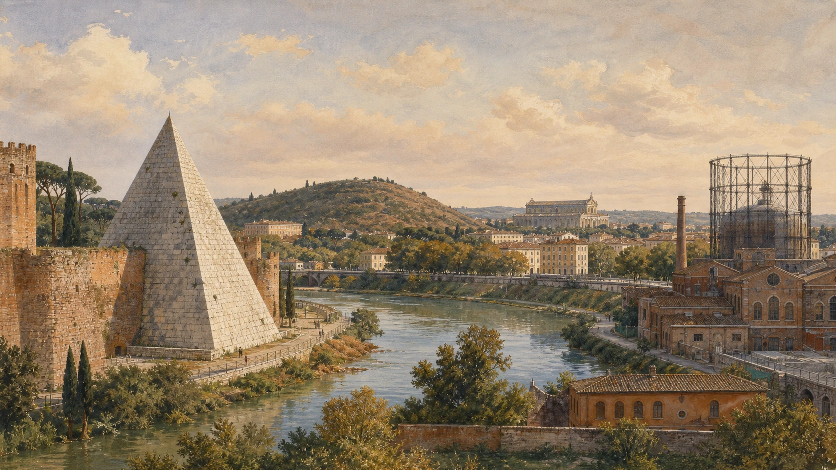
Original documentary watercolour joining the Pyramid of Cestius, Monte Testaccio, industrial Ostiense and Saint Paul Outside the Walls

Rome Guide 14 · River supply, funerary memory and the industrial city

Testaccio,
the Pyramid
and Ostiense

A full-day route from an Augustan tomb and the Aurelian Walls through Rome’s river warehouses, amphora hill and workers’ district, then into the machines, sculpture and rebuilt sacred space of the Ostiense corridor.

Plan the route
Pyramid · Testaccio · Ostiense10 chapters · 10 route points

Why this district matters

This route follows what Rome moved, stored, discarded, powered and remembered outside the ceremonial centre.

The Pyramid of Cestius is a Roman tomb, not an Egyptian royal monument transplanted to Italy. Its steep concrete core and marble skin belong to the taste for Egyptian forms that followed Rome’s conquest of Egypt, while its inscriptions identify a Roman magistrate and the deadline imposed on his heirs. The Aurelian Wall later absorbed the already old tomb, and Porta Ostiensis—now Porta San Paolo—controlled the road leading toward the river ports, the coast and the basilica raised over the venerated burial of the apostle Paul.

Testaccio preserves the logistics behind an imperial capital. River quays, warehouses and the enormous Porticus Aemilia handled goods arriving from the Mediterranean through Ostia and Portus. Monte Testaccio is not a natural hill or a random rubbish heap: it is a carefully organised accumulation dominated by broken oil amphorae, many carrying stamps and painted records of production and control. Modern streets, housing and a covered market occupy the same plain without reproducing the ancient commercial system.

The nineteenth- and twentieth-century city added another infrastructure landscape. Gioacchino Ersoch’s municipal slaughterhouse organised animals, water, work and inspection at the edge of a new workers’ district. The Montemartini power station, opened in 1912 after municipalisation of electricity, later became an extraordinary setting for Capitoline sculpture. Farther down Via Ostiense, Saint Paul Outside the Walls appears ancient in scale but is substantially the result of rebuilding after the fire of 1823, wrapped around a tomb, medieval ciborium, mosaics, doors and cloister that survived or were restored in different ways.

Read Testaccio and Ostiense as systems rather than scenery: a tomb incorporated into defence, a port converted into archaeology, containers converted into a hill, industrial plants converted into cultural institutions and a destroyed basilica rebuilt around material points of continuity.

The route

Plan your visit

Begin at the Pyramid of Cestius and Porta San Paolo, then enter the Non-Catholic Cemetery. Move north through the Emporium and Porticus Aemilia before climbing Monte Testaccio when an official visit is available. Continue through the archaeology beneath the New Testaccio Market and the Mattatoio, then follow Via Ostiense to Centrale Montemartini and Saint Paul Outside the Walls.

Morning I

Tomb, wall and cemetery

Separate the Augustan pyramid from the later Aurelian defences, read Porta San Paolo as a road gate and enter the cemetery as a living burial institution rather than a literary theme park.

Morning II

The river supply district

Use the Emporium quay and Porticus Aemilia fragments to reconstruct unloading, storage and redistribution without turning every surviving wall into a complete warehouse.

Afternoon I

Shards, market and municipal work

Read Monte Testaccio as an archive of amphora traffic, then compare controlled ancient disposal with the modern market and the engineered circulation of Ersoch’s slaughterhouse.

Afternoon II

Electricity, museum and basilica

At Montemartini keep ancient objects and industrial machines in their separate histories; at Saint Paul distinguish the rebuilt nineteenth-century envelope from surviving and excavated sacred fabric.

Ten chapters

Explore the places

The route follows the Ostiense supply corridor from funerary road and wall to river port, warehouse plain, industrial municipality and rebuilt pilgrimage basilica. Use the index to revisit one chapter without separating infrastructure from labour, memory and later reuse.

  1. 01The Pyramid of Cestius
  2. 02Porta San Paolo and the Via Ostiense Museum
  3. 03The Non-Catholic Cemetery
  4. 04The Emporium and the Tiber quay
  5. 05Porticus Aemilia and the warehouse grid
  6. 06Monte Testaccio, an archive of amphorae
  7. 07The New Testaccio Market and its archaeology
  8. 08Mattatoio: industrial archaeology and reuse
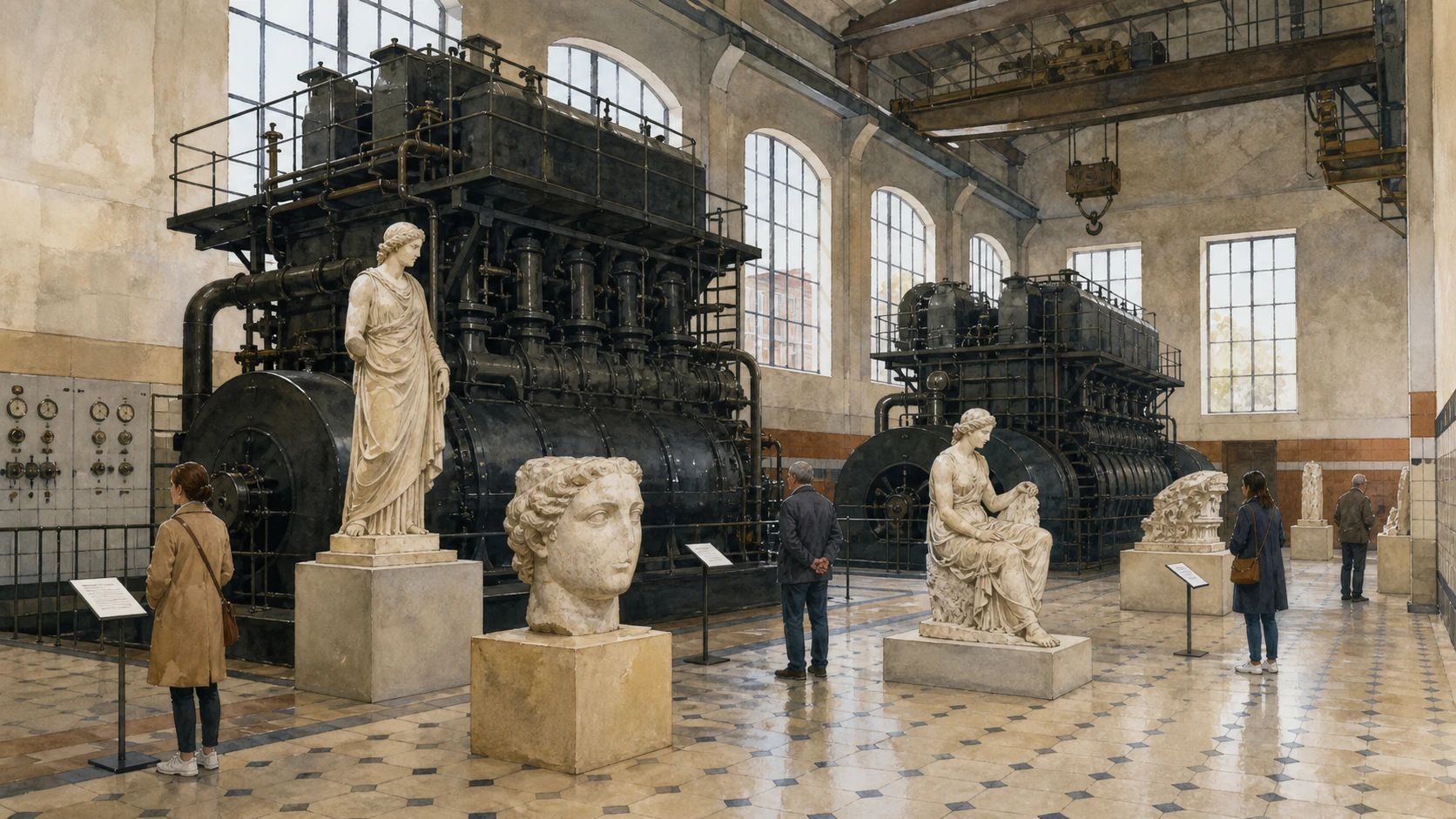
  9. 09Centrale Montemartini: machines and gods
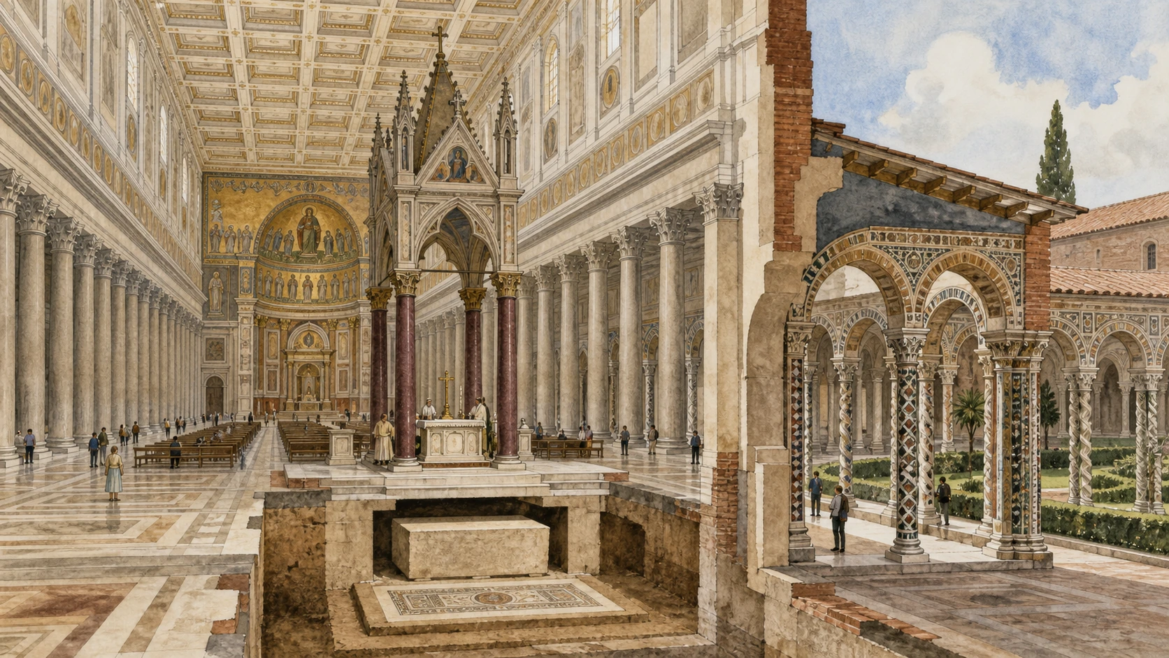
  10. 10Saint Paul Outside the Walls
01

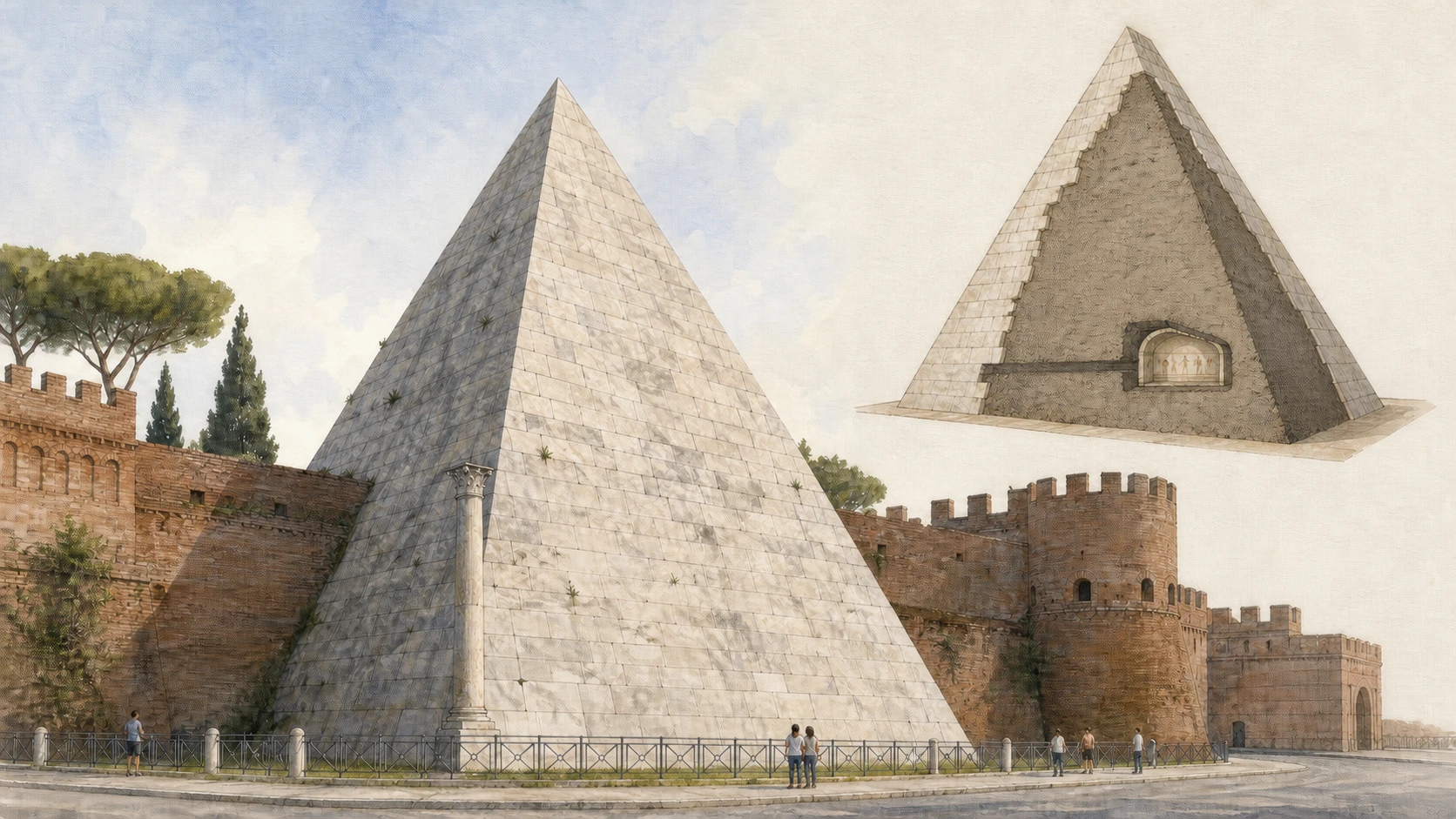
A Roman magistrate’s fast-built tomb became a marble landmark only later absorbed by the city wall

The Pyramid of Cestius

Its Egyptian form reflects Augustan Rome, while inscriptions, concrete construction and a tiny painted chamber identify a specifically Roman funerary monument.

Today

The pyramid rises immediately beside the railway and road interchange at Piazzale Ostiense, its four steep faces clad in pale Lunense marble. It stands about 36.4 metres high on a base roughly thirty metres square. The entrance to the barrel-vaulted burial chamber is controlled and normally available only during special openings; from the street the most useful evidence is the relation between marble faces, inscriptions, surviving corner columns and the Aurelian Wall bonded against the monument. Traffic and later infrastructure compress what was once a roadside funerary setting.

History

Gaius Cestius, whose inscriptions call him praetor, tribune of the plebs and member of the Septemviri Epulones, commissioned the tomb between 18 and 12 BC. Another inscription records that his heirs completed it within 330 days. The concrete core and marble revetment translate an Egyptianising fashion after Octavian’s conquest of Egypt into Roman construction. The chamber received delicate painted panels with nymphs and winged Victories. Around AD 270–275, Aurelian’s builders incorporated the existing tomb into the new defensive circuit, helping preserve its cladding.

How to read this place

The pyramid adapts an Egyptian form to a Roman elite tomb. Its proportions are markedly steeper, its core is Roman concrete and its programme belongs to a Roman elite tomb. The wall did not create the pyramid; it reused a monument already about three centuries old. Medieval breaches removed the urn and damaged paintings, so today’s empty chamber is not an intact burial. Exterior access is constant, but entry should never be promised without checking the current official calendar.

What to notice

  • The marble-clad faces narrowing much more steeply than major royal pyramids in Egypt
  • Latin inscriptions identifying Cestius and the construction deadline
  • Aurelian masonry meeting the older funerary monument on both sides
Roma Capitale Tourism · Pyramid of Caius Cestius
Original documentary watercolour of the marble Pyramid of Cestius joined to the Aurelian Walls
The Pyramid of CestiusOriginal Merlintravel documentary watercolour · 2026
02

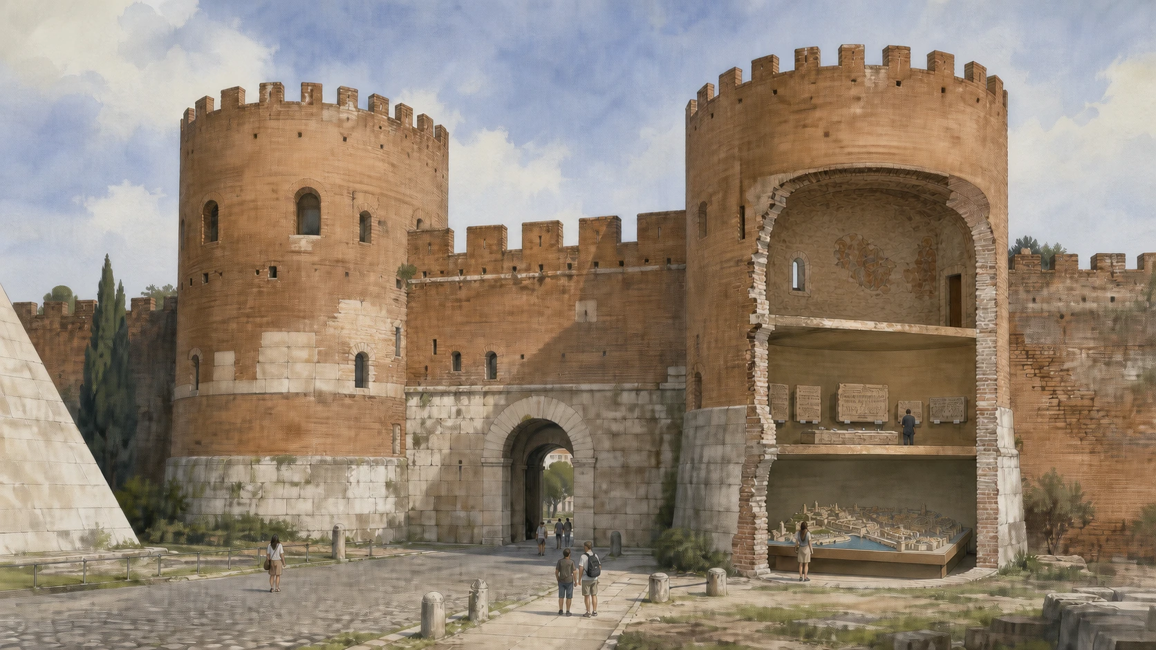
A late Roman gate, medieval devotional threshold and museum occupy the same defensive structure

Porta San Paolo and the Via Ostiense Museum

The gate’s present name points toward Saint Paul, but its towers and passages preserve changing military, road and religious histories.

Today

Porta San Paolo stands just east of the pyramid as a monumental twin-towered gate in the Aurelian Walls. The present outer and inner passages, tower rooms and battlements reflect late Roman construction, Honorian strengthening, medieval use and modern restoration rather than one untouched design. The internal Museo della Via Ostiense holds finds and casts from the corridor between Rome and Ostia, models of ancient Ostia and the imperial harbours, tomb paintings and medieval fresco fragments in the eastern tower. The Ministry page currently lists the museum as temporarily closed, so the exterior must be treated as the dependable visit.

History

The original Porta Ostiensis was built with Aurelian’s wall in the later third century AD and remodelled when Honorius strengthened Rome’s defences in the early fifth century. It controlled the Via Ostiensis running toward the river mouth. In the Middle Ages the gate acquired its current name because pilgrims passed through it toward the basilica of Saint Paul. Tower rooms were adapted, including a chapel used by a Byzantine community whose late thirteenth- or early fourteenth-century frescoes survive. Modern conflict and restoration added further commemorative layers around the piazza.

How to read this place

The gate is not the starting point of the ancient Via Ostiense in a simple modern-road sense, and its medieval name should not be projected back to Aurelian. Compare the narrow controlled passages with the open traffic system around them. The museum’s harbour models are interpretive tools, not surviving pieces of Ostia or Portus. When the interior is closed, do not infer that the walls, tower stairs or roof walk are accessible by another entrance.

What to notice

  • Two semicircular towers framing a controlled passage through the wall
  • Differences between late Roman masonry and later battlements or repairs
  • The short physical distance but chronological gap between gate and pyramid
Italian Ministry of Culture · Porta San Paolo and Via Ostiense Museum
Original documentary watercolour of Porta San Paolo with twin towers, wall passage and museum rooms
Porta San Paolo and the Via Ostiense MuseumOriginal Merlintravel documentary watercolour · 2026
03

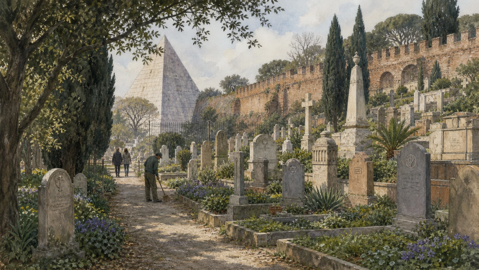
An active multi-faith cemetery grew beside the pyramid from a restricted eighteenth-century burial ground

The Non-Catholic Cemetery

Famous poets are part of the story, but landscape, burial regulation and nearly four thousand graves make the institution much broader than an English cemetery.

Today

The cemetery occupies a green wedge behind the Pyramid of Cestius and the Aurelian Walls. Its older sector opens around the pyramid, while later terraces and shaded paths contain stones in many languages, sculpted angels, modest markers and family monuments. John Keats lies beneath a deliberately unnamed stone near his friend Joseph Severn; Percy Bysshe Shelley is buried in a later sector, and Antonio Gramsci among the twentieth-century graves. The site remains an active cemetery, so funerals, mourners and conservation work take precedence over literary tourism.

History

Permission associated with Pope Clement XI allowed members of the exiled Stuart court to be buried near the pyramid from about 1716, and practice extended to other non-Catholics. Burial outside consecrated Catholic ground reflected both legal restriction and the international population of Rome. The cemetery expanded in stages and was declared a Monumental Area of National Interest in 1918. Its approximately four thousand burials include many nationalities and religious traditions, making labels such as Protestant, English or artists’ cemetery only partial descriptions.

How to read this place

Do not turn the site into a checklist of celebrity graves. Stone type, language, symbols, plantings and changing density reveal communities and burial rules across three centuries. The pyramid is a powerful backdrop but not part of the cemetery’s original eighteenth-century design. Keep voices low, never step across graves for a photograph and follow restrictions on commercial images. Donations and the official map support conservation of an institution that is still in use.

What to notice

  • The open older field near the pyramid contrasted with denser later sectors
  • Many languages and religious symbols rather than one Protestant identity
  • Aurelian masonry functioning as both ancient monument and cemetery boundary
Roma Capitale Tourism · Non-Catholic Cemetery
Original documentary watercolour of the shaded Non-Catholic Cemetery with varied graves and the Pyramid beyond
The Non-Catholic CemeteryOriginal Merlintravel documentary watercolour · 2026
04

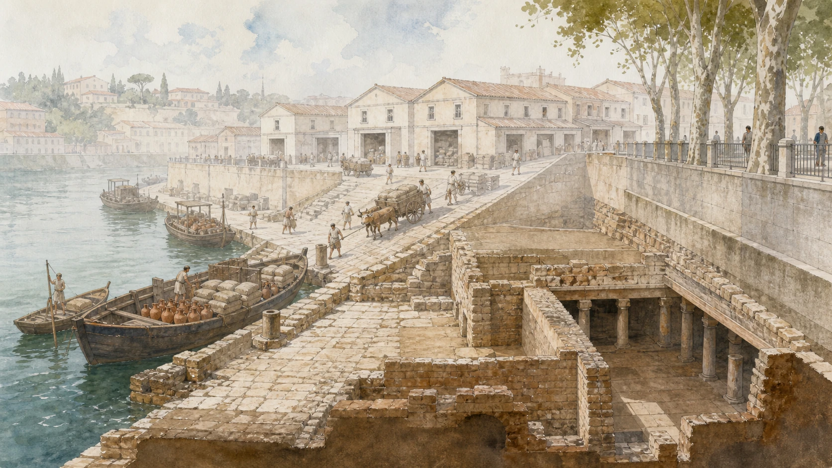
Travertine quays and buried warehouses recover the river interface that fed an imperial capital

The Emporium and the Tiber quay

The surviving port is fragmentary and often accessible only on special occasions, yet it anchors Testaccio’s entire supply landscape to the river.

Today

Along Lungotevere Testaccio, high modern embankments and plane trees conceal stretches of the ancient commercial riverfront. Within the archaeological area, a long travertine-paved quay faces the Tiber, with ramps and access points leading toward warehouse rows and a cryptoporticus; offices once occupied an upper level. River engineering, modern flood walls and changing ground levels make the ancient waterfront difficult to read from the pavement. The site normally opens for scheduled events rather than continuous admission.

History

A commercial district developed south of the Aventine when the older river facilities near the Forum Boarium could no longer handle Rome’s scale. Republican works established the Emporium and related storage buildings in the early second century BC; the visible quay system was rebuilt and enlarged in later phases, especially during the imperial period. Goods arriving through Ostia and Portus—grain, wine, oil, fish products, marble and other cargo—were transferred upriver, unloaded, recorded, stored and distributed. The port declined in late antiquity, was buried and was rediscovered during nineteenth-century works.

How to read this place

Avoid assigning the entire visible complex to a single first-century-AD construction date. Emporium names a commercial zone with Republican origins and repeated rebuilding. The Tiber was not merely a scenic edge: current, flood, boat size, ramps, labour and record-keeping shaped every movement. From outside, use alignment and elevation cautiously; the modern embankment has severed the visual relationship between neighbourhood and water that defined the ancient district.

What to notice

  • Travertine paving and river-facing edges below the modern street level
  • Ramps and storage access rather than a ceremonial harbour façade
  • Modern flood walls separating today’s neighbourhood from the working river
Roma Capitale Tourism · Emporium river port
Original documentary watercolour cutaway of the Emporium travertine quay, ramps, warehouses and Tiber traffic
The Emporium and the Tiber quayOriginal Merlintravel documentary watercolour · 2026
05

A vast Republican storage building survives as isolated walls folded into the modern neighbourhood

Porticus Aemilia and the warehouse grid

Its scale is known from archaeology and the Severan marble plan, while the street fragments reveal only a small portion of an enormous commercial machine.

Today

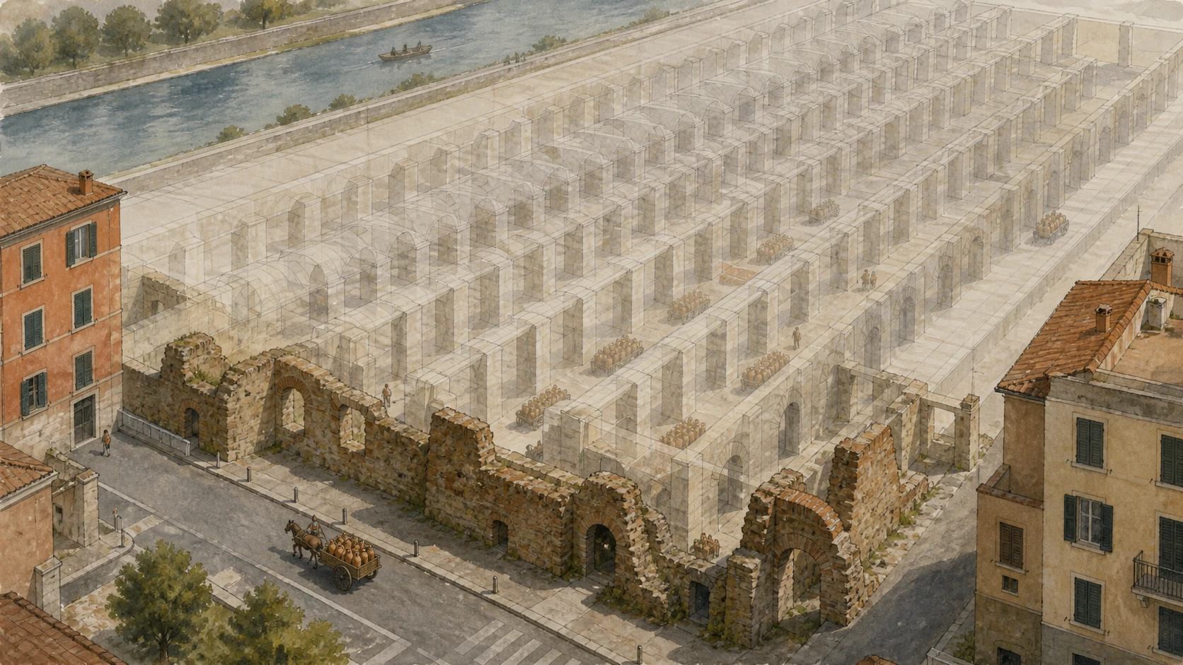
Tufa concrete walls and arches appear between Via Rubattino, Via Franklin and later housing. They are thick, low and incomplete, making the Porticus Aemilia easy to mistake for unrelated retaining walls. The original building ran parallel to the river for roughly 487 metres and about sixty metres in width. Rows of hundreds of piers divided it into seven longitudinal aisles and fifty transverse bays descending in pairs toward the Tiber. Modern streets cut across this grid and buildings conceal most of its footprint.

History

The porticus was closely connected with the new Republican river port. Ancient sources link construction in the early second century BC with the Aemilii, followed by completion or enlargement under the censors of 174 BC. Its tufa construction is an early monumental use of opus incertum in Rome. Function is commonly associated with storage, but the name porticus and the building’s internal arrangements have prompted continuing discussion about the exact mix of covered warehousing, handling and commercial space. Later occupation consumed or incorporated the fabric.

How to read this place

The surviving bay preserves only a fragment of the Porticus Aemilia; other ancient walls in Testaccio belong to different buildings. Use the known grid to scale the fragments, then return to what is actually visible: tufa aggregate, regular arch springing, wall thickness and a descending floor system. The Severan marble plan helps reconstruct the footprint but dates centuries after the Republican building and records Rome in another phase.

What to notice

  • Coarse tufa opus incertum with more regular blocks at arches and corners
  • A fragmentary bay continuing beneath later streets and housing
  • The downhill orientation linking storage spaces toward the river
Sovrintendenza Capitolina · Porticus Aemilia
Original documentary watercolour reconstruction cutaway of Porticus Aemilia fragments within modern Testaccio
Porticus Aemilia and the warehouse gridOriginal Merlintravel documentary watercolour · 2026
06

An artificial hill records oil supply through millions of deliberately stacked transport fragments

Monte Testaccio, an archive of amphorae

The hill is organised archaeological evidence, not a natural rise covered with random pottery and not a source of souvenir shards.

Today

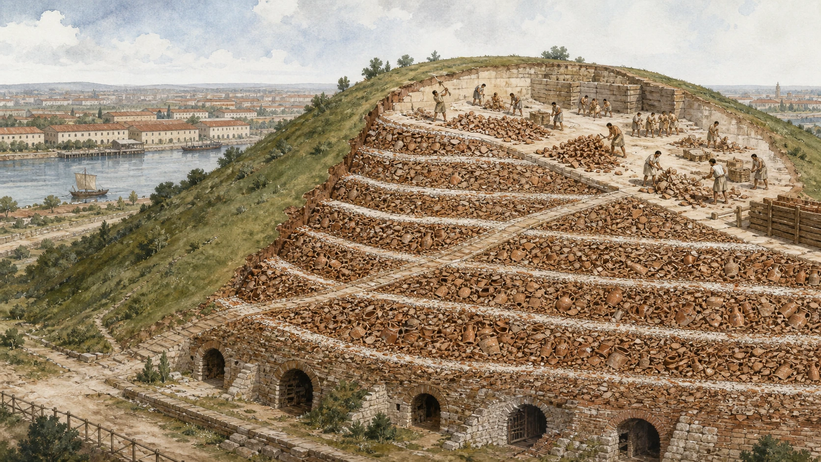
Monte Testaccio rises about fifty-four metres above sea level and measures roughly one kilometre around its base. Vegetation softens the profile, while entrances to later cellars—known as grottini—cut into the lower slopes. On an authorised ascent, paths expose dense layers of amphora handles, shoulders and body fragments rather than ordinary soil. Access is guided, booked and restricted; the edges are unsafe, the route is not fully accessible and removing even one fragment is prohibited.

History

The accumulation developed from the Augustan period to about the middle of the third century AD beside the river port and horrea. Most vessels carried olive oil from Baetica in southern Spain, with later North African imports also represented. Oil residue made many amphorae unsuitable for reuse. Workers broke and stacked them in terraces, added lime to reduce odour and instability, and used ramps for carts. Stamps and painted tituli record workshops, exporters, weight, inspection and consular dates. After dumping ceased, the hill supported medieval games, religious performances, wine cellars and nineteenth-century outings.

How to read this place

Calling Monte Testaccio an ancient landfill is useful only if controlled organisation is retained. It was selective, engineered disposal bound to fiscal and commercial systems. Individual stamps are not decorative marks: context and sequence make them historical evidence. Do not scrape, rearrange or pocket pottery, and do not enter private cellars. From the summit, relate the hill to the Tiber and warehouse plain rather than treating the panorama as the main attraction.

What to notice

  • Amphora fragments stacked in coherent layers with little ordinary soil
  • Handles carrying stamps and body sherds retaining painted commercial notes
  • Later cellar mouths cut into an ancient accumulation rather than natural rock
Sovrintendenza Capitolina · Monte Testaccio
Original documentary watercolour cutaway of Monte Testaccio with ordered amphora layers, lime bands and cart ramps
Monte Testaccio, an archive of amphoraeOriginal Merlintravel documentary watercolour · 2026
07

A contemporary food market is suspended over traces of the ancient storage and transport district

The New Testaccio Market and its archaeology

Daily trade continues above exposed ancient remains, but continuity of function should not be confused with continuity of buildings or ownership.

Today

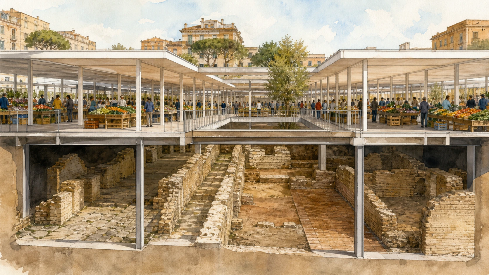
The covered New Testaccio Market occupies a bright modern grid of stalls around open courts. Below and between the market structures, protected archaeological areas preserve wall lines, road or yard surfaces and remains associated with the ancient commercial district. Elevated views allow shoppers to recognise a lower historical level without walking through it. The arrangement makes archaeology part of ordinary movement, though access to individual excavation areas may depend on guided openings and current market operations.

History

The market site lies within the broad Emporium landscape of quays, Porticus Aemilia, horrea and Monte Testaccio. Republican investment was followed by major imperial expansion between the first and second centuries AD. Excavation before construction of the modern market recovered evidence for storage, circulation and later reuse rather than one perfectly preserved warehouse. The neighbourhood’s traditional open market formerly occupied Piazza Testaccio; its relocation to the new building belongs to the twenty-first-century reorganisation of local commerce, while the Fountain of the Amphorae returned to the old square.

How to read this place

It is tempting to call the modern market a direct descendant of the Emporium, but the social and economic systems are radically different. The useful continuity is topographical: exchange still takes place over ground shaped by ancient supply. Read the supports and transparent edges of the new building as deliberate framing devices. Respect working stalls, avoid blocking circulation and never enter fenced archaeological voids for a closer photograph.

What to notice

  • Modern market columns landing around rather than disguising lower remains
  • Ancient wall alignments that do not match every present-day aisle
  • Open courts bringing daylight into both commerce and archaeological viewing
Roma Capitale Tourism · New Testaccio Market archaeology
Original documentary watercolour cutaway of the New Testaccio Market suspended above ancient warehouse remains
The New Testaccio Market and its archaeologyOriginal Merlintravel documentary watercolour · 2026
08

Municipal architecture once organised slaughter and inspection; cultural reuse now occupies the same rational grid

Mattatoio: industrial archaeology and reuse

Ersoch’s pavilions are not picturesque sheds but parts of a carefully planned civic production complex with difficult labour histories.

Today

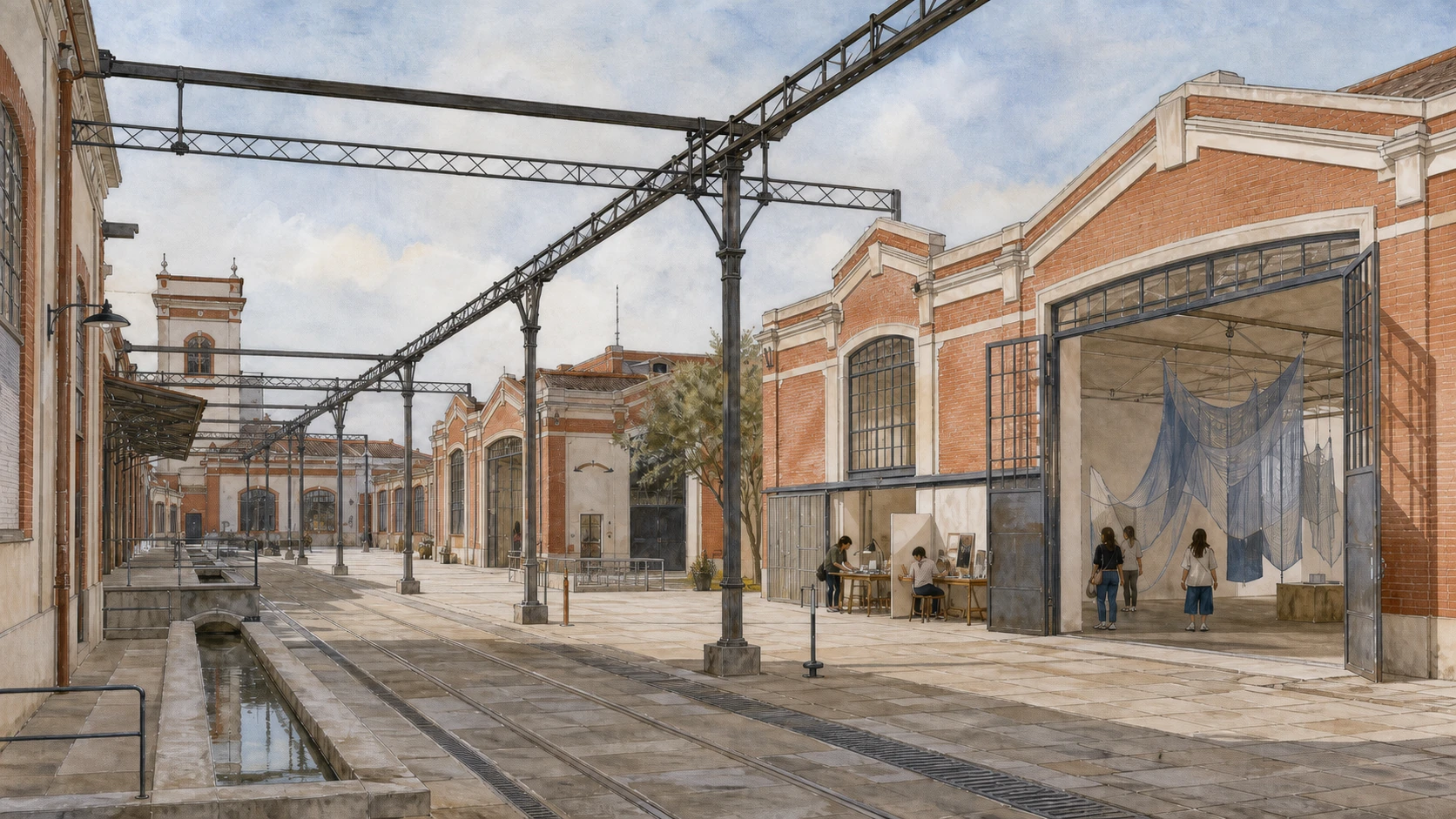
The Mattatoio complex spreads across brick and pale-rendered pavilions, open yards, iron frames, rails and surviving overhead systems. Piazza Orazio Giustiniani provides access to cultural spaces managed by Azienda Speciale Palaexpo, while other portions support university, educational and community uses. Exhibitions and performances occupy selected buildings; the whole former slaughterhouse is not one continuously open museum. Restored surfaces coexist with intentionally retained mechanisms whose original purpose may be uncomfortable but should not be concealed.

History

Municipal architect Gioacchino Ersoch designed the slaughterhouse, built from 1888 to 1891 when Rome was expanding beyond its old walls. The complex separated animal arrival, holding, slaughter, processing, inspection and removal through a rational circulation system connected to water, roads and rail. It contributed to Testaccio’s working-class identity and to the food economy of the capital. After slaughterhouse activity ended, abandonment and partial reuse were followed by a long conversion into cultural and educational spaces.

How to read this place

Industrial archaeology is not valuable only because it produces dramatic photographs. Measure yards, rails, hooks, roof spans and drainage against the movement of animals and workers. Contemporary art does not erase that history, and the former function should not be sensationalised. Check the programme because public access follows events and building schedules; do not cross barriers into unrestored pavilions.

What to notice

  • Repeated pavilions organised around yards rather than one factory hall
  • Iron rails and overhead handling frames retained as evidence
  • New cultural insertions that remain visibly separate from Ersoch’s fabric
Mattatoio di Roma · site and architectural history
Original documentary watercolour of the Mattatoio pavilions, iron handling frames and contemporary cultural reuse
Mattatoio: industrial archaeology and reuseOriginal Merlintravel documentary watercolour · 2026
09

Capitoline sculpture and early municipal power machinery share a museum without sharing an original context

Centrale Montemartini: machines and gods

The museum’s famous contrast is a modern curatorial decision built on two authentic but separate histories: Rome’s archaeological collections and its public electricity system.

Today

Inside the former power station, white marble statues, mosaics and architectural fragments stand against dark diesel engines, turbines, pipes, switchgear and tiled control surfaces. The machinery establishes scale and rhythm rather than functioning as theatrical decoration. Objects belong to the Capitoline collections and come from many urban excavations; they were not discovered inside the plant. Current displays and temporary exhibitions can alter routes, while parts of the larger energy site remain technical infrastructure rather than museum space.

History

A popular referendum in 1909 supported municipalisation of Rome’s public services and the creation of the municipal electricity company. The Via Ostiense plant opened in 1912 under Mayor Ernesto Nathan and was named in 1913 for Giovanni Montemartini, the councillor who shaped its technical and financial programme. Steam turbines supplied continuous demand and diesel engines met peaks; the historic plant was largely decommissioned in the mid-1960s. In 1997, renovation of the Capitoline Museums prompted the temporary exhibition ‘Machines and Gods’. Its success led to a permanent museum in 2001.

How to read this place

The encounter between antiquities and machinery is a modern curatorial choice. Their encounter is a late twentieth-century curatorial argument that reveals scale, material and civic collecting. Identify what each object did or represented before admiring the contrast. A statue may be ancient but heavily restored; a machine may be original to the plant but inactive. The continuing Acea energy presence nearby also complicates the phrase former power station.

What to notice

  • White sculpture isolated against black engines without false archaeological context
  • Diesel cylinders, flywheels and tiled control panels retained at architectural scale
  • Labels tracing ancient works back to city excavations and Capitoline collecting
Musei Capitolini · Centrale Montemartini
Original documentary watercolour of Roman sculpture displayed among preserved engines in Centrale Montemartini
Centrale Montemartini: machines and godsOriginal Merlintravel documentary watercolour · 2026
10

A nineteenth-century reconstruction preserves and reframes a venerated tomb and works from earlier basilicas

Saint Paul Outside the Walls

The basilica’s immense early Christian plan survived as a model after the 1823 fire, but most of the visible building belongs to the rebuilding completed under Pius IX.

Today

A four-sided portico opens toward the columned façade before five long naves lead to the papal altar and apse. The regular polished columns, coffered ceiling and repeated papal portraits create an apparently unified interior. Yet the tomb area exposes the sarcophagus beneath the altar, Arnolfo di Cambio’s 1285 ciborium rises above it, the triumphal arch and apse preserve complex mosaic histories, and the Cosmatesque cloister retains paired twisted columns and medieval mosaic work. The basilica is active worship space and part of an extraterritorial Holy See property.

History

A modest Constantinian basilica was consecrated around AD 330 above the venerated burial of Paul on the Via Ostiensis. Theodosius, Valentinian II and Arcadius sponsored a much larger building, consecrated in 390, which reversed the earlier orientation while keeping the tomb in place. Medieval patrons added doors, ciborium, mosaics and cloister. Fire in July 1823 devastated most of the basilica. Luigi Poletti led a reconstruction on the earlier dimensions, dedicated by Pius IX in 1854 and completed in later phases. Excavations in 2006 exposed the sarcophagus more clearly to visitors.

How to read this place

The present nave largely belongs to the nineteenth-century reconstruction of the earlier basilica. Its scale and five-aisled scheme consciously recover the predecessor, but construction, columns, ceiling and much decoration are nineteenth-century. Conversely, the fire did not erase every earlier object. Read the tomb, ciborium, arch, apse and cloister separately, checking restoration histories. The sarcophagus supports the continuity of veneration at the site; claims about the apostle’s remains belong to religious and archaeological interpretation, not modern forensic certainty.

What to notice

  • The exceptionally regular nineteenth-century nave built to an ancient basilical scale
  • Arnolfo’s Gothic ciborium marking the tomb beneath the papal altar
  • Paired and twisted Cosmatesque cloister columns surviving beside the rebuilt church
Papal Basilica of Saint Paul Outside the Walls · official history
Original documentary watercolour cutaway of Saint Paul Outside the Walls showing rebuilt nave, tomb, ciborium and cloister
Saint Paul Outside the WallsOriginal Merlintravel documentary watercolour · 2026

The district through time

A short chronology

From Republican port investment and an Augustan tomb to municipal electricity and permanent museum reuse, these dates connect the long systems that moved goods, people, power and memory through southern Rome.

  1. A new commercial port and warehouse district develops south of the Aventine as Rome’s supply system expands.

  2. Censorial works complete or enlarge the Porticus Aemilia within the Republican Emporium landscape.

  3. The heirs of Gaius Cestius construct his marble-clad pyramid tomb within the recorded deadline.

  4. Millions of mainly oil-amphora fragments are systematically stacked to form Monte Testaccio.

  5. The Aurelian Walls absorb the Pyramid of Cestius and establish Porta Ostiensis in the defensive circuit.

  6. Honorian strengthening transforms the road gate while preserving its Ostiense function.

  7. A Constantinian basilica is consecrated above the venerated burial of Paul.

  8. The much larger basilica of the three emperors is consecrated, reversing orientation but retaining the tomb.

  9. Cosmati and Vassalletto workshops create the cloister at Saint Paul.

  10. Arnolfo di Cambio completes the ciborium above the papal altar and tomb.

  11. Authorised non-Catholic burials begin near the Pyramid of Cestius.

  12. Fire destroys most of the ancient and medieval basilica of Saint Paul.

  13. Pius IX dedicates the monumental reconstructed basilica led by Luigi Poletti.

  14. Gioacchino Ersoch’s municipal slaughterhouse is built beside Monte Testaccio.

  15. Rome municipalises electricity services and opens the Via Ostiense power station.

  16. ‘Machines and Gods’ moves Capitoline works into Montemartini and becomes a permanent museum.

Before your visit

Practical information

01

Plan around controlled openings

Pyramid interior, Porta San Paolo museum, Emporium and Monte Testaccio require current official confirmation; exterior viewing is not evidence of access.

02

Treat the cemetery as active

Use the official map, keep voices low and avoid funerals, mourners and stepping across graves.

03

Never collect amphora fragments

Every sherd on Monte Testaccio is protected archaeological evidence; remain on the guided route and away from slope edges.

04

Do not block working commerce

At the New Testaccio Market, observe archaeology from designated points without interrupting vendors or delivery routes.

05

Separate machines from sculpture

At Montemartini read both labels: the power equipment and the ancient objects reached the room through different histories.

06

Respect worship at Saint Paul

Services, pilgrim routes and prayer at the tomb take priority; check separate access and fees for the cloister area.

Method and sources

Sources and image credits

The guide uses current official material from Roma Capitale Tourism, Sovrintendenza Capitolina, the Italian Ministry of Culture, Mattatoio di Roma, the Capitoline Museums, Acea and the Papal Basilica of Saint Paul Outside the Walls, checked on 27 August 2026. It distinguishes Roman Egyptianising architecture from Egyptian royal monuments; Cestius’s tomb from its later incorporation into the wall; Porta Ostiensis from the medieval name Porta San Paolo; exterior visibility from interior access; the active multi-faith cemetery from a literary celebrity park; Republican origins of the Emporium from later visible quay phases; the reconstructed Porticus grid from isolated street fragments; organised amphora disposal from random refuse; the modern market from the ancient supply economy; slaughterhouse evidence from picturesque industrial styling; Capitoline objects from power-station context; and Saint Paul’s nineteenth-century envelope from surviving, restored and excavated earlier fabric.

All ten images are original Merlintravel editorial watercolours based on documented present-day conditions. They are illustrations, not substitutes for archaeological plans. Opening hours, tickets, accessible routes, temporary exhibitions and conservation work can change; consult the linked official pages shortly before visiting.