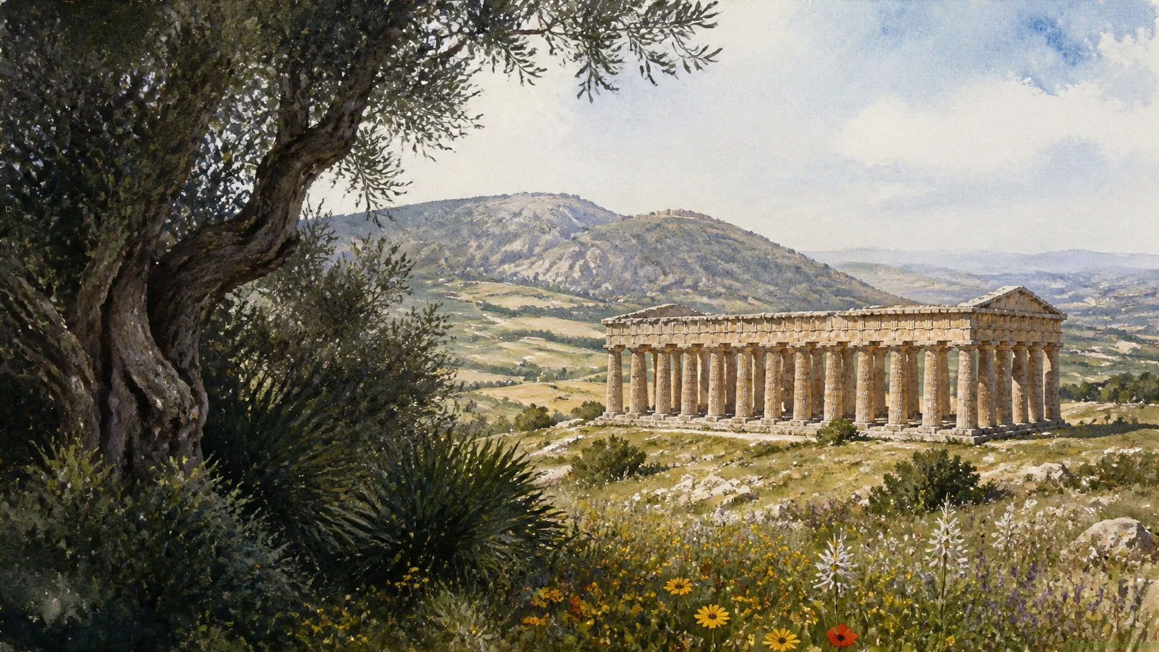
Documentary watercolour of Segesta's Doric temple, the green slopes of Monte Barbaro and the western Sicilian landscape

Illustrated guide · Sicily

An Elymian city,
a Doric silhouette
and many lives on the mountain

Twenty-two substantial chapters follow Segesta from Elymian identity and Mediterranean politics through walls, sanctuaries, temple, theatre, houses, medieval settlement and the living archaeological park.

Explore the places
Segesta · Elymian identity, Greek forms, Roman city and medieval mountain

A western chapter in a journey that began with family roots

Sicily first entered this project through family memory, journeys to relatives and summers in Taormina.

Segesta carries that personal beginning toward the island's west. Here Sicily cannot be told as a sequence in which one people simply replaces another: an Elymian community used Greek architectural language, negotiated with Phoenician and Greek neighbours, called Athens and Carthage into its conflicts, prospered under Rome and later gave the same summit to Muslim and Christian inhabitants.

That is why this guide refuses the postcard shortcut. The famous temple and theatre remain essential, but they become more meaningful when the visitor also reads gates, terraces, water systems, houses, sanctuaries, graves and medieval walls.

The aim is not to make the mountain look crowded. It is to restore the density of human choices held inside a landscape that now appears open and silent.

One destination

Twenty-two chapters across an Elymian city larger than its two famous monuments

Segesta occupied the slopes and twin summits of Monte Barbaro in western Sicily. Natural scarps protected parts of the settlement; walls, gates and roads organised the other approaches. The western temple hill stood outside the main urban enclosure, while the public city, theatre and later medieval occupation concentrated on the northern acropolis and houses extended across the southern one.

Greek columns do not turn Segesta into a Greek colony. The city belonged to the Elymian world and adopted, adapted and commissioned forms circulating across the Mediterranean. Its long rivalry with Selinunte and appeals to Athens and Carthage made a local frontier dispute part of island-wide history, yet material culture also records trade, worship and shared craft rather than permanent ethnic separation.

The archaeological park preserves a dispersed landscape. Some areas are monumental and immediately visible; others survive as low foundations, reused blocks or excavated sectors opened only on special routes. A complete visit therefore requires both distance and caution: named buildings remain scholarly interpretations, current excavations can revise them, and seasonal events or conservation work can change access.

The selection

Twenty-two chapters across mountain, city and sacred landscape

The route consolidates related architectural parts while preserving political history, urban systems, houses, medieval settlement, excavation and present conservation.

  1. 01Monte Barbaro, Two Summits and the Western Sicilian Landscape
  2. 02Elymians, Names and Trojan Traditions
  3. 03Selinunte, Athens and a Local Conflict with Island-Wide Consequences
  4. 04Carthaginian Protection, Selinunte's Fall and Agathocles' Dicaeopolis
  5. 05Rome, Trojan Kinship, Civic Privilege and the Age of Verres
  6. 06Two Acropoleis, Urban Plan and Lower Walls
  7. 07The Upper Circuit, Porta di Valle and Monumental Approaches
  8. 08The Doric Temple: Landscape and Design
  9. 09An Unfinished Temple over an Earlier Sacred Place
  10. 10Contrada Mango: Peribolos, Temple Building and an Elymian Sacred District
  11. 11Grotta Vanella and the Sacred Materials from the Summit
  12. 12The Theatre: Cavea, Stage and Living Performance
  13. 13Agora Terraces and the North Stoa
  14. 14Bouleuterion, Gymnasium and the Problem of Naming Civic Buildings
  15. 15The So-Called Sacred Road of the Aedicules
  16. 16The Southern Acropolis, House of the Ships and House of the Navarch
  17. 17The Hellenistic Necropolis outside Porta di Valle
  18. 18Late Antiquity and Byzantine Life among Reused Buildings
  19. 19The Islamic Village and Mosque on the Northern Acropolis
  20. 20The Norman-Swabian Castle, Churches and a Shared Summit
  21. 21The Stazzo, Antiquarium and Objects that Correct the Monumental View
  22. 22Excavation, the 2023 Fire and a Living Archaeological Park
01

TOPOGRAPHY EXPLAINS WHY THE CITY WAS DEFENSIBLE, DISPERSED AND CONNECTED TO BOTH INTERIOR ROUTES AND THE TYRRHENIAN COAST

Monte Barbaro, Two Summits and the Western Sicilian Landscape

Before temple or theatre, Segesta is a mountain system of ridges, saddles, scarps and long views.

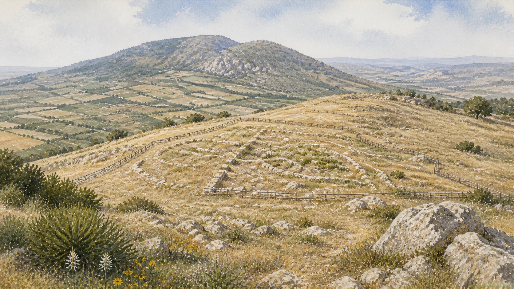
Documentary watercolour of Segesta's sparse archaeological terraces and fenced low foundations on dry Monte Barbaro above the cultivated western Sicilian valleys
A CITY IN THE MOUNTAIN

The place today

The archaeological park rises across Monte Barbaro rather than forming one compact excavation. The temple occupies a separate western hill; the ancient city spreads over a northern and southern acropolis joined by a saddle. Valleys divide the slopes from Monte Pispisa and open toward the territory of Calatafimi Segesta, Castellammare del Golfo and the Belice. Distance between monuments, strong sun, wind and uneven gradients are part of the real site.

The historical chapter

Steep eastern and southern faces provided natural defence, while accessible western and northern slopes required walls and gates. The summit commanded routes between inland Elymian centres and coastal landing places without being a seaport itself. Public buildings later occupied the northern acropolis, residential quarters extended across the southern heights, and the western sanctuary remained outside the principal enclosure. Medieval communities selected the summit again because the same topography still controlled movement and visibility.

What to notice

  • Read the gaps between monuments as historical space, not as empty parkland; most of the ancient city is not exposed as continuous masonry.
  • Do not place Castellammare's coast directly beneath the temple in your mental map. Segesta controls a regional corridor but remains an inland mountain city.
Segesta Archaeological Park · official site description
Documentary watercolour of Segesta's sparse archaeological terraces and fenced low foundations on dry Monte Barbaro above the cultivated western Sicilian valleys
A CITY IN THE MOUNTAINSparse foundations, fenced excavation areas and intermittent wall traces restore urban scale without rebuilding an imaginary complete city.
02

ARCHAEOLOGY, LANGUAGE AND FOUNDATION STORIES REVEAL IDENTITY WITHOUT MAKING IT SIMPLE

Elymians, Names and Trojan Traditions

Segesta's communities can be studied through material life and changing names while Trojan ancestry remains a powerful ancient claim rather than a literal excavation result.

Documentary watercolour of Segesta's sparse archaeological terraces and fenced low foundations on dry Monte Barbaro above the cultivated western Sicilian valleys
A CITY IN THE MOUNTAIN

The place today

Painted indigenous pottery, Greek imports, inscriptions, coins and sanctuaries provide different kinds of evidence. Greek forms such as Egesta or Aigesta and the Latin Segesta occur in texts and scholarly discussion.

The historical chapter

Greek and Roman authors associated the Elymians with western Sicily and named Segesta, Eryx and Entella among their centres. Foundation traditions changed with audiences.

What to notice

  • Avoid describing the Elymians as either untouched natives or disguised Greeks. Both formulas erase the evidence for selective interaction.
  • A myth can explain diplomacy and civic identity without becoming a factual migration itinerary.
University of Palermo · sacred spaces and objects in Elymian Segesta
03

A FRONTIER DISPUTE DREW DISTANT POWERS INTO WESTERN SICILY

Selinunte, Athens and a Local Conflict with Island-Wide Consequences

The conflict with Selinunte and appeal to Athens belong to one political sequence without reducing the Sicilian Expedition to Segesta alone.

Documentary watercolour of Segesta's sparse archaeological terraces and fenced low foundations on dry Monte Barbaro above the cultivated western Sicilian valleys
A CITY IN THE MOUNTAIN

The place today

The two archaeological parks are separated by western Sicilian river valleys and uplands. No surviving monument at Segesta can be labelled the place where the Athenian decision was made.

The historical chapter

Ancient sources record repeated disputes from the archaic period into the later fifth century BC. In 415 BC Segesta requested Athenian assistance in its renewed conflict with Selinunte and presented itself as able to help finance the campaign.

What to notice

  • Do not reduce the conflict to Elymians versus Greeks: alliances crossed cultural labels and changed with circumstance.
  • The Athenian disaster occurred chiefly around Syracuse; Segesta is the diplomatic point of departure, not the battlefield.
Treccani · Segesta and the Selinuntine conflict
04

SURVIVAL REQUIRED NEW ALLIANCES, AND LATER AUTHORS RECORDED A BRUTAL SYRACUSAN REVERSAL

Carthaginian Protection, Selinunte's Fall and Agathocles' Dicaeopolis

The decades after Athens were not a simple Punic takeover but a succession of pressure, alliance and violence.

Documentary watercolour of Segesta's sparse archaeological terraces and fenced low foundations on dry Monte Barbaro above the cultivated western Sicilian valleys
A CITY IN THE MOUNTAIN

The place today

The urban fabric does not display a neat layer labelled Carthaginian. Objects, building phases and repairs must be dated context by context. Segesta's fifth- and fourth-century history is reconstructed by combining texts with a material record that rarely mirrors political events exactly.

The historical chapter

After the Athenian defeat, Segesta appealed to Carthage. Carthaginian intervention culminated in the destruction of Selinunte in 409 BC and altered western Sicily's political order. In 307 BC Agathocles of Syracuse seized Segesta, killed or displaced inhabitants according to later narratives and renamed it Dicaeopolis. The punitive episode did not end settlement on Monte Barbaro; later Hellenistic rebuilding transformed the city on a monumental scale.

What to notice

  • Political control does not automatically determine the style of every pot, cult or house found in the corresponding period.
  • The name Dicaeopolis belongs to the Agathoclean episode; it should not replace Segesta across the site's whole chronology.
Segesta Archaeological Park · official guide
05

ROMAN ALLIANCE BROUGHT FAVOUR, BUT PRIVILEGE DID NOT FREE THE CITY FROM POWER, TAXATION OR EXTRACTION

Rome, Trojan Kinship, Civic Privilege and the Age of Verres

Segesta's Roman centuries combine political memory, urban prosperity and the abuses denounced by Cicero.

Documentary watercolour of Segesta's sparse archaeological terraces and fenced low foundations on dry Monte Barbaro above the cultivated western Sicilian valleys
A CITY IN THE MOUNTAIN

The place today

The most imposing public terraces and several rich houses belong to Hellenistic and Roman phases. Their Greek architectural vocabulary should not lead visitors to date all of them before Roman rule. Inscriptions, building technique and excavation context identify successive programmes.

The historical chapter

Segesta supported Rome during the First Punic War and promoted its legendary Trojan kinship with the Romans. It received favourable status and prospered especially between the second and first centuries BC. Cicero's speeches against the governor Verres describe the removal of a revered statue of Diana from Segesta and the coercion surrounding it. The episode shows how civic status and ancestral rhetoric could still be overridden by provincial abuse.

What to notice

  • Do not call every Greek-form building 'Greek period'; Segesta remained culturally Greek-speaking while operating inside Roman power.
  • Cicero is an advocate constructing a prosecution. His account is indispensable but should still be read as a rhetorical source.
Treccani · Segesta under Rome
06

THE CITY OCCUPIED TERRACES AND DEFENDED APPROACHES FAR BEYOND ITS FAMOUS MONUMENTS

Two Acropoleis, Urban Plan and Lower Walls

Urban organisation and the lower circuit restore a substantial city to a landscape too often reduced to temple and theatre.

Documentary watercolour of Segesta's sparse archaeological terraces and fenced low foundations on dry Monte Barbaro above the cultivated western Sicilian valleys
A CITY IN THE MOUNTAIN

The place today

The northern summit contains the theatre, agora and later medieval occupation. Segments of the lower circuit, towers and approaches survive around the western and northern slopes.

The historical chapter

Houses were established on the slopes by the late sixth century BC. A classical circuit protected the less precipitous sides of Monte Barbaro.

What to notice

  • Use the terms northern and southern acropolis as topographic guides, not as proof that one summit had only public life and the other only houses.
  • Wall masonry can be reused in later phases; visual difference alone is not a secure date.
Segesta Archaeological Park · city and acropoleis
07

A SECOND, HIGHER DEFENSIVE LINE CHANGED HOW THE CITY MET ITS VALLEYS AND EVENTUALLY CUT AN EARLIER GATE OUT OF USE

The Upper Circuit, Porta di Valle and Monumental Approaches

Gates are not decorative gaps: they record changing security, roads and urban contraction.

Documentary watercolour of Segesta's sparse archaeological terraces and fenced low foundations on dry Monte Barbaro above the cultivated western Sicilian valleys
A CITY IN THE MOUNTAIN

The place today

Porta di Valle and associated towers are best understood with an archaeological plan. Parts of the route may fall outside the ordinary short visit, and named gates do not all survive with monumental elevations. The relationship between lower and upper circuits becomes clear from changes in altitude.

The historical chapter

A higher circuit, generally associated with later ancient phases, shortened or reorganised the defended area. Research on Porta di Valle shows that an intervening wall eventually excluded the earlier gate and altered circulation. Hellenistic graves outside the walls confirm that burial, entry and defence occupied related but distinct zones. The fortifications therefore document the city expanding, monumentalising and later redefining its perimeter.

What to notice

  • A gate's abandonment does not date the abandonment of the entire city.
  • Distinguish the lower external towers from numbered elements of the upper circuit when using excavation maps.
University of Palermo · Segesta walls and necropolis
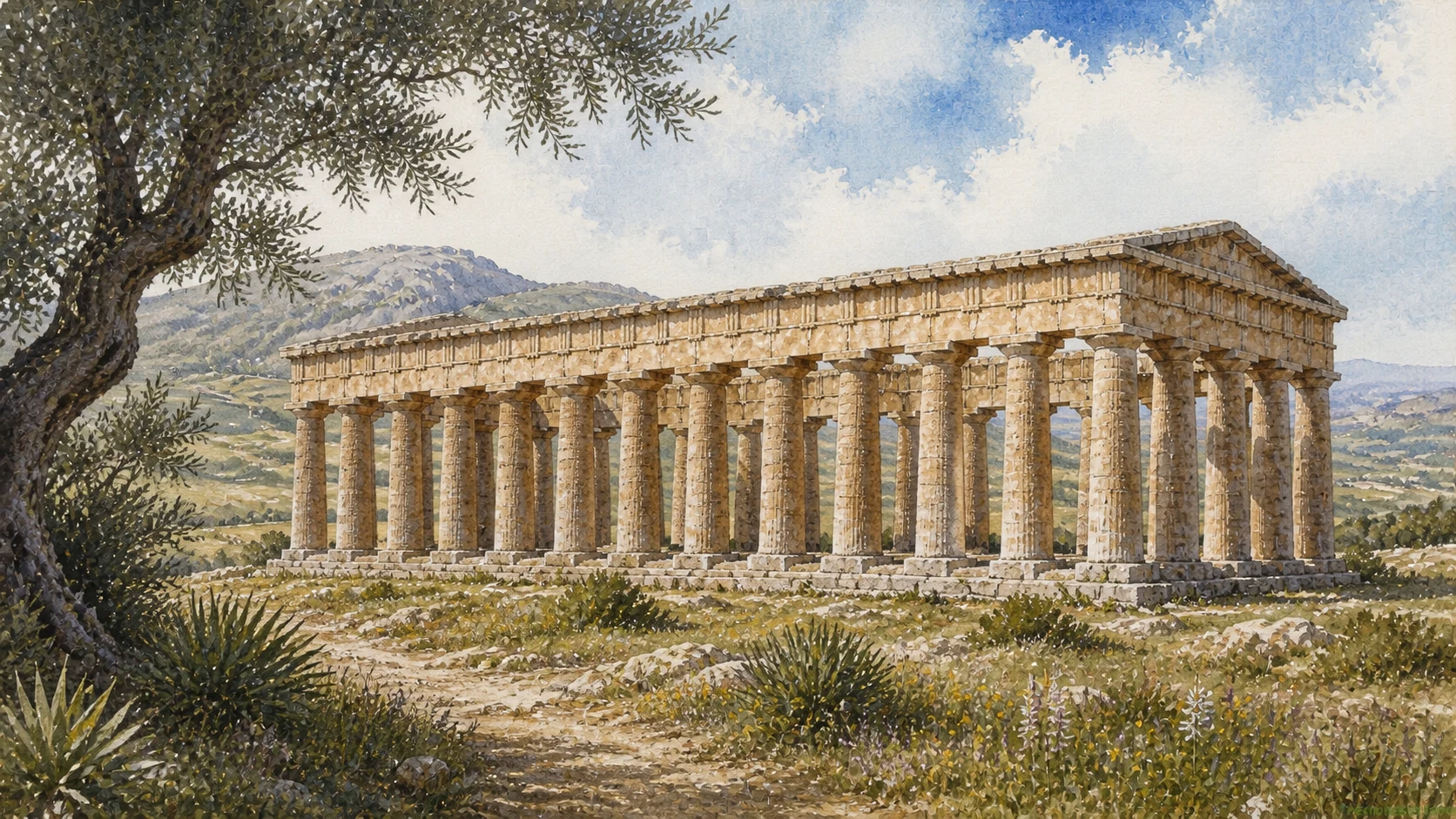
Documentary watercolour of Segesta's unfinished Doric temple seen obliquely with unfluted columns, complete external entablature, open interior and mountain landscape
THE UNFINISHED DORIC TEMPLEUnfluted columns, complete external entablature and an open interior make incompletion visible without proving that sacred use simply stopped.
08

A SIX-BY-FOURTEEN COLONNADE STANDS ON A SEPARATE HILL WITH PRECISE SICELIOTE PROPORTIONS

The Doric Temple: Landscape and Design

Position, scale and architectural system should be read together before asking why the building remained incomplete.

Documentary watercolour of Segesta's unfinished Doric temple seen obliquely with unfluted columns, complete external entablature, open interior and mountain landscape
THE UNFINISHED DORIC TEMPLE

The place today

The colonnade crowns a low hill west of Monte Barbaro. Six columns stand across each front and fourteen along each long side, counting the corner columns in both directions.

The historical chapter

The sanctuary lay beyond the principal urban circuit but within Segesta's ritual territory. The project is generally dated around 430–420 BC.

What to notice

  • Look back toward Monte Barbaro to recover the relationship between sanctuary and city that postcard views omit.
  • The honey-grey limestone is local building material; imagined white marble falsifies both geology and appearance.
Segesta Archaeological Park · official temple description
09

INCOMPLETION DOES NOT PROVE ABANDONED WORSHIP OR AN EMPTY INTERIOR

An Unfinished Temple over an Earlier Sacred Place

Unfinished construction and earlier cult structures are separate bodies of evidence whose relationship remains more complex than a picturesque shell.

Documentary watercolour of Segesta's unfinished Doric temple seen obliquely with unfluted columns, complete external entablature, open interior and mountain landscape
THE UNFINISHED DORIC TEMPLE

The place today

Column shafts remain unfluted and projecting bosses used in handling blocks were not removed. Low remains within the colonnade can be visually overwhelmed by the standing Doric order.

The historical chapter

Construction may have stopped amid the political and military crises at the end of the fifth century BC, but that explanation is not the only one proposed. Official accounts refer to a simple earlier sacred building identified during exploration within the temple.

What to notice

  • Unfluted shafts and lifting bosses are stronger evidence for unfinished dressing than the simple absence of a surviving roof.
  • Earlier sacred use does not identify the later temple's deity; continuity of place is not continuity of dedication proved by inscription.
Segesta Archaeological Park · temple interpretation
10

A SECOND EXTRA-URBAN SANCTUARY SHOWS THAT SEGESTA'S RELIGIOUS LANDSCAPE CANNOT BE REDUCED TO THE GREAT DORIC TEMPLE

Contrada Mango: Peribolos, Temple Building and an Elymian Sacred District

Contrada Mango preserves a long-used sacred enclosure whose architecture and offerings joined local and Greek forms.

Documentary watercolour of Segesta's unfinished Doric temple seen obliquely with unfluted columns, complete external entablature, open interior and mountain landscape
THE UNFINISHED DORIC TEMPLE

The place today

The sanctuary lies away from the standard temple-theatre circuit and is generally encountered through special routes, excavation reports or displays. A monumental enclosure, architectural fragments and ritual material identify a complex rather than a solitary shrine. Access can depend on park programming and active research.

The historical chapter

The sacred area was active by the archaic period. In the mid-fifth century BC it received a monumental Greek-type peripteral temple within a peribolos. Terracottas, lion-head waterspouts, palmettes, pottery and a stone architectural model illuminate construction and offering practices. Re-examination of old finds and renewed excavation are still changing the reconstruction of the sanctuary.

What to notice

  • Do not move Mango's reconstructed temple beside the standing western temple; they are separate sanctuaries in different settings.
  • An architectural model is evidence for how buildings were imagined or represented, not a miniature blueprint that can be enlarged without question.
University of Palermo · Contrada Mango sanctuary research
11

DISCARDED OR REDEPOSITED OBJECTS CAN REVEAL RITUAL PRACTICE EVEN WHEN THE BUILDING THEY SERVED REMAINS ELUSIVE

Grotta Vanella and the Sacred Materials from the Summit

The so-called Grotta Vanella deposit expands Segesta's sacred history beyond standing architecture.

Documentary watercolour of Segesta's unfinished Doric temple seen obliquely with unfluted columns, complete external entablature, open interior and mountain landscape
THE UNFINISHED DORIC TEMPLE

The place today

Most visitors understand the deposit through museum displays and research rather than a monumental cave interior. Ceramics and other finds were recovered in older campaigns and are now being restudied in their groups. The label identifies an archaeological context, not a complete sanctuary preserved in place.

The historical chapter

Material discarded from or associated with a cult area on the northern summit includes imported Attic pottery and locally meaningful ritual objects from the sixth and fifth centuries BC. Revisiting storerooms and documentation has allowed scholars to reconstruct choices of vessels, images and offerings that older monument-centred narratives ignored. The evidence makes sacred interaction visible at the scale of objects.

What to notice

  • Do not describe every fragment in the deposit as a votive offering; formation processes and original use must be evaluated separately.
  • The presence of Attic pottery records exchange and ritual selection, not an Athenian population living on the summit.
University of Palermo · the sacred at Segesta
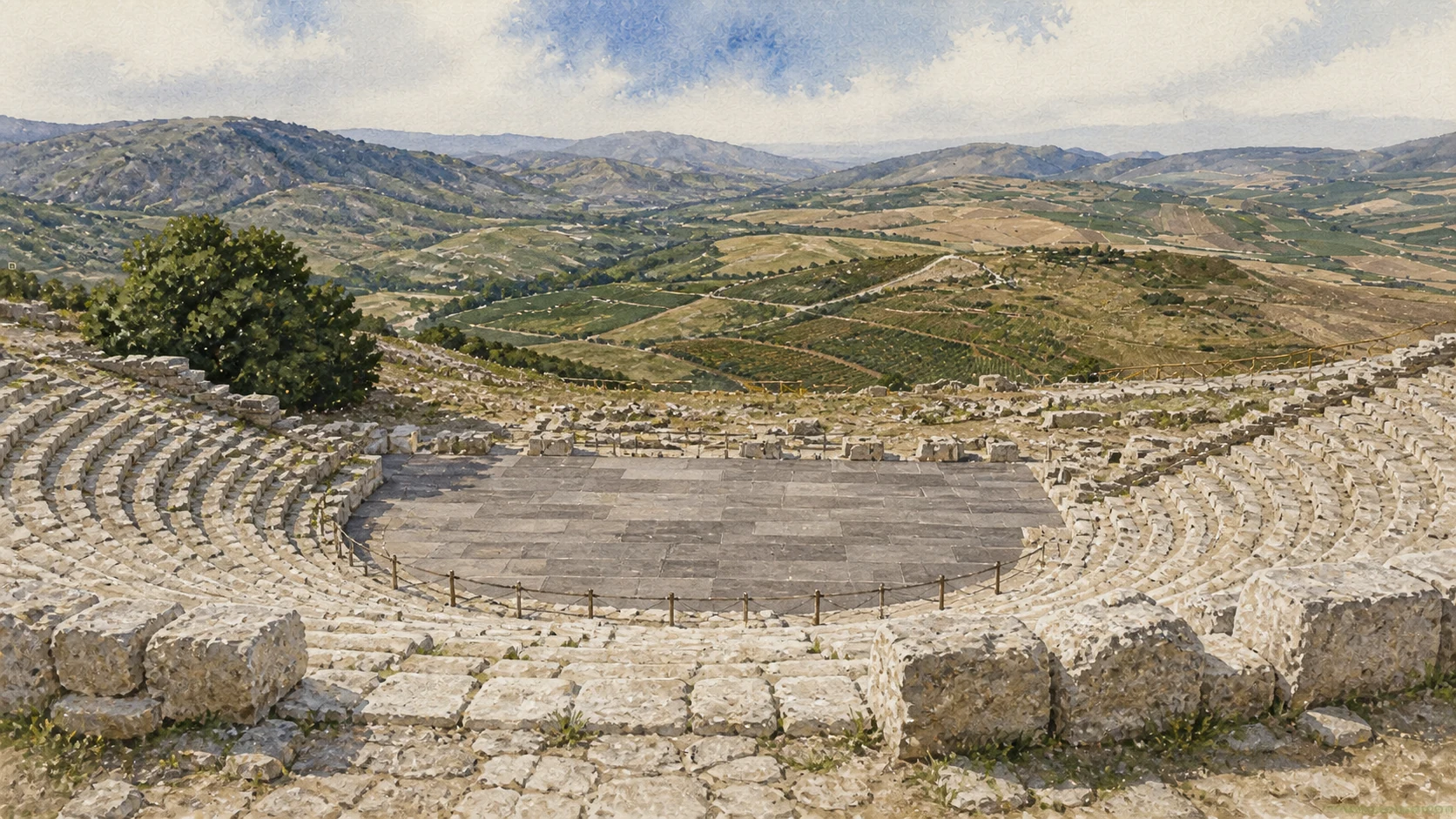
Documentary watercolour from the upper cavea of Segesta's theatre across the stone seating and modern stage floor toward the broad western Sicilian valley
THE THEATRE AND ITS HORIZONThe surviving cavea and modern stage surface face a vast agricultural landscape; the lost ancient stage building is not reconstructed.
12

STONE SEATING, A TRANSFORMED STAGE AND THE OPEN LANDSCAPE CREATE ONE COMPLEX MONUMENT

The Theatre: Cavea, Stage and Living Performance

Ancient construction phases, lost sculpture and modern performances should be distinguished while the theatre is read as a whole.

Documentary watercolour from the upper cavea of Segesta's theatre across the stone seating and modern stage floor toward the broad western Sicilian valley
THE THEATRE AND ITS HORIZON

The place today

The cavea opens northward across hills toward the Gulf of Castellammare. Seasonal productions return performance to the site but may introduce a stage, seating controls, lighting, barriers and restricted routes.

The historical chapter

The theatre was placed behind the agora on a summit with earlier sacred activity. The ancient stage complex had projecting lateral bodies and architectural sculpture that included satyr imagery associated with theatre.

What to notice

  • Look for the constructed edge and retaining logic rather than repeating that the whole cavea is carved into the mountain.
  • Check the Park before visiting: a functioning performance venue can have different circulation, opening and accessibility arrangements.
Segesta Archaeological Park · theatre study
13

CIVIC SPACE WAS BUILT THROUGH RETAINING WALLS, PORTICOES AND CONTROLLED MOVEMENT

Agora Terraces and the North Stoa

Agora and stoa reveal the scale of the Hellenistic-Roman city without pretending that every excavated room has a secure public function.

Documentary watercolour from the upper cavea of Segesta's theatre across the stone seating and modern stage floor toward the broad western Sicilian valley
THE THEATRE AND ITS HORIZON

The place today

Excavated walls below the theatre define terraces and building ranges around the public centre. Foundations and architectural blocks mark the northern range of the agora.

The historical chapter

Between the Hellenistic and early Roman periods, Segesta reshaped the northern acropolis with large public architecture inspired by Mediterranean and especially eastern Hellenistic models. The portico participated in the monumental programme of the later city.

What to notice

  • Identify terrace edges before trying to assign every wall to a separate building.
  • A stoa could support commercial, administrative and social activity; assigning one exclusive function is rarely justified.
University of Palermo · excavations in Segesta's agora
14

PUBLIC ARCHITECTURE CAN SUGGEST INSTITUTIONS, BUT NAMES MUST FOLLOW PLANS, INSCRIPTIONS AND CONTEXT RATHER THAN TOURISTIC EXPECTATION

Bouleuterion, Gymnasium and the Problem of Naming Civic Buildings

Segesta's civic centre contained more than one portico, yet not every excavated room has a secure ancient name.

Documentary watercolour from the upper cavea of Segesta's theatre across the stone seating and modern stage floor toward the broad western Sicilian valley
THE THEATRE AND ITS HORIZON

The place today

Park summaries refer to an agora, bouleuterion, gymnasium and probable temple around the northern acropolis. Some identifications are stronger than others and may represent complexes with several phases. On site, labels should be read as current archaeological interpretation.

The historical chapter

Council meeting, education, exercise, cult and administration were essential to the self-presentation of a prosperous Hellenistic-Roman city. Architectural ensembles around the agora allowed those activities to occupy visible civic space. Rebuilding under Roman power preserved Greek institutional vocabulary while changing patrons and political relationships. Excavation continues to refine which walls belong to which public function.

What to notice

  • Words such as bouleuterion and gymnasium describe interpreted functions, not forms that can always be recognised from one wall.
  • Keep 'probable temple' provisional unless a dedication or diagnostic cult arrangement secures it.
Segesta Archaeological Park · northern acropolis buildings
15

SMALL CULT MARKERS ALONG MOVEMENT ROUTES CONNECT DOMESTIC SLOPES, SUMMIT SANCTUARIES AND THE PUBLIC CITY

The So-Called Sacred Road of the Aedicules

Procession and everyday circulation may have shared the same hillside routes.

Documentary watercolour from the upper cavea of Segesta's theatre across the stone seating and modern stage floor toward the broad western Sicilian valley
THE THEATRE AND ITS HORIZON

The place today

The route across the southern acropolis toward the theatre is promoted on special visits alongside the House of the Navarch. Small rock-cut or built religious features can be difficult to distinguish from later cuts without guidance. Vegetation and access conditions affect visibility.

The historical chapter

Aedicules and ritual points along a route suggest that movement through Segesta carried sacred as well as practical meaning. The path linked residential and public zones rather than isolating worship inside a single temple. Its use likely changed through antiquity and later centuries, and the modern phrase 'sacred road' should not imply one immutable ceremonial programme.

What to notice

  • Look for repetition and placement of small features rather than expecting a paved avenue lined with complete shrines.
  • The modern itinerary may combine ancient segments and present-day paths; do not assume every step follows the original road surface.
Segesta Archaeological Park · House of the Navarch route
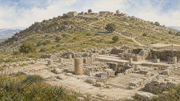
Documentary watercolour of the House of the Navarch excavation with low limestone rooms, protected geometric mosaic and sparse later remains on Segesta's summit
HOUSES AND LATER SUMMIT LIFEExcavated rooms and a protected geometric mosaic lead toward sparse later remains, keeping domestic, late-antique and medieval layers distinct.
16

MOSAICS, WATER SYSTEMS AND CONVENTIONAL NAMES OPEN A WINDOW ON ELITE DOMESTIC LIFE

The Southern Acropolis, House of the Ships and House of the Navarch

The two houses belong to a connected residential quarter, while their modern names must not be mistaken for identified owners.

Documentary watercolour of the House of the Navarch excavation with low limestone rooms, protected geometric mosaic and sparse later remains on Segesta's summit
HOUSES AND LATER SUMMIT LIFE

The place today

House foundations and possible street traces occupy the slopes beyond the compact visitor image of Segesta. The house is normally reached on guided or specially opened routes and may remain an active excavation area.

The historical chapter

Houses on Monte Barbaro changed from late archaic occupation through Hellenistic and Roman rebuilding. The residence was once associated with the wealthy shipowner Heraclius mentioned by Cicero, but the attribution is not established.

What to notice

  • Do not turn decorative ships into a biography of a known shipowner without inscriptional evidence.
  • Never cross excavation barriers for a better mosaic view; open trenches and conservation surfaces change between campaigns.
Segesta Archaeological Park · southern acropolis houses
17

BURIALS BEYOND THE WALL CONNECT CIVIC BOUNDARY, ROAD, MEMORY AND THE CHANGING USE OF THE VALLEY APPROACH

The Hellenistic Necropolis outside Porta di Valle

The dead occupied a carefully related landscape outside the living city's defences.

Documentary watercolour of the House of the Navarch excavation with low limestone rooms, protected geometric mosaic and sparse later remains on Segesta's summit
HOUSES AND LATER SUMMIT LIFE

The place today

Graves near the valley gate are less visually dominant than temple and theatre and may lie beyond ordinary short routes. Their significance depends on their position relative to roads and walls as well as grave form and objects. Exposure and reburial can limit what is visible.

The historical chapter

A Hellenistic necropolis developed outside the urban circuit near Porta di Valle. Excavation has clarified the relationship between tombs, the late archaic wall and later defensive alterations. Burials record family commemoration and social distinction, but also confirm where the city considered its boundary at particular moments.

What to notice

  • Do not assume that every space outside a wall was cemetery or that one necropolis served every period of Segesta.
  • Grave goods date and characterise burial practice only when their archaeological context is secure.
University of Palermo · necropolis and urban wall
18

THE ANCIENT CITY CONTRACTED AND CHANGED FUNCTION BEFORE THE MEDIEVAL SUMMIT EMERGED; IT DID NOT VANISH IN ONE EVENT

Late Antiquity and Byzantine Life among Reused Buildings

Reuse, spoliation and smaller occupations bridge the monumental Roman city and the later fortified village.

Documentary watercolour of the House of the Navarch excavation with low limestone rooms, protected geometric mosaic and sparse later remains on Segesta's summit
HOUSES AND LATER SUMMIT LIFE

The place today

Late walls, altered rooms, graves and ceramics can be difficult to notice because they interrupt more celebrated Hellenistic plans. Archaeological interpretation identifies them through stratigraphy and material, not greater monumentality. Some are preserved inside sectors usually described by their earlier buildings.

The historical chapter

Public architecture lost or changed function during the later Roman and Byzantine centuries. Materials were removed, walls subdivided and vulnerable buildings accumulated collapse. Recent archaeoseismological work examines deformation and destruction without reducing every change to an undocumented earthquake. Occupation persisted in altered forms before the stronger medieval concentration on the northern acropolis.

What to notice

  • Do not use 'decline' as a substitute for describing what people actually rebuilt, buried, removed or inhabited.
  • A collapse layer may result from earthquake, abandonment, salvage or later disturbance; multidisciplinary evidence is needed.
University of Palermo · Segesta archaeoseismology
19

FROM THE NINTH CENTURY, HOUSES, BURIALS AND WORSHIP RETURNED URBAN LIFE TO THE SUMMIT IN A NEW LANGUAGE

The Islamic Village and Mosque on the Northern Acropolis

Medieval Segesta was not a thin occupation laid over ruins but a community using ancient terraces and strategic height.

Documentary watercolour of the House of the Navarch excavation with low limestone rooms, protected geometric mosaic and sparse later remains on Segesta's summit
HOUSES AND LATER SUMMIT LIFE

The place today

Low house walls, burial evidence and the mosque area occupy ground near the ancient theatre and agora. Their modest scale makes them easy to overlook beside the cavea. Modern art installations or event infrastructure may temporarily alter the setting but are not part of the medieval plan.

The historical chapter

From about the ninth century the northern acropolis was inhabited and fortified, possibly associated with the place-name Qalʿat al-Ballūṭ or Calatabarbaro. Ceramics, houses, graves and a mosque reveal daily life and faith. Ancient blocks and terraces were practical resources rather than untouchable heritage. The settlement linked interior and coastal routes under new political networks.

What to notice

  • Do not call the mosque a later Christian church or erase it because only foundations survive.
  • The proposed link with Qalʿat al-Ballūṭ is historically useful but should remain qualified rather than presented as an inscription found on site.
Segesta Archaeological Park · cultures and medieval memory
20

CONQUEST CHANGED AUTHORITY AND RELIGIOUS ARCHITECTURE, WHILE PEOPLE CONTINUED TO BUILD WITHIN AN OCCUPIED AND MEMORY-LADEN LANDSCAPE

The Norman-Swabian Castle, Churches and a Shared Summit

Castle and churches transformed the medieval settlement without clearing away every Muslim or ancient trace.

Documentary watercolour of the House of the Navarch excavation with low limestone rooms, protected geometric mosaic and sparse later remains on Segesta's summit
HOUSES AND LATER SUMMIT LIFE

The place today

Foundations of the summit castle and Christian buildings overlap earlier occupation near the theatre. One church belongs to the Norman period, while a later church was founded in 1442 on already complex ground. The remains are low and require careful separation by phase.

The historical chapter

Norman and Swabian power reorganised the fortified summit after the Islamic period. Archaeology records castle construction, Christian worship, continued burial and relationships between communities that cannot be reduced to instant replacement. By the later Middle Ages administrative gravity moved toward Calatafimi, but the mountain retained strategic and symbolic value.

What to notice

  • Do not use the language of peaceful coexistence as a blanket that hides conquest, hierarchy and chronological change.
  • The church dated 1442 is not the same building as the earlier Norman religious structure; separate them in plans and chronology.
Segesta Archaeological Park · official city chronology
21

POTTERY, TERRACOTTAS, ARCHITECTURAL FRAGMENTS AND RESEARCH DISPLAYS RESTORE RITUAL AND DAILY LIFE TO THE OPEN LANDSCAPE

The Stazzo, Antiquarium and Objects that Correct the Monumental View

A small exhibition space can explain more about Elymian Segesta than another distant photograph of the temple.

Documentary watercolour of the House of the Navarch excavation with low limestone rooms, protected geometric mosaic and sparse later remains on Segesta's summit
HOUSES AND LATER SUMMIT LIFE

The place today

The adapted rural Stazzo serves park reception and exhibition functions. Displays may change, and not every object from decades of excavation is on view. Current exhibitions have highlighted Contrada Mango, Grotta Vanella and the varied faces of sacred practice.

The historical chapter

Early exploration privileged the standing temple and theatre. Later excavation, storeroom study and conservation brought fragmented material into the historical narrative. Roof terracottas, painted pottery, votive objects and architectural pieces allow researchers to reconstruct building technology, exchange, image choice and ritual action. The museum layer therefore changes how the landscape itself is interpreted.

What to notice

  • Check current exhibition information rather than promising a specific object will always be displayed.
  • Read labels for excavation context; visual beauty alone cannot tell whether an object came from Mango, Grotta Vanella, a house or a grave.
University of Palermo · Segesta sacred-objects exhibition
22

SEGESTA IS STILL BEING RESEARCHED, CONSERVED, BURNED, REGENERATED, PERFORMED IN AND REINTERPRETED

Excavation, the 2023 Fire and a Living Archaeological Park

The present landscape is neither untouched nature nor a finished excavation.

Documentary watercolour of the House of the Navarch excavation with low limestone rooms, protected geometric mosaic and sparse later remains on Segesta's summit
HOUSES AND LATER SUMMIT LIFE

The place today

Research teams continue work in the agora, House of the Navarch, sanctuaries and defensive system. The 2023 wildfire damaged vegetation and altered parts of the park landscape; subsequent regeneration is real but does not erase ecological vulnerability. Performances, paths, shuttle operations, accessibility work and seasonal closures add further present-day layers.

The historical chapter

Travellers documented the standing monuments long before systematic excavation. Twentieth-century campaigns exposed sanctuaries, walls, houses and medieval settlement; recent projects use stratigraphy, digital recording, geophysics and material reanalysis. Each method changes what can be asked. Conservation must now balance limestone weathering, vegetation, fire risk, visitor movement and active performance without freezing the mountain into a single preferred date.

What to notice

  • Treat an open trench or newly cleaned wall as provisional research, not a finished attraction with permanent access.
  • A green slope after fire is not proof of complete ecological recovery; follow park rules on smoking, paths and seasonal risk.
Segesta Archaeological Park · latest House of the Navarch research

The city through time

Ten passages through Elymian identity, Mediterranean politics and reuse

The chronology separates political events from building phases and continues beyond the Roman city into the Muslim and Christian summit and modern research.

  1. Settlement and exchange in western Sicily form the deeper context from which later Elymian communities emerge; ancient Trojan stories are cultural memory, not a substitute for archaeology.

  2. Houses appear on Monte Barbaro's slopes, while Grotta Vanella and Contrada Mango preserve evidence for sacred practice using local and imported objects.

  3. The great 6-by-14 Doric colonnade rises on the western hill but remains incompletely finished; its dedication and intended final interior are unknown.

  4. Segesta's appeal helps launch the Athenian Sicilian Expedition; Athens' wider campaign ends in catastrophe around Syracuse.

  5. Carthage intervenes after renewed conflict with Selinunte; later Agathocles seizes Segesta and imposes the name Dicaeopolis.

  6. The northern acropolis receives monumental agora terraces, porticoes and theatre, while elite houses and water systems reshape the southern slopes.

  7. Alliance and Trojan kinship support favourable Roman status; prosperity, provincial power and the abuses described by Cicero coexist.

  8. Public buildings lose or change function, materials are reused and smaller occupations and burials bridge the ancient and medieval settlements.

  9. An Islamic fortified village and mosque occupy the northern acropolis, followed by Norman-Swabian castle and churches; a later church is founded in 1442.

  10. Travellers, excavation, museum study, conservation, performance and digital archaeology progressively replace the two-monument image with a multilayered city.

Before your visit

Practical information,
without turning it into promises

01

Plan the temple and upper city as distinct routes

The western temple hill and the northern acropolis are separated by distance and elevation. Allow more time than a two-photo stop, and confirm the current internal transport service and walking route rather than assuming they operate unchanged.

02

Check the Park's current seasonal hours and tickets

The official calendar changes opening and last-entry times across the year. Tickets, events, free days, evening openings and festival access can also change; use the linked Park pages shortly before travelling.

03

Treat special sectors as research areas, not guaranteed access

Contrada Mango, the House of the Navarch, walls and lesser-known routes may open through guided visits or active excavation. Do not cross barriers or promise that a temporary route will be available on an ordinary visit.

04

Prepare for slope, sun, wind, fire risk and live performance

Wear stable footwear, carry water and protect yourself from sun. Follow seasonal fire rules and check whether theatre rehearsals, performances or accessibility arrangements alter normal circulation.

Sources

This guide cross-checks the current Segesta Archaeological Park, the Sicilian Region's official guide and visitor pages, University of Palermo excavation and object studies, recent archaeoseismological work and Treccani's historical synthesis. It distinguishes Elymian identity from isolation, foundation tradition from excavated migration, Greek architectural form from Greek colonial status, political control from cultural uniformity, temple incompletion from demonstrated ritual abandonment, a conventional house name from a known owner, different official theatre chronologies from false precision, ancient public buildings from later summit occupation, current excavation from permanent access and post-fire vegetation from complete ecological recovery.

The hero is an original documentary illustration, not an official photograph or archaeological reconstruction. Opening hours, ticket rules, internal transport, festival arrangements, excavations, conservation closures and access to special sectors can change; consult the linked official Park pages shortly before visiting. Temple dedication, reasons for incompletion, theatre chronology, functional names and several historical identifications remain qualified where the evidence does not permit certainty.