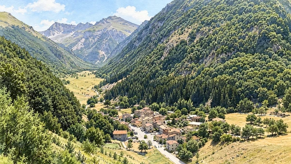
Watercolour: Sibillini Mountains establishing view

Marche · Guide 06

The Sibillini

High basins, a reservoir, pilgrimage architecture and communities rebuilding their towns reveal a mountain landscape with many scales of time.


Plan the route
Sibillini Mountains10 chapters · history, culture and landscape

Why this place matters

Choose an approach, not a collection of summits.

The Sibillini cross the boundary between Marche and Umbria. This guide concentrates on the Marche side: lake country, Visso and Ussita, Macereto, Montemonaco and the approaches to Vettore. Distances around the massif matter. A village visit, an official nature trail and a high mountain route are separate undertakings. Reconstruction after the earthquakes is a present human reality, and an older image never establishes current access.

The guide separates documented history from suggestions for reading the site. Named buildings and landscape relationships follow institutional sources; the illustrations are editorial interpretations, not measured surveys or records of current access.

High basins, a reservoir, pilgrimage architecture and communities rebuilding their towns reveal a mountain landscape with many scales of time.
The route

Plan your visit

Plan separate days for Fiastra, Visso–Ussita and Montemonaco–Foce. Macereto is a cultural destination, while the higher Vettore and Pilato terrain requires an independent mountain plan. Castelluccio is in Umbria and is not listed as a Marche town.

Lake-country day

Fiastra and a suitable official trail

Plan separate days for Fiastra, Visso–Ussita and Montemonaco–Foce.

Separate western day

Visso, Ussita and Macereto

Separate eastern day

Montemonaco and Foce

Experienced mountain option

Vettore and the Pilato basin

Ten chapters

Explore the places

The chapters connect history and terrain. Mountain areas and outlying towns are separate options, not a single continuous walking route.

  1. 01Lake Fiastra
  2. 02Lame Rosse
  3. 03The Fiastrone gorge: a closed route
  4. 04Visso and the work of recovery
  5. 05Ussita and the valley settlements
  6. 06Sanctuary of Macereto
  7. 07Montemonaco
  8. 08Foce and its valley
  9. 09Monte Vettore from an authorised viewpoint
  10. 10The Pilato basin
01

Terrain and access

Lake Fiastra

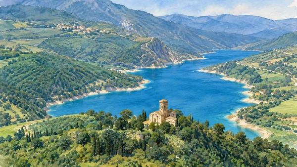
The reservoir introduces a gentler visual scale than the highest ridges. Its shoreline and surrounding settlements make water management part of the mountain story.

Today

Conditions depend on the exact route and the day. Check the responsible operator, weather and local access notices; a viewpoint is not the same undertaking as a mountain traverse.

History

The lake is an artificial reservoir, not a glacial lake. Its formation belongs to the twentieth-century use of the valley for hydroelectric infrastructure.

How to read this place

Read the water level and engineered edges alongside the wooded slopes. Use authorised shore access and confirm any activity with the responsible local operator.

What to notice

  • Read the water level and engineered edges alongside the wooded slopes.
  • The relationship between the site and its surrounding route.
  • The distinction between surviving evidence and modern interpretation.
Regione Marche · Sibillini landscape study
Watercolour: Lake Fiastra
Lake FiastraEditorial watercolour · AI-generated · 2026
02

Terrain and access

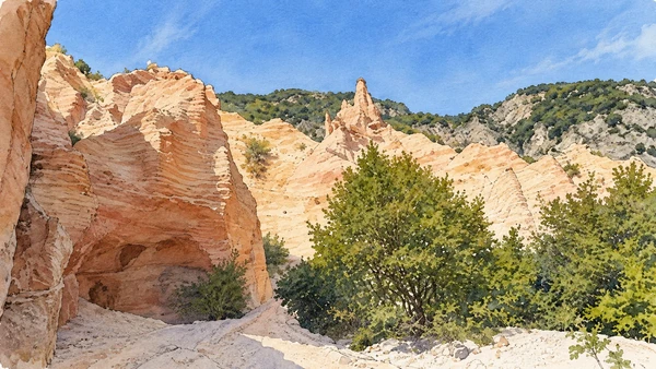
Lame Rosse

Eroded reddish formations create a striking change of colour within the wooded terrain near Fiastra. Their fragility is part of what makes the place distinctive.

Today

Conditions depend on the exact route and the day. Check the responsible operator, weather and local access notices; a viewpoint is not the same undertaking as a mountain traverse.

History

The pinnacles and loose material reflect erosion rather than volcanic construction. Their current shape is one moment in an ongoing geological process.

How to read this place

Use the park’s current route information and remain clear of unstable formations. Do not confuse access to Lame Rosse with permission to continue into the closed Fiastrone gorge.

What to notice

  • Use the park’s current route information and remain clear of unstable formations.
  • The relationship between the site and its surrounding route.
  • The distinction between surviving evidence and modern interpretation.
Regione Marche · Sibillini landscape study
Watercolour: Lame Rosse
Lame RosseEditorial watercolour · AI-generated · 2026
03

Terrain and access

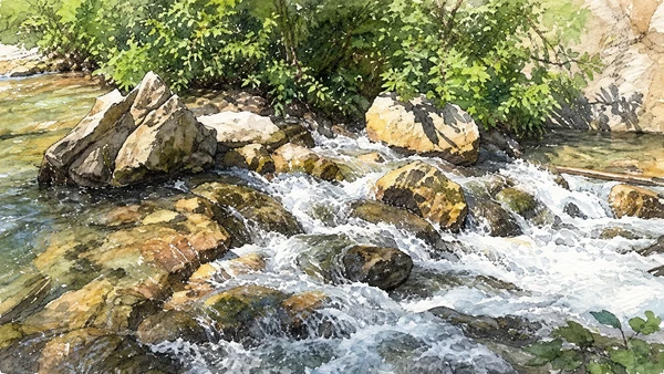
The Fiastrone gorge: a closed route

The river’s confined passage is important to understanding the landscape, but it must not be offered as a casual excursion while its route is closed.

Today

The park FAQ lists the Gole del Fiastrone route as closed, citing Fiastra Ordinance 41/2020. Check for an explicit official change before planning any access.

History

The park’s visitor guidance cites the Fiastra municipal closure of the gorge route. Nearby open destinations do not cancel that site-specific restriction.

How to read this place

Use this chapter to understand the terrain from published information. Do not follow an older itinerary, river shortcut or social-media track into the closed passage.

What to notice

  • Use this chapter to understand the terrain from published information.
  • The relationship between the site and its surrounding route.
  • The distinction between surviving evidence and modern interpretation.
Monti Sibillini National Park · routes and access questions
Watercolour: Water and rocks in the wooded Fiastrone stream
The Fiastrone gorge: a closed routeEditorial watercolour · AI-generated · 2026
04

The inhabited landscape

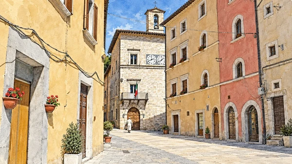
Visso and the work of recovery

The town belongs to the civic and inhabited history of the western mountains. Its story must include the people and institutions working through earthquake recovery.

Today

This remains an inhabited place. Use pedestrian routes, keep entrances clear and check municipal mobility notices for any restricted area.

History

The 2016 earthquake sequence profoundly affected Visso and neighbouring communities. Heritage conservation and the restoration of everyday services are related but distinct tasks.

How to read this place

Follow the municipality’s current accessible areas and local businesses’ actual addresses. Historic illustrations show architectural character, not a guarantee of an unobstructed present-day square.

What to notice

  • Follow the municipality’s current accessible areas and local businesses’ actual addresses.
  • The relationship between the site and its surrounding route.
  • The distinction between surviving evidence and modern interpretation.
Monti Sibillini National Park · visitor information
Watercolour: Visso streetscape interpreted from a historical photographic reference; not evidence of current conditions
Visso and the work of recoveryEditorial watercolour · AI-generated · 2026
05

The inhabited landscape

Ussita and the valley settlements

The valley’s dispersed settlements give a different rhythm from a single compact hill town. Mountains, roads and inhabited places need to be read together.

Today

This remains an inhabited place. Use pedestrian routes, keep entrances clear and check municipal mobility notices for any restricted area.

History

Ussita’s history combines pastoral activity, settlement and later mountain tourism. Earthquake recovery continues to shape how visitors encounter its buildings and services.

How to read this place

Confirm the precise locality and access route for your destination. A valley name should not be treated as one central parking area from which every site is walkable.

What to notice

  • Confirm the precise locality and access route for your destination.
  • The relationship between the site and its surrounding route.
  • The distinction between surviving evidence and modern interpretation.
Regione Marche · Sibillini landscape study
Watercolour: Ussita town hall interpreted from a historical photographic reference; not evidence of current conditions
Ussita and the valley settlementsEditorial watercolour · AI-generated · 2026
06

Worship and memory

Sanctuary of Macereto

The sanctuary stands in open upland terrain where religious architecture meets routes across the mountains. Its enclosure and central church offer a concentrated cultural visit.

Today

Worship and local religious life continue here. Visitor access may pause for services; consult the church or managing institution before planning an interior visit.

History

The sixteenth-century sanctuary surrounds an earlier chapel. The park connects the site with the historic Via Lauretana; the story of a mule stopping here is explicitly a devotional tradition.

How to read this place

Separate that tradition from the building chronology. Check current access to the complex and assess any walk from Visso as a proper excursion, not an automatic approach on foot.

What to notice

  • Separate that tradition from the building chronology.
  • The relationship between the site and its surrounding route.
  • The distinction between surviving evidence and modern interpretation.
Monti Sibillini National Park · Macereto
Watercolour: Sanctuary of Macereto
Sanctuary of MaceretoEditorial watercolour · AI-generated · 2026
07

The inhabited landscape

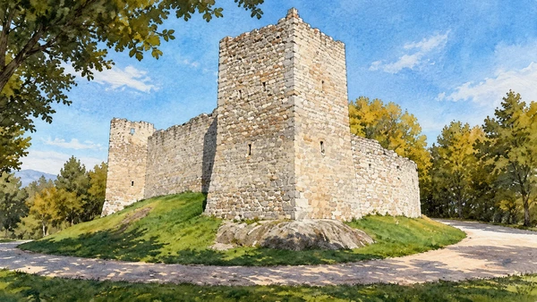
Montemonaco

The eastern village connects local life with the mountain’s literary and legendary reputation. Its streets make a suitable focus without requiring an ascent beyond them.

Today

This remains an inhabited place. Use pedestrian routes, keep entrances clear and check municipal mobility notices for any restricted area.

History

Stories associated with the Sibyl belong to the cultural history of the massif. They are traditions and literary narratives, not evidence for supernatural events.

How to read this place

Read the terrain from a public outlook and seek local interpretation of the stories. Keep a town visit separate from any route towards Monte Sibilla.

What to notice

  • Read the terrain from a public outlook and seek local interpretation of the stories.
  • The relationship between the site and its surrounding route.
  • The distinction between surviving evidence and modern interpretation.
Regione Marche · Sibillini landscape study
Watercolour: Stone fortification and tower at Montemonaco
MontemonacoEditorial watercolour · AI-generated · 2026
08

Terrain and access

Foce and its valley

The valley settlement is an approach to high terrain, but arrival here is not the same thing as completing a mountain route. The scale changes rapidly beyond the village.

Today

Conditions depend on the exact route and the day. Check the responsible operator, weather and local access notices; a viewpoint is not the same undertaking as a mountain traverse.

History

The park identifies established historic paths from Foce towards the Pilato area. Their existence does not eliminate distance, ascent, exposure or changing conditions.

How to read this place

Choose whether you are making a village visit or a properly planned hike. Never improvise a shortcut through steep ground because a lake appears close on a small map.

What to notice

  • Choose whether you are making a village visit or a properly planned hike.
  • The relationship between the site and its surrounding route.
  • The distinction between surviving evidence and modern interpretation.
Monti Sibillini National Park · routes and access questions
Watercolour: Foce and its valley
Foce and its valleyEditorial watercolour · AI-generated · 2026
09

Terrain and access

Monte Vettore from an authorised viewpoint

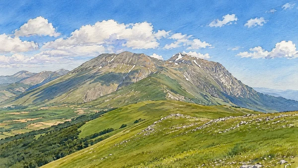
A distant view of the massif can be a complete mountain experience. The folds and exposed upper slopes reveal a different terrain from the lower wooded valleys.

Today

Conditions depend on the exact route and the day. Check the responsible operator, weather and local access notices; a viewpoint is not the same undertaking as a mountain traverse.

History

Vettore is part of the high Sibillini landscape shared by different approaches and watersheds. Its prominence does not make every visible ridge a straightforward path.

How to read this place

Identify the mountain using an official map. Summit routes require their own assessment of weather, experience and current access; no ascent is implied by this chapter.

What to notice

  • Identify the mountain using an official map.
  • The relationship between the site and its surrounding route.
  • The distinction between surviving evidence and modern interpretation.
Monti Sibillini National Park · sensitive areas
Watercolour: Monte Vettore from an authorised viewpoint
Monte Vettore from an authorised viewpointEditorial watercolour · AI-generated · 2026
10

Terrain and access

The Pilato basin

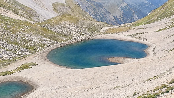
The high basin combines an imposing rocky enclosure with an exceptionally sensitive aquatic habitat. Its significance does not depend on a guaranteed amount of visible water.

Today

Conditions depend on the exact route and the day. Check the responsible operator, weather and local access notices; a viewpoint is not the same undertaking as a mountain traverse.

History

The lake’s extent varies, and the basin is known for the specialised crustacean Chirocephalus marchesonii. Conservation is central to the park’s treatment of the site.

How to read this place

Consult the park’s current rules and route status. Do not enter the water or disturb the shore, and do not interpret an illustration with water as a seasonal forecast.

What to notice

  • Consult the park’s current rules and route status.
  • The relationship between the site and its surrounding route.
  • The distinction between surviving evidence and modern interpretation.
Monti Sibillini National Park · sensitive areas
Watercolour: The Pilato basin
The Pilato basinEditorial watercolour · AI-generated · 2026

The territory through time

A short chronology

A concise chronology linking the documented sites to the wider story.

  1. Limestone structure and erosion shape the massif and its valleys.

  2. High basins preserve landforms distinct from the lower wooded slopes.

  3. Settlement, grazing and pilgrimage connect communities across the mountains.

  4. The Macereto sanctuary encloses an earlier devotional site.

  5. Lake Fiastra adds hydroelectric infrastructure to the valley landscape.

  6. National-park management brings habitats and visitor routes into a shared framework.

  7. Earthquakes deeply affect settlements and heritage across the central Apennines.

  8. Recovery, conservation and changing route conditions require place-specific planning.

Before your visit

Practical information

01

Plan separate days

Choose a manageable set of visits and allow for transport, booked entries and the return journey.

02

Use the exact place name

The Marche contain separate valleys, towns and coastal approaches. Confirm the precise locality and route rather than treating nearby names as one destination.

03

Check the institution

Opening hours, tickets, exhibitions and religious access change. Use the linked managing institution shortly before visiting.

04

Check the actual terrain

A town walk, gorge walkway, lift arrival and mountain path have different demands. Use current route information, weather and closures for the option you choose.

05

Arrange accessible visits

Historic interiors and mountain approaches can include steps, gradients or uneven surfaces. Ask about the specific route instead of assuming an entire destination is step-free.

06

Respect work and residence

Farms, workshops, churches and historic streets remain in use. Follow signs, keep entrances clear and ask permission before entering private spaces.

Method and sources

Sources and image credits

Prepared on 9 September 2026 from the institutional sources linked below. Historical claims are separated from editorial observations and itinerary suggestions. Older institutional brochures are used for stable cultural context, never as current timetables. Prices, transport schedules, trail status and admission are deliberately left to the responsible operators. Illustrations are not photographs, measured reconstructions or evidence of current conditions.

The eleven images are AI-generated editorial watercolours guided by photographic references. They interpret named places and are not photographs or substitutes for measured plans. Opening hours, tickets, accessible routes, temporary exhibitions and conservation work can change; consult the linked official pages shortly before visiting.

Illustration references and credits