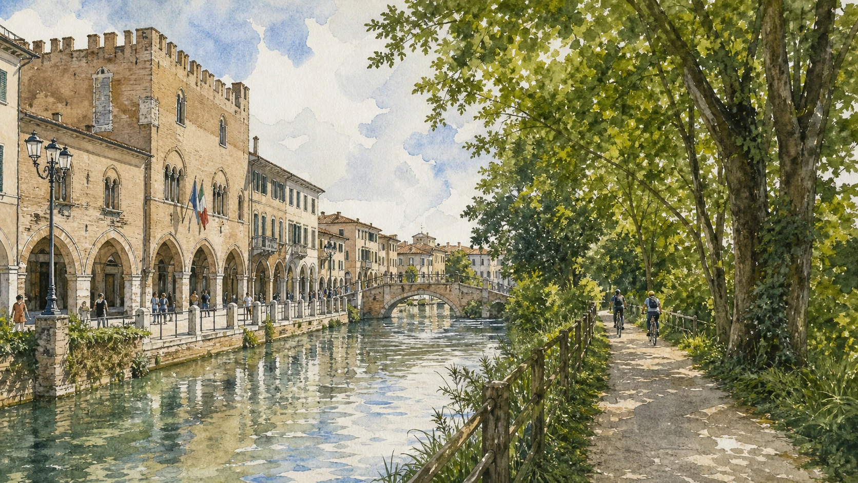
Original documentary watercolour panorama of Treviso with porticoes, canals, walls and the Sile towpath toward Casier

Veneto Guide 07 · Civic Treviso, painted churches, canals, towpath labour and protected river

Treviso & the Sile:
Porticoes, Canals, Working River

A documented route through Treviso’s civic centre, Cathedral, Santa Caterina, San Nicolò and walls, then along the Sile’s Restera to Casier and the Burci, reading water as transport, labour, habitat and public space.

Plan the route
Piazza dei Signori to Casier · Treviso10 chapters · city plus river day

Why the city and river belong together

Treviso is not a miniature Venice, and the Sile is not a scenic canal: civic institutions, frescoed churches, walls, springs, mills, towpaths and freight boats form a distinct city-river system.

Piazza dei Signori and Palazzo dei Trecento establish communal government amid porticoes and markets. The Cathedral complex, Santa Caterina and San Nicolò preserve different cycles of art and worship, while canals and the Buranelli reveal controlled urban water rather than lagoon geography.

The sixteenth-century walls and gates redefined the city under Venetian rule. Watercourses crossed those defences to power mills and connect trade. The Restera follows the historic towpath where animals hauled flat-bottomed burci against the current, linking Treviso to Casier and the lagoon network.

The Sile is a spring-fed lowland river protected by a regional park. Its reeds, fisheries, former industries, hydrography and habitats require slower interpretation than a riverside bicycle image. The cemetery of the Burci preserves decaying freight vessels whose controlled conservation belongs to wetland ecology and labour memory.

Give the historic centre a half-day, then follow the official GiraSile route on a separate half-day or full day, checking path conditions and respecting shared pedestrian and cycling space.

The route

Plan your visit

Begin in Piazza dei Signori, move through cathedral and museum precincts to canals and walls, then join the Restera toward Casier and the Burci. A separate upstream park visit can explore the river’s spring ecology.

Early morning

Civic centre and markets

Read Palazzo dei Trecento, porticoes and active market routes before heavy pedestrian traffic.

Late morning

Cathedral and museums

Choose Cathedral/San Nicolò or Santa Caterina in depth and follow worship or museum rules.

Afternoon

Canals and walls

Trace urban water to a gate and join the river edge without calling it Venetian lagoon fabric.

Second half-day

Restera to Casier

Use the official park itinerary, yield on shared paths and finish at the Burci.

Ten chapters

Explore the places

The route connects Treviso’s palaces, churches, painted façades and canals to the Sile’s springs, mills, towpaths, boats and habitats. Use the index without treating the river as decoration.

  1. 01Piazza dei Signori and Palazzo dei Trecento
  2. 02Buranelli and canals: Treviso is not Venice
  3. 03Cathedral and Baptistery: layers beneath the dome
  4. 04Santa Caterina and Musei Civici: fresco, building, collection
  5. 05San Nicolò and Tomaso da Modena
  6. 06Walls and gates: water through defence
  7. 07Sile Regional Park: a river born from springs
  8. 08Restera: walking a transport machine
  9. 09Casier and the Burci: boats returned to the river
  10. 10Living river: access with limits
01

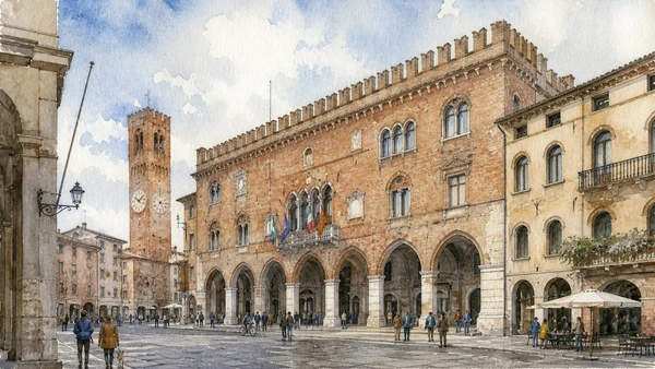
Communal government, porticoes and market streets meet in Treviso’s principal civic room

Piazza dei Signori and Palazzo dei Trecento

The square remains a working meeting place rather than an empty medieval stage.

Today

Public events, markets and municipal activity can alter access. Palazzo interiors open only for announced exhibitions or civic occasions. Read the exterior and arcades without blocking entrances.

History

The communal palace developed in the thirteenth and fourteenth centuries for the city’s councils. Later Venetian rule, alteration, wartime damage and reconstruction shaped the building now visible. Surrounding palaces sustained government and commerce.

How to read this place

Walk the arcades and compare public loggia with enclosed council hall. Post-war reconstruction is part of the monument’s visible history.

What to notice

  • Porticoes binding government to market streets
  • Council hall expressed above public ground
  • Reconstruction recording wartime destruction
Comune di Treviso · Palazzo dei Trecento
Original documentary watercolour of Piazza dei Signori, Palazzo dei Trecento, porticoes and everyday civic movement
Piazza dei Signori and Palazzo dei TrecentoOriginal Merlintravel documentary watercolour · 2026
02

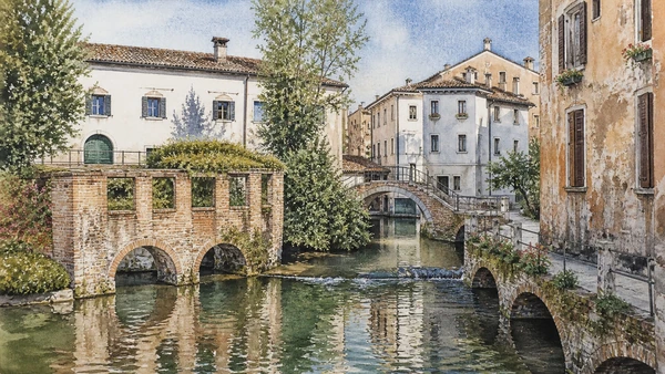
Urban branches, bridges and mill channels make controlled water visible inside the walls

Buranelli and canals: Treviso is not Venice

Treviso’s canals belong to a lowland river and mill system, not to a lagoon city copied inland.

Today

Narrow banks and bridges are shared with residents and deliveries; some edges are unguarded or slippery. Visit quietly and avoid turning laundry, homes or private courtyards into staged photographs.

History

Branches of the Botteniga and related channels crossed Treviso, feeding mills, workshops and drainage before joining the Sile. Buildings adapted to water access and changing sanitation. Restoration made selected stretches prominent public spaces.

How to read this place

Follow flow direction and look for sluices, mill traces and level changes. Compare inhabited backs with public fronts. Picturesque reflections are evidence only when connected to hydraulic work.

What to notice

  • Flow direction distinguishing canals from static water
  • Mill and sluice traces embedded in urban fabric
  • Homes and workshops sharing narrow banks
Turismo Treviso · Official destination portal
Original documentary watercolour of Buranelli canals with bridges, mill traces, inhabited banks and restrained daily use
Buranelli and canals: Treviso is not VeniceOriginal Merlintravel documentary watercolour · 2026
03

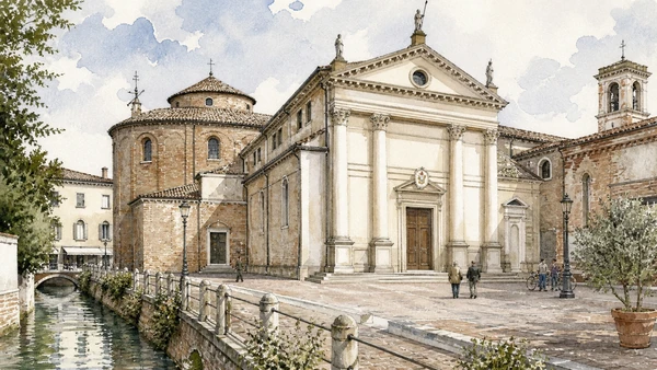
A long cathedral complex combines Roman foundations, Renaissance patronage, Titian and continuing diocesan worship

Cathedral and Baptistery: layers beneath the dome

The Cathedral should be read as an active complex rather than a container for one Titian painting.

Today

Worship, ceremonies and restoration determine entry. The crypt and baptistery may follow separate access. Dress respectfully and do not interrupt chapels in use.

History

A Christian complex developed through early and medieval phases before major Renaissance and later rebuilding. The Malchiostro Chapel received frescoes and Titian’s Annunciation, while crypt, baptistery and canonical spaces preserve other periods.

How to read this place

Begin outside with the neoclassical front as a late layer, then use floor levels and masonry to reconstruct older phases. View Titian within its chapel and patronage context.

What to notice

  • Late façade masking a much older complex
  • Crypt and baptistery preserving distinct ritual spaces
  • Renaissance art remaining inside active worship
Diocese of Treviso · Cathedral
Original documentary watercolour of Treviso Cathedral complex, baptistery, crypt and Titian chapel
Cathedral and Baptistery: layers beneath the domeOriginal Merlintravel documentary watercolour · 2026
04

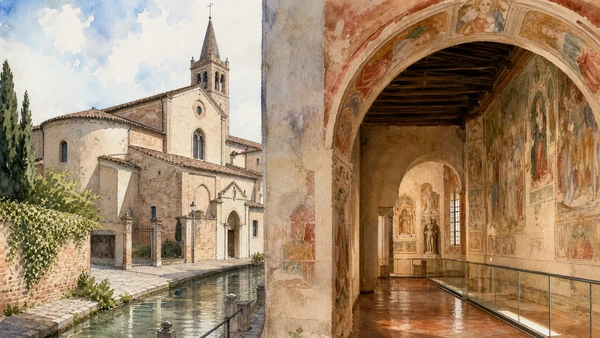
A former church and convent preserve medieval frescoes within a civic museum complex

Santa Caterina and Musei Civici: fresco, building, collection

The museum’s art should remain connected to the religious rooms and archaeological history that house it.

Today

Exhibition installation and conservation can change the route. Combined civic tickets may include other museums. The complex has multiple levels; use the current accessible path.

History

The Servite complex developed from the fourteenth century and received fresco cycles, including works associated with the Stories of Saint Ursula. Suppression and later uses preceded restoration and museum adaptation, which reunited detached art with historic spaces.

How to read this place

Read surviving wall painting before portable collections. Distinguish fresco in original setting from transferred panels. Cloister and church volume explain how the museum occupies a former institution.

What to notice

  • Fresco cycles responding to church architecture
  • Former convent adapted to civic museum circulation
  • Archaeology and art extending the city’s chronology
Musei Civici Treviso · Official site
Original documentary watercolour of Santa Caterina church, cloister, medieval frescoes and civic galleries
Santa Caterina and Musei Civici: fresco, building, collectionOriginal Merlintravel documentary watercolour · 2026
05

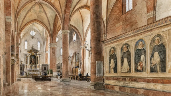
A vast Dominican church and its chapter-room portraits connect preaching, learning and early visual records of scholarly identity

San Nicolò and Tomaso da Modena

The famous painted Dominican portraits belong to a conventual learning environment, not a gallery of modern individual celebrities.

Today

The church and seminary spaces follow worship and institutional access. The chapter room may require current visitor arrangements. Maintain silence and do not enter seminary areas without permission.

History

The Dominican complex expanded in the thirteenth and fourteenth centuries. Tomaso da Modena painted a sequence of learned Dominican figures in the chapter room in 1352, representing reading and writing tools within a corporate intellectual programme.

How to read this place

Compare the immense brick church with the more intimate portrait room. Look at books, desks and gestures as signs of study, while avoiding simplistic claims about the first eyeglasses portrait without context.

What to notice

  • Large mendicant interior designed for preaching
  • Portrait sequence organising Dominican learning
  • Books and instruments documenting scholarly practice
Turismo Treviso · Official destination portal
Original documentary watercolour of San Nicolò's brick interior and Tomaso da Modena's Dominican scholars
San Nicolò and Tomaso da ModenaOriginal Merlintravel documentary watercolour · 2026
06

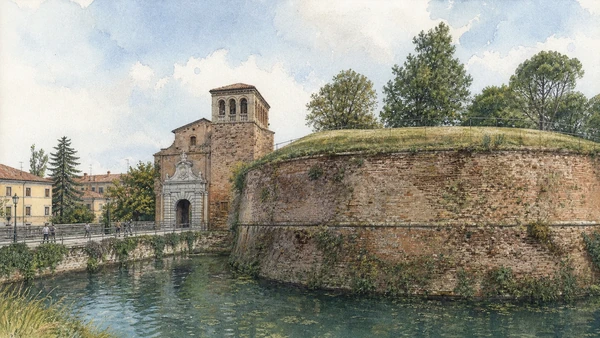
Renaissance earthworks, gates and water entries show Treviso as a defended Venetian mainland city

Walls and gates: water through defence

The walls are now green public space, but their geometry was designed for artillery, control and water management.

Today

Paths are popular for walking and cycling; road crossings interrupt the circuit. Ramparts and moat edges can be steep. Gates remain traffic nodes, so use marked crossings.

History

Venice strengthened Treviso’s defences in the early sixteenth century amid continental war. Bastions, earthworks, moats and monumental gates reorganised approaches. Later military decline and public adaptation preserved substantial sections.

How to read this place

Walk one complete bastion and observe angles, field of fire and water. Compare Porta San Tomaso’s ceremonial front with the earth mass behind it. Green space should not erase the military purpose.

What to notice

  • Angular bastions built for artillery defence
  • Watercourses integrated into moat and city entry
  • Monumental gates combining control with representation
Comune di Treviso · Civic heritage
Original documentary watercolour of Treviso walls, Porta San Tomaso, moat water and present public paths
Walls and gates: water through defenceOriginal Merlintravel documentary watercolour · 2026
07

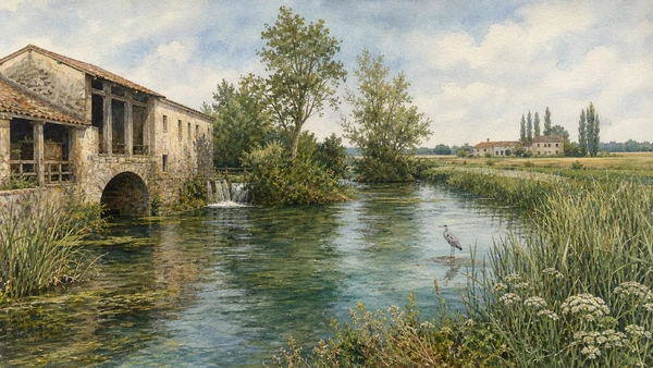
A spring-fed lowland river supports wetlands, agriculture, mills, towns and exceptional slow-flow habitats

Sile Regional Park: a river born from springs

The Sile’s identity depends on groundwater springs and a long human-natural corridor, not on mountain runoff alone.

Today

Use park maps and signed access; paths can flood or become muddy. Wildlife observation requires distance. Fishing, boating and cycling follow regulations and shared-space etiquette.

History

The Sile rises from resurgent groundwater in the plain and flows toward the Venetian lagoon. Settlements, mills, navigation, drainage and industry transformed its banks. The regional park was created in 1991 to protect natural and cultural systems across multiple municipalities.

How to read this place

Watch current speed, springs, vegetation and bank engineering. Restored habitats, farms and industrial remains coexist along the river. A slow river can still be ecologically dynamic.

What to notice

  • Spring-fed flow sustaining a relatively constant river
  • Wetland vegetation sharing space with farms and towns
  • Park boundaries coordinating many municipalities
Sile Regional Park · Official site
Original documentary watercolour of Sile springs, reed beds, lowland flow, farms and protected habitat
Sile Regional Park: a river born from springsOriginal Merlintravel documentary watercolour · 2026
08

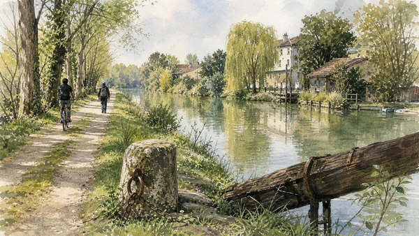
The towpath preserves the labour system that moved freight boats upstream before engines

Restera: walking a transport machine

Today’s greenway follows a working corridor where animals and people hauled burci along the Sile.

Today

The route is shared by walkers, runners and cyclists. Yield, control speed and expect narrow bridges or seasonal maintenance. The official Treviso–Casier itinerary is about 13.6 kilometres as a circuit; choose a shorter out-and-back if needed.

History

The alzaia allowed teams to tow flat-bottomed freight vessels against the current, linking Treviso’s port and mills with downstream markets. Motor transport ended much of that system, and the former industrial edge gradually became a recreational and ecological corridor.

How to read this place

Look for straight towing lines, bridge solutions and former mills. Imagine rope clearance and animal movement rather than treating the path as naturally occurring riverbank. Modern cycling adds another transport layer.

What to notice

  • Continuous bank path shaped by tow ropes and animals
  • Mills and landing places marking freight movement
  • Greenway reuse preserving a former industrial corridor
Sile Park · GiraSile Treviso to Burci
Original documentary watercolour of the Sile Restera with historic towing labour subtly overlaid on today's shared greenway
Restera: walking a transport machineOriginal Merlintravel documentary watercolour · 2026
09

Submerged timber freight boats decay within a wetland visitor route that joins industrial archaeology and habitat

Casier and the Burci: boats returned to the river

The Burci cemetery is not a romantic ship graveyard; it preserves the end of a freight system inside an active ecosystem.

Today

Stay on boardwalks and platforms. Timber is unstable, water levels change and drones or close approach can disturb wildlife. Casier remains an inhabited river town.

History

Burci carried goods along the Sile and lagoon network until motorised road transport made them obsolete. Several vessels were abandoned in a bend near Casier. Park interpretation and access works protect visitor safety while allowing wood, water and vegetation to continue interacting.

How to read this place

Identify hull structure, loading capacity and relation to towpath before focusing on decay. Conservation may accept controlled transformation rather than rebuild vessels as new. Read reeds and birds as part of the site, not visual obstruction.

What to notice

  • Timber hulls revealing freight-boat construction
  • Wetland processes transforming industrial remains
  • Boardwalk managing access without recovering every vessel
Sile Park · Burci Cemetery
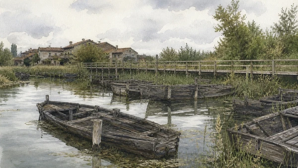
Original documentary watercolour of Casier's Burci timber hulls, boardwalk, reeds and working river settlement
Casier and the Burci: boats returned to the riverOriginal Merlintravel documentary watercolour · 2026
10

Flooding, water quality, navigation, habitat and heavy path use require continuous management

Living river: access with limits

The Sile park is not a continuous urban promenade; different reaches carry different ecological sensitivity and ownership.

Today

Check closures, avoid flooded paths, keep dogs under control, take waste away and do not feed wildlife. On bikes, slow for pedestrians. Use authorised boat operators and landing places.

History

Drainage, industry, farming and urban growth affected river quality and form. Protection, restoration and slow mobility improved some reaches while pressures continue. Climate variability and invasive species add present management challenges.

How to read this place

Notice wastewater infrastructure, bank reinforcement, restored reeds and busy path sections. Responsible use is observable behaviour, not a slogan. Choose fewer kilometres when surfaces or crowds make the route unsafe.

What to notice

  • Restored habitat beside engineered banks
  • Shared paths requiring negotiated speed
  • Water-quality management connecting city and park
Sile Park · Maps and routes
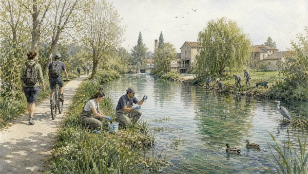
Original documentary watercolour of responsible Sile use with walkers, slow cyclists, habitat restoration and water monitoring
Living river: access with limitsOriginal Merlintravel documentary watercolour · 2026

Treviso and the Sile through time

A short chronology

From Roman Tarvisium and medieval commune to Venetian water routes, industrial canals, park protection and restored slow mobility.

  1. Tarvisium develops at a strategic lowland water and road junction.

  2. Commune, cathedral and market institutions consolidate.

  3. Palazzo dei Trecento and major mendicant complexes take shape.

  4. Tomaso da Modena paints the Dominican scholar portraits at San Nicolò.

  5. Treviso passes through changing lordships before Venetian control stabilises.

  6. Venice strengthens Treviso’s walls during the wars of the League of Cambrai.

  7. Mills, canals and the Sile support urban production and navigation.

  8. Venetian rule ends.

  9. Treviso joins the Kingdom of Italy.

  10. Rail and road transport gradually displace towpath freight.

  11. Allied bombing devastates Treviso and damages Palazzo dei Trecento.

  12. Reconstruction restores civic monuments while the city expands beyond the walls.

  13. Burci are abandoned near Casier as traditional freight ends.

  14. The Sile River Regional Nature Park is established.

  15. Museums, greenways and habitat management reconnect city and working river.

Before your visit

Practical information

01

Treviso’s waterways

Its waterways belong to a distinct spring-fed river, mill and urban-drainage system.

02

Separate church and museum access

Cathedral, San Nicolò and Santa Caterina follow different institutions.

03

Yield on the Restera

The towpath is a shared route; cyclists must slow for walkers and narrow sections.

04

Stay on the Burci boardwalk

Submerged timber and wetland are fragile and unsafe to approach directly.

05

Check water conditions

Flooded or muddy sections are reasons to shorten the route, not to bypass closures.

06

Read labour

Mills, towing, boats and freight explain the river more fully than reflections alone.

Method and sources

Sources and image credits

This guide uses current official material from Comune di Treviso, Musei Civici, Diocese of Treviso and the Sile Regional Park, checked on 28 August 2026. It distinguishes Treviso’s river canals from Venice’s lagoon; reconstructed civic fabric from untouched survival; worship from museum entry; towpath labour from recreational greenway; industrial remains from romantic ruin; and protected river from pristine nature.

All ten images are original Merlintravel editorial watercolours based on documented present-day conditions. They are illustrations, not substitutes for archaeological plans. Opening hours, tickets, accessible routes, temporary exhibitions and conservation work can change; consult the linked official pages shortly before visiting.