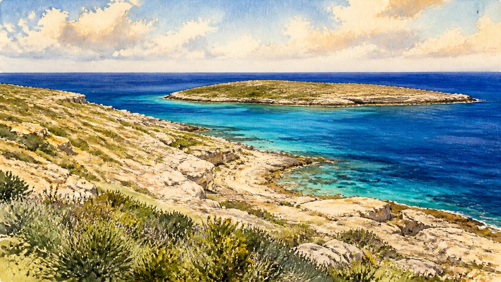
Documentary watercolour linking Ustica's dark volcanic coast, Lampedusa's pale cliffs and Linosa's red-black cones across open Mediterranean water

Illustrated guide · Sicily

Four islands,
two seas of memory

Twenty-four grouped chapters across Ustica, Lampedusa, Linosa and Lampione: volcanic villages, African limestone, Bronze Age walls, protected seas, migration and island life.

Explore the places
Ustica · Lampedusa · Linosa · Lampione

Islands are not interchangeable

The smaller islands require distance as well as detail.

Ustica rises north of Palermo in the Tyrrhenian Sea; the Pelagie lie far south, between Sicily and Africa. Combining them in one guide is useful only if their differences remain visible: dark volcanic Ustica, pale limestone Lampedusa, volcanic Linosa and the uninhabited rock of Lampione.

Their shared story is not a simple beach circuit. Each island holds evidence of movement, scarcity and protection: Bronze Age settlements, Roman routes, rural cisterns, undersea anchors, turtle nesting beaches, bird colonies and modern communities dependent on ports and weather.

The route therefore proceeds island by island and treats the crossings between them as part of the journey.

One destination

Ustica and the Pelagie,
an archipelago only on the page.

Ustica is a solitary volcanic island in the southern Tyrrhenian Sea and home to Italy's first marine protected area. Lampedusa and Lampione belong geologically to the African continental shelf, while Linosa is volcanic; together the Pelagie occupy one of the Mediterranean's most exposed ecological and human corridors.

The four islands cannot be visited as consecutive neighbourhoods. Transport, season, sea state and protected-area rules decide what is possible. Their chapters are grouped to create three complete island readings rather than a checklist of coves.

The selection

Twenty-four chapters,
four island identities

Eight chapters read Ustica, eight read Lampedusa and eight read Linosa with Lampione. Every island combines settlement, archaeology, land and sea so that no coastline is reduced to a single famous beach.

  1. 01Ustica's Volcanic Ring and Terraces
  2. 02Ustica Town and Cala Santa Maria
  3. 03The Bronze Age Village of the Faraglioni
  4. 04Rocca della Falconiera and Ancient Ustica
  5. 05The Marine Protected Area and Cala Sidoti
  6. 06Punta Falconiera Underwater Archaeology
  7. 07Rural Ustica: Trails, Cisterns and Dry Walls
  8. 08Museums, Murals and Island Memory
  9. 09Lampedusa on the African Continental Shelf
  10. 10Lampedusa Town, Porto Vecchio and Porto Nuovo
  11. 11Isola dei Conigli and the Protected Beach
  12. 12Albero Sole, Vallone Forbice and the Western Cliffs
  13. 13Cala Pulcino, Tabaccara and the Southern Coves
  14. 14The Archaeological Museum of the Pelagie
  15. 15Roman Fish Processing and the Cala Palma Catacomb
  16. 16Migration, Rescue and the Memory of the Mediterranean
  17. 17Linosa's Four Volcanic Centres
  18. 18Linosa Town, Black Stone and Coloured Houses
  19. 19Cala Pozzolana di Ponente
  20. 20Linosa's Faraglioni and Marine Coast
  21. 21Shearwaters, Migrants and the Linosa Reserve
  22. 22Linosa's Fields, Cisterns and Rural Work
  23. 23Linosa's Archaeology and Island Collections
  24. 24Lampione and the Open Pelagie Sea
01

A compact island built from eruptions and marine erosion

Ustica's Volcanic Ring and Terraces

Dark cliffs, tuff slopes and level cultivated shelves give Ustica a geology distinct from the southern Pelagie.

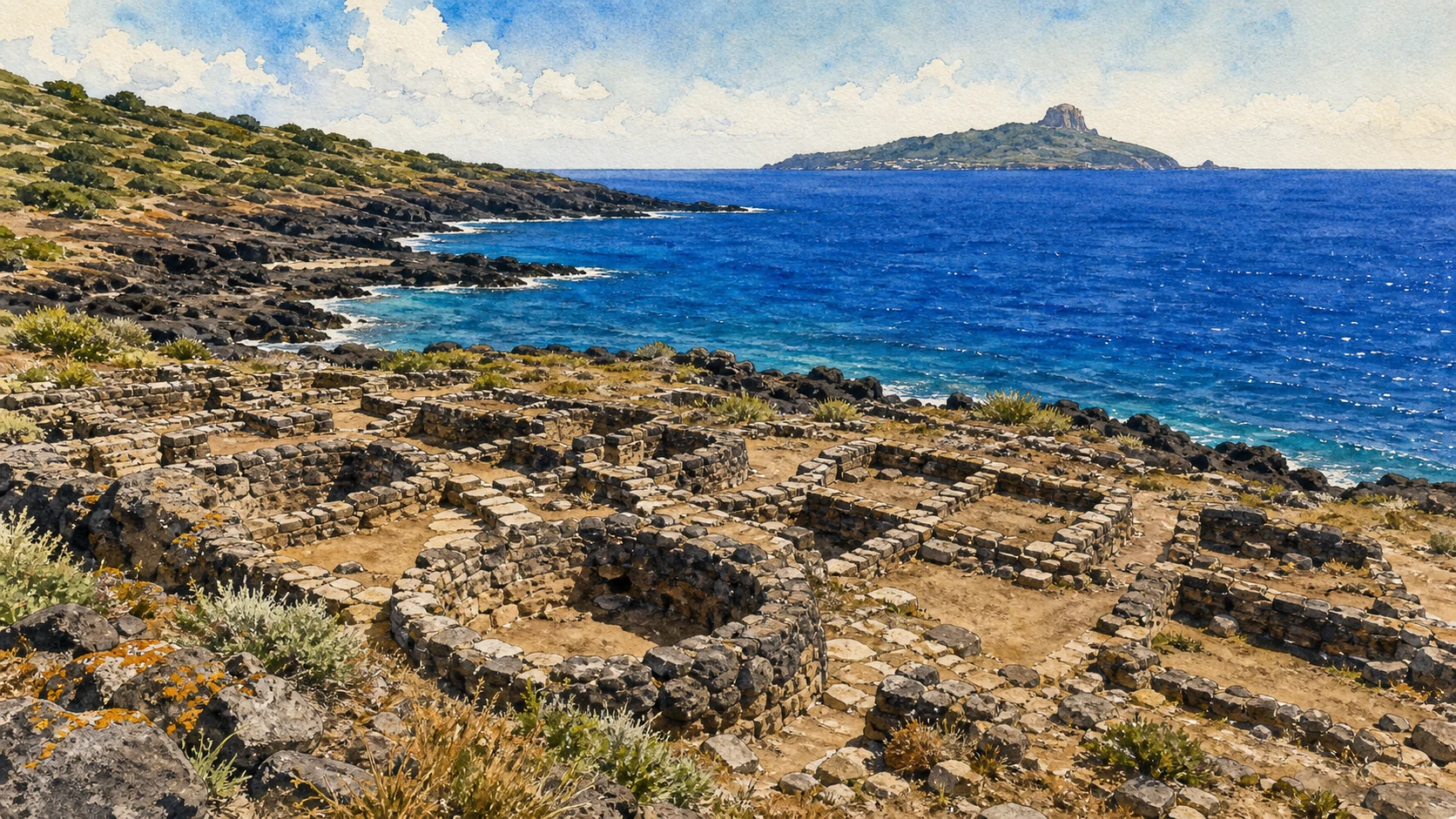
Documentary watercolour of the low stone foundations of Ustica's Bronze Age Villaggio dei Faraglioni on a dark volcanic coast
Ustica · a settlement held by dark stone

The place today

A circuit of coastal roads and paths reveals basaltic promontories, sea caves, layered tuffs and the broad Piano dei Cardoni. Old terraces, walls and cisterns occupy gentler ground, while Monte Guardia dei Turchi and Falconiera preserve higher viewpoints.

The historical chapter

Successive volcanic phases formed the island before erosion opened caves and isolated stacks. Human communities reused the available shelves for settlement and farming; natural springs are absent, so stored rainwater and careful land division became essential.

What to notice

  • Colour changes between compact lava and softer tuff
  • Terraces aligned with the limited cultivable ground
Municipality and Marine Protected Area of Ustica
02

A Bourbon settlement above the island's working harbour

Ustica Town and Cala Santa Maria

The painted town, parish church, harbour and defensive towers form Ustica's civic centre.

Documentary watercolour of the low stone foundations of Ustica's Bronze Age Villaggio dei Faraglioni on a dark volcanic coast
Ustica · a settlement held by dark stone

The place today

The harbour at Cala Santa Maria receives ferries, fishing boats and diving craft below a compact grid of houses. Piazza Umberto I, Santa Maria church and surrounding streets remain everyday spaces; murals and coloured façades add recent layers without erasing the eighteenth-century plan.

The historical chapter

After long periods of insecurity and sparse occupation, the Bourbon monarchy organised permanent resettlement in the mid-eighteenth century. Towers, fortifications and planned streets supported a community exposed to raids, storms and irregular mainland contact.

What to notice

  • The rise from harbour warehouses to the civic square
  • Defensive positions controlling the landing place
Municipality of Ustica
03

A fortified community on the exposed Tramontana cusp

The Bronze Age Village of the Faraglioni

One of Sicily's best-preserved Middle Bronze Age settlements records houses, streets and defence at island scale.

Documentary watercolour of the low stone foundations of Ustica's Bronze Age Villaggio dei Faraglioni on a dark volcanic coast
Ustica · a settlement held by dark stone

The place today

Oval huts and rectangular enclosures spread behind a powerful curving fortification with semicircular buttresses. The eastern cliff once formed a natural defence, and erosion now makes the relationship between settlement, faraglione and sea especially visible.

The historical chapter

The principal phase belongs to the fourteenth to thirteenth centuries BC and relates to the Thapsos-Milazzese cultural world. Ceramics and domestic equipment indicate an organised community connected to Sicily, the Aeolian Islands and wider maritime exchange before an abrupt abandonment around 1200 BC.

What to notice

  • The straight internal lane and clustered oval houses
  • Fortification built from large rough volcanic blocks
Sicilian Region · Village of the Faraglioni
04

A high settlement, cistern system and cemetery above the harbour

Rocca della Falconiera and Ancient Ustica

Falconiera preserves traces from Hellenistic, Roman and late-antique occupation within a dramatic tuff headland.

Documentary watercolour of the low stone foundations of Ustica's Bronze Age Villaggio dei Faraglioni on a dark volcanic coast
Ustica · a settlement held by dark stone

The place today

Paths climb above the town to rock-cut cisterns, wall lines, burial features and wide views over Cala Santa Maria. Vegetation and erosion make the archaeological evidence dispersed; the geological profile and strategic outlook remain central to understanding the site.

The historical chapter

Occupation intensified from the late fourth and third centuries BC and continued through Roman and late-antique phases. Farms and harbour trade connected Ustica to North Africa and the route toward Ostia, while later abandonment and reuse obscured the extent of the settlement.

What to notice

  • Rock-cut water storage on the exposed summit
  • Burial and settlement traces occupying different terraces
Sicilian Region · Archaeology of Ustica
Documentary watercolour of the low stone foundations of Ustica's Bronze Age Villaggio dei Faraglioni on a dark volcanic coast
Ustica · a settlement held by dark stoneThe Villaggio dei Faraglioni remains an excavated Bronze Age fabric of low walls, paths and domestic spaces on a volcanic coastal terrace, not a reconstructed monument.
05

A pioneering reserve organised through zones and permitted uses

The Marine Protected Area and Cala Sidoti

Ustica's protected sea is a managed ecological space, not an unrestricted ring of clear water.

Documentary watercolour of the low stone foundations of Ustica's Bronze Age Villaggio dei Faraglioni on a dark volcanic coast
Ustica · a settlement held by dark stone

The place today

Different zones regulate bathing, navigation, fishing and diving. Cala Sidoti and the western coast offer accessible views of rocky seabeds and coastal habitat, while reserve staff and authorised operators provide current information on routes and conditions.

The historical chapter

Established in 1986, the reserve became a national reference for Mediterranean marine protection. Long-term observation helped demonstrate how restrictions, research and local participation can support biodiversity, although pressures from warming, pollution and intensive visitation remain.

What to notice

  • Buoys and markers defining different protection zones
  • Rocky seabed communities visible without touching or collecting
Marine Protected Area Isola di Ustica
06

Anchors and amphorae within a living marine landscape

Punta Falconiera Underwater Archaeology

The submerged itinerary records repeated anchorage from antiquity to modern times.

Documentary watercolour of the low stone foundations of Ustica's Bronze Age Villaggio dei Faraglioni on a dark volcanic coast
Ustica · a settlement held by dark stone

The place today

The route below Punta Falconiera follows depths and conditions suited to certified divers with authorised support. Ancient anchors, an amphora and later material lie among rock, vegetation and fauna rather than inside a sealed museum display.

The historical chapter

Objects ranging from the Archaic to Byzantine periods show how vessels used the island's approaches across centuries. Their value comes from position and context, so the itinerary protects them in place and demonstrates why underwater archaeology is not treasure recovery.

What to notice

  • Anchors of different forms marking long chronological use
  • Marine growth integrating artefacts into the present ecosystem
Sicilian Region · Punta Falconiera underwater route
07

The interior island built around stored rain and small fields

Rural Ustica: Trails, Cisterns and Dry Walls

Away from the harbour, agricultural paths explain how permanent settlement survived on a dry volcanic island.

Documentary watercolour of the low stone foundations of Ustica's Bronze Age Villaggio dei Faraglioni on a dark volcanic coast
Ustica · a settlement held by dark stone

The place today

Trails cross lentisk scrub, former vineyards, caper plots, stone walls and cisterns toward Guardia dei Turchi and the western coast. Some rural structures are abandoned, while others remain private and active.

The historical chapter

Eighteenth-century resettlement required organised land distribution and water storage. Agriculture never erased earlier occupation, and surface finds remind visitors that modern field systems often overlap ancient and prehistoric landscapes.

What to notice

  • Cistern openings positioned near houses and plots
  • Wind-pruned vegetation on exposed ridges
Municipality of Ustica · Territory
08

Archaeology, geology and contemporary public art in one small town

Museums, Murals and Island Memory

Ustica's collections and street paintings connect research, local identity and the visitor's first walk.

Documentary watercolour of the low stone foundations of Ustica's Bronze Age Villaggio dei Faraglioni on a dark volcanic coast
Ustica · a settlement held by dark stone

The place today

Archaeological displays, earth-science collections and murals are distributed through the town and Falconiera area. Opening arrangements vary, so the urban route works best as a flexible layer around ferry times rather than a promise of continuous museum access.

The historical chapter

Twentieth-century excavations and local collecting made Ustica's deep past visible, while later educational initiatives presented the island's volcanic and marine systems. Murals added a civic visual archive that changes through new commissions and weathering.

What to notice

  • Finds from Faraglioni restoring colour to stone house plans
  • Murals interpreting sea life and island history without replacing evidence
Sicilian Region · Ustica archaeological guide
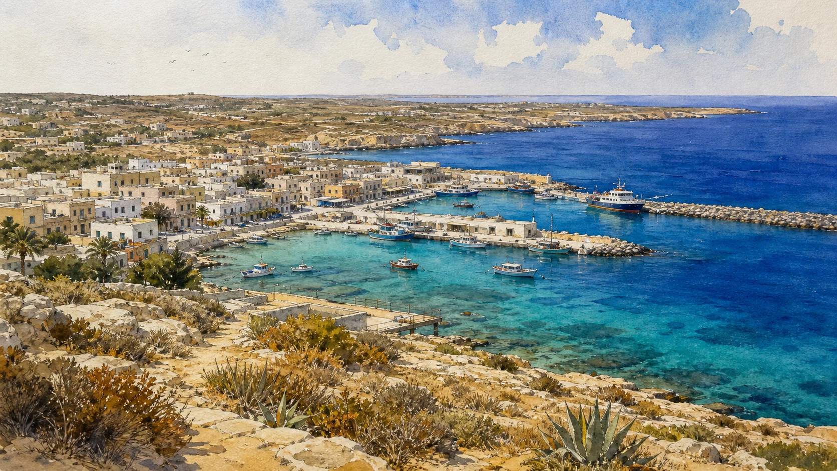
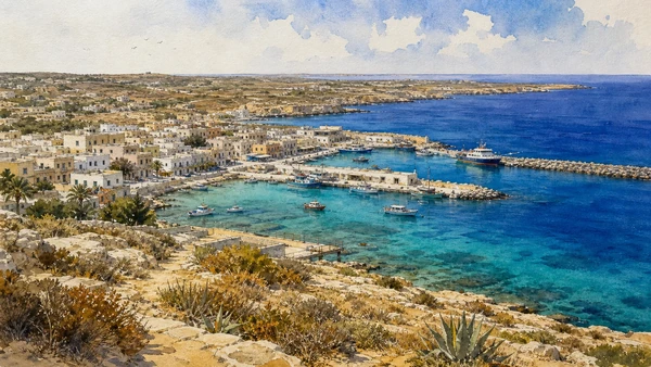
Documentary watercolour of low Lampedusa town and harbour basins with fishing boats, a small ferry and turquoise water
Lampedusa · a low town around working waterPale limestone, modest urban fabric, fishing boats and ferry basins introduce Lampedusa as an inhabited arrival place before its protected coves and cliffs.
09

Pale limestone, tabular cliffs and valleys open to the south

Lampedusa on the African Continental Shelf

Lampedusa's geology and vegetation differ fundamentally from volcanic Ustica and Linosa.

Documentary watercolour of low Lampedusa town and harbour basins with fishing boats, a small ferry and turquoise water
Lampedusa · a low town around working water

The place today

A high, relatively flat northern and western plateau ends in steep cliffs, while valleys descend toward coves on the southern side. Pale limestone, thin soil, low vegetation and strong wind create a horizontal landscape that can appear bare only when its small-scale ecology is overlooked.

The historical chapter

The island belongs geologically to the African shelf. Sea-level change, erosion and human clearance shaped its present form, while its position made it a recurrent stop for navigation, settlement and state projects despite limited water.

What to notice

  • Stratified pale cliffs rather than volcanic flows
  • Vegetation concentrated in protected valleys and restoration areas
Natural Reserve Island of Lampedusa
10

The inhabited centre between fishing, ferries and state infrastructure

Lampedusa Town, Porto Vecchio and Porto Nuovo

Lampedusa's town is the practical heart of the island and the setting for its layered modern history.

Documentary watercolour of low Lampedusa town and harbour basins with fishing boats, a small ferry and turquoise water
Lampedusa · a low town around working water

The place today

The centre extends around Via Roma and the harbour inlets, with fishing boats, ferries, services and seasonal tourism sharing limited space. The port landscape includes working zones that are not scenic promenades and whose access can change with operations.

The historical chapter

Earlier occupation was intermittent, but the Bourbon government established a permanent colony in the nineteenth century. Fishing, sponge gathering, military presence, aviation and tourism successively reshaped the settlement without removing dependence on supplies and transport from outside.

What to notice

  • Different functions of the old and newer harbour basins
  • The short distance between civic streets and working maritime infrastructure
Municipality of Lampedusa and Linosa
11

A famous bay managed as a fragile nesting habitat

Isola dei Conigli and the Protected Beach

The beach belongs first to a reserve and a turtle nesting system, not to unrestricted bathing culture.

Documentary watercolour of low Lampedusa town and harbour basins with fishing boats, a small ferry and turquoise water
Lampedusa · a low town around working water

The place today

A footpath descends through restored Mediterranean vegetation to pale sand and shallow turquoise water opposite the Isola dei Conigli. Access may be timed or limited, and reserve staff manage visitor flows during the sensitive season.

The historical chapter

Protection and habitat restoration reversed damage caused by earlier paths and intensive use. Loggerhead turtles nest on the beach, making darkness, quiet, restricted sectors and monitoring essential; a nesting event cannot be treated as a guaranteed spectacle.

What to notice

  • Restored vegetation stabilising the access slope
  • Marked areas that protect nests and natural beach processes
Sicilian Region · Protected access at Spiaggia dei Conigli
12

A high coast where scale, wind and distance dominate

Albero Sole, Vallone Forbice and the Western Cliffs

The western plateau offers Lampedusa's broadest geological reading but requires caution near exposed edges.

Documentary watercolour of low Lampedusa town and harbour basins with fishing boats, a small ferry and turquoise water
Lampedusa · a low town around working water

The place today

Tracks and roads approach viewpoints over vertical pale cliffs and deep water. Low walls, wartime remains and navigation structures occupy the plateau, while valleys cut routes toward the southern coast. Shade is almost absent.

The historical chapter

The heights served navigation, defence, grazing and observation across different periods. Modern memorials and visitor landmarks now share ground with natural habitat, but informal cliff-edge routes can damage vegetation and create serious fall risk.

What to notice

  • Horizontal plateau suddenly ending at vertical strata
  • Sea birds using ledges far below the viewpoint
Natural Reserve Island of Lampedusa
13

Clear water reached through valleys or carefully managed boats

Cala Pulcino, Tabaccara and the Southern Coves

The southern coast combines submerged limestone, sheltered coves and limits imposed by terrain and reserve rules.

Documentary watercolour of low Lampedusa town and harbour basins with fishing boats, a small ferry and turquoise water
Lampedusa · a low town around working water

The place today

Cala Pulcino requires a long hot approach through a valley; Tabaccara is best understood from authorised sea access or distant viewpoints; other coves have different road, path and mooring conditions. Water clarity does not remove exposure, depth or falling-rock hazards.

The historical chapter

Coves provided anchorage and local movement but were never equivalent ports. Tourism popularised their names and colours, increasing the need for zoning, controlled mooring and respect for Posidonia and rocky habitat.

What to notice

  • Submerged pale rock producing colour changes
  • Mooring restrictions protecting seagrass and shore habitat
Marine Protected Area Isole Pelagie · Zoning
14

Prehistory, Roman industry and late antiquity in four rooms

The Archaeological Museum of the Pelagie

The museum restores chronology to an island whose archaeological remains are often fragmentary or built over.

Documentary watercolour of low Lampedusa town and harbour basins with fishing boats, a small ferry and turquoise water
Lampedusa · a low town around working water

The place today

Displays move from Neolithic and Bronze Age material to Roman fish-processing, late-antique settlement, the Cala Palma catacomb and underwater finds. The marble Fortuna provides a rare monumental object within a collection otherwise grounded in everyday ceramics and maritime activity.

The historical chapter

Excavations across Lampedusa and Linosa recovered evidence for repeated settlement rather than uninterrupted urban life. The museum also hosts projects on Mediterranean dialogue and memory, linking archaeological movement to modern human routes without collapsing their differences.

What to notice

  • African red-slip wares showing late-antique exchange
  • Fish-processing equipment connecting harbour and economy
Sicilian Region · Museum of the Pelagie
15

Industry, settlement and burial beneath the modern town

Roman Fish Processing and the Cala Palma Catacomb

Lampedusa preserves a dispersed late-antique landscape within urban and harbour areas.

Documentary watercolour of low Lampedusa town and harbour basins with fishing boats, a small ferry and turquoise water
Lampedusa · a low town around working water

The place today

Excavated sectors near the so-called Castello and Piazza Brignone are limited and may not function as continuously open attractions. Tanks lined with hydraulic mortar, occupation layers and the partly natural Cala Palma hypogeum are best understood through the museum.

The historical chapter

Fish salting or garum production operated from roughly the late Republican into imperial centuries. A later settlement of the fourth to seventh centuries used imported ceramics tied to North Africa, while the Cala Palma necropolis contained several levels of burials.

What to notice

  • Hydraulic surfaces indicating production rather than domestic rooms
  • Reused cavities showing changing functions over time
Sicilian Region · Archaeology of Lampedusa
16

A lived contemporary history that cannot be reduced to a monument

Migration, Rescue and the Memory of the Mediterranean

Lampedusa's position has made the island a place of arrival, rescue, mourning, debate and solidarity.

Documentary watercolour of low Lampedusa town and harbour basins with fishing boats, a small ferry and turquoise water
Lampedusa · a low town around working water

The place today

The Gate of Europe, cemetery memorials, museum projects and civic initiatives provide places for reflection. They exist beside an operational reception system, coast guard activity and an island community whose daily life should not be treated as a spectacle.

The historical chapter

Central Mediterranean crossings intensified over recent decades, and the shipwreck of 3 October 2013 became one of the most visible tragedies. Local residents, fishers, institutions and volunteers have participated in rescue and remembrance under changing national and European policies.

What to notice

  • Memorial language centred on people rather than anonymous numbers
  • The working harbour as a site of both ordinary life and emergency response
Municipality of Lampedusa and Linosa · Museum and memory projects
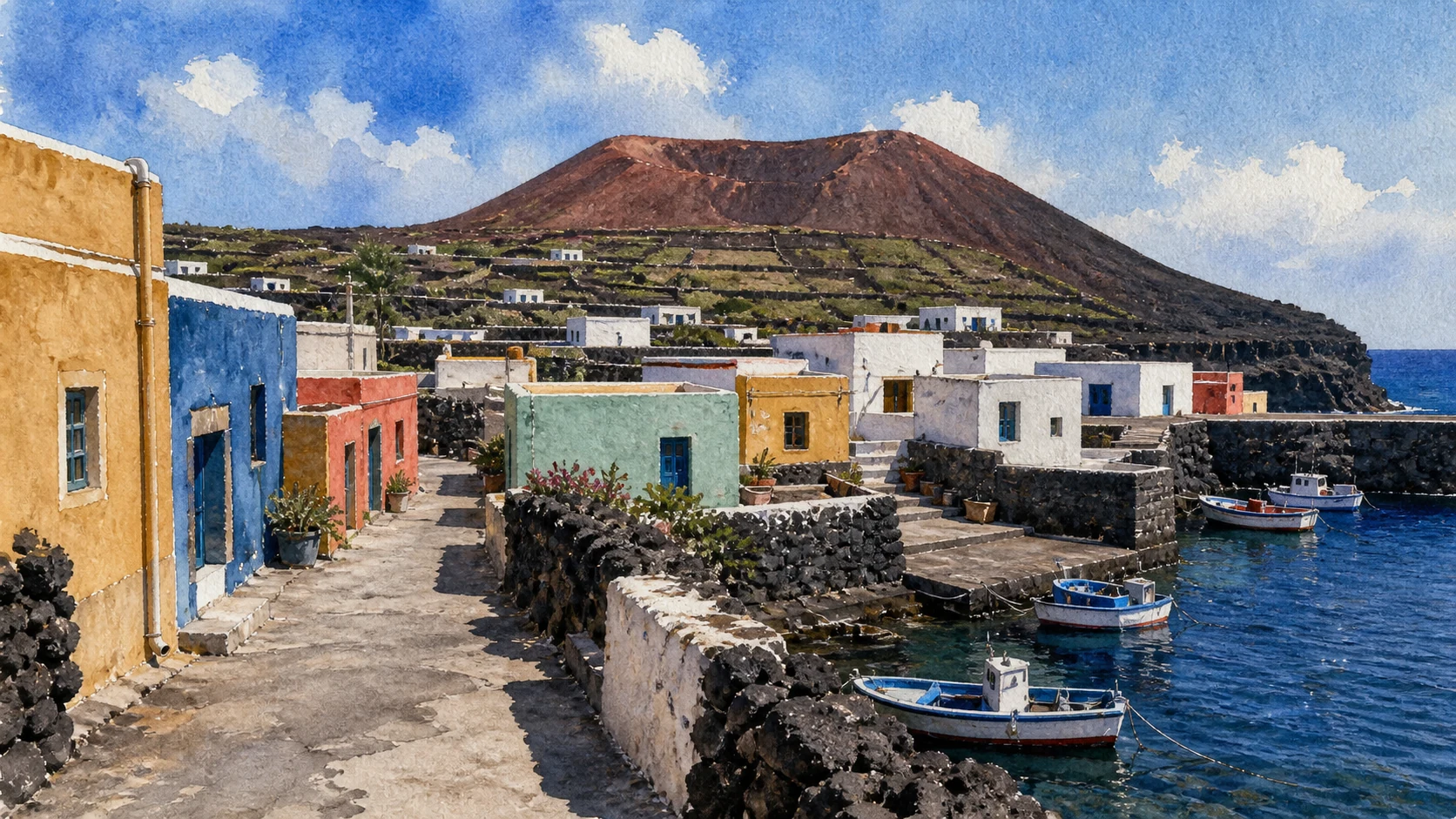
Documentary watercolour of Linosa's coloured low houses, black lava walls, fishing boats and a red-brown volcanic cone
Linosa · colour on black volcanic groundLow coloured houses, lava walls, small fishing boats and a cultivated volcanic cone establish Linosa's distinct scale before the guide follows its coast and rural memory.
17

Red, black and green terrain rising from deep water

Linosa's Four Volcanic Centres

Monte Rosso, Monte Vulcano, Monte Bandiera and Monte Nero give Linosa a vertical form unlike Lampedusa.

Documentary watercolour of Linosa's coloured low houses, black lava walls, fishing boats and a red-brown volcanic cone
Linosa · colour on black volcanic ground

The place today

Trails and lanes circle cones, cultivated crater floors and dark coastal slopes. Monte Rosso is the highest point, while Monte Nero opens toward Cala Pozzolana; weather and nesting seasons can affect access to exposed sectors.

The historical chapter

Linosa grew from eruptions rising from a seabed around one thousand metres deep. Weathering produced fertile pockets that supported agriculture, while isolation and limited water kept settlement small and concentrated near the sheltered southern landing.

What to notice

  • Red scoria beside dense green seasonal vegetation
  • Crater forms reused as fields and paths
Sicilian Region · Natural Reserve Linosa and Lampione
18

A small settlement defined by paint, cisterns and arrival

Linosa Town, Black Stone and Coloured Houses

The inhabited centre uses vivid colour against volcanic ground while remaining a working remote community.

Documentary watercolour of Linosa's coloured low houses, black lava walls, fishing boats and a red-brown volcanic cone
Linosa · colour on black volcanic ground

The place today

Low houses painted in blue, red, yellow and green gather around narrow streets above the landing. Shops and services are limited, and ferry operations depend heavily on sea conditions. Cisterns and water delivery remain more important than the town's photogenic palette suggests.

The historical chapter

Permanent modern colonisation began in the nineteenth century, though archaeology records much earlier visits and settlement. Families adapted masonry, roof forms and agriculture to volcanic material and scarce resources, building a community more closely tied to Lampedusa administratively than geographically.

What to notice

  • Painted edges articulating otherwise simple house volumes
  • Water-storage features integrated into domestic architecture
Municipality of Lampedusa and Linosa
19

A black-red beach beneath layered volcanic slopes

Cala Pozzolana di Ponente

Linosa's best-known landing cove is also a geosite and a regular turtle nesting beach.

Documentary watercolour of Linosa's coloured low houses, black lava walls, fishing boats and a red-brown volcanic cone
Linosa · colour on black volcanic ground

The place today

Dark sand and red-brown tuff lie below Monte Nero, with clear water and a compact shoreline. Marked nesting areas and reserve instructions take priority over the desire to occupy the entire beach.

The historical chapter

The exposed deposits record volcanic phases and later erosion. Loggerhead turtles regularly nest here, connecting Linosa to the conservation work at Lampedusa's Rabbit Beach while requiring separate monitoring adapted to a much smaller community and shore.

What to notice

  • Contrasting layers of black sand and red volcanic material
  • Nesting markers positioned above the normal wash line
Sicilian Region · Reserve of Linosa and Lampione
20

Sea caves, stacks and deep volcanic seabeds

Linosa's Faraglioni and Marine Coast

The island's coastal form is best understood slowly and within the Pelagie marine zoning.

Documentary watercolour of Linosa's coloured low houses, black lava walls, fishing boats and a red-brown volcanic cone
Linosa · colour on black volcanic ground

The place today

Stacks, small inlets and steep submarine slopes surround Linosa. Boat circuits and diving depend on authorised operators, zone rules and rapid changes in wind; there is no continuous accessible coastal road linking every cove.

The historical chapter

Lava and erosion produced a coast used by fishers and occasional shipping but offering few secure landing places. Marine protection now treats the seabed, bird cliffs and shore as connected habitats rather than separate attractions.

What to notice

  • Lava entering deep water with little beach shelf
  • Seabird flight paths between cliffs and open sea
Marine Protected Area Isole Pelagie
21

One of the Mediterranean's great colonies of Scopoli's shearwater

Shearwaters, Migrants and the Linosa Reserve

Linosa's cliffs and night skies carry an ecological story that requires darkness and distance.

Documentary watercolour of Linosa's coloured low houses, black lava walls, fishing boats and a red-brown volcanic cone
Linosa · colour on black volcanic ground

The place today

Large numbers of shearwaters nest in coastal cavities, while other migrant birds use the island as a stop between Africa and Europe. Calls may be heard after dusk, but nesting sectors should not be approached with lights or playback.

The historical chapter

The reserve was created to protect Linosa's flora and seabirds and Lampione's integral habitat. Long-term survival depends on controlling disturbance, invasive predators, bycatch and light pollution across both land and sea.

What to notice

  • Bird movement increasing around sunset without approaching nests
  • Low coastal vegetation shaped by salt and wind
Sicilian Region · Reserve fauna and flora
22

Cultivation inside a small volcanic water economy

Linosa's Fields, Cisterns and Rural Work

Crater soils, low walls and stored rain supported a rural life that survives behind the coast.

Documentary watercolour of Linosa's coloured low houses, black lava walls, fishing boats and a red-brown volcanic cone
Linosa · colour on black volcanic ground

The place today

Small fields occupy flatter ground and sheltered interiors, with capers, lentils, vines and vegetables depending on season and household practice. Stone buildings and cisterns remain scattered beyond the coloured town.

The historical chapter

Colonists transformed volcanic pockets through hand labour and rainwater storage. Mechanisation and demographic change reduced some cultivation, but the remaining plots preserve knowledge essential to fire management, food identity and landscape maintenance.

What to notice

  • Field boundaries following crater contours
  • Cisterns positioned to collect runoff from roofs and yards
Sicilian Region · Linosa conservation measures
23

Small finds reconnecting the volcanic island to ancient routes

Linosa's Archaeology and Island Collections

Linosa's archaeology is less monumental than Ustica's village but equally important to the Pelagie story.

Documentary watercolour of Linosa's coloured low houses, black lava walls, fishing boats and a red-brown volcanic cone
Linosa · colour on black volcanic ground

The place today

Surface sites, burial areas and material now displayed in Lampedusa's museum reveal prehistoric and later occupation. Many locations are not formal visitor sites and should not be searched for objects or entered across private land.

The historical chapter

Neolithic and Bronze Age finds show early movement across the southern Mediterranean, while later ceramics and burials document recurring use. The fragmentary record cautions against inventing a continuous city where evidence instead suggests changing small communities and stopovers.

What to notice

  • Local volcanic fabrics beside imported ceramics in museum cases
  • Burial evidence interpreted through records rather than open excavation
Sicilian Region · Museum of the Pelagie
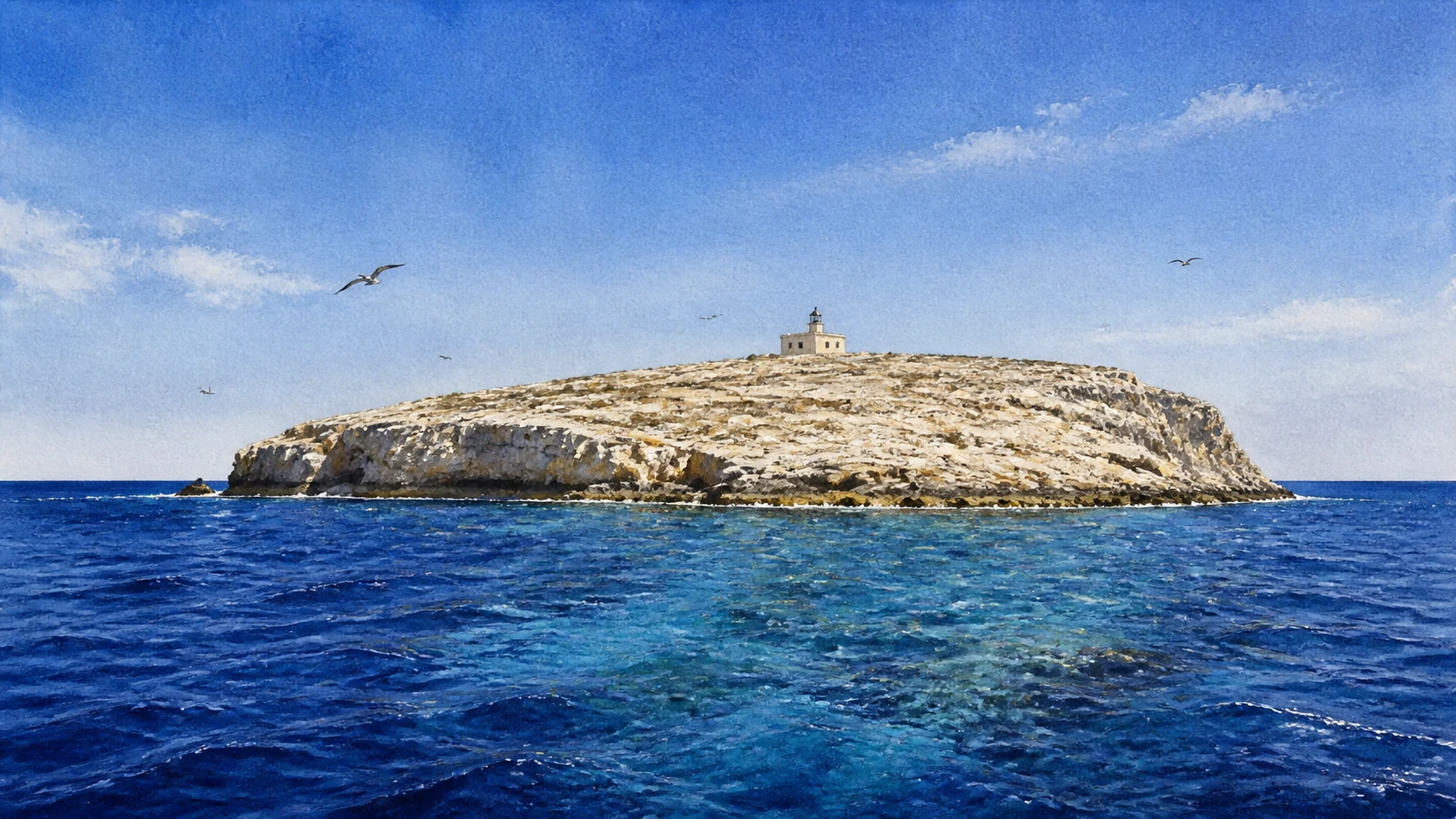
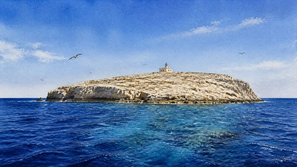
Documentary watercolour of the small pale island of Lampione with its modest lighthouse in the open deep-blue Mediterranean
Lampione · the guide ends in open waterThe tiny lighthouse and pale rock are kept small against the Pelagie sea, making isolation and protected habitat more important than a promise of easy landing.
24

An uninhabited rock protected as habitat, not a final beach stop

Lampione and the Open Pelagie Sea

Lampione completes the archipelago through distance, seabirds and marine life rather than settlement.

Documentary watercolour of the small pale island of Lampione with its modest lighthouse in the open deep-blue Mediterranean
Lampione · the guide ends in open water

The place today

The small bare islet lies west of Lampedusa and has no ordinary inhabited centre or tourist infrastructure. Approaches are governed by marine and integral-reserve rules, weather and authorised navigation; most visitors should understand it from the sea at appropriate distance.

The historical chapter

Its lighthouse and navigation role sit within a much larger ecological importance. Seabird breeding, the surrounding marine community and its isolation justified strict protection, making non-access a meaningful part of the island experience.

What to notice

  • The lighthouse reduced to scale by the low rock platform
  • Bird and marine activity observed without landing
Sicilian Region · Linosa and Lampione Reserve

The city through time

Ten dates for orientation

A chronology connecting Bronze Age island communities, ancient sea routes, Bourbon settlement, protected areas and contemporary Mediterranean memory.

  1. Neolithic material in the Pelagie records early human movement across the central Mediterranean.

  2. Ustica's fortified Village of the Faraglioni flourishes within the Thapsos-Milazzese cultural network.

  3. Settlement expands on Ustica's Falconiera, while the islands continue to serve navigation and exchange.

  4. Roman fish-processing activity develops around Cala Salina and the harbour area of Lampedusa.

  5. Late-antique communities on Lampedusa and Ustica remain connected to North African and Mediterranean trade.

  6. Bourbon authorities organise the permanent resettlement and defence of Ustica.

  7. A new state-sponsored colony establishes the basis of permanent modern settlement on Lampedusa and later Linosa.

  8. The Marine Protected Area Isola di Ustica is established, pioneering marine conservation in Italy.

  9. The Marine Protected Area Isole Pelagie is created around Lampedusa, Linosa and Lampione.

  10. A catastrophic shipwreck near Lampedusa kills hundreds of migrants and becomes a central date of Mediterranean remembrance.

Before your visit

Practical information,
without turning it into promises

01

Build one island at a time

Ustica and the Pelagie are not a practical same-day chain. Treat ferry or flight days as structural parts of the journey and keep weather alternatives.

02

Check reserve rules

Beaches, diving sites, moorings and paths fall under different zones and seasonal controls. Use the current marine and terrestrial reserve notices, not an old travel itinerary.

03

Protect water and shade

Linosa and Lampedusa have exposed routes and limited services away from town; Ustica's short distances can also hide steep heat. Carry water and avoid assuming every cove has facilities.

04

Keep memory ethical

Migration sites are civic and human places, not disaster attractions. Do not photograph operational rescue or reception activity without clear permission and context.

Sources

The guide uses the Sicilian Region's archaeological parks and protected-area portal, the official marine protected areas of Ustica and the Pelagie, the municipalities, and the Lampedusa reserve manager. It separates Ustica from the Pelagie geographically, distinguishes volcanic Linosa from limestone Lampedusa and avoids promising wildlife events or access to protected sectors.

The images are original editorial watercolours, not photographs. Ferry and flight schedules, marine zones, beach access, nesting sectors, diving authorisations, museums and archaeological sites can change; consult the linked managers and current harbour notices before visiting.