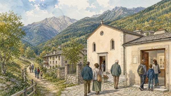
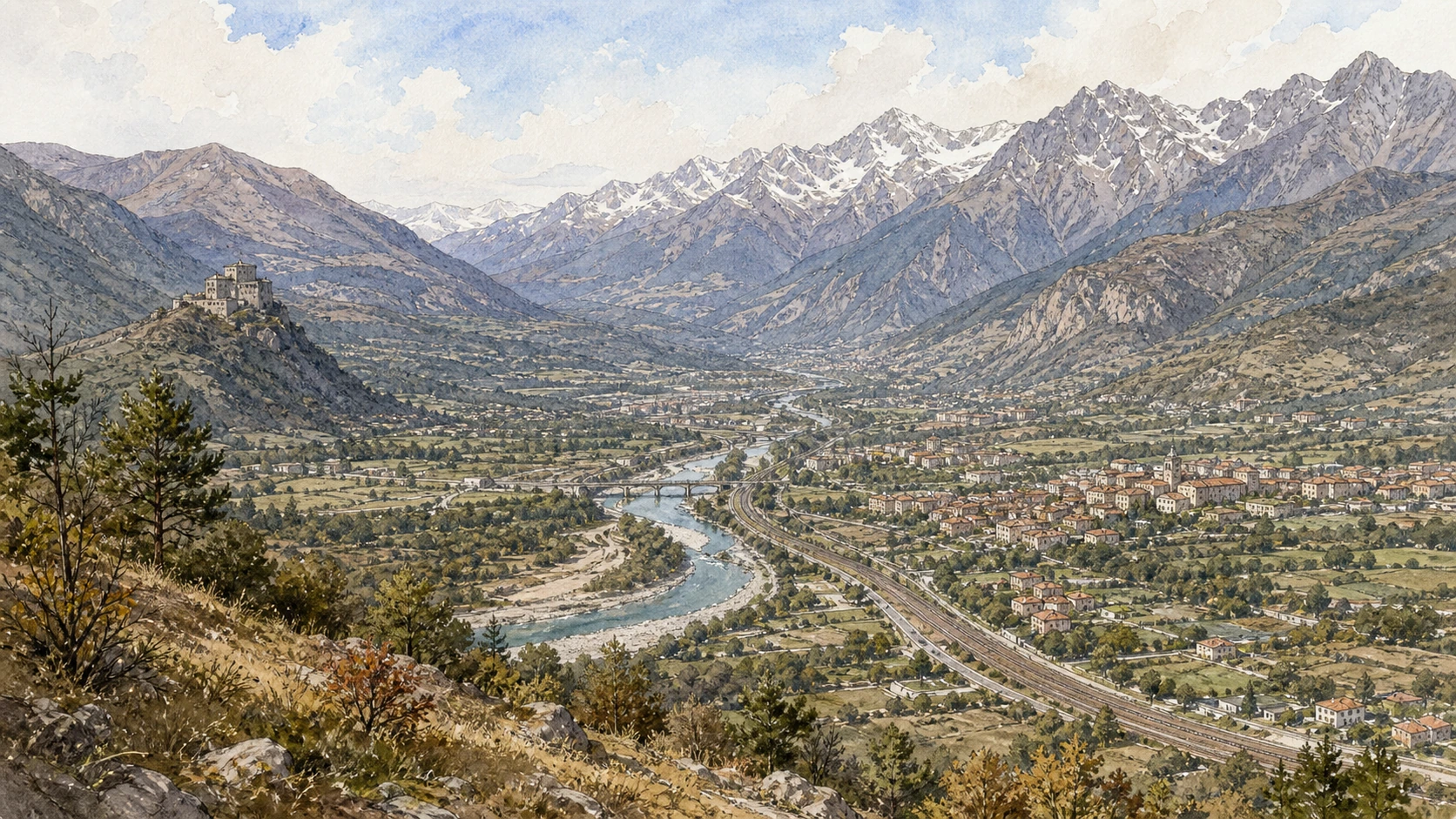
Original documentary watercolour panorama for Val di Susa, Pinerolo and the Olympic Valleys: Complete Guide, with accurate Piedmont architecture, landscape and lived context

Piedmont Guide 08 · Roman pass town, abbeys, border forts, Waldensian history, rail engineering and winter-sport landscapes

Val di Susa, Pinerolo
& the Olympic Valleys

A multi-day Alpine guide from Roman Susa through the Sacra di San Michele, Novalesa and Exilles to the pass routes, then south through Pinerolo, Fenestrelle, the Waldensian valleys and Olympic infrastructure around Bardonecchia and Sestriere.

Plan the route
Val di Susa, Pinerolo and the Olympic valleys · Piedmont10 chapters · one complete route

Why this route must be read in layers

The western valleys are corridors of passage, defence, worship and residence before they are mountain playgrounds. Roads, railways, forts and ski systems occupy terrain whose weather and political borders repeatedly changed movement.

Val di Susa contains Roman monuments, medieval abbeys and modern transport along the same narrow axis. Each layer used the valley differently and cannot be collapsed into a single pilgrimage road.

Exilles and Fenestrelle belong to changing frontier systems. Restoration and guided routes expose only part of structures designed for military control, not scenic ruin.

The Waldensian valleys preserve religious dissent, persecution, return and modern institutions. Olympic venues added another infrastructure layer whose maintenance and environmental effects continue after 2006.

Use rail where practical, assign separate days to the Susa and Pinerolo systems, and treat every high fort, pass and trail as conditional on official opening, weather and transport.

The route

Plan your visit

Begin in Susa and its valley monuments, visit the Sacra and forts only through official access, then transfer to Pinerolo for a separate route through Fenestrelle, Waldensian and Olympic landscapes.

Early morning

Roman Susa · Susa Cathedral and medieval centre · Sacra di San Michele

Move in the documented order: Roman Susa: arch, gate and Alpine administration; then Susa Cathedral and medieval centre: worship beside the Roman gate; then Sacra di San Michele: monastery on the valley threshold. Recheck live access and transport before entering a controlled site.

Late morning

Novalesa Abbey · Exilles Fort · Frejus railway and pass infrastructure

Move in the documented order: Novalesa Abbey: monastic route and painted chapels; then Exilles Fort: frontier architecture above the Dora; then Frejus railway and pass infrastructure: engineering an international corridor. Recheck live access and transport before entering a controlled site.

Afternoon

Pinerolo · Fenestrelle Fort · Waldensian valleys

Move in the documented order: Pinerolo: fortress memory, cavalry city and valley market; then Fenestrelle Fort: a fortified mountain system, not one wall; then Waldensian valleys: religious dissent, persecution and return. Recheck live access and transport before entering a controlled site.

Late afternoon

Bardonecchia, Sestriere and the Olympic valleys

Move in the documented order: Bardonecchia, Sestriere and the Olympic valleys: sport infrastructure after 2006. Recheck live access and transport before entering a controlled site.

Ten chapters

Explore the places

The order follows terrain, institutions and present-day movement. Use the index to return to a chapter without reducing the route to isolated monuments.

  1. 01Roman Susa: arch, gate and Alpine administration
  2. 02Susa Cathedral and medieval centre: worship beside the Roman gate
  3. 03Sacra di San Michele: monastery on the valley threshold
  4. 04Novalesa Abbey: monastic route and painted chapels
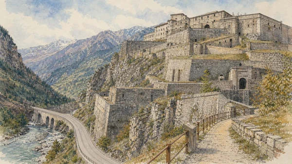
  5. 05Exilles Fort: frontier architecture above the Dora
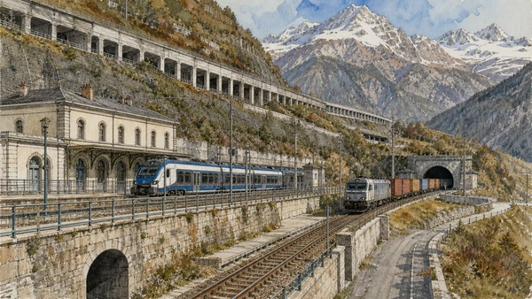
  6. 06Frejus railway and pass infrastructure: engineering an international corridor
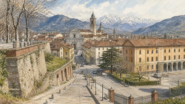
  7. 07Pinerolo: fortress memory, cavalry city and valley market
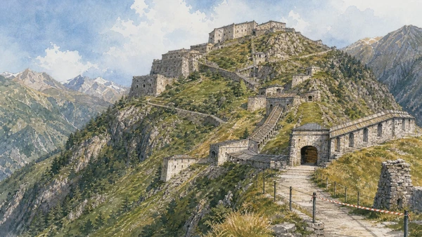
  8. 08Fenestrelle Fort: a fortified mountain system, not one wall
  9. 09Waldensian valleys: religious dissent, persecution and return
  10. 10Bardonecchia, Sestriere and the Olympic valleys: sport infrastructure after 2006
01

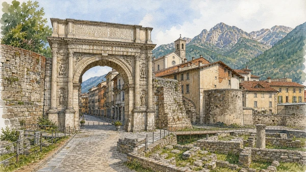
The Arch of Augustus, city gate and archaeological remains mark a settlement positioned to negotiate routes through the Cottian Alps.

Roman Susa: arch, gate and Alpine administration

The Arch of Augustus, city gate and archaeological remains mark a settlement positioned to negotiate routes through the Cottian Alps. The site becomes clearer when its surviving fabric, later alterations and present use are read together.

Today

Archaeological access may be limited to protected viewpoints, scheduled openings or guided routes. Stay outside barriers, distinguish original material from supports and reconstruction, and verify the official opening notice.

History

Segusium developed through an alliance between Rome and the local ruler Cottius before incorporation into imperial administration and long continuity as a valley centre.

How to read this place

Begin with arch inscriptions and reliefs. Then compare gate and street relationship with later town built around roman remains; the differences are evidence, not visual noise.

What to notice

  • arch inscriptions and reliefs
  • gate and street relationship
  • later town built around Roman remains
Turismo Torino e Provincia · Val di Susa and Pinerolo
Original documentary watercolour of Roman Susa: arch, gate and Alpine administration in Val di Susa, Pinerolo and the Olympic valleys · Piedmont, showing accurate architecture, landscape, people and present-day use
Roman Susa: arch, gate and Alpine administrationOriginal Merlintravel documentary watercolour · 2026
02

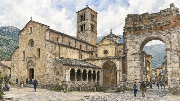
San Giusto, bell tower, cloister traces and narrow streets reuse the strategic centre after the Roman period.

Susa Cathedral and medieval centre: worship beside the Roman gate

San Giusto, bell tower, cloister traces and narrow streets reuse the strategic centre after the Roman period. The site becomes clearer when its surviving fabric, later alterations and present use are read together.

Today

This is an active religious place as well as a historic building. Services, ceremonies and conservation can interrupt tourist access; dress appropriately, remain quiet and never treat a booked visit as priority over worship.

History

The cathedral grew from an eleventh-century monastic foundation and became the seat of the modern diocese, accumulating later art and restoration.

How to read this place

Begin with church against porta savoia. Then compare romanesque masonry and later chapels with active worship within the tourist route; the differences are evidence, not visual noise.

What to notice

  • church against Porta Savoia
  • Romanesque masonry and later chapels
  • active worship within the tourist route
Turismo Torino e Provincia · Val di Susa and Pinerolo
Original documentary watercolour of Susa Cathedral and medieval centre: worship beside the Roman gate in Val di Susa, Pinerolo and the Olympic valleys · Piedmont, showing accurate architecture, landscape, people and present-day use
Susa Cathedral and medieval centre: worship beside the Roman gateOriginal Merlintravel documentary watercolour · 2026
03

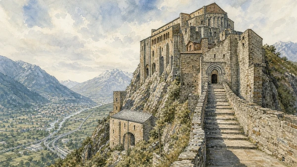
A steep stair, rock foundations and Romanesque church occupy Monte Pirchiriano above the route between plain and Alps.

Sacra di San Michele: monastery on the valley threshold

A steep stair, rock foundations and Romanesque church occupy Monte Pirchiriano above the route between plain and Alps. The site becomes clearer when its surviving fabric, later alterations and present use are read together.

Today

This is an active religious place as well as a historic building. Services, ceremonies and conservation can interrupt tourist access; dress appropriately, remain quiet and never treat a booked visit as priority over worship.

History

The monastic complex developed around the turn of the first millennium and expanded through medieval patronage before decline, restoration and Rosminian custody.

How to read this place

Begin with building joined directly to rock. Then compare stairway of the dead and portal with valley routes visible from controlled terraces; the differences are evidence, not visual noise.

What to notice

  • building joined directly to rock
  • Stairway of the Dead and portal
  • valley routes visible from controlled terraces
Sacra di San Michele · Official site
Original documentary watercolour of Sacra di San Michele: monastery on the valley threshold in Val di Susa, Pinerolo and the Olympic valleys · Piedmont, showing accurate architecture, landscape, people and present-day use
Sacra di San Michele: monastery on the valley thresholdOriginal Merlintravel documentary watercolour · 2026
04

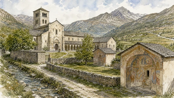
Church, cloister and freestanding chapels sit within a managed Alpine valley landscape near the Mont Cenis route.

Novalesa Abbey: monastic route and painted chapels

Church, cloister and freestanding chapels sit within a managed Alpine valley landscape near the Mont Cenis route. The site becomes clearer when its surviving fabric, later alterations and present use are read together.

Today

This is an active religious place as well as a historic building. Services, ceremonies and conservation can interrupt tourist access; dress appropriately, remain quiet and never treat a booked visit as priority over worship.

History

Founded in 726, the abbey became an important Carolingian institution, suffered abandonment and return, and preserves medieval frescoes under controlled conditions.

How to read this place

Begin with relationship among abbey and chapels. Then compare paint layers and conservation with fields, water and mountain routes around the enclosure; the differences are evidence, not visual noise.

What to notice

  • relationship among abbey and chapels
  • paint layers and conservation
  • fields, water and mountain routes around the enclosure
Abbazia di Novalesa · Official site
Original documentary watercolour of Novalesa Abbey: monastic route and painted chapels in Val di Susa, Pinerolo and the Olympic valleys · Piedmont, showing accurate architecture, landscape, people and present-day use
Novalesa Abbey: monastic route and painted chapelsOriginal Merlintravel documentary watercolour · 2026
05

Walls, ramps and batteries rise from a constricted valley position controlling the route toward the upper passes.

Exilles Fort: frontier architecture above the Dora

Walls, ramps and batteries rise from a constricted valley position controlling the route toward the upper passes. The site becomes clearer when its surviving fabric, later alterations and present use are read together.

Today

Opening, ticketing, room access and temporary displays can change. Check the institution’s official notice shortly before visiting, use the designated entrance and allow for security or conservation controls.

History

Fortifications changed hands and form between Dauphiné, France and Savoy; the present mass reflects major early-modern and nineteenth-century rebuilding.

How to read this place

Begin with defensive levels adapted to rock. Then compare road and river controlled below with restored visitor route versus closed military spaces; the differences are evidence, not visual noise.

What to notice

  • defensive levels adapted to rock
  • road and river controlled below
  • restored visitor route versus closed military spaces
Regione Piemonte · Forte di Exilles
Original documentary watercolour of Exilles Fort: frontier architecture above the Dora in Val di Susa, Pinerolo and the Olympic valleys · Piedmont, showing accurate architecture, landscape, people and present-day use
Exilles Fort: frontier architecture above the DoraOriginal Merlintravel documentary watercolour · 2026
06

Tunnels, stations, viaducts and protection works make the valley a working transalpine transport system.

Frejus railway and pass infrastructure: engineering an international corridor

Tunnels, stations, viaducts and protection works make the valley a working transalpine transport system. The site becomes clearer when its surviving fabric, later alterations and present use are read together.

Today

Timetables, engineering works, capacity and accessibility arrangements can change. Check the operator on the day, leave a realistic connection margin and never enter tracks, depots or restricted infrastructure.

History

The railway tunnel opened in the nineteenth century and was joined by later road infrastructure, repeatedly altered by war, safety standards and Alpine hazards.

How to read this place

Begin with station and tunnel approaches from public space. Then compare slope protection and service structures with freight and passenger movement distinguished; the differences are evidence, not visual noise.

What to notice

  • station and tunnel approaches from public space
  • slope protection and service structures
  • freight and passenger movement distinguished
RFI · Official network
Original documentary watercolour of Frejus railway and pass infrastructure: engineering an international corridor in Val di Susa, Pinerolo and the Olympic valleys · Piedmont, showing accurate architecture, landscape, people and present-day use
Frejus railway and pass infrastructure: engineering an international corridorOriginal Merlintravel documentary watercolour · 2026
07

Historic streets, cathedral, civic museums and former military institutions occupy a city at the opening of several western valleys.

Pinerolo: fortress memory, cavalry city and valley market

Historic streets, cathedral, civic museums and former military institutions occupy a city at the opening of several western valleys. The site becomes clearer when its surviving fabric, later alterations and present use are read together.

Today

The area is inhabited and worked, not staged for visitors. Keep doorways, pavements, cycle lanes and deliveries clear, ask before photographing people and use current municipal mobility information.

History

Pinerolo moved between Savoy and French control and was heavily fortified before demolition; later military schools, rail and industry gave it new regional roles.

How to read this place

Begin with street levels indicating lost defences. Then compare religious and civic centre with former military buildings in later use; the differences are evidence, not visual noise.

What to notice

  • street levels indicating lost defences
  • religious and civic centre
  • former military buildings in later use
Turismo Torino e Provincia · Val di Susa and Pinerolo
Original documentary watercolour of Pinerolo: fortress memory, cavalry city and valley market in Val di Susa, Pinerolo and the Olympic valleys · Piedmont, showing accurate architecture, landscape, people and present-day use
Pinerolo: fortress memory, cavalry city and valley marketOriginal Merlintravel documentary watercolour · 2026
08

Roads, redoubts, covered stair and batteries extend across a steep slope at exceptional scale.

Fenestrelle Fort: a fortified mountain system, not one wall

Roads, redoubts, covered stair and batteries extend across a steep slope at exceptional scale. The site becomes clearer when its surviving fabric, later alterations and present use are read together.

Today

Opening, ticketing, room access and temporary displays can change. Check the institution’s official notice shortly before visiting, use the designated entrance and allow for security or conservation controls.

History

Savoy engineers developed the complex from the eighteenth century to control Val Chisone; later military and prison uses created layered and sometimes contested memory.

How to read this place

Begin with forts distributed by elevation. Then compare covered stair and supply routes with guided safety limits across unstable mountain terrain; the differences are evidence, not visual noise.

What to notice

  • forts distributed by elevation
  • covered stair and supply routes
  • guided safety limits across unstable mountain terrain
Forte di Fenestrelle · Official site
Original documentary watercolour of Fenestrelle Fort: a fortified mountain system, not one wall in Val di Susa, Pinerolo and the Olympic valleys · Piedmont, showing accurate architecture, landscape, people and present-day use
Fenestrelle Fort: a fortified mountain system, not one wallOriginal Merlintravel documentary watercolour · 2026
09

Museums, temples, schools, memorials and mountain routes document a living Protestant community rather than a folkloric enclave.

Waldensian valleys: religious dissent, persecution and return

Museums, temples, schools, memorials and mountain routes document a living Protestant community rather than a folkloric enclave. The site becomes clearer when its surviving fabric, later alterations and present use are read together.

Today

The area is inhabited and worked, not staged for visitors. Keep doorways, pavements, cycle lanes and deliveries clear, ask before photographing people and use current municipal mobility information.

History

Waldensian communities survived centuries of restriction, violence, exile and the 1689 Glorious Return before civil emancipation in 1848 and modern institutional development.

How to read this place

Begin with documented sites and archival testimony. Then compare temples distinguished from catholic churches with living worship and community use respected; the differences are evidence, not visual noise.

What to notice

  • documented sites and archival testimony
  • temples distinguished from Catholic churches
  • living worship and community use respected
Fondazione Centro Culturale Valdese · Official site
Original documentary watercolour of Waldensian valleys: religious dissent, persecution and return in Val di Susa, Pinerolo and the Olympic valleys · Piedmont, showing accurate architecture, landscape, people and present-day use
Waldensian valleys: religious dissent, persecution and returnOriginal Merlintravel documentary watercolour · 2026
10

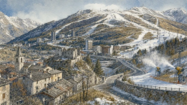
Ski lifts, slopes, roads, lodging and reused venues overlay older settlements, military routes and fragile high landscapes.

Bardonecchia, Sestriere and the Olympic valleys: sport infrastructure after 2006

Ski lifts, slopes, roads, lodging and reused venues overlay older settlements, military routes and fragile high landscapes. The site becomes clearer when its surviving fabric, later alterations and present use are read together.

Today

Weather, water levels, trail conditions and seasonal services can alter the route. Use official transport and park information, remain on authorised paths and do not enter farms, vineyards or private gardens without permission.

History

Winter tourism grew before Turin hosted the 2006 Winter Olympics, which accelerated venue and transport investment; climate change now affects snow, operations and long-term use.

How to read this place

Begin with historic village fabric versus resort planning. Then compare lifts and snow-management systems with current closures and conditions checked before access; the differences are evidence, not visual noise.

What to notice

  • historic village fabric versus resort planning
  • lifts and snow-management systems
  • current closures and conditions checked before access
Turismo Torino e Provincia · Val di Susa and Pinerolo
Original documentary watercolour of Bardonecchia, Sestriere and the Olympic valleys: sport infrastructure after 2006 in Val di Susa, Pinerolo and the Olympic valleys · Piedmont, showing accurate architecture, landscape, people and present-day use
Bardonecchia, Sestriere and the Olympic valleys: sport infrastructure after 2006Original Merlintravel documentary watercolour · 2026

Piedmont through time

A short chronology

From pre-Roman routes and Roman towns to communes, marquisates, Savoy government, industrialisation, heritage protection and climate-sensitive access.

  1. Alpine, lake, hill and plain communities leave settlements, tools, rock art and long-lived route systems.

  2. Ligurians, Celts, Salassi and other communities organise territories later drawn into Roman expansion.

  3. Roman colonies, municipia and roads connect the Po plain to Alpine passes and Ligurian approaches.

  4. Cities, farms, river transport and mountain routes integrate the region into imperial networks.

  5. Christian institutions, Lombard and Frankish powers, monasteries and fortified sites reshape late-Roman territories.

  6. Communes, bishoprics and marquisates develop distinct cities, markets, castles and religious landscapes.

  7. Savoy, Monferrato, Saluzzo, Milanese and local powers contest routes while towns expand civic institutions.

  8. The transfer of the Savoy capital to Turin accelerates centralisation, court construction and territorial administration.

  9. Baroque residences, sanctuaries, planned roads and fortified frontiers reorganise cities and countryside.

  10. French and Napoleonic rule suppresses institutions, reforms government and changes military and transport systems.

  11. Constitutional politics and wars led from Piedmont-Sardinia contribute decisively to Italian unification.

  12. Railways, canals, factories, wine markets and Alpine tourism connect previously separated economies.

  13. World wars, Fascism, resistance and civilian loss leave difficult evidence across towns, hills and valleys.

  14. Industrial expansion, migration, mechanised agriculture and mass tourism transform cities and working landscapes.

  15. Deindustrialisation, heritage recognition, rural reinvestment and climate pressure repeatedly alter access and identity.

Before your visit

Practical information

01

Check the live page

Opening hours, reservation systems, restoration, exhibitions and transport can change. Recheck the linked official institution shortly before departure.

02

Separate worship and tourism

Churches and sanctuaries remain religious spaces. Services, funerals and community use take priority over visitor itineraries.

03

Plan real distances

Val di Susa, Pinerolo and the Olympic valleys · Piedmont combines dense urban routes with lakes, valleys and dispersed towns. Do not compress distant chapters into an unsafe or superficial day.

04

Keep thresholds open

Arcades, station halls, markets, courtyards, workshops and residential streets must continue to function while you observe or photograph them.

05

Use current mobility data

Check the responsible rail, navigation, bus, road or park operator on the day; replacement services and weather can change an otherwise sound route.

06

Read change honestly

Restoration, reconstruction, adaptive reuse and new development have all shaped the landscape visible today.

Method and sources

Sources and image credits

This guide uses official museum, ministry, municipal, transport, park and UNESCO documentation checked on 29 August 2026. It separates durable historical interpretation from access details that can change, distinguishes surviving fabric from restoration or reconstruction, and treats worship, work, residence and public movement as part of the evidence. Every chapter links its principal institutional source; tickets, closures, weather and transport must always be verified again on the day of the visit.

All ten images are original Merlintravel editorial watercolours based on documented present-day conditions. They are illustrations, not substitutes for archaeological plans. Opening hours, tickets, accessible routes, temporary exhibitions and conservation work can change; consult the linked official pages shortly before visiting.