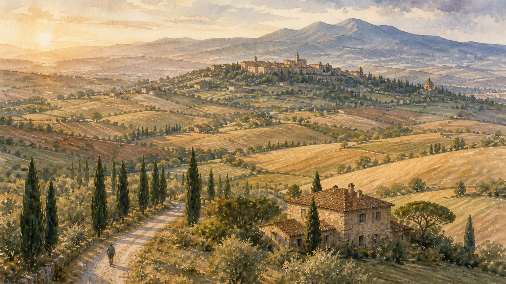
Original documentary watercolour panorama of Pienza, cultivated Val d'Orcia hills, cypress roads and Monte Amiata

Tuscany Guide 04 · Cultivated land, planned town, thermal water and fortified routes

Val d’Orcia & Pienza:
Landscape as Work

A documented route through one of Italy’s most reproduced views: not untouched nature, but a living agricultural and social system shaped by Siena, pilgrimage, papal planning, sheep, vines, thermal water, monasteries, fortresses and present conservation.

Plan the route
Pienza to Radicofani · Province of Siena10 chapters · two or three days

Why the famous view must be read as work

Val d’Orcia is not a timeless rural stage: its beauty records planned land use, unequal labour, pilgrimage, papal ambition, local production, abandonment, tourism and the continuing choice to keep farming viable.

UNESCO inscribed Val d’Orcia in 2004 as a cultural landscape, not a nature reserve frozen outside history. Siena integrated the valley into its agricultural hinterland in the thirteenth and fourteenth centuries. Merchants, tenants, monasteries and settlements organised fields, roads and fortified hills into a productive territory. Later poverty and marginalisation helped many older patterns survive, but survival should not be romanticised as effortless continuity.

Pienza forms a separate World Heritage property. After his election in 1458, Pope Pius II transformed his birthplace Corsignano with Bernardo Rossellino. Piazza Pio II, Cathedral, Palazzo Piccolomini, episcopal palace and town hall staged a humanist court while adapting a medieval town. The celebrated loggia view links architecture to controlled countryside; the Cathedral’s long structural problems also show that ideal form met unstable ground.

Beyond the square, sheep milk, grain, olive oil and wine depend on contemporary farms and regulated production. San Quirico’s garden, Bagno Vignoni’s water, Montalcino’s fortress and vineyards, Sant’Antimo’s living church, Castiglione and Radicofani’s defensive positions all serve different systems. Tourism pressure, erosion, modernised agriculture and housing conversion now affect the same landscape visitors admire.

Use Pienza as one close-reading day, San Quirico and Bagno Vignoni as a second sequence, and Montalcino with Sant’Antimo or the southern fortresses as a separate day. Distances that look short on a map become slow on ridge roads, walking stages and working farm routes.

The route

Plan your visit

The itinerary avoids presenting every famous cypress as a roadside stop. It moves from urban design to agricultural production, then follows public towns, water systems, sacred space and defended routes while keeping travel time realistic.

Day one

Read Pienza closely

Walk Piazza Pio II, Cathedral, Palazzo Piccolomini and the lanes toward Corsignano; do not reduce the town to the terrace view.

Day two morning

San Quirico and the Francigena

Compare Collegiate Church, former hospitality route and the geometry of Horti Leonini before continuing south.

Day two afternoon

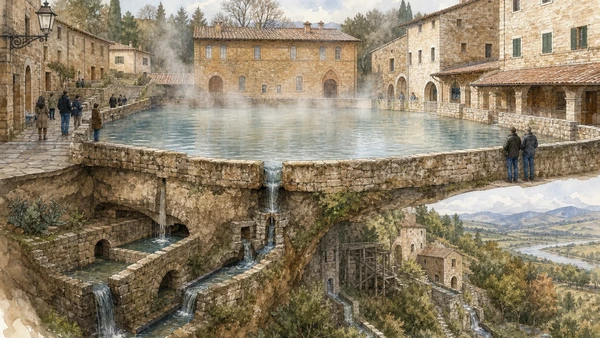
Water at Bagno Vignoni

Read the central basin from its edge, then descend toward the mill channels; the historic pool is not a bathing facility.

Day three

Choose one outer arc

Pair Montalcino with Sant’Antimo, or Castiglione with Radicofani. Combining both arcs turns heritage into windshield time.

Ten chapters

Explore the places

The guide begins with the managed UNESCO landscape, reads Pienza as an urban intervention, then crosses food production, gardens, thermal water, wine, monastic space, fortresses and the environmental pressures of movement through clay country.

  1. 01The UNESCO landscape: cultivation before scenery
  2. 02Piazza Pio II: the ideal city as intervention
  3. 03Cathedral and Palazzo Piccolomini: form meets terrain
  4. 04Pecorino and mixed farming: product is not a souvenir
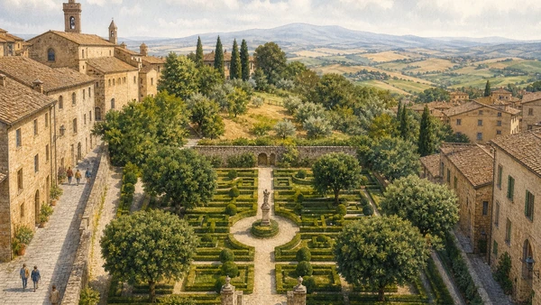
  5. 05San Quirico and Horti Leonini: route becomes garden
  6. 06Bagno Vignoni: water as square and working power
  7. 07Montalcino: fortress, commune and Brunello terrain
  8. 08Sant’Antimo: living abbey beyond the foundation legend
  9. 09Castiglione and Radicofani: defended southern routes
  10. 10Erosion, climate and access: keeping a living landscape
01

A 61,188-hectare World Heritage property remains a mosaic of fields, farms, villages, roads, woods and social decisions

The UNESCO landscape: cultivation before scenery

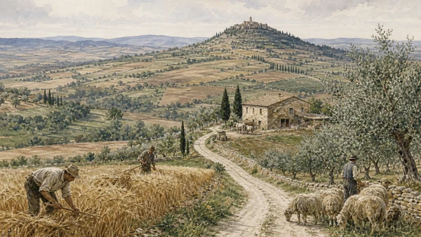
The cypress line and ochre field are results of land use, ownership, labour and maintenance; the celebrated image is neither untouched nature nor a single Renaissance design executed at once.

Today

The property covers most of five municipalities: Montalcino, Pienza, San Quirico d’Orcia, Castiglione d’Orcia and Radicofani. Roads cross working farms, resident towns and protected views. Public access to a road or trail does not extend into every field, farmhouse lane or cypress group. Seasons change both appearance and operations: ploughing, harvest, livestock, fire risk, storms and maintenance can affect movement.

History

Etruscan and Roman occupation preceded medieval decline and renewed activity around monasteries and the Via Francigena. Siena’s expansion in the thirteenth and fourteenth centuries linked merchant investment, agricultural tenancy, fortified settlements and productive land. UNESCO describes the Renaissance-era layout as an expression of governance and aesthetic ideals, while also noting that later marginalisation helped conserve it. The present park was established in 1999 and inscription followed in 2004.

How to read this place

Look for field boundaries, farm scale, water control, roads and the relation between hill town and cultivated slope. Compare the iconic view with less photographed working edges. Do not enter crops for a photograph or stop on blind bends. A landscape remains authentic partly because people can still live and work within it.

What to notice

  • Fields and farm complexes rather than empty background
  • Cypress groups marking routes and settlements
  • Hill towns positioned within systems of defence and cultivation
UNESCO World Heritage Centre · Val d’Orcia
Original documentary watercolour of farmers, sheep, olives and divided fields in the living Val d'Orcia landscape
The UNESCO landscape: cultivation before sceneryOriginal Merlintravel documentary watercolour · 2026
02

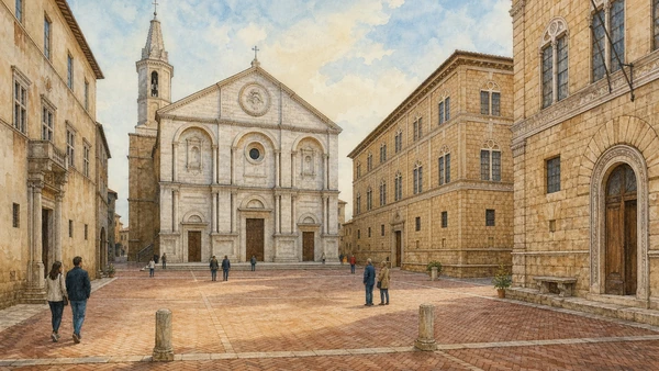
A trapezoidal square turned papal biography and humanist theory into an urban room without erasing the medieval town around it

Piazza Pio II: the ideal city as intervention

Pienza is significant not because an entire town appeared from a drawing, but because a concentrated group of buildings applied Renaissance planning to Corsignano with exceptional clarity.

Today

Piazza Pio II is open civic space shared by worship, municipal life, museum queues, deliveries and visitors. Its small dimensions reward slow movement around the edges rather than a single frontal photograph. Cathedral access follows religious use; Palazzo Piccolomini and the diocesan collection use separate tickets and hours. Corso Rossellino and side lanes reveal how the new centre connected existing gates and fabric.

History

Enea Silvio Piccolomini was born at Corsignano in 1405, became Pope Pius II in 1458 and began the transformation in 1459. Bernardo Rossellino designed the principal ensemble under humanist influence. Cathedral, Piccolomini Palace, Borgia or Episcopal Palace, Presbytery, Town Hall and Ammannati Palace defined the square, while new houses and a principal street extended the programme. UNESCO inscribed the historic centre in 1996.

How to read this place

Stand at several corners to see how paving, angled façades and controlled openings make the square appear larger and ordered. Then leave it. Medieval alignments, modest houses and service streets prevent the phrase ‘ideal city’ from becoming a claim that every building shares one date or patron.

What to notice

  • Trapezoidal geometry correcting a constrained site
  • Herringbone brick paving framed by travertine lines
  • Different civic, sacred and domestic façades held in one composition
UNESCO World Heritage Centre · Historic Centre of Pienza
Original documentary watercolour of Piazza Pio II with Cathedral, palaces, town hall and brick paving
Piazza Pio II: the ideal city as interventionOriginal Merlintravel documentary watercolour · 2026
03

Two buildings on the same square frame different relationships between worship, court, museum, unstable ground and the valley view

Cathedral and Palazzo Piccolomini: form meets terrain

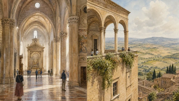
The Cathedral’s Renaissance exterior and German-influenced hall interior differ from the palace’s domestic court, museum rooms, loggia and garden; neither should become a generic backdrop.

Today

The Cathedral remains a church and access can change for services. Palazzo Piccolomini opens as a museum with controlled visits; its rooms, courtyard, loggia and garden require current confirmation. The famous southern prospect is part of the palace design, but terrace capacity and weather matter. The Cathedral’s long relationship with unstable soil is a conservation issue, not a licence to inspect restricted areas.

History

Rossellino built the Cathedral over the earlier parish church and it was consecrated in 1462. Its luminous hall recalls late Gothic churches Pius II knew north of the Alps while its façade participates in the Renaissance square. Palazzo Piccolomini, begun after 1459 as the pope’s family residence, used a courtyard, three-level façade and garden-loggia sequence to connect urban order with the rural horizon.

How to read this place

Inside the Cathedral, compare equal-height spatial impression, light and altarpieces with the classical exterior. In the palace, move from public courtyard to furnished rooms and outward-facing loggia. The view was architecturally framed, but the valley beyond remained productive land owned and worked by many others.

What to notice

  • Renaissance façade with a differently inflected church interior
  • Palace courtyard organising movement before the panorama
  • Hanging garden and loggia turning landscape into a designed prospect
Visit Tuscany · Palazzo Piccolomini
Original documentary watercolour pairing Pienza Cathedral interior with Palazzo Piccolomini loggia and valley view
Cathedral and Palazzo Piccolomini: form meets terrainOriginal Merlintravel documentary watercolour · 2026
04

A market name, a protected denomination and a local wheel are related but not interchangeable

Pecorino and mixed farming: product is not a souvenir

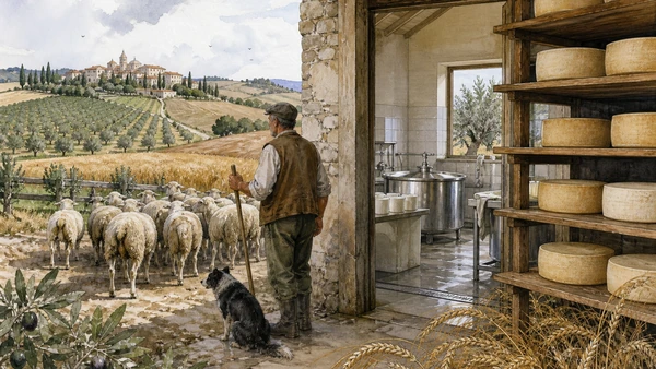
Sheep, fodder, grain, olives, dairies, maturation and regulation connect food to land; ‘Pecorino di Pienza’ should not automatically be treated as identical to Pecorino Toscano PDO.

Today

Shops in Pienza sell young, aged and variously treated sheep cheeses from different producers and specifications. Ask who made a cheese, where the milk came from, how it was matured and whether a protected mark actually applies. Tasting supports local economies when it leads to informed purchase rather than the assumption that every wheel on display was produced inside the town wall.

History

Sheep husbandry formed part of Val d’Orcia’s mixed agricultural system alongside cereals, olives and vines. Modern protected denominations create legal boundaries that older local vocabulary did not. Pecorino Toscano received European PDO status in 1996 and its consortium controls use of the mark. Pienza remains an important centre for sheep-cheese trade and production, but local styles and the regional PDO overlap only when the product specification is met.

How to read this place

Look beyond the retail façade to pasture, fodder, seasonal milk and dairy labour. Compare a producer label with a geographic claim. The useful distinction is not industrial versus authentic, but documented origin, method, scale and the livelihood sustained by each purchase.

What to notice

  • Producer and dairy identity on the label
  • Protected PDO mark only where the specification applies
  • Agriculture around the town as the beginning of the food story
Pecorino Toscano PDO Consortium · Who we are
Original documentary watercolour of sheep, grain, olive fields and a small working pecorino dairy near Pienza
Pecorino and mixed farming: product is not a souvenirOriginal Merlintravel documentary watercolour · 2026
05

Pilgrim route, collegiate church, civic palace and a late-Renaissance garden occupy one small town but represent different institutions

San Quirico and Horti Leonini: route becomes garden

San Quirico is more than a pause between viewpoints: its Francigena role, religious buildings and deliberately ordered garden reveal hospitality, authority and urban leisure.

Today

The town is crossed by recognised Via Francigena stages. Churches remain active and Horti Leonini is public garden space whose access or event use can change. Palazzo Chigi serves municipal functions. Stone streets, steps and garden surfaces require realistic accessibility planning. The famous cypress group outside town is visible from roads, but it is not an invitation to stop unsafely or cross private farmland.

History

San Quirico developed along a major route toward Rome and supported pilgrim hospitality. Diomede Leoni created Horti Leonini around the later sixteenth century on land associated with Medici patronage. The lower geometric garden uses box hedges and holm oaks; an upper zone moves toward less formal planting. The former Cassero tower was destroyed during the Second World War, reminding visitors that apparent continuity includes rupture.

How to read this place

Begin at the Collegiate Church and trace the main street before entering the garden. Compare clipped geometry, central sculpture, Roman Janus head and the transition to the upper area. The Horti are not medieval and the route is not merely recreational: different periods have rewritten the same town.

What to notice

  • Main street aligned with movement and former hospitality
  • Geometric lower garden contrasted with the upper zone
  • Missing Cassero recorded through ruins rather than reconstructed completeness
Visit Tuscany · Horti Leonini
Original documentary watercolour of Horti Leonini, San Quirico stone streets and the surrounding valley
San Quirico and Horti Leonini: route becomes gardenOriginal Merlintravel documentary watercolour · 2026
06

A thermal spring shaped a piazza, hospitality and mills; the historic basin is now observed, while bathing occurs in authorised facilities

Bagno Vignoni: water as square and working power

The central pool is the visible surface of a larger hydraulic story involving hot springs, treatment, channels, tanks and mills descending toward the Orcia.

Today

Visitors cannot bathe in the historic central pool. Spa bathing belongs to separate authorised establishments with their own prices, bookings and health conditions. The Parco dei Mulini descends below the village on uneven paths where wet stone, heat and exposed edges require care. Steam and evening light can be atmospheric without turning residents’ doors into a stage set.

History

Thermal water near the Francigena supported bathing and hospitality over centuries. Sources record organised use by the twelfth century, while the mills are cited in a 1207 community document. Constant warm flow and the drop toward the river powered four mills through channels and basins, including periods when other watercourses were low. Catherine of Siena and members of the Medici family belong to the site’s long reception history, but do not explain the hydraulic system by themselves.

How to read this place

Walk the edge of the square to identify inflow and overflow, then descend only on marked public routes to compare channels and mill structures. Treat water temperature and historic use as technical facts, not proof of universal medical benefit. The best reading joins piazza, labour and terrain.

What to notice

  • Thermal basin occupying the civic centre
  • Overflow moving downhill through engineered channels
  • Mill structures using temperature and elevation rather than spectacle alone
Visit Tuscany · Bagno Vignoni
Original documentary watercolour of Bagno Vignoni thermal piazza and descending medieval mill channels
Bagno Vignoni: water as square and working powerOriginal Merlintravel documentary watercolour · 2026
07

A Sienese fortress and a nineteenth-century wine history share one ridge, but military survival is not a brand origin story

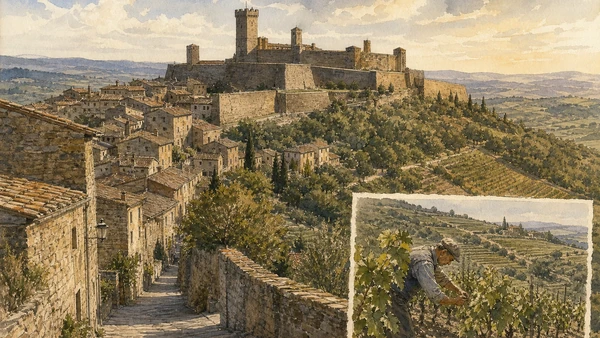
Montalcino: fortress, commune and Brunello terrain

The town’s steep streets, civic buildings and 1361 fortress explain a defended Sienese centre; vineyards explain a later economy that must be read through production and regulation.

Today

The fortress grounds and ramparts can have different access, tickets or event restrictions; wind and stairs matter. Cellars, tasting rooms and the civic-museum complex operate separately. Drivers should decide tastings and transport before arrival. Vineyards are farms, not open parks, and an advertised Montalcino address does not by itself grant access to production areas.

History

Montalcino’s fortress was built in 1361 using earlier defensive structures and later became a stronghold in the final resistance of the Sienese Republic. Palazzo dei Priori and the street network record civic life beyond the citadel. In the nineteenth century, local producers developed long-aged wine from Sangiovese; the modern Brunello identity grew from experimentation, regulation, land and market organisation rather than an unbroken medieval recipe.

How to read this place

Use the fortress to understand ridge control, then descend into the town rather than treating walls as the whole history. From a public viewpoint, compare forest, olive, mixed farming and vineyard. A tasting gains meaning when it includes vintage, site, producer and transport responsibility.

What to notice

  • Fortress enclosing earlier walls at the ridge summit
  • Steep civic town below the military enclosure
  • Vineyards embedded among woods and other cultivation
Visit Tuscany · Montalcino
Original documentary watercolour of Montalcino fortress, steep streets and tended Sangiovese vineyards
Montalcino: fortress, commune and Brunello terrainOriginal Merlintravel documentary watercolour · 2026
08

A Romanesque church, an older foundation tradition and a current spiritual community require separate kinds of evidence and behaviour

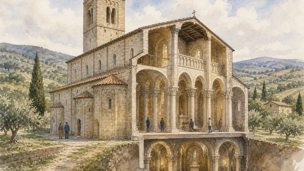
Sant’Antimo: living abbey beyond the foundation legend

The Charlemagne story belongs to tradition; the present church’s major construction is anchored by a 1118 inscription, while worship and managed visits continue now.

Today

The church maintains seasonal opening hours and liturgical priority. Festive Mass and community prayer can delay or restrict tourism without prior notice. The optional ‘Via della Luce’ route, videoguide, upper spaces, pharmacy and garden have their own arrangements and may require booking. Dress, voices and photography should reflect an active sacred site.

History

Sant’Antimo was a Benedictine abbey with a long territorial network. Tradition connects an early chapel to Charlemagne in the ninth century, but that tradition should not be converted into a documented construction date for the surviving church. The Charta Lapidaria records a donation in 1118 and anchors the great Romanesque campaign. Later loss, restoration and renewed religious presence have continued to change the complex.

How to read this place

Approach through the olive valley to see why the church is geographically distinct from Montalcino. Inside, follow nave, columns, carved capitals, ambulatory and controlled light. If upper spaces are open, compare them with ground-level movement. Silence is part of present use, not evidence that the building is abandoned.

What to notice

  • Pale stone mass placed within cultivated valley
  • Ambulatory and carved capitals directing movement
  • Different evidence for legend, inscription and current community
Abbazia di Sant’Antimo · Official visit information
Original documentary watercolour cutaway of Sant'Antimo Abbey, Romanesque interior and olive valley
Sant’Antimo: living abbey beyond the foundation legendOriginal Merlintravel documentary watercolour · 2026
09

Rocca d’Orcia and Radicofani demonstrate territorial control at different scales, while literary legend must not replace military history

Castiglione and Radicofani: defended southern routes

Limestone spur, basalt height and the Via Francigena made fortresses instruments of surveillance, border politics and movement long before they became panoramic destinations.

Today

Rocca di Tentennano and Radicofani fortress involve steep approaches, stairs, exposed wind and variable opening. Check official access rather than assuming a visible tower is open. Radicofani’s museum interprets archaeological and military phases; village churches and civic spaces below deserve separate time. The Francigena remains a route with road crossings, weather and water requirements.

History

Tentennano controlled southern Sienese territory and passed through the Tignosi and Salimbeni spheres; Catherine of Siena is associated with a stay there. Radicofani’s strategic height is documented by the tenth century and was contested by imperial, papal, Sienese and Medici powers. Ghino di Tacco seized it in 1297 and entered literature, but the popular ‘Robin Hood’ version is a later moral simplification.

How to read this place

Compare geology before architecture: a fortress’s power begins with its rock and sightlines. From public paths, trace road, gate, lower settlement and horizon. Read Ghino through documented seizure and literary reception, not as proof that every raid followed a charitable code.

What to notice

  • Natural height amplified by constructed walls
  • Routes and settlements controlled below the fortress
  • Museum evidence separated from literary legend
Visit Tuscany · Radicofani Fortress and Museum
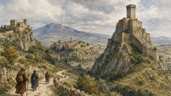
Original documentary watercolour of Rocca d'Orcia, Radicofani fortress and walkers on the historic route
Castiglione and Radicofani: defended southern routesOriginal Merlintravel documentary watercolour · 2026
10

The World Heritage view can be damaged by the same mobility, housing demand, agricultural change and image-making economy that celebrate it

Erosion, climate and access: keeping a living landscape

Clay slopes, farm viability, resident housing, road safety and visitor concentration are conservation subjects; beauty alone does not manage them.

Today

Use designated parking, signed trails and legal cycling routes. Do not park on verges, enter fields, fly drones without authority or stage photographs on active roads. Summer heat, wildfire risk and water scarcity can change safe travel; intense rain can make clay tracks impassable and accelerate runoff. Public transport exists unevenly, so a responsible itinerary may require fewer stops rather than constant movement.

History

UNESCO identifies tourism pressure, agricultural modernisation, erosion and conversion or gentrification of dwellings among threats. The management framework coordinates five municipalities and treats Val d’Orcia as a living landscape. Earlier land systems were not environmentally neutral, but their scale and pattern became attributes now protected. Current conservation must support skilled maintenance and economically viable agriculture rather than preserve only a visual shell.

How to read this place

Notice drainage, exposed clay, hedges, field margins, repaired roads and inhabited houses. Ask whether an experience keeps value in the territory and respects resident time. The ethical photograph is made from a place where one may stand, without redirecting labour or damaging the subject.

What to notice

  • Calanchi and runoff as active geomorphology
  • Working margins and drainage protecting fields
  • Mobility choices determining pressure on small towns and roads
UNESCO World Heritage Centre · Threats and management
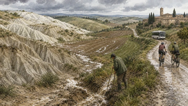
Original documentary watercolour of clay erosion, farm runoff care, cyclists and a village shuttle in Val d'Orcia
Erosion, climate and access: keeping a living landscapeOriginal Merlintravel documentary watercolour · 2026

Val d’Orcia through land, power and care

A short chronology

From Etruscan and Roman movement to Siena’s agrarian design, Pius II’s Pienza, thermal and monastic systems, modern denominations, UNESCO protection and present conservation.

  1. Settlements and routes precede the later Roman and medieval organisation of the valley.

  2. Roads and movement systems contribute to the route later associated with the Francigena.

  3. Monasteries, settlements and pilgrimage activity expand after earlier medieval contraction.

  4. Sant’Antimo’s Charta Lapidaria records the donation connected to the great Romanesque campaign.

  5. Written evidence records therapeutic use of Bagno Vignoni’s water.

  6. A community document refers to the mill system below Bagno Vignoni.

  7. Sienese expansion reorganises production, tenancy, settlements and defence across Val d’Orcia.

  8. Lorenzetti’s Good Government frescoes articulate a Sienese visual idea of ordered city and countryside.

  9. Montalcino’s fortress is constructed using earlier defensive structures.

  10. Pius II is elected pope and begins transforming Corsignano as Pienza with Bernardo Rossellino.

  11. Pienza Cathedral is consecrated and the principal urban ensemble is substantially established.

  12. Diomede Leoni creates the Horti Leonini at San Quirico d’Orcia.

  13. Pienza enters the World Heritage List and Pecorino Toscano receives European PDO recognition.

  14. The Val d’Orcia park is created and the cultural landscape is inscribed by UNESCO.

  15. Farms, churches, museums, towns and roads remain active within a landscape facing visitor and climate pressure.

Before your visit

Practical information

01

Use several bases, not one race

Pienza, San Quirico, Montalcino and Radicofani sit on slow roads; a two- or three-day route is more credible than collecting every viewpoint.

02

Keep out of fields

A visible cypress road or farmhouse may be private or agricultural. Photograph only from legal, safe public space.

03

Separate look from access

Public square, church, palace, fortress, garden, spa and producer each follow different rules and hours.

04

Plan thermal water correctly

Bagno Vignoni’s historic pool is not for bathing. Reserve authorised facilities if bathing is part of the trip.

05

Choose a sober driver

Wine tasting and ridge-road driving do not belong in the same role. Arrange walking, a driver or a structured transfer.

06

Prepare for clay and heat

White roads and paths can be dusty, exposed or muddy after rain. Carry water and adjust distance to weather.

Method and sources

Sources and image credits

This guide uses current official material from UNESCO, Parco della Val d’Orcia, Visit Tuscany, the Pecorino Toscano PDO Consortium and Sant’Antimo Abbey checked on 28 August 2026. It distinguishes cultural landscape from untouched nature; UNESCO inscription from universal public access; Sienese land organisation from a single executed design; Pienza’s concentrated papal intervention from a wholly new town; Cathedral worship from palace museum; Pienza retail language from PDO regulation; pilgrim route from leisure trail; thermal history from medical claim; historic pool from bathing facility; fortress from wine brand; Sant’Antimo legend from dated construction evidence; Ghino di Tacco’s documented seizure from Robin Hood mythology; and visual conservation from the economic viability of resident agriculture.

All ten images are original Merlintravel editorial watercolours based on documented present-day conditions. They are illustrations, not substitutes for archaeological plans. Opening hours, tickets, accessible routes, temporary exhibitions and conservation work can change; consult the linked official pages shortly before visiting.