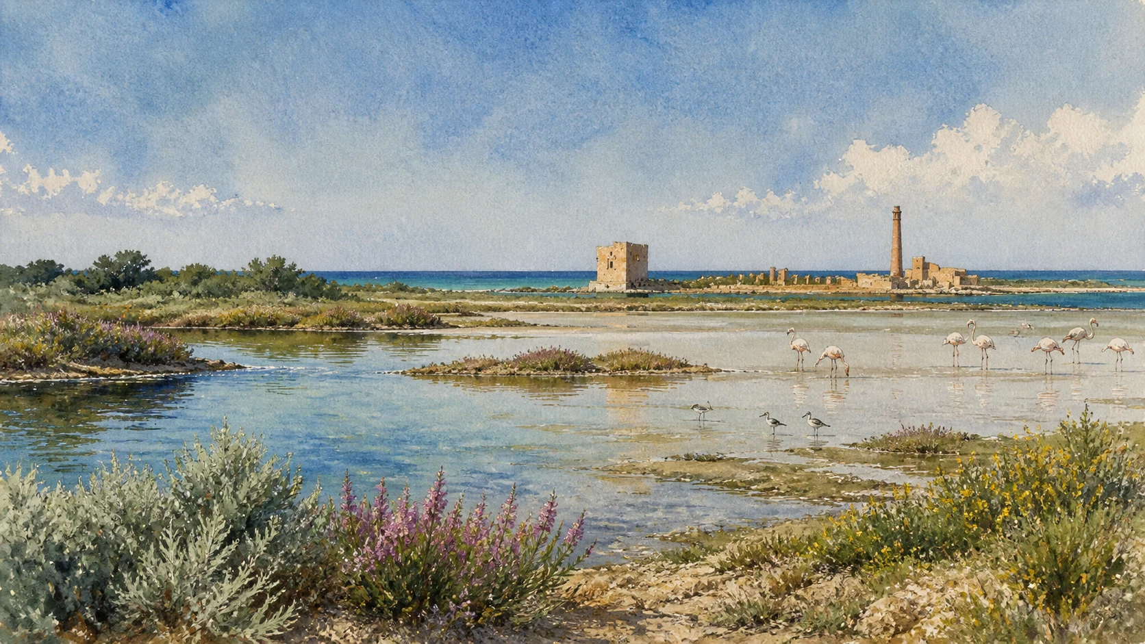
Documentary spring watercolour of Vendicari wetlands with shallow water, flamingos and waders, the Torre Sveva and tonnara beside the Ionian Sea

Illustrated guide · Sicily

Where a Greek city
meets the migrant sea

Fourteen places through which to read one coast as wetland, ancient road, Greek colony, burial ground, Byzantine settlement, defensive harbour, tuna industry and late-Roman estate.

Explore the places
Vendicari · Eloro, wetlands, tower, tonnara and Tellaro

A protected coast is also a corridor through time

Vendicari is frequently presented as a choice between a beach day and a photograph of flamingos.

The reserve deserves more. Its pantani, saline soils, dunes, rocky coves and offshore habitats form one of Sicily's essential stopping places for migratory birds. The landscape changes by season and water level, which means no single postcard can stand for the whole wetland.

Archaeology adds another scale. The Greek city of Eloro controlled the mouth of the Tellaro and the southern route from Syracuse; late-antique communities reused the coast around Cittadella dei Maccari; the Torre Sveva guarded trade; the tonnara transformed fish into an industrial system; and an inland villa carried African-influenced mosaic workshops into fourth-century Sicily.

These are not attractions scattered beside a beach. They are successive ways of organising water, movement, labour, defence, belief and land between Noto and the Ionian Sea.

One destination

One narrow coast, fourteen different kinds of evidence.

Vendicari protects a long, low coastal strip in the municipality of Noto. Shallow lagoons, former salt-working areas, sandy and rocky shore, Mediterranean scrub, halophytic vegetation and garigue create closely adjacent habitats. The reserve is a Natura 2000 site and an internationally recognised Ramsar wetland; birds use it to rest, feed, winter or pass between Africa and Europe.

The Tellaro gives the coast its historical axis. Eloro was connected to Syracuse by the Via Elorina and occupied a low hill near the river mouth. The later Villa del Tellaro stood inland on the river's right bank, while Byzantine settlement and cult buildings developed farther south. Medieval and early-modern tower, warehouses and tuna-processing structures then reused the same strategic shore. The guide follows those layers without pretending that every ruin was occupied at the same time.

The selection

Fourteen places, from the Via Elorina to the mosaics

The route begins at ancient Eloro and its burial landscape, follows the river mouth and reserve north to south through wetland, tower, tonnara and coves, reaches the late-antique Cittadella, and closes inland at the Villa del Tellaro.

  1. 01Eloro and the Southern End of the Via Elorina
  2. 02The Agora, Stoa and Sanctuaries of Eloro
  3. 03The Theatre and Eloro's Coastal Edge
  4. 04Colonna Pizzuta and the Necropoleis of Eloro
  5. 05The Tellaro Mouth and Eloro Beach
  6. 06Marianelli, Dunes and the Coastal Plant Mosaic
  7. 07Pantani, Saline and the Ramsar Wetland
  8. 08Migration Corridors and the Observation Hides
  9. 09Torre Sveva and the Defence of the Loader
  10. 10The Tonnara of Vendicari and Its Working Court
  11. 11Calamosche and the Eroding Limestone Coves
  12. 12Cittadella dei Maccari, Catacombs and the Trigona
  13. 13Villa del Tellaro: Masseria, Peristyle and Residential Plan
  14. 14The Tellaro Mosaics: Hector, Hunting and Africa
01

A SYRACUSAN SUBCOLONY STOOD WHERE ROAD, RIVER MOUTH AND COAST COULD BE CONTROLLED TOGETHER

Eloro and the Southern End of the Via Elorina

Eloro was a city with its own topography and institutions, not a scenic outpost of Noto or a ruin inside a beach reserve.

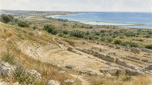
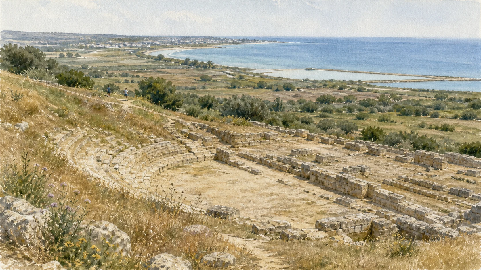
Documentary watercolour of the fragmentary theatre of Eloro with its small cavea, coastal plain, Tellaro mouth and sea beyond
A GREEK THEATRE FACING THE COASTAL PLAIN

The place today

The archaeological area occupies a low coastal hill north of the Tellaro mouth. Wall traces, gates, streets and public areas are spread through open agricultural terrain, so the city is understood by walking distances rather than by one standing monument. The route from Syracuse approached from the north along the Via Elorina, while the river valley opened inland communication toward the Hyblaean plateau.

The historical chapter

Eloro developed as one of Syracuse's earliest subcolonies, probably during the later eighth or seventh century BC. Its position helped Syracuse organise the southern coast, agricultural territory and route toward the interior. The city participated in conflicts around the river, including the Syracusan defeat by Hippocrates of Gela in 493 BC. Greek, Hellenistic and Roman phases changed its walls and public spaces before urban life contracted in late antiquity.

What to notice

  • Begin with the hill and river mouth before looking for individual structures; geography explains why the city existed.
  • Verify the current public opening: official regional databases have sometimes listed the Eloro area as closed.
Regional Archaeological Park · Eloro within the park system
02

PUBLIC SPACE AND CULT BUILDINGS REVEAL A COMMUNITY LARGER THAN ITS SURVIVING WALL HEIGHTS

The Agora, Stoa and Sanctuaries of Eloro

Recent research focuses on how open spaces, porticoes and sanctuaries organised the city rather than on reconstructing one perfect temple.

Documentary watercolour of the fragmentary theatre of Eloro with its small cavea, coastal plain, Tellaro mouth and sea beyond
A GREEK THEATRE FACING THE COASTAL PLAIN

The place today

Low foundations define parts of the agora and adjacent structures. Their importance lies in alignment and relation: street approaches, edges of open space, long portico traces and sacred areas. Vegetation and uneven preservation can make the plan difficult to read without a map. Digital recording projects have concentrated on the agora and the area conventionally associated with a sanctuary of Asclepius.

The historical chapter

Public and cult areas were repeatedly altered across Greek and Hellenistic phases. The agora concentrated exchange, assembly and civic display, while sanctuaries connected the urban community with the agricultural and maritime landscape around it. Names assigned to deities are based on archaeological interpretation and inscriptions of varying certainty; a responsible guide distinguishes a documented sacred area from a fully reconstructed dedication.

What to notice

  • Use alignments and changes in ground level; isolated blocks are less informative than the plan they once formed.
  • Treat deity names and room functions as scholarly interpretations unless an inscription or official panel states them securely.
Sicilian Region · New digital research at Eloro and Tellaro
03

A DAMAGED PERFORMANCE BUILDING STILL CONNECTS THE CITY'S PUBLIC LIFE TO THE SEA-FACING SLOPE

The Theatre and Eloro's Coastal Edge

The theatre survives poorly, yet its position shows how architecture used the natural descent toward the coastal plain.

Documentary watercolour of the fragmentary theatre of Eloro with its small cavea, coastal plain, Tellaro mouth and sea beyond
A GREEK THEATRE FACING THE COASTAL PLAIN

The place today

The theatre is far less complete than those of Syracuse or Akrai. Portions of the seating form, orchestra and supporting structures have been disturbed by erosion, agriculture and later interventions. Its value is topographic: the building occupied a slope close to the public city and the coastal route, orienting gatherings within the wider landscape rather than enclosing them behind a monumental Roman façade.

The historical chapter

Theatre architecture at Eloro developed during the Greek and Hellenistic life of the city and was later modified. What survives cannot support a complete reconstruction of stage elevation, seating capacity or decoration. Regional cultural mapping lists Eloro among ancient theatres whose remains are severely reduced. The fragment is therefore evidence for civic performance, not an invitation to imitate better-preserved theatres elsewhere.

What to notice

  • Do not expect a complete cavea; locate the curve and slope before trying to identify individual architectural pieces.
  • Never climb walls or cross barriers to obtain a clearer outline from above.
Sicilian Region Tourism Observatory · Ancient theatres dataset
04

BURIAL GROUNDS OUTSIDE THE CITY WALLS SHOW HOW MEMORY OCCUPIED ROAD AND COUNTRYSIDE

Colonna Pizzuta and the Necropoleis of Eloro

Eloro's dead were placed in several zones and periods; one visible monument cannot represent the whole funerary landscape.

Documentary watercolour of the fragmentary theatre of Eloro with its small cavea, coastal plain, Tellaro mouth and sea beyond
A GREEK THEATRE FACING THE COASTAL PLAIN

The place today

North and inland from the city, tombs and quarry-cut features occupy a landscape now divided by roads, fields and vegetation. The monument called Colonna Pizzuta rises as a slender stone marker on a stepped base. It is visually isolated, but archaeologically connected to roads and burial zones. Access and interpretation differ from the main archaeological area and should be checked separately.

The historical chapter

Eloro's necropoleis developed outside the inhabited hill across archaic, classical and Hellenistic phases. Tomb forms, grave goods and later disturbance record changes in status and ritual. Colonna Pizzuta is generally treated as a funerary monument of the Hellenistic landscape, but older attempts to connect it to specific battles or named individuals remain uncertain. Its strongest evidence is position, masonry and relation to the cemetery zone.

What to notice

  • Do not turn a debated monument into a memorial to one famous event without explicit archaeological evidence.
  • Burial areas may lie beyond maintained visitor paths; respect fences, crops and current site boundaries.
Regional Archaeological Park · Eloro archaeological landscape
Documentary watercolour of the fragmentary theatre of Eloro with its small cavea, coastal plain, Tellaro mouth and sea beyond
A GREEK THEATRE FACING THE COASTAL PLAINEloro's modest cavea and low remains stay embedded in the terrain, with the Tellaro mouth and migrant sea establishing the larger horizon.
05

RIVER SEDIMENT, DUNES AND SEA LINK THE GREEK CITY TO THE NORTHERN GATE OF THE RESERVE

The Tellaro Mouth and Eloro Beach

The river mouth is an ecological boundary and historical route, not simply the edge of a bathing beach.

Documentary watercolour of the fragmentary theatre of Eloro with its small cavea, coastal plain, Tellaro mouth and sea beyond
A GREEK THEATRE FACING THE COASTAL PLAIN

The place today

Eloro beach combines golden sand, low dunes, river influence and the first northern sector of the reserve. The position of channels, deposited material and vegetation shifts with storms and seasonal flow. From the shore, the ancient city hill becomes legible as a controlled elevation above a landing and river corridor. Bathing conditions and the exact mouth can differ sharply after heavy weather.

The historical chapter

The Tellaro—ancient Heloros—gave the city and route their geographic logic. Sediment created low coastal ground while the river opened a passage inland. Armies, merchants and farmers moved through a landscape that was never a fixed modern shoreline. Later drainage, agriculture and coastal erosion changed the mouth, but the relation among water, hill and road remains the essential historical evidence.

What to notice

  • Do not cross flowing or unstable river channels to shorten a walk.
  • Protect dune vegetation and follow the reserve entrance system rather than creating new tracks from the beach.
Municipality of Noto · Eloro beach
06

A QUIETER SHORE SECTOR SHOWS HOW SAND, JUNIPER, GARIGUE AND CULTIVATED LAND MEET

Marianelli, Dunes and the Coastal Plant Mosaic

Marianelli is valuable for transitional habitat, not because it promises an empty beach at every season.

Documentary watercolour of the fragmentary theatre of Eloro with its small cavea, coastal plain, Tellaro mouth and sea beyond
A GREEK THEATRE FACING THE COASTAL PLAIN

The place today

The coast around Marianelli passes through sandy shore, low dune vegetation, juniper, tamarisk and open scrub before meeting fields inland. Salt, wind and moving sand select specialised plants, while paths concentrate pressure on a narrow band. The visual openness can hide nesting, resting and fragile pioneer vegetation close to the ground.

The historical chapter

Agriculture, grazing, coastal movement and salt-laden wind shaped this mosaic long before modern leisure use. Reserve protection now treats beach, dune and scrub as one ecological sequence. Fragmenting that sequence with informal paths reduces the very habitat that keeps the shore resilient. Historical emptiness should also not be romanticised: rural production and seasonal work have long occupied the surrounding territory.

What to notice

  • Use established paths and never step through dune plants to create a private route to the water.
  • Silence and distance matter during nesting and migration even when no barrier is visible.
Sicilian Region ORBS · Vendicari habitats and flora
07

SHALLOW WATER AND SALT GRADIENTS CREATE A NETWORK OF BASINS RATHER THAN ONE LAKE

Pantani, Saline and the Ramsar Wetland

Vendicari's ecological engine is the changing relation among separate pantani, salinity, evaporation and shore.

Documentary watercolour of the fragmentary theatre of Eloro with its small cavea, coastal plain, Tellaro mouth and sea beyond
A GREEK THEATRE FACING THE COASTAL PLAIN

The place today

Pantano Piccolo, Pantano Grande and the southern basins differ in size, depth, salinity and seasonal persistence. Former salt-working structures and embankments altered circulation, while rainfall and summer evaporation continually redraw the water surface. Salicornia, limonium, tamarisk and other salt-tolerant plants occupy zones that may look bare from a distance.

The historical chapter

Humans used the shallow coastal basins for salt and fish-related economies, but modern conservation recognises their larger ecological role. The reserve was established in 1984 and Vendicari entered the Ramsar list of internationally important wetlands in 1989. Those designations protect a dynamic system; they do not require every basin to remain permanently full or every historical embankment to function as it once did.

What to notice

  • Read several basins rather than judging the reserve from the first viewpoint.
  • Never enter mudflats or saline crusts: they are habitat and can be physically unsafe.
Sicilian Region ORBS · Vendicari reserve and Ramsar status
08

BIRDS USE VENDICARI AS REST, FEEDING, WINTERING AND PASSAGE HABITAT ON DIFFERENT CALENDARS

Migration Corridors and the Observation Hides

Responsible birdwatching begins by abandoning the promise that one species or flock will appear on demand.

Documentary watercolour of the fragmentary theatre of Eloro with its small cavea, coastal plain, Tellaro mouth and sea beyond
A GREEK THEATRE FACING THE COASTAL PLAIN

The place today

Observation hides and screened paths allow views across shallow water with less disturbance. Flamingos may be conspicuous, but herons, stilts, ducks, cormorants, ospreys and many smaller migrants use the reserve at different times. Wind, water depth, food and disturbance influence where they gather. Binoculars reveal behaviour that a close approach would interrupt.

The historical chapter

The south-eastern tip of Sicily sits on movement routes between Africa, the central Mediterranean and Europe. Birds have used the wetland long before formal protection. The reserve's conservation history turned that recurring passage into a public responsibility: visitors can observe because distance, quiet and habitat continuity are maintained. A photograph obtained by leaving a hide weakens the system it celebrates.

What to notice

  • Stay inside designated observation areas and keep voices, phones and camera sounds low.
  • Record season, water and behaviour rather than judging a visit by the number of flamingos.
Sicilian Region ORBS · Vendicari fauna and migration
09

A COASTAL TOWER PROTECTED GOODS, LANDING AND WATCH RATHER THAN A FEUDAL PALACE

Torre Sveva and the Defence of the Loader

The tower belongs to a commercial and defensive shoreline whose form changed through collapse, repair and erosion.

Documentary watercolour of the fragmentary theatre of Eloro with its small cavea, coastal plain, Tellaro mouth and sea beyond
A GREEK THEATRE FACING THE COASTAL PLAIN

The place today

The square stone tower stands between pantano, tonnara and rocky shore. Missing upper levels and roofs make its present silhouette lower and more broken than its operational form. Openings, heavy masonry and traces of raised access point to surveillance and defence. Sea erosion and protective works affect the setting, so the monument cannot be read as an untouched medieval object isolated on sand.

The historical chapter

The national heritage catalogue dates the Torre Vendicari between the fourteenth century and 1464. Documentary tradition links completion to a 1464 act and to the protection of coastal loaders where agricultural goods were stored for trade. Later adaptations supported firearms and watch functions. The 1693 earthquake caused damage, and military use ended in the nineteenth century as defensive systems and commercial routes changed.

What to notice

  • Read the tower together with the loader, warehouses and shoreline rather than inventing a castle complex.
  • Observe barriers and erosion controls; the apparent open ground around the building may not be a visitor route.
National Catalogue of Cultural Heritage · Torre Vendicari
10

BOATHOUSES, CHIMNEY, PROCESSING ROOMS AND DWELLINGS TURNED A MIGRATORY FISH INTO AN INDUSTRIAL SEASON

The Tonnara of Vendicari and Its Working Court

The tonnara is an organised production landscape, not a romantic roofless backdrop beside the sea.

Documentary watercolour of the fragmentary theatre of Eloro with its small cavea, coastal plain, Tellaro mouth and sea beyond
A GREEK THEATRE FACING THE COASTAL PLAIN

The place today

Stone walls, broad openings, a high chimney and service spaces extend beside the bay. Their arrangement separates landing, hauling, processing, storage and the daily life of workers. Roof loss makes the structures appear lighter than the dense operating complex they once formed. Posidonia deposits on the adjacent shore are part of a healthy marine cycle, not rubbish to be removed for a cleaner ruin photograph.

The historical chapter

The national catalogue documents a tonnara at Vendicari in 1655, while later buildings and machinery reflect eighteenth- to twentieth-century change. Tuna processing depended on seasonal runs, salt, boats, specialised labour and access to markets. The plant operated into the early twentieth century and the Second World War period before closure. Its remains preserve both local industry and the wider Mediterranean economy of fish, salt and coastal transport.

What to notice

  • Identify function through connected spaces; do not climb walls or enter unstable rooms for an interior view.
  • Treat beached Posidonia as protected ecological material, not as evidence that the coast is dirty.
National Catalogue of Cultural Heritage · Tonnara di Vendicari
11

A SMALL BAY BETWEEN ROCKY HEADLANDS IS BEAUTIFUL BECAUSE IT IS GEOLOGICALLY EXPOSED, NOT IMMUNE TO CHANGE

Calamosche and the Eroding Limestone Coves

Calamosche must be approached as part of a reserve and an eroding coast, not as a guaranteed sheltered swimming pool.

Documentary watercolour of the fragmentary theatre of Eloro with its small cavea, coastal plain, Tellaro mouth and sea beyond
A GREEK THEATRE FACING THE COASTAL PLAIN

The place today

The sandy cove lies between low limestone headlands with rocky shelves and clear shallow water under favourable conditions. The walk from reserve entrances is part of the experience and limits direct vehicle pressure. Storms redistribute sand, while cliff and coastal erosion can alter safe areas, water entry and route access.

The historical chapter

Waves, wind and changing sediment supply formed and continually reshape the bay. Regional risk studies identify erosion and instability around Calamosche and Cittadella, reminding visitors that the current beach width is temporary. Protection has also limited construction that transformed many other parts of the south-eastern coast. The cove is therefore both a natural landform and an outcome of long conservation decisions.

What to notice

  • Check heat, water, walking distance and current closure information before setting out.
  • Keep away from signed cliff-risk areas even when shade or a photograph makes the overhang attractive.
Sicilian Region · Coastal erosion assessment for Vendicari
12

A LATE-ANTIQUE COMMUNITY REUSED THE SOUTHERN COAST THROUGH BURIAL, WORSHIP AND RURAL SETTLEMENT

Cittadella dei Maccari, Catacombs and the Trigona

The small domed Trigona belongs to a dispersed Byzantine landscape, not to an isolated picturesque chapel.

Documentary watercolour of the fragmentary theatre of Eloro with its small cavea, coastal plain, Tellaro mouth and sea beyond
A GREEK THEATRE FACING THE COASTAL PLAIN

The place today

Around Cittadella dei Maccari, low structural remains, rock-cut burials, catacomb spaces and the compact Trigona church occupy fields above the coast. The Trigona's cubic mass and domed interior make it visually distinct, but it was one element within a wider settlement and funerary zone. Agricultural use, vegetation and unstable cliff sectors complicate access and visibility.

The historical chapter

After the contraction of classical Eloro, late-antique and Byzantine communities organised new rural and religious centres along the coast. Hypogea and catacombs served burial; basilical and domed buildings served worship; farms used surrounding soils and routes. Dating and building sequence are not identical for every feature. The name Cittadella describes an archaeological district whose pieces belong to several phases rather than one fortified town.

What to notice

  • Do not enter hypogea or cliff-edge cavities unless an authorised route explicitly permits it.
  • Read the Trigona together with burials, walls and fields; its isolation today is partly the result of lost structures.
Sicilian Region ORBS · Vendicari protected historical landscape
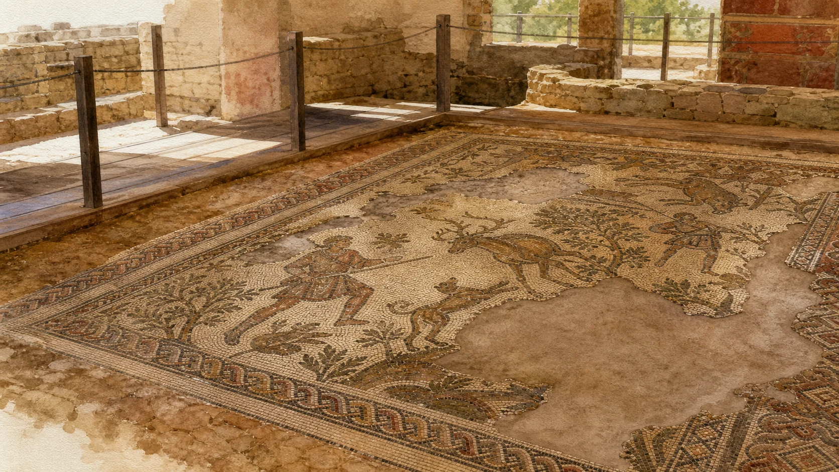
Documentary watercolour of a conserved hunting mosaic inside the Roman Villa del Tellaro with fragmentary tesserae, masonry and a protective walkway
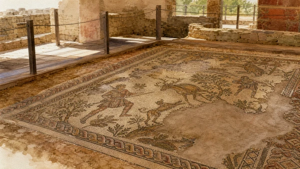
THE VILLA RETURNED THROUGH ITS MOSAIC FLOORHunters, animals and patterned borders remain fragmentary within the protected Villa del Tellaro, keeping image, masonry and conservation together.
13

A LATE-ROMAN RESIDENCE SURVIVED BENEATH A FARM BUILDING AND EMERGED AFTER CLANDESTINE EXCAVATION

Villa del Tellaro: Masseria, Peristyle and Residential Plan

The villa is a partially preserved complex whose modern shelter and later masseria are part of the site's history.

Documentary watercolour of a conserved hunting mosaic inside the Roman Villa del Tellaro with fragmentary tesserae, masonry and a protective walkway
THE VILLA RETURNED THROUGH ITS MOSAIC FLOOR

The place today

The site lies inland on the right bank of the Tellaro beneath and beside an eighteenth- to nineteenth-century masseria. Surviving rooms occupy the north and south sides of a peristyle about twenty metres across; later construction heavily damaged the east and west sectors. The visitor sees mosaics within a protected archaeological presentation, not a complete open-air villa with standing walls.

The historical chapter

Clandestine excavation revealed the villa in 1971, after which more than two decades of investigation recovered the central residential body. Its organisation around a peristyle and richly decorated rooms places it among major late-imperial estates in Sicily. Agricultural production, elite residence and river-valley transport likely belonged to the same economy, but the surviving portion cannot define the full estate boundary or every activity.

What to notice

  • Look at the relation between masseria and ancient rooms: later buildings both damaged and protected the mosaics.
  • Confirm current opening and ticket information with the regional archaeological park shortly before travel.
Italian Ministry of Culture · Villa Romana del Tellaro
14

FOURTH-CENTURY FLOORS CONNECT SICILIAN LANDOWNERSHIP WITH ROMAN NARRATIVE AND AFRICAN WORKSHOP TASTE

The Tellaro Mosaics: Hector, Hunting and Africa

The mosaics are not copies of Piazza Armerina; they belong to a related Mediterranean world with their own programme.

Documentary watercolour of a conserved hunting mosaic inside the Roman Villa del Tellaro with fragmentary tesserae, masonry and a protective walkway
THE VILLA RETURNED THROUGH ITS MOSAIC FLOOR

The place today

The best-known floors include a hunting composition organised around a seated female figure, often interpreted as a personification of Africa, and a narrative scene concerning the ransom of Hector's body. Animals, clothing, movement, borders and changes in tessera colour reward slow inspection. Losses and restored areas should remain visible rather than being mentally filled with a complete modern image.

The historical chapter

The regional archaeological park dates the mosaics to around the middle of the fourth century AD. Their closest comparisons include Piazza Armerina and sites in Proconsular Africa, suggesting craftsmen or artistic models shaped by African taste within a Roman figurative programme. The Homeric subject gave an educated patron classical prestige, while hunting imagery spoke to estate power, abundance and elite identity.

What to notice

  • Compare border, figure and animal styles before looking for a single famous scene.
  • Use the park's interpretation for uncertain identities; the seated woman is commonly, not absolutely, identified as Africa.
Regional Archaeological Park · Villa del Tellaro mosaics

The city through time

Ten thresholds between colony, wetland and estate

The chronology separates ancient urban history, late-Roman and Byzantine reuse, coastal defence, industry, excavation and modern environmental protection.

  1. Eloro develops as an early Syracusan subcolony controlling the southern coastal road, the Tellaro mouth and surrounding agricultural territory.

  2. Hippocrates of Gela defeats the Syracusans near the Heloros River, demonstrating the strategic importance of the route and valley.

  3. Walls, public spaces, sanctuaries, theatre and funerary monuments reflect Eloro's Hellenistic development and changing relation with Syracuse.

  4. The Villa del Tellaro receives its celebrated mosaic programme, linking a Sicilian estate to Roman narrative and African-influenced workshop culture.

  5. Late-antique and Byzantine communities create churches, burials and rural settlement around Cittadella dei Maccari as classical Eloro contracts.

  6. The Torre Vendicari takes shape and is completed or reorganised to defend the coastal loader and stored agricultural goods.

  7. The documented tonnara grows through successive phases, organising seasonal tuna capture, processing, salt, labour and export before final closure.

  8. Clandestine digging exposes the Villa del Tellaro, prompting a long official excavation and conservation programme beneath the later masseria.

  9. The Sicilian Region establishes the Vendicari wildlife oasis reserve to protect the wetland, coast, habitats and migratory corridor.

  10. Vendicari gains Ramsar recognition in 1989, while the regional archaeological park created in 2019 integrates Eloro and Tellaro into a larger research and management system.

Before your visit

Practical information,
without turning it into promises

01

Plan three separate days or half-days

Eloro and the northern reserve, central Vendicari with pantani, tower and tonnara, and the inland Villa del Tellaro are different visits. Cittadella and the southern coast add further walking and cannot be treated as a short detour.

02

Carry water without expecting services

Reserve beaches and paths are intentionally lightly equipped. Heat, shade, walking distance and return time matter more than the short road distance shown on a map.

03

Let birds decide the distance

Use hides and binoculars, remain quiet and never leave a path to approach a flock. Migration, species and water levels change; no sighting can be promised.

04

Verify archaeology independently

Eloro, Villa del Tellaro and reserve routes have different managers, openings and safety conditions. A valid reserve entrance does not prove that an archaeological area is open.

Sources

This guide cross-checks the Sicilian Region's archaeological park, protected-area portal, Natura 2000 and Ramsar documentation with the Ministry of Culture, the national heritage catalogue and the Municipality of Noto. It separates Eloro's Greek city from late-antique Cittadella, historic tower and tonnara from the wetland, and Villa del Tellaro's documented plan from reconstructions of a complete estate. Seasonal ecology and current access are never presented as fixed promises.

The hero image is an illustration, not a photograph. Water levels, bird presence, beach width, river channels, cliff stability, fire risk, reserve routes, archaeological openings and monument access can change. Consult the linked managing bodies shortly before travel; remain on marked paths, keep away from closed cliffs and never enter protected basins or hypogea.