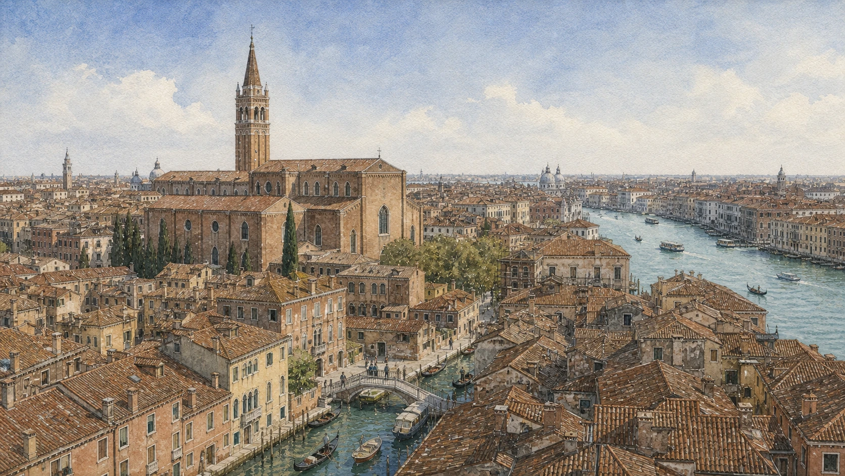
Original documentary watercolour panorama of San Polo and Santa Croce with the Frari, tiled roofs, canals and Grand Canal

Venice Guide 04 · Churches, confraternities, museums and lived neighbourhoods

San Polo
& Santa Croce

A documented walk through Venice’s central-western sestieri, from Campo San Polo and the Frari to San Rocco, San Giacomo dall’Orio, civic museums, resident workshops and the road-to-water threshold.

Plan the route
San Polo · Santa Croce · Venice10 chapters · one full day

Why these central sestieri matter

San Polo and Santa Croce are not the quiet remainder between Rialto and the station: they show how worship, charity, housing, museums and arrival infrastructure coexist in the same compact city.

San Polo contains the Rialto market zone but extends into large campos, Franciscan and confraternal institutions, workshop streets and residential canals. Santa Croce reaches from the Grand Canal palaces around San Stae to Piazzale Roma, where buses and cars stop and movement is transferred to foot and water. Together they reveal Venice as a connected system rather than a chain of famous façades.

The Frari and Scuola Grande di San Rocco demonstrate different institutional forms. A mendicant church accumulated burials, altars, painting and civic memory across a vast liturgical interior. A lay confraternity organised devotion, charity, government and an exceptional cycle of paintings within meeting rooms. Ca’ Pesaro and Palazzo Mocenigo add later museum histories that reinterpret patrician residences through modern art, textiles, dress and conservation.

Residential campos and working canals are equally important. San Giacomo dall’Orio remains legible through trees, benches, shops and daily routes. Workshops and deliveries depend on narrow passages and low quays. At the western edge, the road terminal creates extraordinary pressure on pedestrian bridges and vaporetto stops. High water adds a time-dependent layer that must be checked through official forecasts rather than treated as permanent spectacle.

Move from large institution to ordinary threshold: the sestieri become coherent when church, confraternity, palace, workshop, canal and transport interchange are read as parts of one inhabited urban fabric.

The route

Plan your visit

Begin before the museum crowds, reserve substantial time for Frari and San Rocco, then cross into Santa Croce. Finish at Piazzale Roma only after the smaller campos have established the neighbourhood scale.

Early morning

Campo San Polo and Frari exterior

Use the open campo to understand routes and plot edges, then approach the Frari across its canal before entering.

Late morning

Frari and Scuola Grande di San Rocco

Treat the church and confraternity as separate institutions. Allow slow looking and verify current admission rules at both.

Afternoon

San Giacomo, Ca’ Pesaro and Mocenigo

Move through resident streets to San Stae, choosing one or both museums according to current opening and stamina.

Late afternoon

Craft canals and the western gateway

Observe deliveries and local circulation before reaching the land-transport edge; check tides and ACTV conditions for the return.

Ten chapters

Explore the places

The route follows public space, Franciscan architecture, confraternities, museums, residential life, arrival infrastructure and high-water adaptation. Use the index to keep distinct the institutions that share this compact area.

  1. 01Campo San Polo: a civic room formed by movement
  2. 02The Frari outside: mendicant architecture at city scale
  3. 03Inside the Frari: worship, art and civic memory
  4. 04Scuola Grande di San Rocco: confraternity and painted institution
  5. 05San Giacomo dall’Orio: a resident campo and layered church
  6. 06Ca’ Pesaro: Baroque patronage and the modern civic museum
  7. 07Palazzo Mocenigo: house, textile study centre and museum
  8. 08Piazzale Roma and Tolentini: the western gateway
  9. 09Craft, housing and delivery: reading the ordinary city
  10. 10High water and conservation: prepare without spectacle
01

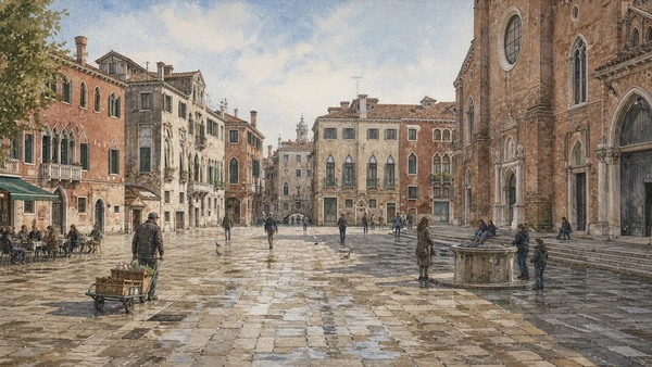
One of Venice’s largest campos works through irregular edges, multiple entrances and everyday occupation rather than a single monumental axis

Campo San Polo: a civic room formed by movement

The campo’s scale supported ceremonies and gatherings, but its present value also lies in ordinary circulation, housing and controlled shared use.

Today

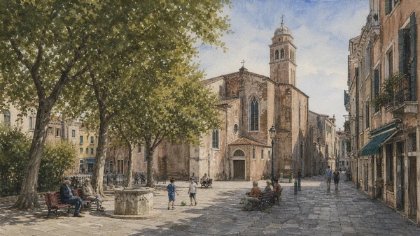
Campo San Polo is an expansive paved space surrounded by residences, the church of San Polo and several calle entrances. Benches, wells, drainage lines and perimeter businesses divide use without fixing a central route. Events can temporarily change access. Outside programmed occasions, the campo remains a daily crossing and recreation space, so entrances and quieter residential edges should not be blocked for photographs.

History

The area developed within the early Rivoalto settlements and took shape around a parish church and privately defined plot lines. The campo hosted public celebrations, games and bull hunts under changing regulation. Stone paving, drainage and façade alterations accumulated over centuries. Its irregular geometry is not failed planning: it records property, water edges and routes that preceded the unified surface visible today.

How to read this place

Walk the perimeter before crossing the centre. Count the distinct calle mouths and notice how each creates a different diagonal. The church does not command a symmetrical forecourt; it forms one side among houses. Wellheads recall stored freshwater beneath a salt-water city, while low points and drains reveal continuing hydraulic maintenance. Activity, shade and sound explain the space better than an empty wide-angle photograph.

What to notice

  • Several circulation routes crossing one open surface
  • Wellhead and drainage embedded in the paving
  • Residential façades defining civic rather than ceremonial edges
Comune di Venezia · Accessible city itineraries
Original documentary watercolour of Campo San Polo as a lived civic space with church edge, wellhead and multiple entrances
Campo San Polo: a civic room formed by movementOriginal Merlintravel documentary watercolour · 2026
02

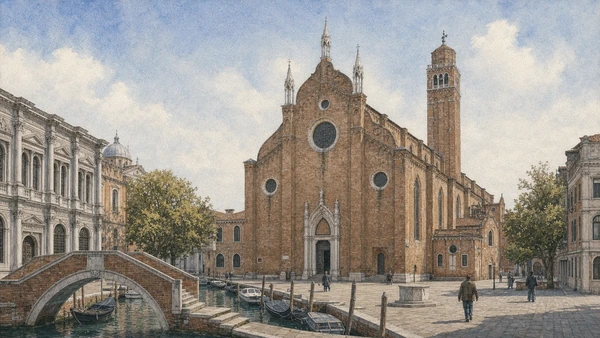
The great brick exterior translates Franciscan scale into a Venetian urban fabric of canal, bridge, campo and campanile

The Frari outside: mendicant architecture at city scale

Its comparatively plain brick mass should be read before the art-filled interior, because nave, transepts and chapels remain clear in the external volume.

Today

Santa Maria Gloriosa dei Frari occupies a dense junction between Campo dei Frari, Rio dei Frari and San Rocco. The tall brick campanile and long flank are more dominant than the restrained west front. Visitors cross small bridges and narrow approaches before the full mass appears. The basilica remains a place of worship with ticketed cultural visiting conditions; services, closures and appropriate dress take precedence over sightseeing.

History

Franciscans established themselves in the area in the thirteenth century. Successive building campaigns produced the present large Gothic church, substantially completed by the fifteenth century. Brick walls, high windows and a timber roof enclosed a preaching space later filled with choir stalls, tombs, chapels and altarpieces. The surrounding convent and Scuola di San Rocco created an institutional district rather than one isolated monument.

How to read this place

Approach across the canal and compare the low residential fabric with the church flank. Buttresses and tall lancets map interior bays; chapels project around the east end. The façade with its central portal is less descriptive than the side elevation. Locate San Rocco nearby but keep the institutions separate. The Frari’s urban force comes from measured brick volume, not a marble screen or open ceremonial plaza.

What to notice

  • Long brick flank revealing the nave bay structure
  • Campanile acting as a district landmark
  • Bridges and narrow approaches compressing the exterior view
Basilica dei Frari · Official site
Original documentary watercolour of the Frari exterior, campanile, canal bridge and Campo dei Frari
The Frari outside: mendicant architecture at city scaleOriginal Merlintravel documentary watercolour · 2026
03

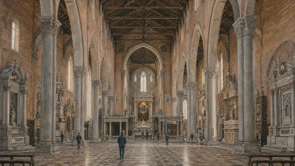
Choir, high altar, family chapels and monuments divide a vast preaching church into distinct liturgical and commemorative territories

Inside the Frari: worship, art and civic memory

Titian and major monuments matter most when their position within the working church is understood, not when reduced to a checklist of masterpieces.

Today

The nave leads toward the surviving monumental choir enclosure and Titian’s Assumption at the high altar. Side aisles contain family chapels, funerary monuments and works from different centuries, including Titian’s Pesaro Madonna and memorials associated with Canova and Titian. Lighting varies and services restrict circulation. Visitors should follow church instructions and avoid crossing roped liturgical areas.

History

Burial, patronage and confraternal devotion gradually transformed the Franciscan interior. Titian’s Assumption was installed in 1518 as a major high-altarpiece commission, while the Pesaro family work joined a side altar to dynastic representation. The monks’ fifteenth-century choir survived later removals that changed many Venetian churches. Nineteenth-century monuments added a new national and artistic memory to the medieval structure.

How to read this place

Begin with the choir screen because it changes the nave’s apparent continuity. From the side, see how worshippers, friars and patrons occupied different zones. Read altarpieces in relation to their altars and sightlines. Compare the vertical pull of columns and windows with the horizontal interruption of choir and tombs. No single work explains the church; the cumulative spatial negotiation does.

What to notice

  • Choir enclosure surviving in the central nave
  • High altar visible through layered liturgical space
  • Side monuments recording different periods of civic memory
Basilica dei Frari · Official visit and history
Original documentary watercolour of the Frari nave, choir enclosure, monuments and high altar
Inside the Frari: worship, art and civic memoryOriginal Merlintravel documentary watercolour · 2026
04

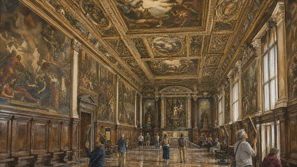
A lay confraternity joined charity, devotion, corporate government and image-making within rooms that remain distinct from the neighbouring church

Scuola Grande di San Rocco: confraternity and painted institution

Tintoretto’s cycle is inseparable from the Scuola’s meeting hierarchy, charitable identity and continuing responsibility for its patrimony.

Today

The Scuola Grande is a separately ticketed institution in Campo San Rocco. Its route connects ground-floor rooms, staircase, Sala Capitolare and Sala dell’Albergo. Large paintings occupy walls and ceilings above carved seating and administrative furniture. The active archconfraternity maintains the building and church; official opening and extraordinary closures should be checked on its own website.

History

The confraternity was recognised in 1478 and became wealthy through devotion to Saint Roch, particularly in a city repeatedly threatened by plague. It built its church from 1489 and a monumental meeting house in the sixteenth century. Tintoretto secured the initial commission in 1564 and produced an extensive cycle over decades. The paintings supported institutional ritual and collective identity rather than forming a modern gallery display.

How to read this place

Follow the building’s hierarchy from entrance to the upper rooms. Benches and raised positions show governance before paintings explain sacred narrative. Ceiling works require slow, angled looking; use available mirrors without blocking circulation. Distinguish the Scuola from the Church of San Rocco and from the Frari. Proximity created a devotional district, not one merged complex.

What to notice

  • Room hierarchy from ground-floor assembly to upper halls
  • Carved seating preserving institutional order
  • Painting cycles integrated with walls and ceiling
Scuola Grande di San Rocco · Official site
Original documentary watercolour of the upper hall of the Scuola Grande di San Rocco with paintings, ceiling and carved seating
Scuola Grande di San Rocco: confraternity and painted institutionOriginal Merlintravel documentary watercolour · 2026
05

A shaded campo and repeatedly rebuilt church make residential continuity visible without pretending that neighbourhood life is untouched by tourism

San Giacomo dall’Orio: a resident campo and layered church

Trees, benches, play, shops and several routes give the space a daily rhythm different from the great visitor corridors.

Today

Campo San Giacomo dall’Orio lies within Santa Croce and remains used by residents, families and local businesses. The church has an irregular exterior and complex interior shaped by many campaigns. Trees create unusual shade, while bridges and calli distribute movement toward San Stae and the station. Quiet use is not an invitation to photograph residents closely or convert benches and doorways into private visitor space.

History

A church existed here by the Middle Ages and was enlarged or modified across Romanesque, Gothic and later phases. Reused columns, differing roof volumes and chapels preserve that accretion. The surrounding campo developed through parish life rather than a single monumental project. Modern paving, services and tree management sustain an old urban form whose continued value depends on habitation.

How to read this place

Walk around the church and accept the absence of one canonical façade. Different masonry and roof junctions identify additions. In the campo, map play areas, benches, wellhead and shop fronts before entering. The space works because circulation crosses social use without completely displacing it. Visit slowly and keep voices low near housing.

What to notice

  • Irregular church volumes recording several campaigns
  • Trees and benches supporting ordinary neighbourhood use
  • Bridges and calle mouths distributing movement without one axis
Chorus Venezia · San Giacomo dall’Orio collection record
Original documentary watercolour of Campo San Giacomo dall'Orio with trees, residents, wellhead and irregular church exterior
San Giacomo dall’Orio: a resident campo and layered churchOriginal Merlintravel documentary watercolour · 2026
06

Longhena’s monumental canal palace became a civic museum through donation, modern-art collecting and repeated reinterpretation rather than continuous family display

Ca’ Pesaro: Baroque patronage and the modern civic museum

The building’s water-to-courtyard axis and heavy rustication should be read before separating the modern and Oriental art collections inside.

Today

Ca’ Pesaro houses the International Gallery of Modern Art and the Museum of Oriental Art. MUVE lists the historic building as fully accessible while warning of slight slopes, thresholds and uneven steps. Current galleries and temporary displays can change. The museum closes on Monday under the present seasonal schedule, with selected extended 2026 Friday and Saturday evenings listed officially.

History

Construction began in 1659 for the Pesaro family under Baldassare Longhena and was completed by Gian Antonio Gaspari in 1710. The palace passed through later owners before Felicita Bevilacqua La Masa donated it to Venice to support modern art. The civic gallery was established here in 1902, with works acquired from early Biennials and exhibitions supporting younger artists. Palace, collection and museum therefore belong to different patronage systems.

How to read this place

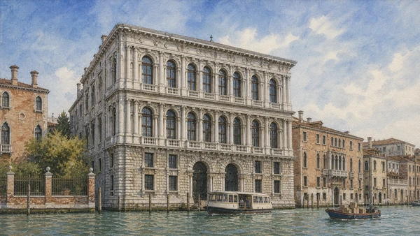
From the canal, compare the deeply rusticated lower level with the open upper window orders. Inside, the androne connects the water entrance to a courtyard and wellhead. That practical axis explains the palace more clearly than surface ornament alone. In the galleries, distinguish works acquired for the civic modern collection from the building’s Baroque decoration and from the separate Oriental Art Museum.

What to notice

  • Twin water portals within a heavily rusticated base
  • Androne linking canal entrance to internal courtyard
  • Modern museum sequence inhabiting a Baroque residential shell
Ca’ Pesaro · Building and history
Original documentary watercolour of Ca' Pesaro's Baroque Grand Canal façade, water entrance and working boat traffic
Ca’ Pesaro: Baroque patronage and the modern civic museumOriginal Merlintravel documentary watercolour · 2026
07

A patrician interior now interprets textiles, dress and perfume through museum collections that came from several Venetian sources

Palazzo Mocenigo: house, textile study centre and museum

Historic rooms provide context but the displayed garments are conserved museum objects, not an untouched family wardrobe left in place.

Today

Palazzo Mocenigo near San Stae contains period rooms, textiles, historic dress and a perfume section, as well as a specialist study centre and library. MUVE currently lists seasonal hours, Monday closing and extended Friday and Saturday evenings through late September 2026. Displays rotate for conservation, so a garment seen in an older photograph may not be present.

History

The Mocenigo family occupied and modified the palace over generations. A central portego and flanking rooms preserve a typical patrician spatial organisation. Alvise Nicolò Mocenigo bequeathed the building to the city in the twentieth century; it opened as a museum in 1985 and became the base for textile and costume collections assembled from the civic museums and major donations. Later reorganisation expanded interpretation to perfume and material production.

How to read this place

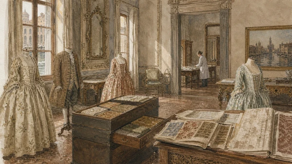
Separate fixed room fabric from movable display. Doors and the portego explain household circulation; mannequins, cases and sample books show museum classification. Look closely at weave, support and stitching without touching. Reduced light and rotating exhibits are conservation measures, not incomplete display. The study centre connects attractive garments to evidence, cataloguing and specialist research.

What to notice

  • Central portego organising the patrician plan
  • Conservation mannequins separating garment from imagined wearer
  • Textile samples revealing technique beyond finished fashion
Palazzo Mocenigo · Building and history
Original documentary watercolour of Palazzo Mocenigo rooms with conserved historic dress, textile samples and museum work
Palazzo Mocenigo: house, textile study centre and museumOriginal Merlintravel documentary watercolour · 2026
08

Venice’s road network ends abruptly at Santa Croce, concentrating buses, parking, pedestrians, baggage and water transport within a narrow transfer zone

Piazzale Roma and Tolentini: the western gateway

The apparent visual disorder records a necessary intermodal boundary where wheeled regional arrival becomes local movement by foot and boat.

Today

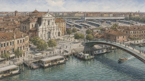
Piazzale Roma is the principal road terminal at the edge of the historic city. ACTV land and water services, taxis, parking, the People Mover and pedestrian routes converge here and at nearby Tronchetto and Santa Lucia. The Constitution Bridge links toward the station across the Grand Canal, while Tolentini and Santa Croce begin immediately behind the transport areas. Crowding and stop assignments change, so wayfinding must follow current signs.

History

For most of Venetian history this western edge had no automobile function. The nineteenth-century railway and twentieth-century road bridge shifted large-scale arrival toward the lagoon city’s western margin. Piazzale Roma, garages, engineered quays and later bridge projects inserted modern transport into older convent, church and canal fabric. The result is not a historic campo but an evolving piece of infrastructure.

How to read this place

Stand clear of flows and trace each mode: road vehicle, pedestrian bridge, floating vaporetto stop and service canal. The transfer is compressed but not seamless; luggage, accessibility and ticketing affect route choice. Look back toward Tolentini to see how quickly the modern terminal gives way to narrower urban texture. Do not use a quiet church step as a baggage depot.

What to notice

  • Road vehicles stopping where the pedestrian-water city begins
  • Floating stops absorbing large arrival waves
  • Historic church fabric immediately beside modern infrastructure
Venezia Unica · Piazzale Roma
Original documentary watercolour of Piazzale Roma, Constitution Bridge, vaporetto landings and the Tolentini edge
Piazzale Roma and Tolentini: the western gatewayOriginal Merlintravel documentary watercolour · 2026
09

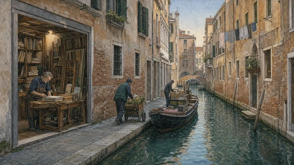
Small workshops and residential landings depend on the same narrow passages visitors often mistake for freely available scenic space

Craft, housing and delivery: reading the ordinary city

A workshop door, handcart and freight boat expose the daily logistics that keep the sestieri inhabited beyond their monuments.

Today

Bookbinding, framing, food preparation, repair and other small activities survive among housing, hospitality and retail, though individual businesses change. Deliveries arrive by boat, transfer to handcarts and pass through narrow calli. Waste collection follows the same constrained system. Visitors should yield at bridges, doorways and quays, and should not infer that every visibly traditional workshop is open for unscheduled visits.

History

Venetian production was historically organised through guilds, specialised streets, household labour and lagoon-wide supply networks. San Polo and Santa Croce combined commerce with varied crafts and service occupations close to Rialto and canal routes. Industrial change, depopulation and visitor demand transformed that economy. Surviving manual work is therefore neither a frozen remnant nor a guaranteed tourism performance.

How to read this place

Follow an object rather than a picturesque façade: boat to landing, package to cart, cart to workshop or residence. Threshold wear and protective corner stones show repeated movement. Ask permission before photographing workers. A responsible guide treats inhabited detail as evidence of an urban system and leaves enough space for that system to continue.

What to notice

  • Low landings transferring goods from boat to handcart
  • Workshop thresholds embedded within residential façades
  • Narrow bridges functioning as essential service routes
UNESCO World Heritage Centre · Venice and its Lagoon
Original documentary watercolour of a San Polo workshop, residential canal, handcart and freight delivery
Craft, housing and delivery: reading the ordinary cityOriginal Merlintravel documentary watercolour · 2026
10

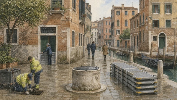
Tide forecasts, drainage, doorway protection and temporary pedestrian routes turn a natural lagoon event into a managed urban condition

High water and conservation: prepare without spectacle

Acqua alta is time-dependent and usually short; official forecasts are more useful than viral images or fixed assumptions about which street will flood.

Today

The Comune di Venezia Tide Forecasting and Reporting Centre publishes observed levels and forecasts. It notes that raised-walkway installation is seasonally suspended from 1 May to 15 September in 2026. Public transport may modify routes at particular levels, while local elevation determines which path is affected first. Waterproof footwear does not authorise entry into closed or resident-protected spaces.

History

High tides are part of the lagoon environment, but twentieth-century land subsidence, lagoon alteration and exceptional events changed risk awareness and monitoring. Municipal forecasting, sirens, mapped pedestrian routes and movable walkways developed as public systems. Building owners also use thresholds, barriers, pumps and repeated material repair. Adaptation is distributed across public infrastructure and private responsibility.

How to read this place

Check forecast time and local datum, not just a maximum number. In the street, identify drainage, raised thresholds and protected doors before a tide arrives. Stored walkway modules and municipal work are evidence of preparation. Avoid framing residents’ routine measures as catastrophe. The correct response is flexible route planning and respect for barriers.

What to notice

  • Raised thresholds and removable doorway barriers
  • Drainage and mapped low points in campo paving
  • Temporary walkways managed as seasonal public infrastructure
Comune di Venezia · Tide Forecasting and Reporting Centre
Original documentary watercolour of municipal drainage work, doorway protection and stored high-water walkways in a residential campo
High water and conservation: prepare without spectacleOriginal Merlintravel documentary watercolour · 2026

San Polo and Santa Croce through time

A short chronology

From early Rivoalto settlement and mendicant expansion to confraternities, Baroque patronage, civic museums and the modern road-water threshold.

  1. Rivoalto settlement expands across the future San Polo and Santa Croce areas.

  2. Franciscans establish a major presence and begin the long development of the Frari complex.

  3. The present Frari takes shape as a vast Venetian Gothic preaching church.

  4. The Scuola di San Rocco receives official recognition as a lay confraternity.

  5. The confraternity begins construction of the Church of San Rocco near the Frari.

  6. Titian’s Assumption is installed at the Frari high altar.

  7. Tintoretto begins the painting programme that will define the Scuola Grande di San Rocco.

  8. Construction of Ca’ Pesaro begins for the Pesaro family under Baldassare Longhena.

  9. Gian Antonio Gaspari completes Ca’ Pesaro after Longhena’s death.

  10. New monuments and restoration reshape the way the Frari presents Venetian and national memory.

  11. The Bevilacqua La Masa donation leads to Ca’ Pesaro’s designation as the civic modern-art gallery.

  12. The road connection and Piazzale Roma establish a new western land-transport gateway.

  13. Palazzo Mocenigo opens as a civic museum and textile-costume study centre.

  14. The Constitution Bridge opens, altering pedestrian transfer between Piazzale Roma and the station.

  15. Resident life, museums, transport and tide management continue within the same historic urban fabric.

Before your visit

Practical information

01

Reserve depth for Frari and San Rocco

Allow at least ninety minutes for each if painting, architecture and institutional history are genuine priorities.

02

Check every institution separately

Church, confraternity and MUVE museums maintain different tickets, closures, services and access rules.

03

Use San Stae for the museum pair

The ACTV stop is practical for Ca’ Pesaro and Palazzo Mocenigo; verify current service before relying on it.

04

Protect residential space

Keep voices low, yield on bridges and never occupy doorways, workshops or delivery landings.

05

Treat Piazzale Roma as infrastructure

Follow live signs and allow transfer time instead of stopping in the main passenger flow to orient yourself.

06

Read the official tide forecast

A predicted level has a time and local effect; old flood photographs are not a safe route-planning tool.

Method and sources

Sources and image credits

This guide uses current official information from the Basilica dei Frari, Scuola Grande di San Rocco, Fondazione Musei Civici di Venezia, Comune di Venezia, Venezia Unica, ACTV and UNESCO, checked on 28 August 2026. It distinguishes parish church from confraternity; exterior volume from interior art; lay charity from monastic worship; patrician palace from civic museum; historic rooms from rotating textile display; residential campo from event space; traditional craft from visitor performance; road arrival from water distribution; and normal lagoon tides from exceptional events and sensational imagery.

All ten images are original Merlintravel editorial watercolours based on documented present-day conditions. They are illustrations, not substitutes for archaeological plans. Opening hours, tickets, accessible routes, temporary exhibitions and conservation work can change; consult the linked official pages shortly before visiting.